Category:Whitminster
Jump to navigation
Jump to search
village and civil parish in Gloucestershire, United Kingdom .jpg) | |||||
| Upload media | |||||
| Instance of | |||||
|---|---|---|---|---|---|
| Location | Stroud, Gloucestershire, South West England, England | ||||
 | |||||
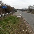
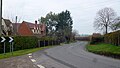
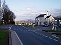
English: Whitminster is a village in Gloucestershire, on the A38 trunk road about six miles south of Gloucester. It was formerly known as Wheatenhurst, the name being changed officially in 1945. Wheatenhurst manor, with Whitminster House and the parish church of St Andrew, lies about a mile to the west of the modern village.
Subcategories
This category has only the following subcategory.
S
Media in category "Whitminster"
The following 131 files are in this category, out of 131 total.
-
 A38 heading north - geograph.org.uk - 3403958.jpg 640 × 480; 52 KB
-

-
 A419 between the M5 and the A38 - geograph.org.uk - 3855907.jpg 800 × 527; 119 KB
-
 A419 bridge over the M5 motorway - geograph.org.uk - 3855868.jpg 800 × 528; 140 KB
-
 A419 near Fromebridge - geograph.org.uk - 6288018.jpg 800 × 600; 634 KB
-
 Al fresco haircut - geograph.org.uk - 4146443.jpg 3,872 × 2,592; 3.88 MB
-
 Arable field near Whitminster - geograph.org.uk - 2804683.jpg 1,024 × 680; 290 KB
-
 Arable land at Whitminster - geograph.org.uk - 2800087.jpg 1,024 × 680; 253 KB
-
 Bend in the road - geograph.org.uk - 6013794.jpg 1,600 × 900; 457 KB
-
 Camellia japonica, 'Black Lace' - geograph.org.uk - 5718961.jpg 1,600 × 1,202; 1,021 KB
-
 Canal marina, Saul - geograph.org.uk - 2803820.jpg 1,024 × 680; 104 KB
-
 Construction site, Whitminster - geograph.org.uk - 2802371.jpg 1,024 × 680; 222 KB
-

-
 Culvert and Pill Box - geograph.org.uk - 1179224.jpg 640 × 480; 108 KB
-
 Drain near Fromebridge - geograph.org.uk - 3403847.jpg 640 × 480; 95 KB
-
 Duck House and Duck Pond - geograph.org.uk - 5592477.jpg 2,560 × 1,920; 2.75 MB
-

-
-
 Entrance to Saul Junction Marina - geograph.org.uk - 4013061.jpg 800 × 465; 73 KB
-
 Farmland at Whitminster - geograph.org.uk - 2802376.jpg 1,024 × 680; 226 KB
-
 Farmland near Fromebridge - geograph.org.uk - 3403858.jpg 640 × 480; 66 KB
-
 Farmland off the A38 - geograph.org.uk - 3403960.jpg 640 × 431; 52 KB
-

-
 Fromebridge Mill - geograph.org.uk - 3313559.jpg 640 × 480; 72 KB
-
 Fromebridge Mill - geograph.org.uk - 4638165.jpg 2,500 × 1,676; 4.04 MB
-
 Fromebridge Mill - waterwheel - geograph.org.uk - 3355047.jpg 466 × 640; 111 KB
-
 Highfield Garden Centre entrance - geograph.org.uk - 5175997.jpg 1,600 × 1,200; 878 KB
-
 Highfield Garden World - geograph.org.uk - 1576331.jpg 640 × 480; 187 KB
-
 Highfield Garden World, 1 - geograph.org.uk - 4326173.jpg 800 × 451; 216 KB
-
 Highfield Garden World, 2 - geograph.org.uk - 4326180.jpg 800 × 600; 263 KB
-
 House on the A38, Whitminster - geograph.org.uk - 3403922.jpg 640 × 480; 67 KB
-
 Houses on Roman Road, Whitminster - geograph.org.uk - 3403924.jpg 1,024 × 768; 155 KB
-
 In the grounds of Whitminster House - geograph.org.uk - 5497431.jpg 2,592 × 1,944; 1.98 MB
-
 Junction 13 of M5 - geograph.org.uk - 3185826.jpg 1,024 × 768; 474 KB
-

-

-
 Junction Bridge at Saul Junction - geograph.org.uk - 4013051.jpg 800 × 481; 94 KB
-

-
 Junction Bridge House, Saul Junction - geograph.org.uk - 4145513.jpg 3,872 × 2,592; 4.14 MB
-
 Junction Bridge in action - geograph.org.uk - 4124559.jpg 800 × 450; 92 KB
-

-
 Lay-by on A419 link to M5 junction 13 - geograph.org.uk - 5877127.jpg 1,600 × 1,200; 735 KB
-

-
 Lodge and Whitminster church - geograph.org.uk - 2800138.jpg 1,024 × 680; 235 KB
-
 Lodge Cottage, Whitminster - geograph.org.uk - 4013158.jpg 800 × 634; 153 KB
-
 M5 approaching Junction 13 for A419 - geograph.org.uk - 4115586.jpg 1,600 × 1,044; 325 KB
-

-
 M5 Junction 13 at Stroud - geograph.org.uk - 3809000.jpg 640 × 427; 243 KB
-
 M5 Motorway - Junction 13 Northbound - geograph.org.uk - 2629808.jpg 640 × 480; 65 KB
-

-

-

-
 M5 motorway NE of junction 13 - geograph.org.uk - 3855875.jpg 800 × 570; 102 KB
-
 M5 motorway SW of junction 13 - geograph.org.uk - 3855914.jpg 800 × 512; 91 KB
-
 M5 motorway west of Stroud, Gloucestershire - geograph.org.uk - 2974172.jpg 1,024 × 640; 314 KB
-
 M5 motorway west of Stroud, Gloucestershire - geograph.org.uk - 2974199.jpg 1,024 × 659; 280 KB
-
 M5 motorway west of Stroud, Gloucestershire - geograph.org.uk - 2974204.jpg 1,024 × 586; 269 KB
-
 M5 Motorway, A419 Flyover at Junction 13 - geograph.org.uk - 3809008.jpg 640 × 427; 230 KB
-
 M5 northbound at junction 13 - geograph.org.uk - 4324138.jpg 1,600 × 1,200; 948 KB
-
 M5 northbound towards junction 12 - geograph.org.uk - 4324165.jpg 1,600 × 1,200; 1.09 MB
-
 M5 southbound - geograph.org.uk - 3537028.jpg 640 × 454; 35 KB
-
 Marina entrance, Saul - geograph.org.uk - 2803815.jpg 1,024 × 680; 101 KB
-
 Mistletoe on trees - geograph.org.uk - 2804692.jpg 1,024 × 680; 248 KB
-
 Moored narrowboats SE of Saul Junction - geograph.org.uk - 4013057.jpg 800 × 660; 156 KB
-
 Narrowboat passes through Saul Junction - geograph.org.uk - 4013031.jpg 800 × 574; 100 KB
-
 Narrowboats moored on the Stroudwater Canal - geograph.org.uk - 2804660.jpg 1,024 × 680; 129 KB
-
 Narrowboats on the Stroudwater Canal - geograph.org.uk - 2803806.jpg 1,024 × 680; 270 KB
-
 New housing in Whitminster - geograph.org.uk - 319455.jpg 640 × 480; 101 KB
-
 Next services 23 miles - geograph.org.uk - 2045862.jpg 640 × 480; 59 KB
-
 Northbound M5, Granny Shephard's Wood - geograph.org.uk - 3809011.jpg 640 × 427; 230 KB
-
 Occupation Bridge - geograph.org.uk - 344297.jpg 640 × 480; 129 KB
-

-
 Oil Pipeline sign - geograph.org.uk - 1179222.jpg 640 × 480; 81 KB
-
 Overbridge north of junction 13 - geograph.org.uk - 4740517.jpg 640 × 372; 117 KB
-
 Parkland Farm, Whitminster - geograph.org.uk - 6008775.jpg 1,600 × 900; 889 KB
-
 Pill box - geograph.org.uk - 344256.jpg 640 × 480; 111 KB
-
 Pillbox near the Stroudwater Canal - geograph.org.uk - 3403851.jpg 640 × 480; 80 KB
-
 Pink promotion - geograph.org.uk - 5718958.jpg 1,600 × 901; 788 KB
-

-
 Plant area, Highfield Garden World - geograph.org.uk - 4945636.jpg 1,600 × 1,200; 1.5 MB
-
 Rabbit rabbit - geograph.org.uk - 831083.jpg 640 × 579; 140 KB
-
 River Frome and Frome Bridge - geograph.org.uk - 4739533.jpg 800 × 531; 142 KB
-
 Roman Road (A38) heading north - geograph.org.uk - 3403854.jpg 640 × 480; 61 KB
-
 Roman Road, Whitminster - geograph.org.uk - 5863640.jpg 1,980 × 1,440; 1.68 MB
-
 Roundabout on the A38, A419 junction - geograph.org.uk - 632159.jpg 640 × 433; 90 KB
-
 Sandfurlong, 1 - geograph.org.uk - 6013803.jpg 1,600 × 901; 656 KB
-
 Sandfurlong, 2 - geograph.org.uk - 6013806.jpg 1,600 × 901; 691 KB
-

-
 Saul Junction Bridge, Gloucestershire - geograph.org.uk - 2979329.jpg 1,024 × 743; 433 KB
-
 Saul Junction Bridge, Gloucestershire - geograph.org.uk - 2982172.jpg 800 × 557; 280 KB
-

-

-
 Slip road onto M5 at junction 13 - geograph.org.uk - 3185829.jpg 1,024 × 768; 518 KB
-
 Spring Rhyne - geograph.org.uk - 2802407.jpg 1,024 × 680; 190 KB
-
 Stoudwater Depot - geograph.org.uk - 831096.jpg 640 × 328; 48 KB
-
 Straight track to Packthorne Farm - geograph.org.uk - 6013790.jpg 1,600 × 900; 512 KB
-
 Stream at Wheatenhurst - geograph.org.uk - 2804669.jpg 1,024 × 680; 235 KB
-
 Stroud , The M5 Motorway - geograph.org.uk - 2794299.jpg 4,288 × 2,848; 4.94 MB
-
 Stroud District , M5 Motorway - geograph.org.uk - 5951351.jpg 6,000 × 4,000; 6.31 MB
-
 Stroud District , M5 Motorway - geograph.org.uk - 5951356.jpg 6,000 × 4,000; 7.06 MB
-
 Stroud District , M5 Motorway - geograph.org.uk - 5951357.jpg 6,000 × 4,000; 6.47 MB
-
 Stroudwater Canal - geograph.org.uk - 2803811.jpg 1,024 × 680; 132 KB
-
 Stroudwater Canal - geograph.org.uk - 2803829.jpg 1,024 × 680; 309 KB
-

-
 Stroudwater Canal in early May - geograph.org.uk - 791858.jpg 640 × 426; 72 KB
-
 Stroudwater canal near Fromebridge - geograph.org.uk - 729835.jpg 640 × 426; 85 KB
-
 Stroudwater Canal, near Saul Junction - geograph.org.uk - 2119151.jpg 640 × 480; 110 KB
-
 Stroudwater Canal, Saul Junction - geograph.org.uk - 3754754.jpg 640 × 427; 63 KB
-
 The A38 at Frome Bridge - geograph.org.uk - 4739543.jpg 800 × 531; 114 KB
-

-
 The Old Forge Inn, Whitminster - geograph.org.uk - 3403913.jpg 640 × 480; 58 KB
-
 The River Frome near Frome Bridge - geograph.org.uk - 5497489.jpg 2,592 × 1,944; 1.76 MB
-

-

-
 The Stroudwater Canal, 2 - geograph.org.uk - 6013781.jpg 1,600 × 1,112; 625 KB
-
 The Whitminster Inn - geograph.org.uk - 3403919.jpg 640 × 480; 67 KB
-
 Track to Packthorne Farm - geograph.org.uk - 5592335.jpg 2,068 × 1,552; 720 KB
-
 Track to Whitminster House - geograph.org.uk - 5592471.jpg 2,560 × 1,920; 2.91 MB
-
 View towards M5 junction 13 - geograph.org.uk - 4740313.jpg 800 × 531; 115 KB
-
 Walk Bridge - geograph.org.uk - 1179235.jpg 640 × 480; 103 KB
-
 Western boundary of Whitminster - geograph.org.uk - 4013113.jpg 800 × 596; 162 KB
-
 What looks like a pill box - geograph.org.uk - 831087.jpg 640 × 480; 119 KB
-
 Whitminister , M5 Motorway - geograph.org.uk - 6283907.jpg 6,000 × 4,000; 7.1 MB
-
 Whitminister , M5 Motorway - geograph.org.uk - 6283911.jpg 6,000 × 4,000; 4.73 MB
-
 Whitminster C. of E. primary school - geograph.org.uk - 6013813.jpg 1,600 × 901; 691 KB
-
 Whitminster Endowed C of E School - geograph.org.uk - 5713477.jpg 640 × 480; 81 KB
-
 Whitminster House - geograph.org.uk - 5497443.jpg 2,592 × 1,944; 2.02 MB
-
 Whitminster Stores - geograph.org.uk - 3403916.jpg 640 × 480; 60 KB
-
 Whitminster, Old Forge - geograph.org.uk - 4868604.jpg 1,024 × 763; 153 KB
-
 Highway Agency depot - geograph.org.uk - 167628.jpg 640 × 480; 101 KB
-
 Whitminster crossroads on the A38 - geograph.org.uk - 319467.jpg 640 × 480; 87 KB


_heading_north_-_geograph.org.uk_-_3403854.jpg)


