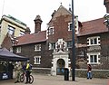
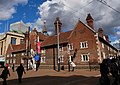
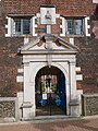
Category:Whitgift Almshouses
Jump to navigation
Jump to search
| Object location | | View all coordinates using: OpenStreetMap |
|---|
Grade I listed building in the United Kingdom  | |||||
| Upload media | |||||
| Instance of | |||||
|---|---|---|---|---|---|
| Location | London Borough of Croydon, Greater London, London, England | ||||
| Heritage designation |
| ||||
 | |||||
Subcategories
This category has the following 2 subcategories, out of 2 total.
C
- Courtyard of Whitgift Almshouses (10 F)
I
- Interior of Whitgift Almshouses (12 F)
Media in category "Whitgift Almshouses"
The following 28 files are in this category, out of 28 total.
-
 Croydon, George Street - geograph.org.uk - 1775571.jpg 3,264 × 2,448; 4.38 MB
-
 De Dion-Bouton Type K1 1902 or Wake me up When we get There - geograph.org.uk - 1566121.jpg 3,872 × 2,592; 3.94 MB
-
 Detail The "Whitgift Hospital" almshouses - panoramio.jpg 2,448 × 3,264; 3.06 MB
-
 Door way at the North End side.jpg 6,000 × 4,000; 12.03 MB
-
 George Street (west) - geograph.org.uk - 722822.jpg 640 × 544; 77 KB
-
 Highways and byways in Surrey (1921) (14596019100).jpg 1,406 × 1,864; 329 KB
-

-
 Hospital of the Holy Trinity, Croydon. - geograph.org.uk - 21862.jpg 640 × 480; 109 KB
-
 La Minerve 1902 on London to Brighton VCR 2009 1566835.jpg 3,872 × 2,592; 4.37 MB
-

-

-
-
 Whitgift Almshouses Courtyard.JPG 3,264 × 2,448; 2.03 MB
-
 Whitgift almshouses croydon.jpg 3,448 × 1,973; 1.52 MB
-
 Whitgift Almshouses, Croydon (Plaque - 01).jpg 3,052 × 3,764; 13.26 MB
-
 Whitgift Almshouses, Croydon (South Face - 01).jpg 4,487 × 3,306; 10.77 MB
-
 Whitgift Almshouses, Croydon (South Face - 02).jpg 3,375 × 4,476; 11.32 MB
-
 Whitgift Almshouses, Croydon (Southwest View - 01).jpg 4,358 × 3,243; 11.27 MB
-
 Whitgift Almshouses, Croydon (West Face - 01).jpg 4,592 × 3,448; 13.58 MB
-
 Whitgift Almshouses, Croydon (West Face - 02).jpg 4,443 × 3,164; 12.11 MB
-
 Whitgift Almshouses, Croydon (West Face Detail - 01).jpg 4,372 × 3,195; 9.3 MB
-
 Whitgift Almshouses, Croydon (West Face Door - 01).jpg 2,830 × 3,784; 8.23 MB
-
 Whitgift Almshouses, Croydon - geograph.org.uk - 2253256.jpg 1,842 × 2,751; 2.37 MB
-
 Whitgift Almshouses, Croydon DSCF0287.JPG 2,048 × 1,536; 744 KB
-
 Whitgift Almshouses, High Street, Croydon - geograph.org.uk - 2194883.jpg 681 × 1,024; 139 KB
-
 Whitgift Almshouses.JPG 3,264 × 2,448; 1.99 MB
-
 Whitgift Foundation Almshouses.jpg 3,920 × 2,940; 3.04 MB
-
 Whitgift Hospital; Croydon, Inner Court. Wellcome L0003042.jpg 1,164 × 1,616; 1,021 KB


_-_geograph.org.uk_-_722822.jpg)
_(14596019100).jpg)


.jpg)


.jpg)
.jpg)
.jpg)
.jpg)
.jpg)
.jpg)
.jpg)
.jpg)


