Category:Whiteparish
Jump to navigation
Jump to search
village and civil parish in Wiltshire, United Kingdom  | |||||
| Upload media | |||||
| Instance of | |||||
|---|---|---|---|---|---|
| Location | Wiltshire, South West England, England | ||||
| official website | |||||
 | |||||
English: Category for files related to Whiteparish.
Subcategories
This category has the following 4 subcategories, out of 4 total.
Media in category "Whiteparish"
The following 200 files are in this category, out of 304 total.
(previous page) (next page)-
 A27 at The Parish Lantern - geograph.org.uk - 3922956.jpg 640 × 361; 45 KB
-
 A27 entering Cowesfield - geograph.org.uk - 3922982.jpg 640 × 480; 62 KB
-
 A27 enters Whiteparish - geograph.org.uk - 3430047.jpg 3,648 × 2,736; 1.48 MB
-

-
 A27 passes The Parish Lantern - geograph.org.uk - 3430050.jpg 3,307 × 2,555; 1.14 MB
-
 A27 penetrates Cowsfield Wood, Great Plantation - geograph.org.uk - 3429976.jpg 3,648 × 2,736; 2.67 MB
-
 A27 towards Salisbury - geograph.org.uk - 5805019.jpg 1,024 × 684; 297 KB
-
 A27 towards Salisbury - geograph.org.uk - 5805030.jpg 1,024 × 684; 236 KB
-
 A27 towards Salisbury - geograph.org.uk - 5805047.jpg 1,024 × 684; 178 KB
-
 A36 at Brickworth Down - geograph.org.uk - 4743478.jpg 640 × 389; 133 KB
-
 A36 near Whites farm - geograph.org.uk - 4234345.jpg 640 × 480; 59 KB
-
 A36 towards Salisbury - geograph.org.uk - 5805078.jpg 1,024 × 684; 257 KB
-
 A36 towards Salisbury - geograph.org.uk - 5805087.jpg 1,024 × 684; 223 KB
-
 A36 west of Brickworth Farm - geograph.org.uk - 4234329.jpg 640 × 480; 63 KB
-
 Abbotstone House, The Street, Whiteparish - geograph.org.uk - 368411.jpg 640 × 427; 216 KB
-
 All Saints Church, Whiteparish - geograph.org.uk - 3878385.jpg 640 × 480; 78 KB
-
 All Saints, Whiteparish, churchyard (A) - geograph.org.uk - 2939819.jpg 640 × 480; 120 KB
-
 All Saints, Whiteparish, churchyard (B) - geograph.org.uk - 2939820.jpg 640 × 480; 109 KB
-
 All Saints, Whiteparish, churchyard (C) - geograph.org.uk - 2939821.jpg 640 × 480; 120 KB
-

-
 All Saints, Whiteparish, churchyard (F) - geograph.org.uk - 2939825.jpg 640 × 480; 120 KB
-

-

-
 All Saints, Whiteparish, churchyard (J) - geograph.org.uk - 2939833.jpg 640 × 480; 110 KB
-

-

-
 All Saints, Whiteparish, churchyard (M) - geograph.org.uk - 2939837.jpg 640 × 480; 126 KB
-

-

-

-

-
-

-

-

-

-
-

-

-

-

-

-

-

-
-

-

-

-

-

-

-

-

-

-

-

-

-

-
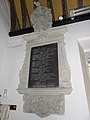
 All Saints, Whiteparish- banner - geograph.org.uk - 2939877.jpg 480 × 640; 68 KB
-

-
 All Saints, Whiteparish- flowers - geograph.org.uk - 2939878.jpg 640 × 480; 59 KB
-
 All Saints, Whiteparish- font - geograph.org.uk - 2939879.jpg 480 × 640; 59 KB
-

-
 All Saints, Whiteparish- lectern - geograph.org.uk - 2939876.jpg 480 × 640; 69 KB
-
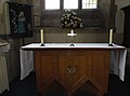
 All Saints, Whiteparish- main altar - geograph.org.uk - 2939888.jpg 640 × 480; 57 KB
-
 All Saints, Whiteparish- organ - geograph.org.uk - 2939875.jpg 480 × 640; 68 KB
-
 All Saints, Whiteparish- pulpit - geograph.org.uk - 2939889.jpg 480 × 640; 55 KB
-
 All Saints, Whiteparish- side altar - geograph.org.uk - 2939886.jpg 640 × 475; 39 KB
-

-
 Approaching entrance to Barters Farm - geograph.org.uk - 3922925.jpg 640 × 437; 95 KB
-

-
 Arnwood, The Street - geograph.org.uk - 2832290.jpg 800 × 610; 137 KB
-
 Ashdod Pond - geograph.org.uk - 4451989.jpg 640 × 480; 142 KB
-
 Ashmore Lane, towards Dean Hill - geograph.org.uk - 2385228.jpg 640 × 480; 58 KB
-
 B and W Nursery, Plaitford - geograph.org.uk - 740378.jpg 640 × 427; 104 KB
-
 Bench Mark, The Pepperbox - geograph.org.uk - 2833715.jpg 480 × 640; 99 KB
-
 Bench Mark, White Parish Primary School - geograph.org.uk - 2781302.jpg 640 × 480; 120 KB
-
 Benchmark (1), Arnwood - geograph.org.uk - 2832353.jpg 800 × 694; 239 KB
-
 Benchmark (2), Arnwood - geograph.org.uk - 2834034.jpg 800 × 672; 228 KB
-
 Benchmark on the pub - geograph.org.uk - 2832808.jpg 800 × 642; 263 KB
-
 Bend in minor road to Whiteparish - geograph.org.uk - 3922917.jpg 640 × 425; 112 KB
-
 Bends in Common Road - geograph.org.uk - 1773153.jpg 640 × 480; 130 KB
-

-
 Brickworth Road near Firlands - geograph.org.uk - 4743494.jpg 640 × 452; 131 KB
-

-
 Bridleway to Whiteparish - geograph.org.uk - 1053000.jpg 640 × 480; 97 KB
-
 Bunny Lane's going nowhere - geograph.org.uk - 3429971.jpg 3,648 × 2,736; 3.1 MB
-
 By-way on Pepperbox Hill - geograph.org.uk - 6191463.jpg 1,024 × 683; 288 KB
-
-
 Chimney stack, The Kings Head - geograph.org.uk - 2781255.jpg 480 × 640; 75 KB
-
 Common Road entering Whiteparish - geograph.org.uk - 3922933.jpg 640 × 483; 114 KB
-
 Common Road just past Jewsons - geograph.org.uk - 2356782.jpg 640 × 480; 100 KB
-
 CommonRoad, Parkwater Road, junction - geograph.org.uk - 2356805.jpg 640 × 480; 130 KB
-
 Communications mast on Dean Hill - geograph.org.uk - 3430081.jpg 3,648 × 2,736; 1.63 MB
-
 Communications mast on Dean Hill - geograph.org.uk - 3628110.jpg 427 × 640; 45 KB
-
 Cottages in Dean Lane - geograph.org.uk - 3810026.jpg 640 × 427; 73 KB
-
 Country lane - geograph.org.uk - 4448709.jpg 640 × 480; 136 KB
-
 Croft Heights, Whiteparish - geograph.org.uk - 2356809.jpg 640 × 480; 57 KB
-

-
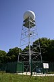 Dean Hill Weather Radar - geograph.org.uk - 315750.jpg 427 × 640; 75 KB
-
 East Dean - Pillbox - geograph.org.uk - 2638529.jpg 800 × 600; 225 KB
-
 East Dean - Pillbox - geograph.org.uk - 2638540.jpg 800 × 600; 235 KB
-
 East Dean - Pillbox - geograph.org.uk - 2641227.jpg 800 × 600; 151 KB
-
 East Dean - Pillbox - geograph.org.uk - 2641235.jpg 800 × 600; 198 KB
-
 East out of Whiteparish on A27 - geograph.org.uk - 3922960.jpg 640 × 444; 56 KB
-
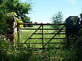 Entrance gate to footpath - geograph.org.uk - 452667.jpg 640 × 480; 131 KB
-
 Farmland north of Whiteparish - geograph.org.uk - 5803023.jpg 1,024 × 768; 144 KB
-

-
 Field beside Bunny Lane - geograph.org.uk - 5923637.jpg 1,024 × 683; 286 KB
-
 Field beside the A36 - geograph.org.uk - 3810072.jpg 640 × 427; 72 KB
-

-
 Fields north of A27 - geograph.org.uk - 2356795.jpg 640 × 480; 82 KB
-

-
 Flush Bracket S9674, Whiteparish - geograph.org.uk - 2781240.jpg 480 × 640; 108 KB
-
 Footpath across meadow, Moor Farm - geograph.org.uk - 460612.jpg 640 × 480; 69 KB
-

-
 Footpath off Moor Lane - geograph.org.uk - 388375.jpg 480 × 640; 173 KB
-

-
 Footpath through the Wood - geograph.org.uk - 363064.jpg 640 × 480; 109 KB
-
 Footpath to Whelpley Farm - geograph.org.uk - 2221114.jpg 640 × 480; 81 KB
-

-
 Frozen pond beside Ashmore Lane - geograph.org.uk - 1628469.jpg 640 × 480; 104 KB
-
 Gill's Hole - geograph.org.uk - 4451958.jpg 640 × 480; 73 KB
-
 Green Close, Whiteparish - geograph.org.uk - 2356786.jpg 640 × 480; 73 KB
-
 Hand car wash - geograph.org.uk - 4448832.jpg 640 × 480; 62 KB
-

-
 Hide, track - geograph.org.uk - 4465531.jpg 640 × 480; 143 KB
-
 Horse exerciser at Whelpley Farm - geograph.org.uk - 368527.jpg 640 × 427; 211 KB
-
 Inside All Saints, Whiteparish (I) - geograph.org.uk - 2939862.jpg 640 × 480; 87 KB
-
 Inside All Saints, Whiteparish (II) - geograph.org.uk - 2939863.jpg 640 × 468; 56 KB
-
 Inside All Saints, Whiteparish (III) - geograph.org.uk - 2939864.jpg 480 × 640; 52 KB
-
 Inside All Saints, Whiteparish (IV) - geograph.org.uk - 2939866.jpg 480 × 640; 52 KB
-
 Inside All Saints, Whiteparish (IX) - geograph.org.uk - 2939872.jpg 480 × 640; 62 KB
-
 Inside All Saints, Whiteparish (V) - geograph.org.uk - 2939867.jpg 480 × 640; 54 KB
-
 Inside All Saints, Whiteparish (VI) - geograph.org.uk - 2939868.jpg 480 × 640; 56 KB
-
 Inside All Saints, Whiteparish (VII) - geograph.org.uk - 2939870.jpg 640 × 480; 54 KB
-

-
 Inside All Saints, Whiteparish (X) - geograph.org.uk - 2939873.jpg 480 × 640; 72 KB
-
 Interior of The Fountain Inn, Whiteparish - geograph.org.uk - 368388.jpg 640 × 427; 196 KB
-
 Junction of Dean Lane and Miles's Lane - geograph.org.uk - 3430071.jpg 3,545 × 2,670; 1.68 MB
-
 Kings Head - geograph.org.uk - 2832559.jpg 800 × 600; 118 KB
-
 Kings Head - geograph.org.uk - 4448791.jpg 640 × 480; 79 KB
-
 Landscape by The Pepperbox - geograph.org.uk - 6191441.jpg 1,024 × 683; 204 KB
-
 Lay-by on A27 - geograph.org.uk - 4448825.jpg 640 × 480; 45 KB
-
 Layby at Cowesfield - geograph.org.uk - 3922978.jpg 640 × 350; 71 KB
-

-
 Looking at Tower Farm from footpath - geograph.org.uk - 368608.jpg 427 × 640; 152 KB
-

-
 Looking northwards in Common Road - geograph.org.uk - 2939894.jpg 640 × 480; 103 KB
-
 Meadow Court, Whiteparish - geograph.org.uk - 2356792.jpg 640 × 480; 92 KB
-

-

-
 Miles Lane, north of Whiteparish - geograph.org.uk - 2385221.jpg 640 × 480; 88 KB
-
 Milestone, Brickworth Corner - geograph.org.uk - 1670992.jpg 480 × 640; 215 KB
-
 Milestone, Whiteparish - geograph.org.uk - 1659025.jpg 640 × 481; 165 KB
-
 Milestone, Whiteparish - geograph.org.uk - 1659109.jpg 480 × 640; 203 KB
-
 Molehills, Pepperbox Hill - geograph.org.uk - 2833705.jpg 640 × 480; 68 KB
-

-

-

-

-
 Moor Farm - geograph.org.uk - 4451967.jpg 640 × 480; 53 KB
-
 Moor Lane - geograph.org.uk - 4451955.jpg 640 × 480; 131 KB
-
 Moor Lane - geograph.org.uk - 4451964.jpg 640 × 480; 49 KB
-
 Muddy track near Tower Farm - geograph.org.uk - 3810014.jpg 640 × 427; 101 KB
-
 Near the end of the A27 - geograph.org.uk - 5805068.jpg 1,024 × 684; 262 KB
-

-
 New house - geograph.org.uk - 4448816.jpg 640 × 480; 74 KB
-
 Newly surfaced by-way near Dean Hill Farm - geograph.org.uk - 6191486.jpg 1,024 × 683; 241 KB
-
 OS benchmark - geograph.org.uk - 4448790.jpg 640 × 480; 65 KB
-
 OS benchmark - geograph.org.uk - 4448817.jpg 640 × 480; 124 KB
-
 OS benchmark on The Pepper Box - geograph.org.uk - 4448840.jpg 640 × 480; 132 KB
-
 OS flush bracket bench mark - geograph.org.uk - 4448752.jpg 640 × 480; 105 KB
-
 Paddock fence north of Whelpley Farm - geograph.org.uk - 368503.jpg 427 × 640; 117 KB
-
 Parkwater Farm - geograph.org.uk - 2356796.jpg 640 × 480; 122 KB
-
 Parkwater Road - geograph.org.uk - 1773163.jpg 640 × 480; 141 KB
-
 Parkwater Road - geograph.org.uk - 2356797.jpg 640 × 480; 113 KB
-
 Parkwater Road - geograph.org.uk - 2356798.jpg 640 × 480; 129 KB
-
 Parkwater Road - geograph.org.uk - 2356802.jpg 640 × 480; 131 KB
-
 Path along edge of sweetcorn field - geograph.org.uk - 5923636.jpg 1,024 × 683; 366 KB
-

-
 Path in Mean Wood - geograph.org.uk - 1053171.jpg 640 × 480; 166 KB
-
 Pit in field NW of Whiteparish - geograph.org.uk - 368584.jpg 640 × 386; 157 KB
-

-
 Public footpath - geograph.org.uk - 4448774.jpg 640 × 480; 104 KB
-
 Public footpath - geograph.org.uk - 4448784.jpg 640 × 480; 125 KB
-
 Public footpath - geograph.org.uk - 4448822.jpg 640 × 480; 96 KB
-
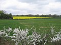
 Rape fields - geograph.org.uk - 3012284.jpg 2,816 × 2,112; 2.5 MB
-
 Refurbishment in The Street, Whiteparish - geograph.org.uk - 368373.jpg 640 × 427; 215 KB
-
 Road junction - geograph.org.uk - 4448758.jpg 640 × 480; 64 KB
-
-
 Roadside duck pond near Cowesfield Green - geograph.org.uk - 413752.jpg 640 × 480; 129 KB
-
 Salisbury District , Countryside Scenery - geograph.org.uk - 3106740.jpg 4,288 × 2,848; 4.9 MB
-
 Salisbury District , Lower Bush Farm - geograph.org.uk - 3106745.jpg 4,288 × 2,848; 5.75 MB
-
 Salisbury District , Road off the A36 - geograph.org.uk - 3106747.jpg 4,288 × 2,848; 5.38 MB
-
 Salisbury District , The A36 Roadside - geograph.org.uk - 3126553.jpg 4,288 × 2,848; 5.52 MB
-
 Salisbury District , The A36 Salisbury Road - geograph.org.uk - 3106756.jpg 3,156 × 2,040; 3.23 MB
-
 Sheep near Whiteparish - geograph.org.uk - 1052161.jpg 640 × 431; 99 KB
-

-
 Stream by Ashdod Farm - geograph.org.uk - 4451991.jpg 640 × 480; 121 KB


_-_geograph.org.uk_-_2939819.jpg)
_-_geograph.org.uk_-_2939820.jpg)
_-_geograph.org.uk_-_2939821.jpg)
_-_geograph.org.uk_-_2939824.jpg)
_-_geograph.org.uk_-_2939825.jpg)
_-_geograph.org.uk_-_2939827.jpg)
_-_geograph.org.uk_-_2939829.jpg)
_-_geograph.org.uk_-_2939833.jpg)
_-_geograph.org.uk_-_2939835.jpg)
_-_geograph.org.uk_-_2939836.jpg)
_-_geograph.org.uk_-_2939837.jpg)
_-_geograph.org.uk_-_2939839.jpg)
_-_geograph.org.uk_-_2939840.jpg)
_-_geograph.org.uk_-_2939841.jpg)
_-_geograph.org.uk_-_2939842.jpg)
_-_geograph.org.uk_-_2939843.jpg)
_-_geograph.org.uk_-_2939844.jpg)
_-_geograph.org.uk_-_2939853.jpg)
_-_geograph.org.uk_-_2939854.jpg)
_-_geograph.org.uk_-_2939856.jpg)
_-_geograph.org.uk_-_2939857.jpg)
_-_geograph.org.uk_-_2939858.jpg)
_-_geograph.org.uk_-_2939859.jpg)
_-_geograph.org.uk_-_2939860.jpg)
_-_geograph.org.uk_-_2939861.jpg)
_-_geograph.org.uk_-_2939845.jpg)
_-_geograph.org.uk_-_2939847.jpg)
_-_geograph.org.uk_-_2939848.jpg)
_-_geograph.org.uk_-_2939849.jpg)
_-_geograph.org.uk_-_2939850.jpg)
_-_geograph.org.uk_-_2939851.jpg)
_-_geograph.org.uk_-_2939852.jpg)
_-_geograph.org.uk_-_2939808.jpg)
_-_geograph.org.uk_-_2939809.jpg)
_-_geograph.org.uk_-_2939811.jpg)
_-_geograph.org.uk_-_2939812.jpg)
_-_geograph.org.uk_-_2939813.jpg)
_-_geograph.org.uk_-_2939815.jpg)
_-_geograph.org.uk_-_2939816.jpg)
_-_geograph.org.uk_-_2939818.jpg)


,_Arnwood_-_geograph.org.uk_-_2832353.jpg)
,_Arnwood_-_geograph.org.uk_-_2834034.jpg)


_-_geograph.org.uk_-_2939862.jpg)
_-_geograph.org.uk_-_2939863.jpg)
_-_geograph.org.uk_-_2939864.jpg)
_-_geograph.org.uk_-_2939866.jpg)
_-_geograph.org.uk_-_2939872.jpg)
_-_geograph.org.uk_-_2939867.jpg)
_-_geograph.org.uk_-_2939868.jpg)
_-_geograph.org.uk_-_2939870.jpg)
_-_geograph.org.uk_-_2939871.jpg)
_-_geograph.org.uk_-_2939873.jpg)


_-_geograph.org.uk_-_2646748.jpg)


