Category:Whatfield
Jump to navigation
Jump to search
English: Whatfield is a village and civil parish in Suffolk, England. Located around two miles north of Hadleigh, it is part of Babergh district. The Calves Wood nature reserve in the north of the parish is classed as Ancient Woodland, whilst the parish's south-western border is delineated by the River Brett.
village in the United Kingdom  | |||||
| Upload media | |||||
| Instance of | |||||
|---|---|---|---|---|---|
| Location | Babergh, Suffolk, East of England, England | ||||
 | |||||
Subcategories
This category has only the following subcategory.
M
Media in category "Whatfield"
The following 77 files are in this category, out of 77 total.
-
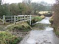
 A ford across the river Brett - geograph.org.uk - 276648.jpg 640 × 480; 88 KB
-
 Ash Street, Ford across the River Brett - geograph.org.uk - 6122380.jpg 6,136 × 4,090; 7.26 MB
-
-
 Ash Street, Wheat field in Rectory Lane - geograph.org.uk - 6122393.jpg 5,608 × 3,739; 5.04 MB
-
 Barely a trickle through Ash Street ford - geograph.org.uk - 4631854.jpg 1,240 × 930; 921 KB
-
 Bridge And Sign - geograph.org.uk - 2269824.jpg 1,200 × 1,600; 459 KB
-
 Cockerel weather vane - geograph.org.uk - 588447.jpg 480 × 640; 55 KB
-

-
 Farm Building - geograph.org.uk - 2269828.jpg 1,600 × 1,200; 463 KB
-
 Field entrance through the trees in Rectory Lane - geograph.org.uk - 4450628.jpg 1,024 × 768; 550 KB
-
 Finger Post - geograph.org.uk - 588439.jpg 480 × 640; 111 KB
-
 Footbridge And Ford - geograph.org.uk - 2785519.jpg 1,024 × 768; 318 KB
-
 Footpath - geograph.org.uk - 2269838.jpg 1,600 × 1,200; 565 KB
-
 Footpath across a field of wheat - geograph.org.uk - 4419301.jpg 1,024 × 768; 264 KB
-
 Footpath And Bridge - geograph.org.uk - 2269820.jpg 1,200 × 1,600; 589 KB
-
 Footpath Sign And road - geograph.org.uk - 2269860.jpg 1,600 × 1,200; 638 KB
-
 Ford Ahead - geograph.org.uk - 2785513.jpg 1,024 × 768; 291 KB
-
 Ford at Ash Street - geograph.org.uk - 3468837.jpg 3,872 × 2,592; 2.34 MB
-
 Ford on Rectory Lane - geograph.org.uk - 5432003.jpg 640 × 480; 175 KB
-

-
 Grey Day - geograph.org.uk - 2243445.jpg 1,600 × 1,200; 571 KB
-
 Haslemere Farm - geograph.org.uk - 2270206.jpg 1,600 × 1,200; 671 KB
-
 House at Whatfield - geograph.org.uk - 618517.jpg 640 × 464; 82 KB
-
-
 Muddy Footpath - geograph.org.uk - 2269835.jpg 1,600 × 1,200; 694 KB
-
 Muddy Road - geograph.org.uk - 2785523.jpg 1,024 × 768; 315 KB
-
 New Road - geograph.org.uk - 2269863.jpg 1,600 × 1,200; 432 KB
-
 Rape coming into flower - geograph.org.uk - 4419302.jpg 1,024 × 768; 374 KB
-
 Rectory Lane, Whatfield - geograph.org.uk - 4450629.jpg 1,024 × 768; 587 KB
-
-
 Rose hips and hedge side footpath - geograph.org.uk - 1070978.jpg 640 × 598; 157 KB
-
 Salvation Army, Whatfield corps - geograph.org.uk - 618512.jpg 640 × 409; 60 KB
-
 The Old Rectory - geograph.org.uk - 2785526.jpg 1,024 × 768; 295 KB
-
 The Old Rectory, Whatfield - moated house in Suffolk (15561712640).jpg 3,072 × 2,100; 2.6 MB
-
 The War Memorial at Whatfield - geograph.org.uk - 4632251.jpg 3,456 × 2,592; 3.51 MB
-
 Town 102 FM - geograph.org.uk - 2785532.jpg 1,024 × 768; 233 KB
-
 Track towards Whatfield Hall - geograph.org.uk - 1071021.jpg 640 × 480; 105 KB
-
 Turning the hay - geograph.org.uk - 5432025.jpg 640 × 480; 134 KB
-

-
 Water Field Ditch - geograph.org.uk - 2269810.jpg 640 × 480; 141 KB
-
 Wet Road - geograph.org.uk - 2269809.jpg 640 × 480; 101 KB
-
 Whatfield CEVC Primary School - geograph.org.uk - 5432021.jpg 640 × 428; 148 KB
-
 Whatfield Road, towards Naughton - geograph.org.uk - 1071036.jpg 640 × 356; 60 KB
-
 Whatfield Roll of Honour - geograph.org.uk - 4632256.jpg 3,456 × 2,592; 3.58 MB
-
 Whatfield village sign (detail) - geograph.org.uk - 4295643.jpg 480 × 640; 84 KB
-
 Whatfield village sign - geograph.org.uk - 4295639.jpg 480 × 640; 68 KB
-
 Whatfield village sign - geograph.org.uk - 588434.jpg 439 × 410; 46 KB
-
 Whatfield village sign - geograph.org.uk - 5889171.jpg 4,320 × 3,240; 4.61 MB
-
 Wheat field south of Rectory Lane - geograph.org.uk - 5432010.jpg 640 × 480; 161 KB
-
 Another muddy footpath - geograph.org.uk - 1071009.jpg 640 × 480; 83 KB
-
 Barrard's Hall, Whatfield, Suffolk - geograph.org.uk - 230165.jpg 640 × 480; 79 KB
-
 Corn Hatches Lane, near Elmsett - geograph.org.uk - 618487.jpg 640 × 519; 103 KB
-
 Country south of Whatfield, looking east - geograph.org.uk - 618324.jpg 640 × 480; 110 KB
-
 Countryside west of Aldham - geograph.org.uk - 618379.jpg 640 × 462; 93 KB
-
 Elmsett Airfield - geograph.org.uk - 561558.jpg 640 × 480; 82 KB
-

-

-

-
 Field edge - geograph.org.uk - 588105.jpg 640 × 480; 109 KB
-
 Footpath to Aldham - geograph.org.uk - 592999.jpg 640 × 427; 97 KB
-
 Footpath to Pigeon Hall Farm - geograph.org.uk - 419739.jpg 640 × 427; 84 KB
-
 Footpath, landing strip and poplars - geograph.org.uk - 618490.jpg 640 × 405; 72 KB
-
 Ground cover - geograph.org.uk - 593002.jpg 640 × 427; 86 KB
-
 High Tree Farm - geograph.org.uk - 277166.jpg 640 × 366; 62 KB
-
 Lane heading west towards the A1141 - geograph.org.uk - 618353.jpg 640 × 420; 55 KB
-
 Lane towards Elmsett from Whatfield - geograph.org.uk - 618510.jpg 640 × 504; 93 KB
-
-

-

-

-
-

-

-
 Samson's Lodge, south of Whatfield - geograph.org.uk - 618334.jpg 640 × 428; 89 KB
-

-
 The lane that leads to Whatfield Hall - geograph.org.uk - 277155.jpg 640 × 480; 114 KB
-
 Tree at lane corner, Whatfield Road - geograph.org.uk - 618508.jpg 640 × 480; 67 KB


.jpg)


_-_geograph.org.uk_-_4295643.jpg)


