Category:Wharfe, Austwick
Jump to navigation
Jump to search
hamlet in North Yorkshire, England, United Kingdom  | |||||
| Upload media | |||||
| Instance of | |||||
|---|---|---|---|---|---|
| Location | Austwick, Craven, North Yorkshire, Yorkshire and the Humber, England | ||||
 | |||||
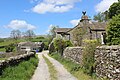
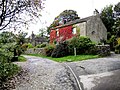
English: Wharfe is a hamlet about a mile north east of the village of Austwick, North Yorkshire, England. Its postcode is LA2 8DQ. The name means 'The bend', referring to the curving hill-side above the hamlet. The name has no connection with the River Wharfe. Moughton Fell rises immediately behind the hamlet to a height of 1,400ft. The upper plateau of Moughton is contained within 856 acres of common land with grazing rights (known as sheep gates).
For the river Wharfe see Category:River Wharfe
Media in category "Wharfe, Austwick"
The following 12 files are in this category, out of 12 total.
-
 A Corner of Wharfe - geograph.org.uk - 1346987.jpg 640 × 480; 116 KB
-
 Cottages in Wharfe - geograph.org.uk - 1525872.jpg 640 × 426; 368 KB
-
 Green Lane in Crummack Dale - geograph.org.uk - 667490.jpg 640 × 480; 79 KB
-
 Limestone pavement, Moughton - geograph.org.uk - 97185.jpg 640 × 418; 99 KB
-
 Manor House, Wharfe.jpg 5,184 × 3,456; 7 MB
-
 Moughton - geograph.org.uk - 32287.jpg 640 × 420; 71 KB
-
 Road to Far End - geograph.org.uk - 749451.jpg 640 × 480; 219 KB
-
 Road to White House - geograph.org.uk - 749460.jpg 640 × 480; 164 KB
-
 Wharfe House, Wharfe - geograph.org.uk - 2624995.jpg 1,024 × 768; 328 KB
-
 White Stone - geograph.org.uk - 172317.jpg 640 × 338; 97 KB
-
 Limestone Pavement near Sulber Gate. - geograph.org.uk - 369874.jpg 640 × 480; 261 KB
-


_above_Crummack_Dale_-_geograph.org.uk_-_667514.jpg)