Category:Whangarei volcanic field
Jump to navigation
Jump to search
volcanic field in New Zealand  | |||||
| Upload media | |||||
| Instance of | |||||
|---|---|---|---|---|---|
| Location | Northland Region, New Zealand | ||||
 | |||||
The Whangarei volcanic field is located around the city of Whangarei. It includes volcanoes in the Glenbervie area northeast of the city, an area from Kamo westward to Church Road, the Maunu, Maungatapere and Whatitiri volcanoes around State Highway 14 (to Dargaville) and Maungakaramea volcano, south of Maungatapere. Sample ref: Whangarei volcanic field page at Global Volcanism Program.
Not to be confused with Category:Whangarei Heads volcano.
Media in category "Whangarei volcanic field"
The following 2 files are in this category, out of 2 total.
-
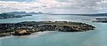 Onerahi Aerial.jpg 284 × 122; 9 KB
-
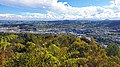 Parihaka te Maunga.jpg 4,032 × 2,268; 2.03 MB
