Category:Whalsay
Jump to navigation
Jump to search
Refer to en:Whalsay

island, one of the Shetland Islands, Scotland, UK  | |||||
| Upload media | |||||
| Instance of | |||||
|---|---|---|---|---|---|
| Part of | |||||
| Location |
| ||||
| Located in or next to body of water | |||||
| Capital | |||||
| Width |
| ||||
| Length |
| ||||
| Population |
| ||||
| Area |
| ||||
| Elevation above sea level |
| ||||
 | |||||
Subcategories
This category has the following 12 subcategories, out of 12 total.
C
- Challister Ness (3 F)
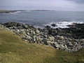
- Coasts of Whalsay (11 F)
L
N
- North Voe, Whalsay (1 F)
W
- Ward of Clett (4 F)
- Whalsay Leisure Centre (2 F)
Y
- Yoxie (1 F)
Media in category "Whalsay"
The following 85 files are in this category, out of 85 total.
-

-
 Beach at Wester Netlar, Whalsay. - geograph.org.uk - 633600.jpg 640 × 374; 71 KB
-
 Benie Hoose - geograph-5453337.jpg 3,727 × 2,414; 2.69 MB
-

-
 Brei Wick, Whalsay, Shetland - geograph.org.uk - 145734.jpg 640 × 480; 108 KB
-
 Brei Wick, Whalsay. - geograph.org.uk - 642720.jpg 640 × 480; 90 KB
-
 Bruse Holm, Lunning Sound - geograph.org.uk - 1809435.jpg 800 × 387; 64 KB
-
 Burnt Mound - geograph.org.uk - 628750.jpg 640 × 480; 54 KB
-
-
 Calf of Linga, Linga Sound - geograph.org.uk - 3346724.jpg 1,024 × 683; 138 KB
-
 Clett Head, Whalsay, Shetland - geograph.org.uk - 145723.jpg 640 × 480; 120 KB
-
 Clett Head, Whalsay, Shetland - geograph.org.uk - 145725.jpg 640 × 480; 78 KB
-
 Clett Head, Whalsay, Shetland - geograph.org.uk - 145740.jpg 640 × 480; 87 KB
-
 Coastline at Symbister - geograph.org.uk - 1809429.jpg 800 × 600; 93 KB
-
 Easter Netlar, Skaw, Whalsay - geograph.org.uk - 3347719.jpg 1,024 × 681; 191 KB
-

-

-
 Gamla Vord (geograph 3578022).jpg 2,560 × 1,920; 3.51 MB
-
 Harbour Mouth, Symbister, Whalsay - geograph.org.uk - 116098.jpg 640 × 482; 64 KB
-
 Houb and Suther Ness, Whalsay - geograph.org.uk - 5021268.jpg 2,592 × 1,944; 1.66 MB
-
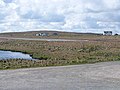
 Huxter Loch - geograph.org.uk - 628879.jpg 640 × 480; 37 KB
-
 Inside a Plantiecrub - geograph.org.uk - 121402.jpg 640 × 480; 178 KB
-

-

-
-
 Kirk Ness, Whalsay - geograph.org.uk - 100925.jpg 640 × 480; 85 KB
-
 Kirk Ness, Whalsay - geograph.org.uk - 1809159.jpg 640 × 241; 35 KB
-
 Lingaveg, Whalsay - geograph.org.uk - 121726.jpg 640 × 480; 105 KB
-
 Mooa Clett, Whalsay, Shetland - geograph.org.uk - 146077.jpg 640 × 480; 63 KB
-
 Nacka Skerry, off Skaw, Whalsay - geograph.org.uk - 3347645.jpg 1,024 × 683; 95 KB
-
 Near Skaw, Whalsay, Shetland - geograph.org.uk - 146055.jpg 640 × 480; 55 KB
-
 Ordnance Survey One-Inch Sheet 3 Shetland, Published 1961.jpg 8,228 × 9,878; 7.74 MB
-
 Outer Holm of Skaw, Whalsay - geograph.org.uk - 3347713.jpg 1,024 × 684; 70 KB
-

-
 Players on Whalsay Golf Course - geograph.org.uk - 1807777.jpg 640 × 436; 95 KB
-
 Prehistoric House - geograph.org.uk - 633230.jpg 640 × 477; 112 KB
-
 Prevail, LK117 at Symbister Harbour - geograph.org.uk - 1809406.jpg 800 × 556; 114 KB
-
-
 Runway of Whalsay Airstrip - geograph-3584975.jpg 640 × 480; 68 KB
-
 Salmon Cages at North Voe, Whalsay - geograph.org.uk - 116107.jpg 640 × 480; 61 KB
-
 Setter Hill, Whalsay, Shetland - geograph.org.uk - 132147.jpg 640 × 480; 53 KB
-
 Sheep in Winter, Whalsay, Shetland - geograph.org.uk - 132086.jpg 640 × 480; 50 KB
-
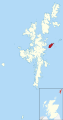 Shetland Whalsay locator.svg 832 × 1,582; 1.64 MB
-

-
 Skaw Loch - geograph.org.uk - 628742.jpg 640 × 480; 69 KB
-
 Skibberhoull, Whalsay, Shetland - geograph.org.uk - 132157.jpg 640 × 480; 58 KB
-

-

-
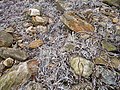 Stones and seaweed - geograph.org.uk - 467214.jpg 640 × 480; 158 KB
-
 Suther Ness - geograph.org.uk - 629729.jpg 640 × 461; 48 KB
-

-
 Symbister Harbour, Whalsay - geograph.org.uk - 116095.jpg 640 × 480; 51 KB
-
 Symbister House, Whalsay - geograph.org.uk - 116087.jpg 640 × 480; 129 KB
-
 Symbister Ness (geograph 3575291).jpg 2,560 × 1,920; 2.31 MB
-
 Symbister Ness lighthouse - geograph.org.uk - 1809424.jpg 800 × 600; 84 KB
-
 Symbister, Whalsay - geograph.org.uk - 1809362.jpg 800 × 600; 77 KB
-
 The Haa, Clett Head, Whalsay, Shetland - geograph.org.uk - 145732.jpg 640 × 480; 129 KB
-
 The Houb, Whalsay - geograph.org.uk - 1809166.jpg 640 × 245; 47 KB
-
-
 The Houll, Whalsay, Shetland - geograph.org.uk - 132126.jpg 640 × 480; 54 KB
-
 Trees at Gardentown, Symbister, Whalsay - geograph.org.uk - 116222.jpg 640 × 480; 142 KB
-
 Veeda Stack, Whalsay, Shetland - geograph.org.uk - 145749.jpg 640 × 480; 65 KB
-
 View at Symbister (geograph 5456125).jpg 3,888 × 2,592; 1.68 MB
-

-
 View towards Brough, Whalsay - geograph.org.uk - 1807607.jpg 640 × 480; 58 KB
-
 View towards Cready Knowe, Whalsay - geograph.org.uk - 1807609.jpg 640 × 480; 48 KB
-
 View towards Wick of Huxter, Whalsay - geograph.org.uk - 1807585.jpg 640 × 274; 45 KB
-
 VK Whalsay.PNG 698 × 551; 10 KB
-
 Ward of Hevdafield, Whalsay, Shetland - geograph.org.uk - 145746.jpg 640 × 480; 78 KB
-

-
 West Linga from Marrister - geograph.org.uk - 3346767.jpg 1,024 × 682; 173 KB
-
 Wester Netlar - geograph.org.uk - 5452359.jpg 3,888 × 2,592; 2.5 MB
-
 Wester Netlar, Whalsay, Shetland - geograph.org.uk - 146067.jpg 640 × 480; 80 KB
-
 Whalsay banner Symbister.jpg 3,883 × 555; 643 KB
-

-
 Whalsay Boating Club - geograph.org.uk - 1809396.jpg 800 × 524; 80 KB
-

-
 Whalsay Golf Out Skerries 1.jpg 640 × 480; 43 KB
-
 Whalsay Golf Out Skerries 2.jpg 640 × 480; 62 KB
-
 Whalsay Kirk and kirkyard - geograph.org.uk - 1809172.jpg 1,024 × 768; 154 KB
-
 Whalsay UK relief location map.svg 1,500 × 1,023; 613 KB
-
 Winter sun over Huxter Loch - geograph.org.uk - 897887.jpg 640 × 363; 62 KB
-
 World War 1 Memorial at Whalsay Kirk - geograph.org.uk - 1809170.jpg 600 × 800; 124 KB
-
 World War 2 Memorial at Whalsay Kirk - geograph.org.uk - 1809167.jpg 1,024 × 768; 320 KB
-
 Yoxie Geo Cliffs - geograph.org.uk - 5294676.jpg 1,600 × 1,200; 731 KB


.jpg)


_Ltd.,_General_Merchants_-_geograph.org.uk_-_1809369.jpg)


.jpg)


.jpg)


