Category:Westerflier
Jump to navigation
Jump to search
| Object location | | View all coordinates using: OpenStreetMap |
|---|
 | |||||
| Upload media | |||||
| Instance of | |||||
|---|---|---|---|---|---|
| Part of | |||||
| Location | Diepenheim, Overijssel, Netherlands | ||||
| Street address |
| ||||
| Heritage designation |
| ||||
 | |||||
|
This is a category about rijksmonumentcomplex number 510155
|
Landhuis:
|
This is a category about rijksmonument number 510156
|
Parkaanleg:
|
This is a category about rijksmonument number 510157
|
Bouwhuis:
|
This is a category about rijksmonument number 510158
|
Dam en hek:
|
This is a category about rijksmonument number 510159
|
Schuur:
|
This is a category about rijksmonument number 529109
|
| Address |
|
Media in category "Westerflier"
The following 16 files are in this category, out of 16 total.
-
 2009-10-07 — Gedichtje bij dikke steen Westerflier.jpg 2,048 × 1,536; 719 KB
-
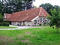 20130815 Westerflier (bouwhuis).jpg 4,896 × 3,672; 2.92 MB
-
 20130815 Westerflier (detail).jpg 2,428 × 4,171; 696 KB
-
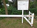 20130815 Westerflier (tolpassage).jpg 4,896 × 3,672; 2.28 MB
-
 20130815 Westerflier1.jpg 4,828 × 3,621; 1.37 MB
-
 20130815 zwerfkei landgoed Westerflier.jpg 3,672 × 4,896; 2.73 MB
-
 Begin van de Regge.jpg 1,280 × 960; 310 KB
-
 Exterieur overzicht voorgevel - Diepenheim - 20311269 - RCE.jpg 1,200 × 953; 315 KB
-
 Huis Westerflier bij Diepenheim.jpg 3,872 × 2,592; 1.31 MB
-
 Huis Westerflier.jpg 2,148 × 1,476; 456 KB
-
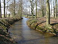 P4010340 Regge river Westervlier.JPG 3,072 × 2,304; 1.72 MB
-
 P4010345 Regge inlaatppunt Schipbeek.JPG 3,072 × 2,304; 1.46 MB
-
 Voor- en zijgevel - Diepenheim - 20057051 - RCE.jpg 1,200 × 810; 310 KB
-
 Voorgevel - Diepenheim - 20057050 - RCE.jpg 1,200 × 807; 233 KB
-
 Westerflier tuin.jpg 2,142 × 1,476; 677 KB
-
 Westerflier.jpg 2,111 × 1,463; 595 KB

.jpg)
.jpg)
.jpg)


