Category:Westcott, Surrey
Jump to navigation
Jump to search
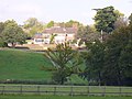
English: Westcott is a village situated on the A25 between Dorking and Guildford in Surrey, England. Neighbouring villages include Friday Street, Wotton, Abinger Common and Abinger Hammer. It formed part of the former Dorking Urban District.
village in the Mole Valley district of Surrey, United Kingdom  | |||||
| Upload media | |||||
| Instance of | |||||
|---|---|---|---|---|---|
| Location | Mole Valley, Surrey, South East England, England | ||||
 | |||||
Subcategories
This category has the following 5 subcategories, out of 5 total.
Media in category "Westcott, Surrey"
The following 80 files are in this category, out of 80 total.
-
 Beast among the bluebells - geograph.org.uk - 788636.jpg 426 × 640; 165 KB
-
 Big Bullsdown railway level crossing.jpg 2,000 × 1,330; 1.57 MB
-

-
 Bluebells - geograph.org.uk - 169078.jpg 640 × 480; 93 KB
-
 Bridleway crossing of the North Downs line - geograph.org.uk - 56862.jpg 640 × 480; 163 KB
-
 Bridleway to the Nower - geograph.org.uk - 328584.jpg 480 × 640; 197 KB
-
 Brook Farm - geograph.org.uk - 589235.jpg 640 × 480; 155 KB
-
 Bury Hill House - geograph.org.uk - 589228.jpg 640 × 480; 106 KB
-
 Bus Stop at Westcott, Surrey - geograph.org.uk - 1405329.jpg 640 × 480; 81 KB
-
 By Florence Farm, south of Westcott - geograph.org.uk - 135632.jpg 640 × 435; 131 KB
-
 Footbridge over the Lake - geograph.org.uk - 326089.jpg 2,848 × 2,136; 2.96 MB
-
 Footpath in Dorking Wood - geograph.org.uk - 779162.jpg 480 × 640; 125 KB
-
 Footpath to Miltoncourt Farm - geograph.org.uk - 589584.jpg 640 × 480; 129 KB
-
 Fox Cottages - geograph.org.uk - 560359.jpg 640 × 480; 149 KB
-
 Guildford Road, Westcott, Surrey - geograph.org.uk - 1405280.jpg 640 × 480; 83 KB
-
 House at Westcott, Surrey - geograph.org.uk - 1405403.jpg 640 × 480; 100 KB
-
 Knoll Brow, Logmore Lane - geograph.org.uk - 1710525.jpg 640 × 427; 103 KB
-
 Lake at Old Bury House - geograph.org.uk - 328545.jpg 640 × 480; 176 KB
-
 Landbarn Farm - geograph.org.uk - 788693.jpg 640 × 426; 90 KB
-
 Lince Lane - geograph.org.uk - 1773337.jpg 427 × 640; 153 KB
-
 Logmore Lane - geograph.org.uk - 59575.jpg 640 × 480; 152 KB
-
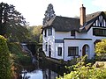 Mill House, Westcott - geograph.org.uk - 589147.jpg 640 × 480; 125 KB
-
 Milton Court Lane (2) - geograph.org.uk - 1728370.jpg 640 × 427; 320 KB
-
 Milton Court Pond - geograph.org.uk - 589560.jpg 640 × 480; 138 KB
-
 Milton Heath - geograph.org.uk - 589542.jpg 640 × 480; 147 KB
-
 Milton Street - geograph.org.uk - 1728342.jpg 640 × 427; 279 KB
-
 North Downs Line - geograph.org.uk - 173777.jpg 480 × 640; 133 KB
-

-
 Pipp Brook Footbridge - geograph.org.uk - 589576.jpg 640 × 480; 126 KB
-
 Pipp Brook Tributary - geograph.org.uk - 589548.jpg 480 × 640; 121 KB
-
 Pond by Westcott - geograph.org.uk - 589151.jpg 480 × 640; 134 KB
-
 Ranmore Common Bridleway - geograph.org.uk - 560363.jpg 640 × 480; 183 KB
-
 Ranmore Common in Spring - geograph.org.uk - 173764.jpg 640 × 480; 129 KB
-
 Rookery Cottage, The Rookery, Westcott.jpg 3,000 × 1,995; 3.04 MB
-

-
 Springs, The Rookery, Westcott.jpg 3,000 × 1,995; 2.29 MB
-
 St.John's, Westcott, Surrey - geograph.org.uk - 1405409.jpg 640 × 480; 84 KB
-
 The Cricketers, Westcott, Surrey - geograph.org.uk - 1405293.jpg 640 × 480; 97 KB
-
 The Cricketers, Westcott, Surrey - geograph.org.uk - 1405299.jpg 640 × 480; 73 KB
-
 The Crown, Westcott, Surrey - geograph.org.uk - 1405422.jpg 640 × 480; 117 KB
-
 The lodge at Milton Court - geograph.org.uk - 56863.jpg 640 × 480; 138 KB
-
 The Old Mill House, Westcott, Surrey.jpg 2,500 × 1,875; 1.35 MB
-

-
 The Temple in The Nower - geograph.org.uk - 104520.jpg 640 × 480; 167 KB
-
 Track Junction in Redlands Wood - geograph.org.uk - 326152.jpg 640 × 480; 188 KB
-
 View to Longmoor Wood, Surrey - geograph.org.uk - 1405242.jpg 640 × 360; 51 KB
-
 View Towards Westcott, Surrey - geograph.org.uk - 1396011.jpg 640 × 428; 70 KB
-
 Wall, The Nower - geograph.org.uk - 1708337.jpg 640 × 427; 99 KB
-
 West of Bury Hill - geograph.org.uk - 589272.jpg 640 × 480; 194 KB
-
 Westcott - geograph.org.uk - 135569.jpg 640 × 439; 160 KB
-
 Westcott - geograph.org.uk - 788695.jpg 640 × 426; 77 KB
-
 Westcott Green bus stop.JPG 3,712 × 2,088; 3.15 MB
-
 Westcott Peace Garden 2019.jpg 3,000 × 1,995; 2.87 MB
-
 Westcott Street - geograph.org.uk - 589143.jpg 640 × 480; 128 KB
-
 Westcott Street - geograph.org.uk - 591934.jpg 640 × 480; 115 KB
-
 Westcott, Dog Poo Fairy sign.jpg 1,470 × 2,000; 634 KB
-
 Westcott, St Johns Community Centre.jpg 3,000 × 1,995; 1.81 MB
-
 Westcott, Surrey - geograph.org.uk - 1405309.jpg 640 × 480; 61 KB
-
 Westlees Farm - geograph.org.uk - 59577.jpg 640 × 480; 129 KB
-
 Wyvern Cottage, 15 Milton Street - geograph.org.uk - 1773370.jpg 640 × 427; 146 KB
-
 By Mad Horse Copse - geograph.org.uk - 589258.jpg 640 × 480; 124 KB
-
 Flintstones, Meet the Flintstones - geograph.org.uk - 560497.jpg 640 × 480; 139 KB
-
 Footpath to Coldharbour Lane - geograph.org.uk - 328549.jpg 480 × 640; 177 KB
-
 Great Copse - geograph.org.uk - 559399.jpg 640 × 480; 190 KB
-
 Hogden Cottage - geograph.org.uk - 560501.jpg 640 × 480; 123 KB
-
 Keeper's Cottage - geograph.org.uk - 589277.jpg 640 × 480; 135 KB
-
 Logmore Green Road End - geograph.org.uk - 589247.jpg 480 × 640; 164 KB
-
 Logpile Near Ranmore Common Road - geograph.org.uk - 559393.jpg 640 × 480; 188 KB
-
 Looking west along the A25, in Westcott - geograph.org.uk - 591925.jpg 624 × 458; 100 KB
-
 North Downs at Ranmore Common - geograph.org.uk - 559412.jpg 640 × 480; 144 KB
-
 North Downs Way by Ranmore Roundabout - geograph.org.uk - 557464.jpg 640 × 480; 135 KB
-
 North Downs Way by Ranmore Roundabout - geograph.org.uk - 559404.jpg 640 × 480; 151 KB
-
 Pickett's Hole - geograph.org.uk - 537196.jpg 640 × 480; 158 KB
-
 Reflections by Milton Court - geograph.org.uk - 589566.jpg 480 × 640; 131 KB
-
 Secret Tunnel - geograph.org.uk - 173760.jpg 480 × 640; 166 KB
-
 Sheep Grazing by Yewtree Farm - geograph.org.uk - 560458.jpg 480 × 640; 114 KB
-
 The Lake, Westcott - geograph.org.uk - 589263.jpg 640 × 480; 159 KB
-
 The Spains, Ranmore - geograph.org.uk - 559410.jpg 640 × 480; 175 KB
-
 View from Ranmore - geograph.org.uk - 382685.jpg 640 × 359; 26 KB
-
 View from the Bridleway - geograph.org.uk - 173758.jpg 500 × 640; 116 KB


_-_geograph.org.uk_-_1728370.jpg)


