Category:Westbourne, West Sussex
Jump to navigation
Jump to search

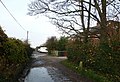
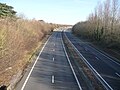
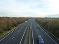
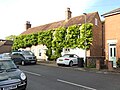
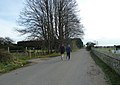
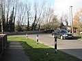
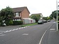
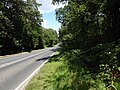
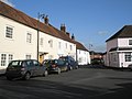
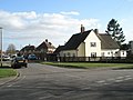
English: Westbourne is a village and civil parish in the Chichester District of West Sussex, England. It is located half a mile (0.8 km) north east of Emsworth. The parish includes the hamlets of Woodmancote and Aldsworth, and once included the settlements of Southbourne and Prinsted to the south. The village stands on the River Ems, a small river flowing into Chichester Harbour at Emsworth. It is believed that the village takes its name from its position on the river, which traditionally marks the westernmost boundary of Sussex, bourne being an archaic term for a boundary as well as for a small river or brook.
village and civil parish in West Sussex, United Kingdom  | |||||
| Upload media | |||||
| Instance of | |||||
|---|---|---|---|---|---|
| Location | Chichester, West Sussex, South East England, England | ||||
| Area |
| ||||
| official website | |||||
 | |||||
Subcategories
This category has the following 3 subcategories, out of 3 total.
W
- Westbourne Baptist Church (9 F)
- Woodmancote, Chichester (6 F)
Media in category "Westbourne, West Sussex"
The following 200 files are in this category, out of 392 total.
(previous page) (next page)-
 "The Cricketers" PH at Westbourne - geograph.org.uk - 1636209.jpg 640 × 360; 32 KB
-
 A chilly morning in Cemetery Lane - geograph.org.uk - 2177668.jpg 640 × 439; 94 KB
-
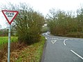
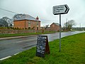
 A familiar sign - geograph.org.uk - 2198594.jpg 640 × 480; 87 KB
-
 A hedge and a screen of trees in Foxbury Lane - geograph.org.uk - 3971336.jpg 1,536 × 1,152; 1.02 MB
-
 A27 from Mill Lane - geograph.org.uk - 5888373.jpg 3,456 × 2,592; 4.34 MB
-
-
 Accident black spot - geograph.org.uk - 1131248.jpg 640 × 480; 137 KB
-
 Across the fields to Westbourne - geograph.org.uk - 355071.jpg 640 × 477; 112 KB
-

-
 Another stile - geograph.org.uk - 4400558.jpg 1,024 × 768; 208 KB
-
 Approaching the bend in the road at Ell Bridge - geograph.org.uk - 2853630.jpg 1,024 × 768; 244 KB
-
-

-
-

-

-

-

-

-
-
-

-

-
-

-

-

-

-
 Art Gallery in North Street - geograph.org.uk - 1203669.jpg 480 × 640; 69 KB
-

-
 B2147 near Ell Bridge - geograph.org.uk - 5804055.jpg 1,024 × 683; 204 KB
-
 B2147 Westbourne - geograph.org.uk - 5888394.jpg 3,456 × 2,592; 4.19 MB
-
 Bend in Westbourne Road - geograph.org.uk - 1286782.jpg 640 × 480; 78 KB
-
 Bend in Westwood Close - geograph.org.uk - 1430164.jpg 640 × 480; 78 KB
-
 Between Emsworth and Westbourne - geograph.org.uk - 355076.jpg 640 × 477; 111 KB
-

-
 Bridge over the A27 - geograph.org.uk - 4401657.jpg 640 × 480; 90 KB
-
 Bridge over the River Ems - geograph.org.uk - 4400547.jpg 1,024 × 768; 201 KB
-

-

-
 Bridleway south to West Ashling Road - geograph.org.uk - 3264099.jpg 4,000 × 3,000; 4.11 MB
-
 Bridleway towards Woodmancote - geograph.org.uk - 5515144.jpg 1,600 × 1,200; 1.14 MB
-
 Bridleway towards Woodmancote - geograph.org.uk - 5515156.jpg 1,600 × 1,200; 1,005 KB
-

-
 Bus shelter in New Brighton Road - geograph.org.uk - 1286687.jpg 640 × 480; 88 KB
-
 Bus shelter in Southleigh Road - geograph.org.uk - 1426872.jpg 640 × 480; 78 KB
-
 Bus shelter in Westbourne Road - geograph.org.uk - 1286762.jpg 640 × 480; 110 KB
-
 Bus stop in North Street - geograph.org.uk - 1203708.jpg 640 × 480; 111 KB
-
 Bus stop in The Square, Westbourne - geograph.org.uk - 1203522.jpg 480 × 640; 49 KB
-

-
 Cemetery Lane, Westbourne - geograph.org.uk - 2448712.jpg 640 × 480; 68 KB
-
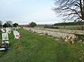
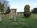
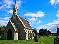 Chapel, Westbourne Cemetery - geograph.org.uk - 227984.jpg 640 × 479; 143 KB
-
 Churcher Road - geograph.org.uk - 1203158.jpg 640 × 429; 86 KB
-
 Churchers Farmhouse, Westbourne, West Sussex (P1020703).jpg 3,672 × 4,896; 7.97 MB
-
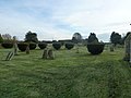
 Clipped yews, Westbourne cemetery - geograph.org.uk - 4386623.jpg 1,024 × 768; 171 KB
-

-
 Cottages in East Street - geograph.org.uk - 1203471.jpg 640 × 480; 51 KB
-
 Cottages in new Road in Westbourne - geograph.org.uk - 1636359.jpg 640 × 360; 52 KB
-
 County boundary in Westbourne - geograph.org.uk - 1636434.jpg 640 × 360; 66 KB
-
 Cranberry, Westbourne, West Sussex (P1020610).jpg 4,896 × 3,672; 7.71 MB
-

-
 Crockford Road - geograph.org.uk - 1203174.jpg 640 × 480; 57 KB
-

-

-
 Cycleway to Westbourne Road - geograph.org.uk - 1430168.jpg 640 × 480; 92 KB
-
 Cyclists in South Lane - geograph.org.uk - 2196717.jpg 640 × 480; 91 KB
-
 Day Centre in Westbourne Road - geograph.org.uk - 1286851.jpg 640 × 480; 95 KB
-
 Dead end in Churcher Road - geograph.org.uk - 1203162.jpg 640 × 480; 62 KB
-
 Decaying shed in Jubilee Wood - geograph.org.uk - 3264106.jpg 4,000 × 3,000; 4.13 MB
-

-
 Derelict stables - geograph.org.uk - 4386634.jpg 1,024 × 768; 250 KB
-
 Duffield Lane, Woodmancote - geograph.org.uk - 2448723.jpg 640 × 480; 126 KB
-
 Duffield Lane, Woodmancote - geograph.org.uk - 4386630.jpg 1,024 × 768; 179 KB
-
 Dukes Close - geograph.org.uk - 1203609.jpg 640 × 480; 70 KB
-
 Eastern end of New Road - geograph.org.uk - 1203581.jpg 480 × 640; 92 KB
-
 Ellesmere Orchard - geograph.org.uk - 1203744.jpg 640 × 480; 80 KB
-
 Emsworth Common Road - geograph.org.uk - 1206549.jpg 640 × 480; 71 KB
-

-
 End of the line - geograph.org.uk - 4386997.jpg 768 × 1,024; 135 KB
-
 Entrance to Hollybank Wood - geograph.org.uk - 355095.jpg 640 × 477; 154 KB
-
-
 Er, actually I've never worn one - geograph.org.uk - 1203539.jpg 640 × 480; 65 KB
-
 Ex-council houses - geograph.org.uk - 351255.jpg 640 × 480; 113 KB
-
 Exhibits at The Art House - geograph.org.uk - 1283693.jpg 640 × 480; 61 KB
-
 Field adjacent to Cemetery Lane - geograph.org.uk - 2177666.jpg 640 × 480; 72 KB
-
 Field behind Westbourne Cemetery - geograph.org.uk - 2178769.jpg 640 × 459; 76 KB
-
 Field corner, Aldsworth - geograph.org.uk - 3990891.jpg 640 × 480; 155 KB
-
 Field to the south of Westbourne Road - geograph.org.uk - 1286834.jpg 640 × 480; 124 KB
-
 Fingerpost at Woodmancote (1) - geograph.org.uk - 2196725.jpg 640 × 480; 116 KB
-
 Fingerpost at Woodmancote (2) - geograph.org.uk - 2196727.jpg 480 × 640; 110 KB
-

-
 Football Pitch, Westbourne - geograph.org.uk - 228055.jpg 640 × 479; 136 KB
-

-
-
 Footpath in Redlands Lane - geograph.org.uk - 355062.jpg 640 × 477; 162 KB
-

-
-
 Footpath sign just south of Woodmancote - geograph.org.uk - 2198605.jpg 640 × 480; 108 KB
-
-
 Footpath to Marlpit Lane - geograph.org.uk - 3264110.jpg 4,000 × 3,000; 3.51 MB
-
 Footpath to Westbourne - geograph.org.uk - 4386974.jpg 1,024 × 768; 223 KB
-
 Footpath Westbourne - geograph.org.uk - 5888388.jpg 3,456 × 2,592; 4.53 MB
-
 Footpath Westbourne - geograph.org.uk - 5888391.jpg 3,456 × 2,592; 4.48 MB
-
 Former Salvation Army Hall, Westbourne Road, Westbourne.JPG 2,400 × 1,800; 1.18 MB
-
 Former The Good Intent Public House, Westbourne, West Sussex (P1020704).jpg 4,896 × 3,672; 7.4 MB
-

-
-
 Havant , Portsmouth Scenery - geograph.org.uk - 3128413.jpg 2,382 × 2,154; 2.86 MB
-
 Hedge in Cemetery Lane - geograph.org.uk - 2196534.jpg 640 × 480; 90 KB
-
 Homefield Road - geograph.org.uk - 1203184.jpg 640 × 480; 77 KB
-
 Horse and four-wheeler at end of Whitechimney Row, Westbourne, West Sussex (P1020785g1).jpg 4,896 × 3,672; 14.08 MB
-
 Horse in South Lane - geograph.org.uk - 2196562.jpg 640 × 480; 65 KB
-
 Houses in New Road - geograph.org.uk - 1203582.jpg 640 × 480; 84 KB
-
-
 Ivy Cottage - Yew Tree Cottage, Westbourne, West Sussex (P1020709).jpg 4,896 × 3,672; 9.1 MB
-
 Joggers in Cemetery Lane - geograph.org.uk - 2196528.jpg 640 × 455; 77 KB
-
 Junction for Stansted Park - geograph.org.uk - 3426594.jpg 640 × 344; 63 KB
-
 Junction of Cemetery and Duffield Lanes - geograph.org.uk - 2177663.jpg 640 × 480; 108 KB
-

-

-

-
-

-
 Junction of New Road and Dukes Close - geograph.org.uk - 1203569.jpg 640 × 480; 97 KB
-

-

-

-

-

-

-
 Junction of two Common Roads - geograph.org.uk - 2853617.jpg 1,024 × 768; 190 KB
-

-
-

-
-

-
 King Street - geograph.org.uk - 1203506.jpg 480 × 640; 52 KB
-
 Kingsbury's Stores The Bakehouse The Lanes (P1020731).jpg 4,896 × 3,672; 7.82 MB
-
 Kingsbury's Stores The Bakehouse The Lanes (P1020909).jpg 4,896 × 3,672; 8.7 MB
-
 Lane arrives at Emsworth Common Road - geograph.org.uk - 2853611.jpg 1,024 × 768; 277 KB
-
 Lane, Aldsworth - geograph.org.uk - 3990914.jpg 640 × 480; 158 KB
-
 Large beech tree on Longcopse Hill - geograph.org.uk - 4593800.jpg 600 × 800; 276 KB
-
 Late autumn in Woodmancote Lane - geograph.org.uk - 2196731.jpg 640 × 480; 115 KB
-
 Late November in Cemetery Lane - geograph.org.uk - 2196537.jpg 640 × 480; 85 KB
-

-
-
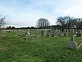
 Late November in Westbourne Cemetery (c) - geograph.org.uk - 2178679.jpg 640 × 480; 117 KB
-
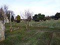
 Late November in Westbourne Cemetery (d) - geograph.org.uk - 2178682.jpg 640 × 480; 110 KB
-
 Late November in Westbourne Cemetery (e) - geograph.org.uk - 2178689.jpg 640 × 480; 120 KB
-

-

-

-

-
 Late November in Westbourne Cemetery (j) - geograph.org.uk - 2178699.jpg 640 × 480; 127 KB
-

-

-
 Late November in Westbourne Cemetery (m) - geograph.org.uk - 2178716.jpg 640 × 480; 117 KB
-

-
-
-
 Late November in Westbourne Cemetery (q) - geograph.org.uk - 2178728.jpg 640 × 480; 107 KB
-

-

-

-

-
 Late November in Westbourne Cemetery (v) - geograph.org.uk - 2178748.jpg 640 × 480; 108 KB
-

-
-
-

-
 Lay-by in South Lane - geograph.org.uk - 2196553.jpg 640 × 465; 56 KB
-
 Lewis Road - geograph.org.uk - 1286693.jpg 640 × 480; 66 KB
-
 Little Hambrook Farm - geograph.org.uk - 2853632.jpg 1,024 × 768; 187 KB
-

-

-

-
 Looking down the New Brighton Road - geograph.org.uk - 1286701.jpg 640 × 480; 101 KB
-

-
 Looking east in South Lane - geograph.org.uk - 2177253.jpg 480 × 640; 82 KB
-
 Looking east on Emsworth Common Road - geograph.org.uk - 4593812.jpg 800 × 600; 176 KB
-

-

-

-

-

-

-

-
-

-

-

-
-
-
-

-
-

-

-

-


.jpg)


.jpg)


_-_geograph.org.uk_-_2196725.jpg)
_-_geograph.org.uk_-_2196727.jpg)


.jpg)


.jpg)


.jpg)


.jpg)
.jpg)


_-_geograph.org.uk_-_2178673.jpg)
_-_geograph.org.uk_-_2178674.jpg)
_-_geograph.org.uk_-_2178679.jpg)
_-_geograph.org.uk_-_2178682.jpg)
_-_geograph.org.uk_-_2178689.jpg)
_-_geograph.org.uk_-_2178692.jpg)
_-_geograph.org.uk_-_2178693.jpg)
_-_geograph.org.uk_-_2178695.jpg)
_-_geograph.org.uk_-_2178703.jpg)
_-_geograph.org.uk_-_2178699.jpg)
_-_geograph.org.uk_-_2178709.jpg)
_-_geograph.org.uk_-_2178713.jpg)
_-_geograph.org.uk_-_2178716.jpg)
_-_geograph.org.uk_-_2178718.jpg)
_-_geograph.org.uk_-_2178722.jpg)
_-_geograph.org.uk_-_2178726.jpg)
_-_geograph.org.uk_-_2178728.jpg)
_-_geograph.org.uk_-_2178730.jpg)
_-_geograph.org.uk_-_2178735.jpg)
_-_geograph.org.uk_-_2178742.jpg)
_-_geograph.org.uk_-_2178738.jpg)
_-_geograph.org.uk_-_2178748.jpg)
_-_geograph.org.uk_-_2178749.jpg)
_-_geograph.org.uk_-_2178751.jpg)
_-_geograph.org.uk_-_2178760.jpg)
_-_geograph.org.uk_-_2178765.jpg)


