Category:West end of St John the Evangelist, Knotty Ash
Jump to navigation
Jump to search
| Object location | | View all coordinates using: OpenStreetMap |
|---|
Media in category "West end of St John the Evangelist, Knotty Ash"
The following 6 files are in this category, out of 6 total.
-
 Clock face, St John the Evangelist, Knotty Ash.jpg 5,184 × 3,456; 7.2 MB
-
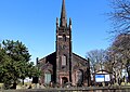
 St John the Evangelist, Knotty Ash - geograph.org.uk - 124087.jpg 421 × 640; 78 KB
-
 St John the Evangelist, Knotty Ash Feb 10 2010.jpg 2,254 × 2,974; 965 KB
-
 St John the Evangelist, Knotty Ash 3.jpg 4,744 × 3,374; 10 MB
-
 St John the Evangelist, Knotty Ash 3a.jpg 2,968 × 4,737; 6.87 MB
-


