Category:West Leake
Jump to navigation
Jump to search
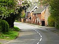
English: West Leake ( is a small village and civil parish in the Rushcliffe district of Nottinghamshire. It is on the Kingston Brook, between East Leake (to the east) and Kingston to the west. The parish church is St. Helena's Church.
village in the United Kingdom | |||||
| Upload media | |||||
| Instance of | |||||
|---|---|---|---|---|---|
| Location | Rushcliffe, Nottinghamshire, East Midlands, England | ||||
 | |||||
Subcategories
This category has only the following subcategory.
H
- St Helena's Church, West Leake (16 F)
Media in category "West Leake"
The following 195 files are in this category, out of 195 total.
-
 Across the fields towards Ash Spinney (1) - geograph.org.uk - 4855993.jpg 1,024 × 768; 242 KB
-
 Across the fields towards Ash Spinney (2) - geograph.org.uk - 4856000.jpg 1,024 × 768; 227 KB
-
 Along the grid line (almost) - geograph.org.uk - 5803973.jpg 1,280 × 960; 401 KB
-
 Approaching Crownend Wood - geograph.org.uk - 4856147.jpg 1,024 × 768; 213 KB
-
 Ash Spinney on Foxhill - geograph.org.uk - 1298826.jpg 640 × 480; 177 KB
-
 Ash Spinney, West Leake - geograph.org.uk - 4465.jpg 640 × 316; 57 KB
-
 Barley and beans - geograph.org.uk - 5798403.jpg 1,280 × 960; 525 KB
-
 Barley field near Grange Farm - geograph.org.uk - 5803971.jpg 1,280 × 960; 310 KB
-
 Benchmark on a building beside Main Street - geograph.org.uk - 3356675.jpg 2,048 × 1,536; 732 KB
-
 Benchmark stone 290ft - geograph.org.uk - 4398999.jpg 960 × 720; 436 KB
-

-
 Blue bells in Leake new wood - geograph.org.uk - 1298868.jpg 640 × 480; 219 KB
-
 Brickyard Lane - geograph.org.uk - 1772521.jpg 640 × 427; 90 KB
-
 Brickyard Lane - geograph.org.uk - 1775153.jpg 640 × 427; 106 KB
-
 Brickyard Lane - geograph.org.uk - 1775212.jpg 640 × 427; 87 KB
-
 Bridge over Kingston Brook - geograph.org.uk - 5758944.jpg 1,280 × 960; 623 KB
-
 Bridleway and trees in the mist - geograph.org.uk - 4267899.jpg 1,024 × 768; 194 KB
-
 Bridleway at Fox Hill - geograph.org.uk - 6310422.jpg 1,024 × 768; 189 KB
-
 Bridleway between two woods - geograph.org.uk - 6310561.jpg 1,024 × 768; 257 KB
-
 Bridleway down Mill Hill to West Leake - geograph.org.uk - 5758978.jpg 1,280 × 960; 732 KB
-
 Bridleway east of West Leake - geograph.org.uk - 4855687.jpg 1,024 × 768; 186 KB
-
 Bridleway junction at Crow Wood Hill - geograph.org.uk - 3356661.jpg 2,048 × 1,536; 593 KB
-
 Bridleway junction on Crow Wood Hill - geograph.org.uk - 5798476.jpg 1,280 × 960; 534 KB
-
 Bridleway near West Leake - geograph.org.uk - 5803981.jpg 960 × 1,280; 571 KB
-
 Bridleway north of West Leake - geograph.org.uk - 4855957.jpg 1,024 × 768; 164 KB
-
 Bridleway on Court Hill - geograph.org.uk - 5798486.jpg 1,280 × 960; 591 KB
-
 Bridleway on Court Hill - geograph.org.uk - 5798488.jpg 1,280 × 960; 585 KB
-
 Bridleway past Crownend Wood (1) - geograph.org.uk - 4856157.jpg 1,024 × 768; 222 KB
-
 Bridleway past Crownend Wood (2) - geograph.org.uk - 4856166.jpg 1,024 × 768; 242 KB
-
 Bridleway through Crownend Wood - geograph.org.uk - 4795362.jpg 480 × 640; 71 KB
-
 Bridleway through Shiddock's Spinney - geograph.org.uk - 4267933.jpg 1,024 × 768; 210 KB
-
 Bridleway towards West Leake - geograph.org.uk - 4795394.jpg 480 × 640; 65 KB
-
 Bridleway towards West Leake - geograph.org.uk - 4795397.jpg 480 × 640; 47 KB
-
 Bridleway towards West Leake - geograph.org.uk - 4795400.jpg 480 × 640; 84 KB
-
 Bridleway west of Ash Spinney - geograph.org.uk - 4855977.jpg 1,024 × 768; 193 KB
-
 Bridleway, Crow Wood Hill - geograph.org.uk - 6310538.jpg 1,024 × 768; 287 KB
-
 California Farm - geograph.org.uk - 10417.jpg 640 × 429; 111 KB
-
 California Farm and Plantation - geograph.org.uk - 4905000.jpg 3,264 × 2,448; 4.02 MB
-
 Calke Hall Farm - geograph.org.uk - 4906857.jpg 3,264 × 2,448; 4.12 MB
-
 Cherry tree and lychgate, Old Leake (geograph 7127618).jpg 1,024 × 768; 325 KB
-
 Chestnut Tree at West Leake - geograph.org.uk - 9655.jpg 640 × 480; 232 KB
-
 Churchyard snowdrops, West Leake - geograph.org.uk - 4855872.jpg 1,024 × 768; 360 KB
-
 Cold Harbour Farm and Plantation - geograph.org.uk - 4905004.jpg 3,264 × 2,448; 4.33 MB
-
 Copse south of Crownend Wood - geograph.org.uk - 4856141.jpg 1,024 × 768; 157 KB
-
 Court Hill in the mist - geograph.org.uk - 4267945.jpg 1,024 × 768; 112 KB
-
 Crop field west of Dark Lane - geograph.org.uk - 4037308.jpg 640 × 480; 83 KB
-
 Crownend Wood in the distance - geograph.org.uk - 4795356.jpg 480 × 640; 51 KB
-
 Danger – Mine subsidence - geograph.org.uk - 5803966.jpg 1,280 × 960; 355 KB
-
 Dark Lane - geograph.org.uk - 4037307.jpg 640 × 480; 80 KB
-
 Dark Lane, West Leake - geograph.org.uk - 3987416.jpg 1,280 × 960; 296 KB
-
 Dew Pond near West Leake - geograph.org.uk - 4795399.jpg 640 × 480; 145 KB
-
 Dew pond west leake.jpg 640 × 480; 142 KB
-
 Disused building beside Rushcliffe golf course - geograph.org.uk - 3356654.jpg 2,048 × 1,536; 590 KB
-
 East Leake - geograph.org.uk - 1298835.jpg 640 × 480; 218 KB
-
 East Leake - geograph.org.uk - 1298853.jpg 640 × 480; 173 KB
-

-
 East Leake sewage works - geograph.org.uk - 4000970.jpg 1,280 × 960; 330 KB
-
 End of the tarmac - geograph.org.uk - 4264729.jpg 1,024 × 768; 140 KB
-
 Entrance to Manor Farm - geograph.org.uk - 1774873.jpg 640 × 427; 122 KB
-
 Farm track near Grange Farm - geograph.org.uk - 5803959.jpg 1,280 × 926; 323 KB
-
 Farm track off Dark Lane - geograph.org.uk - 4037306.jpg 640 × 480; 101 KB
-
 Field east of West Leake - geograph.org.uk - 4855763.jpg 1,024 × 768; 246 KB
-
 Field edge footpath - geograph.org.uk - 5803952.jpg 1,280 × 960; 449 KB
-
 Field north of West Leake - geograph.org.uk - 4855891.jpg 1,024 × 768; 227 KB
-
 Field south west of West Leake Hills - geograph.org.uk - 4856036.jpg 1,024 × 768; 214 KB
-
 Field west of West Leake Hills - geograph.org.uk - 4856079.jpg 1,024 × 768; 187 KB
-
 Fingerpost at Dark Lane, West Leake - geograph.org.uk - 3987413.jpg 960 × 1,280; 453 KB
-
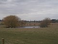
 Fish pond - geograph.org.uk - 5884512.jpg 1,280 × 960; 627 KB
-
 Flooded corner of a field, Fox Hill - geograph.org.uk - 6310534.jpg 1,024 × 768; 192 KB
-
 Footbridge off Wossock Lane north of West Leake - geograph.org.uk - 4856115.jpg 1,024 × 768; 165 KB
-
 Footpath from West Leake - geograph.org.uk - 4590807.jpg 640 × 480; 67 KB
-
 Footpath on Fox Hill - geograph.org.uk - 5798449.jpg 1,280 × 960; 492 KB
-
 Footpath towards Kingston - geograph.org.uk - 5798392.jpg 1,280 × 960; 463 KB
-
 Footpath towards West Leake - geograph.org.uk - 4795403.jpg 480 × 640; 89 KB
-
 Foursquare – an invisible crossing - geograph.org.uk - 5803978.jpg 960 × 1,280; 586 KB
-
 Fox Hill Farm - geograph.org.uk - 3356666.jpg 2,048 × 1,536; 605 KB
-
 Fox Hill Farm - geograph.org.uk - 5798452.jpg 1,280 × 867; 490 KB
-
 Freshly Cut Grass - geograph.org.uk - 10421.jpg 640 × 480; 192 KB
-
 From West Leake Hills - geograph.org.uk - 4795391.jpg 480 × 640; 76 KB
-
 Grange Farm - geograph.org.uk - 4795393.jpg 480 × 640; 77 KB
-
 Hedgerow below West Leake Hills - geograph.org.uk - 5798522.jpg 1,280 × 960; 489 KB
-
 Horse riders passing Fox Hill Farm - geograph.org.uk - 2708.jpg 640 × 480; 75 KB
-
 In Leake New Wood - geograph.org.uk - 5798517.jpg 960 × 1,280; 563 KB
-
 Junction of bridleways east of West Leake - geograph.org.uk - 4855775.jpg 1,024 × 768; 269 KB
-
 Kingston Brook - geograph.org.uk - 5798390.jpg 1,280 × 960; 474 KB
-
 Kingston Brook at Pithouse Lane - geograph.org.uk - 5758897.jpg 1,280 × 960; 776 KB
-
 Lane passing Crow Wood - geograph.org.uk - 5798473.jpg 1,280 × 813; 316 KB
-
 Leake New Wood - geograph.org.uk - 4795377.jpg 480 × 640; 123 KB
-
 Leake New Wood - geograph.org.uk - 4795384.jpg 480 × 640; 140 KB
-
 Leake New Wood - geograph.org.uk - 4795387.jpg 480 × 640; 133 KB
-
 Leake New Wood in the mist - geograph.org.uk - 4267910.jpg 1,024 × 768; 219 KB
-
 Leaving Leake New Wood - geograph.org.uk - 5798519.jpg 1,280 × 961; 397 KB
-
 Leaving Leake New Wood - geograph.org.uk - 5798520.jpg 1,280 × 917; 378 KB
-
 Log pile on the West Leake Hills - geograph.org.uk - 3822641.jpg 3,776 × 2,520; 3.92 MB
-
 Lonely trailer at Manor Farm - geograph.org.uk - 1298730.jpg 640 × 480; 176 KB
-
 Main Street, West Leake - geograph.org.uk - 4037310.jpg 640 × 480; 83 KB
-
 Main Street, West Leake - geograph.org.uk - 4037311.jpg 640 × 480; 78 KB
-
 Main Street, West Leake - geograph.org.uk - 4855855.jpg 1,024 × 768; 244 KB
-
 Manor Farm - geograph.org.uk - 1774886.jpg 640 × 427; 97 KB
-
 Manure yard south west of West Leake Hills - geograph.org.uk - 4856046.jpg 1,024 × 768; 190 KB
-
 May blossom by Kingston Brook - geograph.org.uk - 5758950.jpg 1,280 × 960; 740 KB
-
 Midshires Way at West Leake - geograph.org.uk - 3356673.jpg 2,048 × 1,536; 604 KB
-
 Midshires Way at West Leake - geograph.org.uk - 5798402.jpg 1,280 × 960; 571 KB
-
 Midshires Way on Fox Hill - geograph.org.uk - 3356668.jpg 2,048 × 1,536; 544 KB
-
 Midshires Way on Fox Hill - geograph.org.uk - 5798467.jpg 1,280 × 960; 475 KB
-
 Muddy bridleway over West Leake Hills - geograph.org.uk - 4856070.jpg 1,024 × 768; 239 KB
-
 Muddy bridleway, Court Hill - geograph.org.uk - 4267931.jpg 1,024 × 768; 146 KB
-
 Muddy field off Wossock Lane - geograph.org.uk - 4856086.jpg 1,024 × 768; 125 KB
-
-
 Oilseed rape crop - geograph.org.uk - 4037304.jpg 640 × 480; 66 KB
-
 On Fox Hill - geograph.org.uk - 5798456.jpg 1,280 × 960; 476 KB
-
 Outbuilding on Main Street, West Leake - geograph.org.uk - 3356679.jpg 2,048 × 1,536; 552 KB
-
 Outbuildings at Scotland Farm - geograph.org.uk - 3356943.jpg 2,048 × 1,536; 750 KB
-
 Path junction north of West Leake - geograph.org.uk - 4855939.jpg 1,024 × 768; 187 KB
-
 Pond alongside the bridleway near West Leake - geograph.org.uk - 5803979.jpg 1,280 × 960; 614 KB
-
 Pond in a fleece-covered field - geograph.org.uk - 6147976.jpg 1,280 × 960; 429 KB
-
 Public bridleway near Grange Farm - geograph.org.uk - 5803969.jpg 1,280 × 960; 382 KB
-
 Public footpath north of West Leake - geograph.org.uk - 4855917.jpg 1,024 × 768; 220 KB
-

-
-

-
 Ride in Leake New Wood - geograph.org.uk - 5798516.jpg 960 × 1,280; 618 KB
-
 Rushcliffe golf course. - geograph.org.uk - 4590809.jpg 640 × 480; 66 KB
-
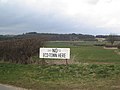 Save the countryside - geograph.org.uk - 740676.jpg 640 × 480; 59 KB
-
 Scotland Plantation - geograph.org.uk - 3433910.jpg 640 × 427; 99 KB
-

-
 Small lake near Scotland Farm - geograph.org.uk - 3356944.jpg 2,048 × 1,536; 581 KB
-
 South eastern edge of Leake New Wood - geograph.org.uk - 4267893.jpg 1,024 × 768; 142 KB
-
 Stocking Lane - geograph.org.uk - 5798465.jpg 1,280 × 960; 271 KB
-
 Stocking Lane on Crow Wood Hill - geograph.org.uk - 5798477.jpg 960 × 1,280; 311 KB
-
 Stubble field, West Leake - geograph.org.uk - 6310419.jpg 1,024 × 768; 222 KB
-
 The edge of Foxhill Wood from the Midshires Way - geograph.org.uk - 5798443.jpg 1,280 × 838; 360 KB
-
 The edge of West Leake Hills - geograph.org.uk - 5803955.jpg 1,280 × 960; 371 KB
-
 The entrance to Fox Hill Farm - geograph.org.uk - 5798460.jpg 1,280 × 960; 604 KB
-
 The Green at West Leake - geograph.org.uk - 6310415.jpg 1,024 × 768; 439 KB
-
 The Midshires Way bridleway heading down towards West Leake - geograph.org.uk - 3822655.jpg 3,776 × 2,520; 1.75 MB
-
 The Midshires Way climbing Fox Hill - geograph.org.uk - 3822656.jpg 3,554 × 2,314; 1.05 MB
-
 The Midshires Way on Fox Hill - geograph.org.uk - 4590812.jpg 640 × 364; 53 KB
-
 The Old Rectory, West Leake - geograph.org.uk - 3987422.jpg 1,280 × 946; 509 KB
-

-
 The site of Grange Farm - geograph.org.uk - 5803961.jpg 1,280 × 960; 315 KB
-
 Track from Grange Farm - geograph.org.uk - 5803968.jpg 1,280 × 960; 383 KB
-
 Track into Shiddock's Spinney - geograph.org.uk - 4267924.jpg 1,024 × 768; 192 KB
-
 Track junction in the mist - geograph.org.uk - 4264737.jpg 1,024 × 768; 90 KB
-
 Track near Grange Farm - geograph.org.uk - 5803962.jpg 1,280 × 960; 403 KB
-
 Track skirting West Leake Hills - geograph.org.uk - 4856057.jpg 1,024 × 768; 227 KB
-
 Track south of Crownend Wood - geograph.org.uk - 4856144.jpg 1,024 × 768; 183 KB
-
 Track towards Moulter Hill - geograph.org.uk - 3356690.jpg 2,048 × 1,536; 513 KB
-
 Tree on Wossock Lane - geograph.org.uk - 2724.jpg 640 × 480; 56 KB
-
 View from Crownend Wood - geograph.org.uk - 4795357.jpg 640 × 480; 55 KB
-
 View from Fox Hill - geograph.org.uk - 5798432.jpg 1,280 × 960; 370 KB
-
 View from the Midshires Way on Fox Hill - geograph.org.uk - 5798405.jpg 1,280 × 960; 579 KB
-
 View from the West Leake Hills - geograph.org.uk - 740606.jpg 640 × 480; 52 KB
-
 View towards Oak Wood - geograph.org.uk - 5798475.jpg 1,280 × 960; 509 KB
-
 Village Hall, West Leake - geograph.org.uk - 4855811.jpg 1,024 × 768; 203 KB
-
 West Leake fields - geograph.org.uk - 1298805.jpg 640 × 480; 181 KB
-
 West Leake Footbridge - geograph.org.uk - 1298745.jpg 640 × 480; 186 KB
-
 West Leake Footbridge - geograph.org.uk - 1298754.jpg 640 × 480; 205 KB
-
 West Leake footpath - geograph.org.uk - 1298779.jpg 480 × 640; 198 KB
-
 West Leake footpath to Fox Hill - geograph.org.uk - 1298793.jpg 640 × 480; 192 KB
-
 West Leake footpath to Fox Hill - geograph.org.uk - 1298809.jpg 640 × 480; 188 KB
-
 West Leake from track on Fox Hill - geograph.org.uk - 1298817.jpg 640 × 480; 185 KB
-
 West Leake from track on Fox Hill - geograph.org.uk - 1298823.jpg 640 × 480; 191 KB
-
 West Leake Lane - geograph.org.uk - 4037305.jpg 640 × 480; 51 KB
-
 West Leake Trees - geograph.org.uk - 1298737.jpg 640 × 480; 154 KB
-
 West Leake Village Hall - geograph.org.uk - 4037312.jpg 640 × 480; 64 KB
-
 West Leake, bus shelter and postbox - geograph.org.uk - 3987425.jpg 1,280 × 960; 433 KB
-
-
 West LeakeMain street - geograph.org.uk - 1298786.jpg 640 × 480; 208 KB
-
 Whitehills Farm - geograph.org.uk - 6147972.jpg 1,280 × 960; 524 KB
-
 Works on Trowell Lane - geograph.org.uk - 10419.jpg 640 × 407; 104 KB
-
 Wossock Lane - geograph.org.uk - 6310562.jpg 1,024 × 768; 209 KB
-
 Wossock Lane - geograph.org.uk - 740651.jpg 640 × 480; 69 KB
-
 Wossock Lane approaching Crownend Wood - geograph.org.uk - 3353290.jpg 2,048 × 1,536; 565 KB
-
 Wossock Lane north of West Leake - geograph.org.uk - 4856124.jpg 1,024 × 768; 127 KB
-
 Wossock Lane to Crownend Wood - geograph.org.uk - 4795342.jpg 480 × 640; 68 KB
-
 Wossock Lane to Crownend Wood - geograph.org.uk - 4795344.jpg 480 × 640; 68 KB
-
 Wossock Lane to Crownend Wood - geograph.org.uk - 4795346.jpg 480 × 640; 66 KB
-
 Wossock Lane to Crownend Wood - geograph.org.uk - 4795349.jpg 480 × 640; 52 KB
-
 Wossock Lane to Crownend Wood - geograph.org.uk - 4795351.jpg 480 × 640; 58 KB
-
 Wossock Lane to Crownend Wood - geograph.org.uk - 4795355.jpg 480 × 640; 78 KB
-
 Bridleway West Leake Hills - geograph.org.uk - 746269.jpg 640 × 480; 130 KB
-
 Crownend Wood - geograph.org.uk - 15935.jpg 640 × 408; 90 KB
-
 East Lodge Entrance, Kingston Hall - geograph.org.uk - 15933.jpg 640 × 506; 179 KB
-
 East Lodge, Kingston Hall - geograph.org.uk - 15932.jpg 640 × 518; 198 KB
-
 Footpath to the West Leake Hills - geograph.org.uk - 740620.jpg 640 × 480; 76 KB
-
 Landcroft Lane - geograph.org.uk - 740687.jpg 640 × 480; 69 KB
-
 Leake New Wood - geograph.org.uk - 2710.jpg 640 × 480; 102 KB
-
 Limekiln Plantation, Normanton on Soar - geograph.org.uk - 18794.jpg 640 × 480; 229 KB
-
 Manor Farm - geograph.org.uk - 10420.jpg 640 × 362; 86 KB
-
 Old Finger Post - geograph.org.uk - 10394.jpg 476 × 640; 187 KB
-
 The Star at West Leake - geograph.org.uk - 10395.jpg 640 × 498; 179 KB
-
 Walking to West Leake - geograph.org.uk - 5704.jpg 640 × 480; 82 KB
-
 West Leake Road - geograph.org.uk - 2728.jpg 640 × 480; 66 KB
-
 Winter landscape - geograph.org.uk - 6178.jpg 640 × 480; 199 KB
_-_geograph.org.uk_-_4855993.jpg)
_-_geograph.org.uk_-_4856000.jpg)
_-_geograph.org.uk_-_5803973.jpg)


_near_Grange_Farm_-_geograph.org.uk_-_5803965.jpg)


_-_geograph.org.uk_-_4856157.jpg)
_-_geograph.org.uk_-_4856166.jpg)


.jpg)


