Category:Wells-next-the-Sea
Jump to navigation
Jump to search

port town on the North Norfolk coast of England  | |||||
| Upload media | |||||
| Instance of | |||||
|---|---|---|---|---|---|
| Location | North Norfolk, Norfolk, East of England, England | ||||
| Located in or next to body of water | |||||
| Population |
| ||||
| Area |
| ||||
 | |||||
English: Wells-next-the-Sea, known locally simply as Wells, is a town, civil parish and seaport situated on the North Norfolk coast in England.
Norsk bokmål: Wells-next-the-Sea, lokalt kjent bare som Wells, er en havneby og et verdslig sogn i Norfolk i England.
Română: Wells-next-the-Sea este un oraş în comitatul Norfolk, regiunea East, Anglia. Oraşul se află în districtul North Norfolk.
Subcategories
This category has the following 8 subcategories, out of 8 total.
Media in category "Wells-next-the-Sea"
The following 200 files are in this category, out of 1,009 total.
(previous page) (next page)-
 "Deadly enemies of mankind" - geograph.org.uk - 5384672.jpg 640 × 480; 46 KB
-
 "ECC Strider" in the Run - geograph.org.uk - 3000070.jpg 640 × 480; 80 KB
-
 "ECC Strider" in the Run - geograph.org.uk - 3000075.jpg 640 × 480; 73 KB
-
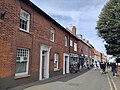 27-41 Staithe Street.jpg 4,000 × 3,000; 4.58 MB
-
 A busy beach at Wells-Next-The-Sea - geograph.org.uk - 6256353.jpg 4,032 × 3,024; 1.34 MB
-

-
 A hardy specimen - geograph.org.uk - 4212938.jpg 1,600 × 1,200; 741 KB
-
 A Rural Hospital - geograph.org.uk - 4223114.jpg 1,600 × 1,019; 642 KB
-
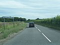
 A149 - geograph.org.uk - 3938726.jpg 640 × 430; 77 KB
-
 A149 - geograph.org.uk - 4053824.jpg 640 × 284; 36 KB
-
-

-
 A149 into Wells - geograph.org.uk - 6022965.jpg 1,600 × 1,177; 283 KB
-
 A149 Mill Road, Wells-next-the-Sea - geograph.org.uk - 3618163.jpg 640 × 480; 57 KB
-
 A149 Warham Road looking east - geograph.org.uk - 3618167.jpg 640 × 481; 72 KB
-
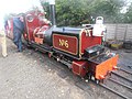 About to depart - geograph.org.uk - 4090901.jpg 640 × 480; 112 KB
-
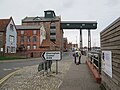
 Access to Wells from the car park - geograph.org.uk - 6017396.jpg 768 × 1,024; 150 KB
-
 Ahead The Quay and the Granary - geograph.org.uk - 5950951.jpg 4,608 × 3,456; 3.91 MB
-
 Along the Bank towards the sea - geograph.org.uk - 6017399.jpg 1,024 × 768; 125 KB
-
 Along the Bank towards the sea - geograph.org.uk - 6017400.jpg 1,024 × 768; 124 KB
-
 Along the Beach Road to Wells - geograph.org.uk - 2084125.jpg 640 × 480; 76 KB
-
-
 Alpacas at Wells-next-the-Sea - geograph.org.uk - 5616507.jpg 800 × 576; 138 KB
-
 Amongst the Dunes - geograph.org.uk - 5634315.jpg 640 × 425; 37 KB
-
 An incoming tide, Wells-Next-The-Sea - geograph.org.uk - 3058964.jpg 4,320 × 3,240; 5.34 MB
-
 Anchor Lane - geograph.org.uk - 5384650.jpg 480 × 640; 75 KB
-
-
 Approaching the Lookout Station - geograph.org.uk - 6017402.jpg 1,024 × 768; 142 KB
-
 B1105 towards Fakenham - geograph.org.uk - 5578457.jpg 640 × 480; 45 KB
-
 B1105 towards Wells-next-the-Sea - geograph.org.uk - 5578447.jpg 640 × 480; 61 KB
-
 B1105 towards Wells-next-the-Sea - geograph.org.uk - 5578606.jpg 640 × 480; 57 KB
-
 Back Street in Wells-next-the-Sea - geograph.org.uk - 4090897.jpg 626 × 447; 364 KB
-
 Bang In Wells sign - geograph.org.uk - 6233912.jpg 5,184 × 3,456; 594 KB
-
 Barn and bales - geograph.org.uk - 3938817.jpg 640 × 407; 44 KB
-
 Barns by Market Lane - geograph.org.uk - 3938783.jpg 640 × 430; 58 KB
-
 Beach at Burnham Harbour - geograph.org.uk - 369412.jpg 640 × 480; 31 KB
-
 Beach at East Hills - geograph.org.uk - 3727770.jpg 1,600 × 1,067; 593 KB
-
 Beach at East Hills - geograph.org.uk - 3727802.jpg 1,600 × 1,067; 649 KB
-
 Beach at East Hills - geograph.org.uk - 5128462.jpg 1,600 × 1,200; 620 KB
-
 Beach at Wells-next-the-Sea - geograph.org.uk - 4660130.jpg 2,560 × 1,920; 1.15 MB
-
 Beach Cafe, Beach Road, Wells - geograph.org.uk - 2969469.jpg 640 × 480; 95 KB
-
 Beach cafe, Wells-Next-The-Sea - geograph.org.uk - 4815534.jpg 1,600 × 1,200; 271 KB
-
 Beach Cafe, Wells-Next-The-Sea - geograph.org.uk - 6193563.jpg 1,024 × 761; 177 KB
-
 Beach hut damage at Wells - geograph.org.uk - 4057233.jpg 1,600 × 1,200; 452 KB
-
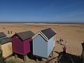
 Beach Huts - geograph.org.uk - 5634419.jpg 1,024 × 576; 110 KB
-
 Beach huts and beach - geograph.org.uk - 3813401.jpg 640 × 480; 110 KB
-
 Beach huts at Wells-next-the-Sea - geograph.org.uk - 1970381.jpg 640 × 480; 91 KB
-
 Beach huts at Wells-next-the-Sea - geograph.org.uk - 5850696.jpg 1,600 × 910; 411 KB
-
 Beach huts at Wells-Next-The-Sea, Norfolk - geograph.org.uk - 5558917.jpg 4,608 × 3,456; 2.56 MB
-
 Beach huts smashed to bits in Wells-Next-The-Sea - geograph.org.uk - 3776673.jpg 4,320 × 3,240; 4.96 MB
-
 Beach huts with verandahs - geograph.org.uk - 4040784.jpg 1,600 × 1,067; 445 KB
-
 Beach huts, Wells-nest-the-Sea - geograph.org.uk - 4660281.jpg 2,560 × 1,920; 984 KB
-
-
 Beach Road path and East Fleet - geograph.org.uk - 6233905.jpg 5,184 × 3,456; 1.32 MB
-
 Beach Road path and Harbour - geograph.org.uk - 6233903.jpg 5,184 × 3,456; 1.29 MB
-
 Beach Road, near Wells-next-the Sea - geograph.org.uk - 1824824.jpg 640 × 480; 112 KB
-
 Beacon, Wells - geograph.org.uk - 3968697.jpg 640 × 430; 48 KB
-
 Beacon, Wells - geograph.org.uk - 3985877.jpg 640 × 430; 53 KB
-
 Big Blue Sky Gallery, Wells-Next-The-Sea - geograph.org.uk - 3845744.jpg 1,600 × 1,080; 348 KB
-
 Big buoy on a roundabout, Wells-Next-the-Sea - geograph.org.uk - 3776442.jpg 4,320 × 3,240; 4.78 MB
-
 Big Norfolk sky at Wells-next-the-Sea - geograph.org.uk - 1959952.jpg 640 × 516; 167 KB
-
 Black fertile farmland - geograph.org.uk - 3955928.jpg 640 × 430; 67 KB
-
-
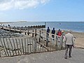
 Boardwalk to Wells Beach - geograph.org.uk - 2682447.jpg 1,280 × 856; 109 KB
-
 Boardwalk to Wells Beach - geograph.org.uk - 2682460.jpg 1,280 × 856; 152 KB
-
 Boat and building - geograph.org.uk - 3963266.jpg 640 × 430; 77 KB
-
 Boat approaching the Run - geograph.org.uk - 2997779.jpg 640 × 480; 52 KB
-
 Boat launching contraption at Wells-Next-The-Sea - geograph.org.uk - 4933498.jpg 4,320 × 3,240; 5.97 MB
-
 Boat launching winch at Wells-Next-The-Sea - geograph.org.uk - 3058937.jpg 4,320 × 3,240; 5.46 MB
-
 Boat on a creek, Wells Marshes - geograph.org.uk - 3955947.jpg 640 × 430; 61 KB
-
 Boat, Wells - geograph.org.uk - 3963507.jpg 640 × 430; 50 KB
-
 Boating lake - geograph.org.uk - 2084120.jpg 640 × 480; 106 KB
-
 Boating Lake - geograph.org.uk - 3996200.jpg 640 × 430; 77 KB
-
 Boating Lake - geograph.org.uk - 3996204.jpg 640 × 430; 71 KB
-
 Boating Lake - geograph.org.uk - 3996209.jpg 640 × 430; 80 KB
-
 Boating Lake - geograph.org.uk - 3996212.jpg 640 × 430; 63 KB
-
-
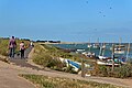
 Boating lake, Wells-Next-The-Sea - geograph.org.uk - 4039500.jpg 1,600 × 1,200; 311 KB
-
-

-

-
 Boats moored on Stonemeal Creek - geograph.org.uk - 5616429.jpg 800 × 501; 86 KB
-
-
 Boats on the mud at Wells-Next-The-Sea - geograph.org.uk - 4933475.jpg 4,320 × 3,240; 5.47 MB
-
 Boats on The Run - geograph.org.uk - 5558904.jpg 4,608 × 3,456; 4.23 MB
-
 Boats, Wells - geograph.org.uk - 3963245.jpg 640 × 430; 83 KB
-
 Boats, Wells Salt Marshes - geograph.org.uk - 3955967.jpg 640 × 430; 72 KB
-
 Boatyard at Wells - geograph.org.uk - 950201.jpg 640 × 480; 107 KB
-
 Boatyard buildings - geograph.org.uk - 3963290.jpg 640 × 430; 63 KB
-
 Boatyard, Wells - geograph.org.uk - 3963252.jpg 640 × 430; 71 KB
-
 Bob Hall's Sand - geograph.org.uk - 5971065.jpg 1,600 × 1,200; 390 KB
-
 Bob Hall's Sand - geograph.org.uk - 5971095.jpg 1,600 × 1,200; 228 KB
-
 Bob Hall's Sands - geograph.org.uk - 5970841.jpg 1,600 × 1,200; 340 KB
-
 Buoy on a roundabout - geograph.org.uk - 3995994.jpg 640 × 430; 43 KB
-
 Buoy on The Quayside - geograph.org.uk - 5384665.jpg 640 × 480; 49 KB
-
 Buoys on shore, Wells - geograph.org.uk - 1258532.jpg 640 × 532; 105 KB
-
 Burnt St (A149) - geograph.org.uk - 3938722.jpg 640 × 430; 56 KB
-
 Burnt Street - geograph.org.uk - 5384480.jpg 480 × 640; 54 KB
-
 Burnt Street, Wells-next-the-Sea - geograph.org.uk - 6041602.jpg 1,600 × 1,200; 266 KB
-
 Buttlands Park, Wells next the Sea - geograph.org.uk - 5081757.jpg 5,184 × 3,456; 6.53 MB
-

-

-
 Buxton’s Bight, near Wells-next-the-Sea - geograph.org.uk - 1824239.jpg 640 × 480; 116 KB
-

-

-
 By the Norfolk Coast Path - geograph.org.uk - 4003635.jpg 640 × 430; 118 KB
-
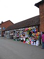
 Cafe at the end of the road - geograph.org.uk - 3995999.jpg 640 × 430; 75 KB
-
 Campsite and bi-planes - geograph.org.uk - 2563384.jpg 640 × 464; 98 KB
-

-
 Caravan park and camping site, Wells-next-the-Sea - geograph.org.uk - 6164833.jpg 2,871 × 2,211; 1.21 MB
-
 Catamaran in the Run - geograph.org.uk - 2997783.jpg 640 × 480; 57 KB
-
 Chancery Lane, Wells-Next-The-Sea, Norfolk - geograph.org.uk - 6247419.jpg 740 × 1,024; 244 KB
-
 Channel between the dunes at High Cape - geograph.org.uk - 3705286.jpg 3,648 × 2,736; 1.86 MB
-
 Channel dredger - Port of Wells - geograph.org.uk - 4933532.jpg 4,320 × 3,240; 5.59 MB
-
 Channel, Port of Wells - geograph.org.uk - 3995949.jpg 640 × 430; 59 KB
-
 Channel, Wells Salt Marsh - geograph.org.uk - 3963315.jpg 640 × 430; 60 KB
-
 Channel, Wells Salt Marsh - geograph.org.uk - 3963341.jpg 640 × 430; 58 KB
-
 Chip 'n' Dip, Wells beach car park - geograph.org.uk - 4815532.jpg 1,600 × 1,200; 233 KB
-
 Christmas lights, Wells - geograph.org.uk - 4016375.jpg 640 × 430; 94 KB
-
 Church Plain - geograph.org.uk - 5384464.jpg 640 × 480; 70 KB
-
 Clubbs Lane - geograph.org.uk - 3976896.jpg 640 × 430; 79 KB
-
 Clubbs Lane - geograph.org.uk - 3976921.jpg 381 × 640; 46 KB
-
 Clumps of vegetation on the beach - geograph.org.uk - 4057210.jpg 1,600 × 1,200; 287 KB
-

-
 Coastguard Lookout - geograph.org.uk - 1208734.jpg 480 × 640; 86 KB
-
 Coastguard lookout station - geograph.org.uk - 1460821.jpg 600 × 450; 77 KB
-
 Coasthopper buses, The Buttlands - geograph.org.uk - 4679247.jpg 2,560 × 1,920; 1.13 MB
-

-
 Come on the Seasiders - geograph.org.uk - 2084135.jpg 640 × 480; 60 KB
-
 Common Darter, East Hills - geograph.org.uk - 5964848.jpg 1,600 × 1,269; 315 KB
-
 Communications mast near Wells-Next-The-Sea - geograph.org.uk - 4930712.jpg 3,240 × 4,320; 4.79 MB
-
 Cones on the footpath - geograph.org.uk - 4039516.jpg 1,600 × 1,108; 668 KB
-
 Cones on The Quay - geograph.org.uk - 5384269.jpg 640 × 480; 41 KB
-
 Construction site - geograph.org.uk - 4679208.jpg 2,560 × 1,920; 1.18 MB
-

-
 Converted granary and warehouses, Wells-Next-The-Sea - geograph.org.uk - 6256547.jpg 3,024 × 4,032; 3.34 MB
-
 Corner of Standard Road and The Quay - geograph.org.uk - 3963463.jpg 640 × 430; 61 KB
-
 Crab fishing on The Quay in Wells-Next-The-Sea - geograph.org.uk - 6256349.jpg 4,032 × 3,024; 3.25 MB
-
-
 Crabbing on The Quay, spring 2017 - geograph.org.uk - 5351670.jpg 640 × 480; 44 KB
-

-
 Creek in Lodge Marsh - geograph.org.uk - 5970851.jpg 1,600 × 1,200; 556 KB
-
 Creek, Wells Salt Marshes - geograph.org.uk - 3955938.jpg 640 × 430; 65 KB
-
 Creek, Wells Salt Marshes - geograph.org.uk - 3955962.jpg 640 × 430; 55 KB
-
 Creek, Wells Salt Marshes - geograph.org.uk - 3968702.jpg 640 × 425; 61 KB
-
 Creeks, Wells Salt Marshes - geograph.org.uk - 3955922.jpg 640 × 430; 59 KB
-
 Creeks, Wells Salt Marshes - geograph.org.uk - 3955937.jpg 640 × 430; 77 KB
-
 Creeks, Wells Salt Marshes - geograph.org.uk - 3955941.jpg 640 × 400; 51 KB
-
 Crop field and hedgerow - geograph.org.uk - 5557953.jpg 640 × 480; 77 KB
-
 Crop field east of the B1105 - geograph.org.uk - 5578240.jpg 640 × 480; 83 KB
-
 Crop field off Warham Road - geograph.org.uk - 5557956.jpg 640 × 480; 73 KB
-
 Cyclist in Newgate Lane - geograph.org.uk - 5384653.jpg 640 × 480; 79 KB
-
 Daft Dog plays in The Run - geograph.org.uk - 6260119.jpg 3,264 × 2,448; 4.41 MB
-
 Datestone in the High Street - geograph.org.uk - 5384442.jpg 640 × 480; 78 KB
-
 Datestone on The Quayside - geograph.org.uk - 5384667.jpg 640 × 480; 86 KB
-
 Dead and alive - geograph.org.uk - 4146538.jpg 4,320 × 3,240; 5.94 MB
-
 Dead trees at East Hills - geograph.org.uk - 4212906.jpg 1,600 × 1,200; 933 KB
-
 Dead trees at East Hills - geograph.org.uk - 4212914.jpg 1,600 × 1,200; 881 KB
-
 Debris left by the tidal surge, Wells-Next-The-Sea - geograph.org.uk - 3776690.jpg 4,320 × 3,240; 4.98 MB
-
 Decaying sand dunes - geograph.org.uk - 4679317.jpg 2,560 × 1,920; 1.33 MB
-
 Depth gauge on the quayside - geograph.org.uk - 5384668.jpg 640 × 480; 83 KB
-
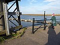
 Dismantled Bridge - geograph.org.uk - 1807661.jpg 800 × 531; 107 KB
-

-
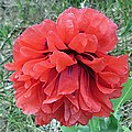 Double poppy beside the path - geograph.org.uk - 4039520.jpg 800 × 800; 359 KB
-
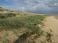
 Downtrodden dunes - geograph.org.uk - 5155677.jpg 1,600 × 1,200; 593 KB
-

-

-
 Dredger and wind farm boats - geograph.org.uk - 4815539.jpg 1,600 × 1,200; 214 KB
-

-
 Dredger in Wells channel - geograph.org.uk - 3777672.jpg 4,320 × 3,240; 4.57 MB
-
 Dredging The Run - geograph.org.uk - 4679339.jpg 2,560 × 1,920; 818 KB
-
 Dressed for a day on the beach^ - geograph.org.uk - 269852.jpg 640 × 480; 133 KB
-
 Drinking pool, Wells Wood - geograph.org.uk - 5155625.jpg 1,600 × 1,200; 1.02 MB
-
 Dune damage - geograph.org.uk - 1714905.jpg 1,600 × 1,200; 691 KB
-
 Dune edge, East Hills - geograph.org.uk - 2122493.jpg 1,600 × 1,200; 958 KB
-
 Dune edge, East Hills - geograph.org.uk - 2122531.jpg 1,600 × 1,200; 895 KB
-
 Dune edge, East Hills - geograph.org.uk - 5555643.jpg 1,600 × 1,200; 172 KB
-
 Dune erosion at Wells - geograph.org.uk - 4057202.jpg 1,600 × 1,200; 523 KB
-
 Dune erosion, Holkham Bay - geograph.org.uk - 4057224.jpg 1,600 × 1,200; 442 KB
-
 Dune formation near High Cape - geograph.org.uk - 2997775.jpg 640 × 480; 46 KB
-
 Dunes at East Hills - geograph.org.uk - 2122525.jpg 1,600 × 1,200; 1.12 MB
-
 Dunes at East Hills - geograph.org.uk - 4660325.jpg 2,560 × 1,920; 1.46 MB
-
 Dunes at East Hills - geograph.org.uk - 4660333.jpg 2,560 × 1,920; 1.84 MB
-
 Dunes at East Hills - geograph.org.uk - 5971074.jpg 1,600 × 1,200; 557 KB
-
 Dunes at East Hills - geograph.org.uk - 5971080.jpg 1,600 × 1,200; 486 KB
-
 Dunes at Wells - geograph.org.uk - 4679305.jpg 2,560 × 1,920; 905 KB
-
 Dunes north of Wells Wood - geograph.org.uk - 5155659.jpg 1,600 × 1,200; 746 KB
-
 East Bank Sluice from coastal path - geograph.org.uk - 5950910.jpg 4,608 × 3,456; 4.53 MB
-
 East Fleet - geograph.org.uk - 6233904.jpg 4,580 × 3,435; 1.68 MB
-
 East Hill dunes - geograph.org.uk - 3727805.jpg 1,600 × 1,067; 684 KB
-
 East Hills - geograph.org.uk - 2122337.jpg 1,600 × 1,200; 1.29 MB
-
 East Hills - geograph.org.uk - 2122409.jpg 1,600 × 1,200; 1.08 MB
-
 East Hills - geograph.org.uk - 4679453.jpg 2,560 × 1,920; 1.02 MB
-
 East Hills - geograph.org.uk - 5128466.jpg 1,600 × 1,200; 1,018 KB
-
 East Hills - geograph.org.uk - 5128469.jpg 1,600 × 1,200; 712 KB
-
 East Hills - geograph.org.uk - 5128481.jpg 1,600 × 1,200; 1.09 MB
-
 East Hills - geograph.org.uk - 5555625.jpg 1,600 × 1,200; 564 KB
-
 East Hills - geograph.org.uk - 5970847.jpg 1,600 × 1,200; 440 KB
-
 East Hills - geograph.org.uk - 5971070.jpg 1,600 × 1,200; 471 KB
-
 East Hills - geograph.org.uk - 5971091.jpg 1,600 × 1,200; 400 KB


_-_geograph.org.uk_-_3938722.jpg)


