Category:Wellingborough
Jump to navigation
Jump to search
market town in Northamptonshire, England  | |||||
| Upload media | |||||
| Instance of |
| ||||
|---|---|---|---|---|---|
| Location | North Northamptonshire, Northamptonshire, East Midlands, England | ||||
| Different from | |||||
| official website | |||||
 | |||||
Subcategories
This category has the following 9 subcategories, out of 9 total.
B
C
E
F
- Farms in Wellingborough (4 F)
G
- Glamis Meadow and Wood (12 F)
P
- Parks in Wellingborough (39 F)
R
- River Nene at Wellingborough (4 F)
T
Media in category "Wellingborough"
The following 30 files are in this category, out of 30 total.
-
 Bedford, Cambridge, Huntingdon, St Ives, Sandy, Shepreth & Wellingborough RJD 5.jpg 2,861 × 1,890; 741 KB
-
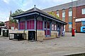
 Corner Shop - geograph.org.uk - 6305325.jpg 800 × 533; 546 KB
-
 Group talk outside the Stanwick Lakes Visitor Centre - June 2009 - panoramio.jpg 1,712 × 2,288; 973 KB
-
 Harrowden Road - geograph.org.uk - 6305316.jpg 800 × 533; 716 KB
-
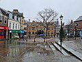 Miesto aikštė gruodį, Velingboras.jpg 4,032 × 3,024; 4.12 MB
-
 Ordnance Survey One-Inch Sheet 74 Kettering & Huntingdon, Published 1923.jpg 11,850 × 8,875; 10.43 MB
-
 Oxford Street, Wellingborough - geograph.org.uk - 6305338.jpg 800 × 533; 780 KB
-
 Pylon in a field - geograph.org.uk - 6312720.jpg 1,600 × 1,066; 330 KB
-
 Shops on Oxford Street - geograph.org.uk - 6305336.jpg 800 × 533; 630 KB
-

-
 The Coach and Horses, Wellingborough - geograph.org.uk - 6305337.jpg 800 × 533; 600 KB
-
 The Gloucester - geograph.org.uk - 6305326.jpg 800 × 600; 750 KB
-
 The Pagoda, Market Street - geograph.org.uk - 6305334.jpg 800 × 533; 520 KB
-
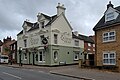 The Queens Head, Broad Green - geograph.org.uk - 6305315.jpg 800 × 534; 767 KB
-
 The Wellingborough Bombing - geograph.org.uk - 6305335.jpg 800 × 800; 758 KB
-
 Three silver ladies.jpg 640 × 456; 97 KB
-
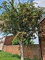 Tree in Shakespeare Road, Wellingborough.jpg 3,024 × 4,032; 9.63 MB
-
 Wellingborough - Northamptonshire dot.png 417 × 599; 112 KB
-
 Wellingborough School.png 350 × 260; 21 KB
-
 Wellingborough United Reformed Church - geograph.org.uk - 6305311.jpg 640 × 800; 875 KB
-
 Wellingborough unparished area UK locator map.svg 1,041 × 1,266; 305 KB
-
 Wellingborough, 1957, eastward on A5193 Sheep Street - geograph.org.uk - 4599765.jpg 2,250 × 1,625; 1.45 MB
-
 Wellingborough, Havelock Street - geograph.org.uk - 6305323.jpg 800 × 600; 641 KB
-
 Wellingborough, Herriotts Lane - geograph.org.uk - 6305319.jpg 800 × 600; 605 KB
-

-
 Wellingborough, Northampton Road - geograph.org.uk - 6305340.jpg 800 × 533; 550 KB
-
 Wellingborough, Queensway - geograph.org.uk - 6305342.jpg 800 × 600; 575 KB
-
 Wellingborough2007Constituency.svg 212 × 238; 111 KB
-
 WellingboroughConstituency.svg 189 × 211; 36 KB
-
 Works by the Nene - geograph.org.uk - 6318864.jpg 1,600 × 1,066; 351 KB


