Category:Weizigt
Jump to navigation
Jump to search
| Object location | | View all coordinates using: OpenStreetMap |
|---|
|
This is a category about rijksmonument number 13513
|
 | |||||
| Upload media | |||||
| Instance of | |||||
|---|---|---|---|---|---|
| Location | Dordrecht, South Holland, Netherlands | ||||
| Street address |
| ||||
| Located on street | |||||
| Heritage designation |
| ||||
 | |||||
| Address |
|
Subcategories
This category has the following 2 subcategories, out of 2 total.
W
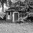
- Weizigt - Koetshuis (14 F)
- Weizigt - Oranjerie (5 F)
Media in category "Weizigt"
The following 27 files are in this category, out of 27 total.
-
 Exterieur ACHTERGEVEL - Dordrecht - 20290523 - RCE.jpg 944 × 1,200; 303 KB
-
 Exterieur INGANGSPARTIJ VOORGEVEL - Dordrecht - 20290520 - RCE.jpg 960 × 1,200; 342 KB
-
 Exterieur LINKER ZIJGEVEL EN ACHTERGEVEL - Dordrecht - 20305282 - RCE.jpg 951 × 1,200; 290 KB
-
 Exterieur OVERZICHT VOORGEVEL - Dordrecht - 20290518 - RCE.jpg 1,200 × 942; 311 KB
-
 Exterieur RECHTER ZIJGEVEL - Dordrecht - 20290521 - RCE.jpg 1,200 × 948; 336 KB
-
 Exterieur RECHTER ZIJGEVEL - Dordrecht - 20305281 - RCE.jpg 960 × 1,200; 335 KB
-
 Exterieur THEEHUIS - Dordrecht - 20290540 - RCE.jpg 1,185 × 1,200; 458 KB
-
 Exterieur VOORGEVEL - Dordrecht - 20290519 - RCE.jpg 960 × 1,200; 374 KB
-
 Exterieur VOORGEVEL - Dordrecht - 20305280 - RCE.jpg 960 × 1,200; 299 KB
-
 Exterieur ZIJPORTAAL, RECHTER ZIJGEVEL (XIX EEUW) - Dordrecht - 20290522 - RCE.jpg 1,190 × 1,200; 469 KB
-
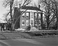
 Huis Weizigt - Van Baerleplantsoen 26 Dordrecht.JPG 2,304 × 3,072; 3.15 MB
-

-

-
 INTERIEUR, GANG, EERSTE VERDIEPING (XIX EEUW), DEEL 2 - Dordrecht - 20290524 - RCE.jpg 1,185 × 1,200; 257 KB
-

-

-
 INTERIEUR, PLAFOND GANG TWEEDE VERDIEPING - Dordrecht - 20290530 - RCE.jpg 1,190 × 1,200; 287 KB
-

-

-

-
 INTERIEUR, PLAFOND THEEHUIS - Dordrecht - 20290541 - RCE.jpg 1,200 × 1,197; 322 KB
-

-

-

-
 INTERIEUR, THEEHUIS - Dordrecht - 20290542 - RCE.jpg 1,200 × 1,195; 342 KB
-
 Landscape with cattle and country seat Weizigt in the distance, by Gillis Smak Gregoor.jpg 3,507 × 2,479; 4.59 MB
-
 Voorgevel - Dordrecht - 20060380 - RCE.jpg 1,200 × 954; 353 KB


_-_Dordrecht_-_20290522_-_RCE.jpg)
_-_Dordrecht_-_20290534_-_RCE.jpg)
,_DEEL_2_-_Dordrecht_-_20290525_-_RCE.jpg)
,_DEEL_2_-_Dordrecht_-_20290524_-_RCE.jpg)
_DEEL_26_-_Dordrecht_-_20290527_-_RCE.jpg)
_DEEL_25_-_Dordrecht_-_20290529_-_RCE.jpg)

_-_Dordrecht_-_20290535_-_RCE.jpg)
,_DEEL_6_-_Dordrecht_-_20290532_-_RCE.jpg)
_DEEL_4_-_Dordrecht_-_20290531_-_RCE.jpg)

_DEEL_14_-_Dordrecht_-_20290526_-_RCE.jpg)
_DEEL_3_-_Dordrecht_-_20290528_-_RCE.jpg)
,_DEEL_1_-_Dordrecht_-_20290533_-_RCE.jpg)


