Category:Weavers' Triangle, Burnley
Jump to navigation
Jump to search

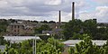
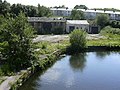
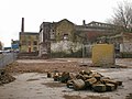
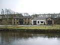
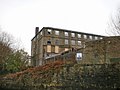
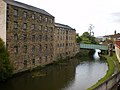
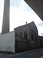
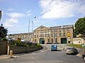
The Weavers' Triangle is an area of Burnley in Lancashire, England consisting mostly of 19th-century industrial buildings at the western side of town centre clustered around the Leeds and Liverpool Canal. The area has significant historic interest as the cotton mills and associated buildings encapsulate the social and economic development of the town and its weaving industry. From the 1980s, the area has been the focus of major redevelopment efforts.
historic textie-producing area with a cotton museum in Lancashire, England  | |||||
| Upload media | |||||
| Instance of | |||||
|---|---|---|---|---|---|
| Location | Burnley, Lancashire, North West England, England | ||||
| Street address |
| ||||
| Inception |
| ||||
| official website | |||||
 | |||||
Subcategories
This category has the following 6 subcategories, out of 6 total.
B
- Burnley Wharf (19 F)
O
- Oak Mount Mill, Burnley (12 F)
S
- Slater Terrace, Burnley (14 F)
V
- Victoria Mill, Burnley (7 F)
W
- Woodfield Mill, Burnley (7 F)
Media in category "Weavers' Triangle, Burnley"
The following 82 files are in this category, out of 82 total.
-
 "The Weavers' Triangle" Leeds-Liverpool Canal - geograph.org.uk - 2332199.jpg 3,072 × 2,304; 1.24 MB
-
 "The Weavers' Triangle" Leeds-Liverpool Canal, Burnley - geograph.org.uk - 2331300.jpg 3,072 × 2,304; 995 KB
-
 Abandoned Bridge Leeds Liverpool Canal - geograph.org.uk - 1370059.jpg 640 × 480; 127 KB
-

-
 Belle Vue Mill, Burnley (13547487844).jpg 3,161 × 3,156; 5.68 MB
-

-

-

-
 Burnley Mill Chimneys - geograph.org.uk - 477739.jpg 640 × 322; 73 KB
-
 Canal Foot Bridge - geograph.org.uk - 1370029.jpg 640 × 480; 95 KB
-

-
 Disused Waterway Yard, Finsley Gate - geograph.org.uk - 868563.jpg 640 × 480; 105 KB
-

-

-
 Finsley Gate canal bridge - geograph.org.uk - 769021.jpg 640 × 480; 229 KB
-
 Finsley Mill - geograph.org.uk - 1120357.jpg 480 × 640; 67 KB
-
 Finsley Mill, Burnley - geograph.org.uk - 769484.jpg 640 × 480; 161 KB
-
 Finsley Mill, Burnley - geograph.org.uk - 782808.jpg 640 × 480; 147 KB
-

-

-

-
 Former warehouse, Burnley.jpg 3,066 × 1,886; 985 KB
-
 Formerly Albion Mills - geograph.org.uk - 1120363.jpg 640 × 480; 80 KB
-
 Formerly Albion Mills - geograph.org.uk - 1120366.jpg 640 × 480; 74 KB
-
 Formerly Albion Mills - geograph.org.uk - 1120372.jpg 640 × 480; 111 KB
-
 Formerly Finsley Dockyard - geograph.org.uk - 769992.jpg 640 × 480; 156 KB
-
 George Street Canal Footbridge - geograph.org.uk - 1445489.jpg 480 × 640; 60 KB
-

-
 Healey Royd Mill - geograph.org.uk - 1120355.jpg 640 × 480; 70 KB
-
 Healey Royd Mill - geograph.org.uk - 1469740.jpg 640 × 480; 75 KB
-

-

-
 Kelvin Fenton George Street Burnley - geograph.org.uk - 1445493.jpg 640 × 480; 65 KB
-
 Leeds and Liverpool Canal - geograph.org.uk - 1058548.jpg 640 × 480; 180 KB
-
 Leeds and Liverpool Canal - geograph.org.uk - 1469736.jpg 640 × 480; 73 KB
-
 Leeds and Liverpool Canal - geograph.org.uk - 1469737.jpg 640 × 480; 62 KB
-
 Leeds and Liverpool Canal - geograph.org.uk - 770001.jpg 640 × 480; 196 KB
-
 Leeds and Liverpool Canal - geograph.org.uk - 991921.jpg 640 × 480; 177 KB
-
-
 Leeds and Liverpool Canal, Burnley (geograph 4376881).jpg 640 × 482; 275 KB
-
 Leeds Liverpool Canal - geograph.org.uk - 1370036.jpg 640 × 480; 95 KB
-
 Leeds Liverpool Canal - geograph.org.uk - 1370038.jpg 640 × 480; 73 KB
-
 Leeds Liverpool Canal - geograph.org.uk - 1370042.jpg 640 × 480; 99 KB
-
 Leeds Liverpool Canal - geograph.org.uk - 1370046.jpg 480 × 640; 71 KB
-
 Leeds Liverpool Canal - geograph.org.uk - 1370052.jpg 640 × 480; 94 KB
-
 Leeds Liverpool Canal - geograph.org.uk - 1393479.jpg 640 × 480; 80 KB
-
 Leeds Liverpool Canal - geograph.org.uk - 1445466.jpg 640 × 480; 72 KB
-
 Leeds Liverpool Canal - geograph.org.uk - 1445475.jpg 640 × 480; 82 KB
-
 Maltings Mill, Sandygate - geograph.org.uk - 1393469.jpg 640 × 480; 74 KB
-
 Mill Engine House - geograph.org.uk - 739437.jpg 480 × 640; 40 KB
-
 Ministry of Ale, Burnley - geograph.org.uk - 5923179.jpg 640 × 580; 75 KB
-
 Mount Pleasant Chapel and 79 Hammerton Street.jpg 4,008 × 3,006; 2.64 MB
-
 Nelson Square - geograph.org.uk - 1469733.jpg 640 × 480; 70 KB
-
 Neptune Street, Sandygate junction - geograph.org.uk - 1393474.jpg 640 × 480; 66 KB
-
 Newton Mill - geograph.org.uk - 1389051.jpg 640 × 480; 72 KB
-

-
 No 1a Exmouth Street - geograph.org.uk - 1120369.jpg 480 × 640; 70 KB
-
 No 1a Exmouth Street, Doorway - geograph.org.uk - 1120370.jpg 480 × 640; 74 KB
-
 Plaque on Finsley Gate canal bridge - geograph.org.uk - 769019.jpg 480 × 640; 181 KB
-
 Pollard's on Stanley Street - geograph.org.uk - 1120323.jpg 640 × 480; 66 KB
-
 Remains of the Canal Street Shed - geograph.org.uk - 1213194.jpg 640 × 480; 101 KB
-
 Remains of the George Street Shed - geograph.org.uk - 1213195.jpg 640 × 480; 101 KB
-
 Roundabout - geograph.org.uk - 1389049.jpg 640 × 480; 74 KB
-
 Sandygate - geograph.org.uk - 1393485.jpg 640 × 384; 53 KB
-
 Sandygate Mill - geograph.org.uk - 788440.jpg 640 × 480; 219 KB
-
 Sandygate Mill, Burnley - geograph.org.uk - 1393484.jpg 640 × 480; 77 KB
-
 Steps - geograph.org.uk - 1120327.jpg 480 × 640; 86 KB
-

-
 The Mitre Junction, Burnley - geograph.org.uk - 519356.jpg 640 × 303; 54 KB
-
 The Mitre, 118, Westgate, Burnley - geograph.org.uk - 1378464.jpg 640 × 480; 69 KB
-
 The Plane Tree Hotel - geograph.org.uk - 1139760.jpg 640 × 480; 67 KB
-
 The Plane Tree, 4 Westgate, Burnley - geograph.org.uk - 1393525.jpg 640 × 480; 101 KB
-
 Trafalgar Street, Burnley - geograph.org.uk - 1370075.jpg 640 × 480; 65 KB
-
 Trafalgar Street, Burnley - geograph.org.uk - 1393503.jpg 640 × 360; 48 KB
-

-
 Waterloo Hotel 39 Trafalgar Street - geograph.org.uk - 1393488.jpg 640 × 480; 73 KB
-
 Westgate - geograph.org.uk - 1393519.jpg 640 × 480; 60 KB
-
 Westgate Mill, Sandygate - geograph.org.uk - 1393465.jpg 640 × 411; 62 KB
-
 Wiseman Street, Burnley - geograph.org.uk - 1393517.jpg 640 × 480; 71 KB
-
 Footbridge - geograph.org.uk - 770212.jpg 640 × 480; 199 KB
-

-
 Old Boatyard, Finsley Gate, Burnley - geograph.org.uk - 113507.jpg 640 × 426; 135 KB


.jpg)


.jpg)


