Category:Watertoren Domburg
Jump to navigation
Jump to search
| Object location | | View all coordinates using: OpenStreetMap |
|---|
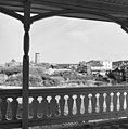
Nederlands: Afbeeldingen van de watertoren van Domburg, Nehalenniaweg 20, 4357 AW Domburg. Gelegen nabij de Duinen van Domburg, het natuurgebied de Manteling en Domburg op Walcheren in de provincie Zeeland in het zuidwesten van Nederland.
|
This is a category about rijksmonument number 508066
|
 | |||||
| Upload media | |||||
| Instance of | |||||
|---|---|---|---|---|---|
| Location | |||||
| Street address |
| ||||
| Located on street |
| ||||
| Architect | |||||
| Heritage designation |
| ||||
 | |||||
Media in category "Watertoren Domburg"
The following 15 files are in this category, out of 15 total.
-
 Domburg - 2016 - panoramio (1).jpg 3,264 × 4,928; 8.74 MB
-
 Duinen P1390199.jpg 4,000 × 2,672; 6.45 MB
-
 Duinen P1390213.jpg 4,000 × 2,672; 5.95 MB
-
 Duinen P1390214.jpg 4,000 × 2,672; 6 MB
-
 Exterieur Nehalenniaweg ongenummerd - Domburg - 20059214 - RCE.jpg 1,190 × 1,200; 360 KB
-
 NED Domburg Nehalenniaweg 01.jpg 3,876 × 2,907; 1.22 MB
-
 Overzicht - Domburg - 20059248 - RCE.jpg 1,185 × 1,200; 230 KB
-
 Wasserturm Domburg Oktober 2016 01.jpg 2,322 × 2,748; 3.36 MB
-
 Wasserturm Domburg Oktober 2016 02.jpg 2,448 × 2,520; 3.43 MB
-
 Watertoren Domburg - duinside.jpg 2,400 × 1,800; 1.15 MB
-
 Watertoren Domburg - view from the beach.jpg 1,800 × 2,400; 2.28 MB
-
 Watertoren Domburg 2016.JPG 3,264 × 4,928; 6.43 MB
-
 Watertoren Domburg P1390216.jpg 2,672 × 4,000; 5.66 MB
-
 Watertoren Domburg P1390217.jpg 4,000 × 2,672; 5.92 MB
-
 ©FSB 2318.jpg 3,543 × 2,362; 5.93 MB
.jpg)


