Category:Wasatch Range
Jump to navigation
Jump to search
mountain range in northern Utah, United States   | |||||
| Upload media | |||||
| Instance of | |||||
|---|---|---|---|---|---|
| Location | |||||
| Length |
| ||||
| Mountain range | |||||
| Highest point | |||||
| Elevation above sea level |
| ||||
| Different from | |||||
 | |||||
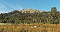
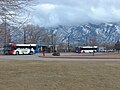
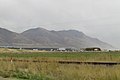
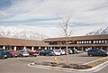
English: Media related to the Wasatch Range, a mountain range in northern Utah, United States, that has a subrange that extends into southeastern idaho.
Subcategories
This category has the following 59 subcategories, out of 59 total.
A
B
- Big East Dam (1 F)
- Brighton Ski Resort (16 F)
C
- Chad's Gap (3 F)
D
- Done Ridge (1 F)
E
- Emigration Canyon, Utah (16 F)
G
H
L
M
- McClellan Lake Dam (Utah) (1 F)
- Mineral Basin (Utah) (5 F)
- Mutual Dell Organization Camp (empty)
N
O
P
- Pinecrest, Utah (empty)
R
- Round Valley (Morgan County, Utah) (empty)
S
- Sundance Resort (9 F)
T
U
- Upper Bells Canyon Reservoir (1 F)
W
Media in category "Wasatch Range"
The following 200 files are in this category, out of 353 total.
(previous page) (next page)-

-

-
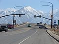
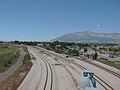
 2013-09-23 18 27 35 View north along Interstate 15 in Utah near milepost 206.JPG 3,264 × 2,448; 2.07 MB
-

-
-
-
 20190707-FS-UWC NF-NL-Squaw Peak Narrow-01 (48937232428).jpg 6,000 × 4,000; 11.47 MB
-

-
-
-

-
 26 to 84 east (45164454442).jpg 4,032 × 3,024; 2.06 MB
-
 388ogroup-f-16s-1.jpg 375 × 283; 51 KB
-
 Above the Y - panoramio.jpg 2,128 × 2,800; 1.42 MB
-
 Across South State Street at Lone Peak Hospital, Draper, Utah, Jun 16.jpg 2,592 × 1,944; 2.35 MB
-

-
-

-
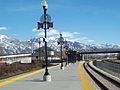
 American Fork Station passenger platform west end.JPG 2,816 × 2,112; 2.52 MB
-
 American Fork Twin Peaks.jpg 2,560 × 1,664; 1.11 MB
-
 American Forks Twin Peaks.jpg 2,772 × 1,629; 1.25 MB
-
 American Forks Twins.jpg 2,302 × 1,503; 994 KB
-
 Antelope Island Causeway 2005.JPG 1,280 × 960; 507 KB
-
 Autumn mountain trail.jpg 3,008 × 2,000; 5.53 MB
-
 Baled hay in Utah Valley.jpg 3,521 × 2,315; 4.65 MB
-
 Bear River Valley 2016-10-14 2668.jpg 4,608 × 3,072; 2.67 MB
-
 Bicycle lockers and rack at South Jordan Parkway station, Apr 16.jpg 2,592 × 1,944; 2.45 MB
-
 Newbraska Wasatch Mountains.jpg 1,000 × 692; 229 KB
-
 Big Cottonwood Canyon winter.jpg 8,064 × 6,048; 29.77 MB
-
 Bountiful Peak.jpg 2,091 × 1,125; 944 KB
-
 Broads Fork Twins.jpg 3,530 × 2,345; 4.33 MB
-
 Bus stands at Midvale Center station, Jan 15.jpg 2,816 × 2,112; 2.48 MB
-
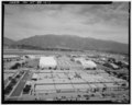
 BYU Motion Picture Studio, ca. 1959.png 1,056 × 848; 962 KB
-
 Cache Mtn (Summit Pass) 2016-10-14 2671.jpg 4,608 × 3,072; 2.92 MB
-
 Cache Mtn 2016-10-14 2675.jpg 4,608 × 3,072; 2.8 MB
-
 Cache Mtn 2016-10-14 2678.jpg 4,608 × 3,072; 2.67 MB
-
 Caldera Systems offices in Orem Utah January 2001.jpg 1,163 × 783; 210 KB
-
 Canyon View Park parking lot, Spanish For, Utah, Jul 15.jpg 2,816 × 2,112; 2.27 MB
-
 Capitol Hill, Salt Lake City, UT, USA - panoramio (4).jpg 3,264 × 2,448; 2.9 MB
-
 Cardiff Boundary arete.jpg 892 × 586; 223 KB
-
 Cascade, near Ogden, Weber County, Utah - NARA - 516747.jpg 2,397 × 3,000; 2.38 MB
-
 Catherine Pass Trail.jpg 2,700 × 1,800; 2.02 MB
-
 Cattle guard, Road 115 Uinta National Forest, Jul 16.jpg 2,592 × 1,944; 2.19 MB
-
 Central Morgan Valley, Sep 09.jpg 3,296 × 2,472; 1.22 MB
-
 Chevron station north Provo, Utah.JPG 2,816 × 2,112; 2.37 MB
-
 Chuck-A-Rama restaurant in south Provo, Utah, Aug 16.jpg 2,592 × 1,944; 2.37 MB
-
 Collier's 1921 Salt Lake City - Main Street.jpg 2,436 × 1,375; 1,013 KB
-
 Combat ready (10477868563).jpg 2,618 × 1,452; 532 KB
-
 Constructing a building on the site of a new steel mill 1a34850v.jpg 1,024 × 826; 322 KB
-
 Crescent View pedestrian safety barriers.JPG 2,816 × 2,112; 2.63 MB
-
 Crescent View Station NE across Park and Ride.JPG 2,816 × 2,112; 2.59 MB
-
 Crown Burgers Restaurant.jpeg 2,560 × 1,920; 1.01 MB
-
 Daily morning operations 121031-F-US032-259.jpg 3,622 × 2,542; 4.16 MB
-
 Daybreak Community Utah 2011-06-20.JPG 5,184 × 3,456; 3.49 MB
-
 Deer at Forest Lake - panoramio.jpg 4,288 × 3,216; 7.14 MB
-
 East (north side) along tracks from 1940 West North Temple station, Aug 15.jpg 2,816 × 2,112; 2.35 MB
-
 East (south side) along tracks from 1940 West North Temple station, Aug 15.jpg 2,816 × 2,112; 2.51 MB
-
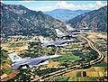
 East across American Fork at Wasatch Range on southbound FrontRunner, Jul 16.jpg 2,592 × 1,944; 2.34 MB
-
 East across Layton station Park and Ride, Jan 16.jpg 2,816 × 2,112; 2.48 MB
-
 East along SR-194 in Lehi, Utah, Jul 16.jpg 2,592 × 1,944; 2.34 MB
-
 East along SR-201 from I-80 interchange, Mar 16.jpg 2,592 × 1,944; 2.41 MB
-
 East along tracks from Power station, Aug 15.jpg 2,816 × 2,112; 2.37 MB
-
 East along W 750 S in Provo, Utah, Apr 17.jpg 2,592 × 1,944; 2.36 MB
-
 East at 2230 North station site, Aug 16.jpg 2,592 × 1,944; 2.41 MB
-
 East at 2700 W Sugar Factory Rd passenger platform, Apr 16.jpg 2,592 × 1,944; 2.44 MB
-
 East at a South Jordan Parkway station passenger shelter, Apr 16.jpg 2,592 × 1,944; 2.38 MB
-
 East at Dividend Road (about mm 0.5) in Utah County, Utah, May 16.jpg 2,592 × 1,944; 2.41 MB
-
 East at Emergency Vehicle Operations Range on Camp Williams, Oct 16.jpg 2,592 × 1,944; 2.38 MB
-
 East at Exit 362 interchange, !-15 & I-84, Feb 17.jpg 2,592 × 1,944; 2.38 MB
-
 East at former SR-68 & SR-140 junction, Bluffdale, Utah, Sep 16.jpg 2,592 × 1,944; 2.31 MB
-
 East at I-15 & SR-114 interchange, Provo, Utah, May 16.jpg 2,592 × 1,944; 2.33 MB
-
 East at I-15 & SR-92 interchange, Apr 16.jpg 2,592 × 1,944; 2.39 MB
-
 East at I-15, US-189, & Lakeview Pkwy interchange, Oct 16.jpg 2,592 × 1,944; 2.4 MB
-
 East at Palmyra Dr & W 4400 S intersection Palmyra, Utah, May 16.jpg 2,592 × 1,944; 2.36 MB
-
 East at US-6 & Dividend Rd intersection from Dividend Rd, May 16.jpg 2,592 × 1,944; 2.36 MB
-
 East at US-6 & Dividend Rd intersection from US-6, May 16.jpg 2,592 × 1,944; 2.36 MB
-
 East at US-89 & US-189, Provo, Utah, Jan 17.jpg 2,592 × 1,944; 2.42 MB
-
 East at Vineyard Connector Road railroad overpass, Nov 15.jpg 2,816 × 2,112; 2.38 MB
-
 East down tracks from N 2400 West on W North Temple, Aug 15.jpg 2,816 × 2,112; 2.58 MB
-
 East from Dividend Road (about mm 1.2) in Utah County, Utah, May 16.jpg 2,592 × 1,944; 2.34 MB
-
 East from South Jordan Parkway station, Apr 16.jpg 2,592 × 1,944; 2.39 MB
-
 East in Provo Yard toward FrontRunner end of line, Mar 15.jpg 2,816 × 2,112; 2.73 MB
-
 East Layton 5.png 4,032 × 3,024; 17.36 MB
-
 East on Center St at Geneva Rd, Provo, Utah, Oct 16.jpg 2,592 × 1,944; 2.4 MB
-
 East on Center St from 100 E, Provo, UT, Feb 17.jpg 2,592 × 1,944; 2.26 MB
-
 East on Center St from 700 E, Provo, UT, Feb 17.jpg 2,592 × 1,944; 2.17 MB
-
 East on Dividend Road (about mm 0.4) in Utah County, Utah, May 16.jpg 2,592 × 1,944; 2.38 MB
-
 East on E Canyon Crest Rd, Alpine, Utah, Jun 16.jpg 2,592 × 1,944; 2.4 MB
-
 East on Lakeview Pkwy at 620 W, Oct 16.jpg 2,592 × 1,944; 2.35 MB
-
 East on N 2100 W in Utah County, Utah, Oct 16.jpg 2,592 × 1,944; 2.34 MB
-
 East on SR-265 in Provo, Aug 16.jpg 2,592 × 1,944; 2.39 MB
-
 East on SR-71 in Riverton, Utah, Jun 16.jpg 2,592 × 1,944; 2.31 MB
-
 East on SR-77 at N 2600 W & S 400 W intersection in Springville, Utah, May 16.jpg 2,592 × 1,944; 2.42 MB
-
 East on US-89 at 200 E, Provo, Utah, Jan 17.jpg 2,592 × 1,944; 2.39 MB
-
 East southeast past Pioneer Rd from Draper Town Center station, Jan 15.jpg 2,816 × 2,112; 2.75 MB
-
 East SR-172 & SR-173 junction, May 17.jpg 2,592 × 1,944; 2.35 MB
-
 East through The Shops at Riverwoods, Apr 16.jpg 2,592 × 1,944; 2.39 MB
-
 East toward I-15 & SR-178 interchange.jpg 2,816 × 2,112; 2.42 MB
-
 East toward I-15 and SR-75 interchange, Feb 16.jpg 2,816 × 2,112; 2.18 MB
-
 East toward junction of SR-178 & SR-198, Feb 16.jpg 2,816 × 2,112; 2.45 MB
-
 East toward State Street, Jan 16.jpg 2,816 × 2,112; 2.59 MB
-
 East-southeast on SR-265 in Provo, Jul 16.jpg 2,592 × 1,944; 2.37 MB
-
 Elk by Highway 224 in Snyderville Basin JW 2021-12-30.jpg 9,469 × 3,823; 13.19 MB
-
 Farmington bay to wastach mountains (15334133759).jpg 4,288 × 2,848; 10.92 MB
-
 Flickr - …trialsanderrors - The Wasatch Range from the Valley of the Jordan, Utah, 1900.jpg 6,530 × 2,708; 5.84 MB
-
 Franklin, Idaho.jpg 1,600 × 1,200; 248 KB
-
 Free creative commons Rural Stop Landscape, Antelope Island, Utah (4594258122).jpg 5,616 × 3,744; 15.22 MB
-

-
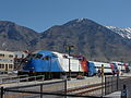 FrontRunner train at Provo Station, March 2015.JPG 2,816 × 2,112; 2.58 MB
-
 Future sight of Spanish Fork Hospital, Mar 17.jpg 2,592 × 1,944; 2.37 MB
-
 Geneva Steel Mill 1942 by Andreas Feininger.jpg 7,264 × 5,640; 10.17 MB
-
 Great Salt Lake.jpg 640 × 480; 62 KB
-
 Gunnison, Gunnison Valley Wasatch Mountains in distance, Utah 1872 - NARA - 519737.jpg 3,000 × 1,918; 1.54 MB
-
 GWR 75 SLC May 9 1969x1x4RP (12004010574).jpg 1,008 × 643; 617 KB
-
-
 Here by Norie Sato 13, Oct 16.jpg 2,592 × 1,944; 2.17 MB
-
 Higher view of Ogden Intermodal Transit Center's bus stands.JPG 2,816 × 2,112; 2.38 MB
-
 Higher view of Ogden Intermodal Transit Center's passenger platform.JPG 2,816 × 2,112; 2.5 MB
-
 Higher view of Ogden Intermodal Transit Center.JPG 2,816 × 2,112; 2.4 MB
-
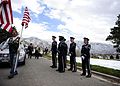 Hill Air Force Base Honor Guard funeral detail 121116-F-RN544-619.jpg 3,882 × 2,773; 4.98 MB
-
 Holme's Cabin - panoramio.jpg 4,000 × 3,000; 3.82 MB
-
 Holmes Cabin view - panoramio (1).jpg 4,000 × 3,000; 3.82 MB
-
 Holmes Cabin view - panoramio.jpg 4,000 × 3,000; 3.91 MB
-
 Honor Flight return Hill AFB, Oct 07 (2).jpg 1,280 × 960; 312 KB
-
 I 15 salt lake city.jpg 1,000 × 750; 99 KB
-
 Iceberg resturant Orem, Utah.JPG 2,816 × 2,112; 1.97 MB
-
 Industrial Pkwy (30275845357).jpg 4,032 × 3,024; 1.37 MB
-
 Interstate 15 from FrontRunner, Salt Lake County, Utah, Jun 16.jpg 2,592 × 1,944; 2.3 MB
-
 Iss007e07360.jpg 3,032 × 2,008; 1.89 MB
-
 Jan 14 06 eastern Salt Lake County UT USA.JPG 2,048 × 1,536; 1.4 MB
-
 Layton Station with old depot.JPG 3,296 × 2,472; 1.01 MB
-
 LDS Church in Orem against winter mountain background.jpg 2,304 × 1,536; 533 KB
-
 Light pillar in winter.jpg 3,024 × 4,032; 6.17 MB
-
 Light pillar.jpg 3,024 × 4,032; 5.32 MB
-

-
 Lone Peak from FrontRunner, Jul 16.jpg 2,592 × 1,944; 2.38 MB
-
 Lone Peak Hospital sign, Draper, Utah, Jun 16.jpg 2,592 × 1,944; 2.38 MB
-
 Looking down on east Mapleton, Utah, Jun 04.jpg 1,280 × 960; 313 KB
-
 Looking down on Ether Peak, Jun 04.jpg 1,280 × 960; 307 KB
-
 Looking down on west Mapleton, Utah, Jun 04.jpg 1,280 × 960; 305 KB
-
 Looking east from Historic Gardner.JPG 2,816 × 2,112; 2.48 MB
-
 Looking east-northeast from West Jordan City Center Station.JPG 2,816 × 2,112; 2.82 MB
-
 Looking north along TRAX tracks from Murray Central Station.JPG 2,816 × 2,112; 2.51 MB
-
 Looking south from American Fork Station.JPG 2,816 × 2,112; 2.49 MB
-
 Lower upper Right Fork Hobble Creek, Jul 16.jpg 2,592 × 1,944; 2.27 MB
-
 Macey's store in Provo, Utah.JPG 2,816 × 2,112; 2.46 MB
-
 Macey's store in Spanish Fork, Utah.JPG 2,816 × 2,112; 2.23 MB
-
 Mario Capecchi Dr (The University of Utah) - panoramio.jpg 2,592 × 1,621; 1.29 MB
-
 Miami to Seattle flight - over Brigham City, Utah, looking N to Box Elder Peak (15955401619).jpg 5,130 × 3,420; 12.87 MB
-
 Mine of Utah Bit and Mine at Bingham Junction.JPG 2,816 × 2,112; 2.65 MB
-
 MississippianMarbleUT.JPG 1,500 × 1,125; 994 KB
-
 Misty Sunset over Wasatch Mountains, U.S. Route 6, Santaquin, Utah 2.jpg 4,000 × 3,000; 3.12 MB
-
 Misty Sunset over Wasatch Mountains, U.S. Route 6, Santaquin, Utah.jpg 4,000 × 3,000; 3.32 MB
-
 Mount Ben Lomond in Ogden Utah.jpg 1,624 × 820; 337 KB
-
 Mount Nebo and Utah Lake aerial.jpg 2,688 × 1,512; 898 KB
-
 Mount Raymond and Gobblers Knob.jpg 3,136 × 2,291; 1.17 MB
-
 Mount Raymond.jpg 1,925 × 1,474; 747 KB
-
 Mount Superior Winter.jpg 3,024 × 4,032; 4.01 MB
-
 Mount Superior.jpg 2,277 × 3,034; 4.41 MB
-
 Mountain around Salt Lake City Utah - panoramio.jpg 2,304 × 1,728; 1.51 MB
-
 Mountain meadow near Pumphouse Hill, July 16.jpg 2,592 × 1,944; 2.4 MB
-
 Murray station parking lot looking north.jpg 2,816 × 2,112; 1.88 MB
-
 Near Lake Blanche Utah.jpg 1,080 × 1,350; 211 KB
-
 Nebo School District Bus Facility, Springville, Utah May 16.jpg 2,592 × 1,944; 2.3 MB
-
 North & down from Right Fork Hobble Creek Rd, Jul 16.jpg 2,592 × 1,944; 2.13 MB
-
 North across Spanish Fork River Bottoms, Jul 15.jpg 2,816 × 2,112; 2.4 MB
-
 North at I-15 & SR-178 interchange, May 16.jpg 2,592 × 1,944; 2.31 MB
-
 North at intersection of SR-51 & Expressway Ln, Apr 16.jpg 2,592 × 1,944; 2.43 MB
-
 North at Spanish Fork Pkwy & SR-51, Spanish Fork, Utah, Apr 16.jpg 2,592 × 1,944; 2.37 MB
-
 North on S 2050 W at Center St, Provo, Utah, Oct 16.jpg 2,592 × 1,944; 2.34 MB
-
 North on US-89, Springville-Mapleton, Jul 15.jpg 2,816 × 2,112; 2.64 MB
-
 North-northwest across Spanish Fork River Bottoms, Jul 15.jpg 2,816 × 2,112; 2.32 MB
-
 Northeast across the Utah Valley Convention Center terrace, Jan 16.jpg 2,816 × 2,112; 2.54 MB
-
 Northeast across Utah Valley from West Mountain, Utah, Jun 16.jpg 2,592 × 1,944; 2.23 MB
-
 Northeast at 1940 West North Temple station, Aug 15.jpg 2,816 × 2,112; 2.21 MB
-
 Northeast at E 1860 S & Novell Pl in Provo, Mar 15.jpg 2,816 × 2,112; 2.59 MB
-
 Northeast at Jackson-Euclid station, Aug 15.jpg 2,816 × 2,112; 2.55 MB
-
 Northeast at Park & Ride lot at 4800 W Old Bingham Highway station, Apr 16.jpg 2,592 × 1,944; 2.31 MB
-
 Northeast at Power station, Aug 15.jpg 2,816 × 2,112; 2.42 MB
-
 Northeast from Jordan Valley station, Apr 16.jpg 2,592 × 1,944; 2.43 MB
-
 Northeast on track from S 1300 E, Draper, Utah, Apr 15.jpg 2,816 × 2,112; 2.79 MB
-
 Northern Morgan Valley, Sep 09.jpg 3,296 × 2,472; 1.11 MB
-
 Northwest at Towne Centre Blvd & W 1200 S in Provo, Mar 15.jpg 2,816 × 2,112; 2.45 MB
-
 Northwest at US-40 & US-189 junction, Apr 16.jpg 2,592 × 1,944; 2.28 MB
-
 Northwest on Emma Park Road at county line, May 17.jpg 2,592 × 1,944; 2.41 MB
-
 Novell Brainshare letters display 1995.jpg 1,149 × 633; 129 KB
-
 Novell BrainShare letters display forward 1995.jpg 927 × 495; 91 KB
-
 Novell HQ Provo April 2008.jpg 2,335 × 1,557; 745 KB
-
 Main Street, Salt Lake City, Utah (NYPL b12647398-73982).tiff 2,360 × 1,539; 10.4 MB
-
 Ogden Utah satellite map.jpg 582 × 847; 71 KB
-
 Ogden-Hinckley Airport Runway 3 short final PC 12 photo Don Ramey Logan.jpg 3,968 × 2,232; 4.22 MB
-
 Open Field Near Provo River - 1 - panoramio.jpg 3,264 × 2,448; 2.09 MB
-
 Oquirrh Lake at sunrise.jpg 1,600 × 1,063; 119 KB
-
 Orem Station Park and Ride lot.JPG 3,296 × 2,472; 1,018 KB
-
 Partly finished open hearth furnaces and stacks for a steel mill 1a34846v.jpg 1,024 × 829; 351 KB
-
 Passenger platform at Historic Gardner from northwest.JPG 2,816 × 2,112; 2.38 MB
-

-

-
 Pedestrian level crossing at 4800 W Old Bingham Hwy station, Apr 15.jpg 2,592 × 1,944; 2.35 MB
-
 Plate 33 Comparative Map of Great Salt Lake.jpg 1,338 × 1,973; 406 KB


.jpg)


.jpg)


_2016-10-14_2671.jpg)


.jpg)


.jpg)


_along_tracks_from_1940_West_North_Temple_station,_Aug_15.jpg)
_along_tracks_from_1940_West_North_Temple_station,_Aug_15.jpg)


_in_Utah_County,_Utah,_May_16.jpg)


_in_Utah_County,_Utah,_May_16.jpg)


_in_Utah_County,_Utah,_May_16.jpg)


.jpg)


.jpg)
.jpg)


.jpg)


.jpg)

.jpg)


.jpg)


_-_panoramio.jpg)
.jpg)


Categories:
- Mountain ranges of Utah
- Mountain ranges of Idaho
- Ranges of the Rocky Mountains
- Landforms of Box Elder County, Utah
- Landforms of Davis County, Utah
- Landforms of Juab County, Utah
- Landforms of Morgan County, Utah
- Landforms of Rich County, Utah
- Landforms of Utah County, Utah
- Landforms of Wasatch County, Utah
- Landforms of Weber County, Utah
- Mountain ranges of the Great Basin (USA) in Utah
- Regions of Utah
- Basin and Range Province
- Uinta National Forest
- Wasatch-Cache National Forest
- Locations along Interstate 80 in Salt Lake County, Utah
- Locations along Interstate 80 in Summit County, Utah
- Locations along Interstate 80N in Box Elder County, Utah
- Locations along Interstate 80N in Morgan County, Utah
- Locations along Interstate 80N in Weber County, Utah
- Locations along Interstate 84 in Box Elder County, Utah
- Locations along Interstate 84 in Morgan County, Utah
- Locations along Interstate 84 in Weber County, Utah
- Locations along U.S. Route 6 in Utah County, Utah
- Locations along U.S. Route 30S (Idaho–Utah–Wyoming) in Box Elder County, Utah
- Locations along U.S. Route 30S (Idaho–Utah–Wyoming) in Weber County, Utah
- Locations along U.S. Route 30S (Idaho–Utah–Wyoming) in Davis County, Utah
- Locations along U.S. Route 30S (Idaho–Utah–Wyoming) in Morgan County, Utah
- Locations along U.S. Route 40 in Summit County, Utah
- Locations along U.S. Route 50 in Utah (1926-1953) in Salt Lake County, Utah
- Locations along U.S. Route 50 in Utah (1926-1953) in Utah County, Utah
- Locations along U.S. Route 50 Alternate in Salt Lake County, Utah
- Locations along U.S. Route 50 Alternate in Utah County, Utah
- Locations along U.S. Route 89 in Box Elder County, Utah
- Locations along U.S. Route 89 in Cache County, Utah
- Locations along U.S. Route 89 in Davis County, Utah
- Locations along U.S. Route 89 in Rich County, Utah
- Locations along U.S. Route 89 in Salt Lake County, Utah
- Locations along U.S. Route 89 in Utah County, Utah
- Locations along U.S. Route 89 in Weber County, Utah
- Locations along U.S. Route 91 in Box Elder County, Utah
- Locations along U.S. Route 91 in Cache County, Utah
- Locations along U.S. Route 91 in Utah (1926-1974) in Box Elder County, Utah
- Locations along U.S. Route 91 in Utah (1926-1974) in Cache County, Utah
- Locations along U.S. Route 91 in Utah (1926-1974) in Salt Lake County, Utah
- Locations along U.S. Route 91 in Utah (1926-1974) in Davis County, Utah
- Locations along U.S. Route 91 in Utah (1926-1974) in Weber County, Utah
- Locations along U.S. Route 91 in Utah (1926-1974) in Utah County, Utah
- Locations along U.S. Route 189 in Summit County, Utah
- Locations along U.S. Route 189 in Utah County, Utah
- Locations along U.S. Route 189 in Wasatch County, Utah
- Locations along Utah State Route 4 (1910-1962) in Salt Lake County, Utah
- Locations along Utah State Route 4 (1910-1962) in Summit County, Utah
- Locations along Utah State Route 30 in Box Elder County, Utah
- Locations along Utah State Route 30 in Cache County, Utah
- Locations along Utah State Route 39 in Weber County, Utah
- Locations along Utah State Route 66
- Locations along Utah State Route 85 (1962-1977) in Box Elder County, Utah
- Locations along Utah State Route 85 (1962-1977) in Cache County, Utah
- Locations along Utah State Route 92
- Locations along Utah State Route 190
- Locations along Utah State Route 210
- Locations along Utah State Route 220 (1966-1990)