Category:Warmingham
Jump to navigation
Jump to search
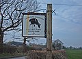
English: Warmingham is a village (at SJ 708 611) and civil parish in the unitary authority of Cheshire East and the ceremonial county of Cheshire, England. The village lies 3¼ miles to the north of Crewe and 3¼ miles to the west of Sandbach. The parish also includes the settlement of Lane Ends. Nearby villages include Minshull Vernon. St Leonard's Church and the Bear Paw public house are in Warmingham village. The River Wheelock runs north–south through the parish.
village and civil parish in Cheshire, UK  | |||||
| Upload media | |||||
| Instance of | |||||
|---|---|---|---|---|---|
| Location | Cheshire East, Cheshire, North West England, England | ||||
 | |||||
Subcategories
This category has the following 2 subcategories, out of 2 total.
C
- Church House, Warmingham (2 F)
L
Media in category "Warmingham"
The following 94 files are in this category, out of 94 total.
-

-
 Bear Paw Public House - geograph.org.uk - 213597.jpg 640 × 389; 19 KB
-
 Bears Paw, Warmingham.jpg 640 × 480; 207 KB
-
 Brook Farm - geograph.org.uk - 236948.jpg 640 × 480; 24 KB
-
 Close up, Elizabeth II postbox, Warmingham - geograph.org.uk - 5175135.jpg 1,270 × 2,429; 578 KB
-
 Crabmill Flash.jpg 800 × 600; 118 KB
-
 Elizabeth II postbox, Warmingham - geograph.org.uk - 5175132.jpg 2,214 × 1,961; 982 KB
-
 Entering Warmingham - geograph.org.uk - 5173627.jpg 640 × 480; 109 KB
-
 Entering Warmingham village - geograph.org.uk - 5173653.jpg 640 × 480; 89 KB
-
 Farm buildings, Warmingham - geograph.org.uk - 5173658.jpg 640 × 480; 70 KB
-

-
 Farmland at Moss Field Farm - geograph.org.uk - 2562643.jpg 640 × 450; 51 KB
-
 Field entrance off Warmingham Road - geograph.org.uk - 5173630.jpg 640 × 480; 135 KB
-
 Field gate near Moston - geograph.org.uk - 303556.jpg 640 × 481; 97 KB
-
 Forge Mill Lane - geograph.org.uk - 5173704.jpg 640 × 480; 120 KB
-
 Gated farm track off Warmingham Road - geograph.org.uk - 5173657.jpg 640 × 480; 101 KB
-
 Grazing and farm track, Warmingham - geograph.org.uk - 5173652.jpg 640 × 480; 67 KB
-
 Grazing east of Warmingham Road - geograph.org.uk - 5173642.jpg 640 × 480; 57 KB
-
 Grazing off Dragon's Lane - geograph.org.uk - 5173708.jpg 640 × 480; 63 KB
-
 Grazing, Lane Ends - geograph.org.uk - 5173638.jpg 640 × 480; 52 KB
-
 Green Lane - geograph.org.uk - 213601.jpg 640 × 452; 24 KB
-
 Hail, fellow cyclist^ - geograph.org.uk - 4877174.jpg 1,024 × 768; 273 KB
-
 Hall Lane - geograph.org.uk - 5173641.jpg 640 × 480; 104 KB
-
 Horse and ponies on Crabmill Lane - geograph.org.uk - 4877168.jpg 1,024 × 768; 310 KB
-
 Houses on School Lane, Warmingham - geograph.org.uk - 5173685.jpg 640 × 480; 59 KB
-
 Junction of Crabmill Lane and Green Lane - geograph.org.uk - 4877178.jpg 1,024 × 768; 198 KB
-
 Lane, Warmingham - geograph.org.uk - 5175138.jpg 640 × 480; 97 KB
-
 Looking north on Warmingham Road - geograph.org.uk - 5173644.jpg 640 × 480; 55 KB
-

-
 Moss End Farm - geograph.org.uk - 5173632.jpg 640 × 480; 77 KB
-
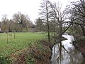
 Moston-Warmingham, River Wheelock - geograph.org.uk - 263550.jpg 640 × 480; 171 KB
-
 Number 7 wellhead - geograph.org.uk - 6054253.jpg 6,032 × 4,014; 5.23 MB
-

-

-

-
 Old road sign on Crabmill Lane - geograph.org.uk - 4877177.jpg 1,024 × 768; 244 KB
-
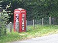
 Phone box - geograph.org.uk - 270250.jpg 480 × 640; 136 KB
-
 Private road signs - geograph.org.uk - 6054250.jpg 6,032 × 4,014; 5.66 MB
-
 Pylon near Oakfields Farm - geograph.org.uk - 5173701.jpg 480 × 640; 53 KB
-
 Pylon, Spring Farm - geograph.org.uk - 4959364.jpg 640 × 426; 39 KB
-
 Pylon, West Coast Main Line - geograph.org.uk - 4959369.jpg 640 × 426; 44 KB
-
 River in spate - geograph.org.uk - 6054247.jpg 6,032 × 4,014; 6.56 MB
-
 River Wheelock - geograph.org.uk - 6054249.jpg 6,032 × 4,014; 6.39 MB
-
 River Wheelock with cows - geograph.org.uk - 213618.jpg 640 × 480; 28 KB
-
 River Wheelock, Warmingham.jpg 640 × 480; 240 KB
-
 Roadside spring flowers - geograph.org.uk - 1266709.jpg 640 × 480; 376 KB
-
 Sandbach Flashes, Crabmill Flash - geograph.org.uk - 4247587.jpg 1,152 × 904; 274 KB
-
 School Lane, Warmingham - geograph.org.uk - 5173689.jpg 640 × 480; 98 KB
-
 Sharp bend on Dragon's Lane - geograph.org.uk - 1266692.jpg 640 × 480; 278 KB
-

-
 St Leonard's Church, Warmingham - geograph.org.uk - 5173662.jpg 640 × 512; 89 KB
-
 Telephone box and exchange, Warmingham - geograph.org.uk - 5173671.jpg 640 × 480; 117 KB
-
 The Crofts, Crabmill Lane - geograph.org.uk - 4877165.jpg 1,024 × 768; 200 KB
-
 Warmingham - Moss Lane - geograph.org.uk - 811855.jpg 480 × 640; 351 KB
-
 Warmingham -Brine Pump.jpg 640 × 480; 31 KB
-
 Warmingham Bridge.JPG 1,800 × 1,200; 951 KB
-
 Warmingham C of E Primary School - geograph.org.uk - 5173682.jpg 640 × 480; 88 KB
-
 Warmingham Church - geograph.org.uk - 5514898.jpg 4,813 × 3,384; 1.72 MB
-
 Warmingham K6 Telephone Kiosk.jpg 4,000 × 3,000; 4.59 MB
-
 Warmingham Moss - geograph.org.uk - 811863.jpg 640 × 480; 223 KB
-
 Warmingham Road - geograph.org.uk - 5173636.jpg 640 × 480; 75 KB
-
 Warmingham Road - geograph.org.uk - 5173649.jpg 640 × 480; 53 KB
-
 Warmingham Road - geograph.org.uk - 5528248.jpg 4,389 × 2,187; 1.76 MB
-
 Warmingham Road, Lane Ends - geograph.org.uk - 5173639.jpg 640 × 480; 90 KB
-
 Warmingham Village Hall - geograph.org.uk - 5173690.jpg 640 × 480; 103 KB
-
 Warmingham Village Hall - geograph.org.uk - 5514945.jpg 5,184 × 3,456; 1.93 MB
-
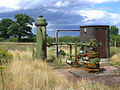
 Warmingham, brine well-head - geograph.org.uk - 263560.jpg 608 × 456; 149 KB
-

-
 Whitehall Lane - geograph.org.uk - 5528250.jpg 5,184 × 3,456; 1.7 MB
-
 Worm firm - geograph.org.uk - 213599.jpg 640 × 355; 15 KB
-
 Entrance to Fields Farm, Occlestone Green - geograph.org.uk - 375774.jpg 640 × 466; 100 KB
-
 Farm machinery - geograph.org.uk - 213622.jpg 640 × 480; 204 KB
-
 Farm Sign, Occlestone Green - geograph.org.uk - 375805.jpg 640 × 466; 137 KB
-
 Field harvested for silage or hay - geograph.org.uk - 532492.jpg 640 × 411; 69 KB
-
 Flash Farm, Ettiley Heath - geograph.org.uk - 375705.jpg 640 × 452; 149 KB
-
 Footpath near Old Hough - geograph.org.uk - 213613.jpg 480 × 640; 32 KB
-
 Going round the Bend - geograph.org.uk - 375817.jpg 640 × 480; 169 KB
-

-
 Hill Top Farm - geograph.org.uk - 213609.jpg 640 × 480; 23 KB
-
 Hole House underground gas storage plant - geograph.org.uk - 197132.jpg 549 × 371; 143 KB
-
 Moston Flash - geograph.org.uk - 303568.jpg 640 × 361; 44 KB
-
 Moston Manor - geograph.org.uk - 375757.jpg 640 × 480; 137 KB
-
 On a Warmingham footpath - geograph.org.uk - 197130.jpg 576 × 384; 189 KB
-
 Park Hall Farm, Minshull Vernon - geograph.org.uk - 572279.jpg 640 × 480; 61 KB
-
 Parkfield Bridge, Minshull Vernon - geograph.org.uk - 572275.jpg 640 × 480; 78 KB
-
 Reed beds at Tetton Lake - geograph.org.uk - 303571.jpg 640 × 421; 75 KB
-

-
 Warmingham farmland - geograph.org.uk - 197128.jpg 576 × 384; 189 KB
-
 Warmingham, Crabmill Flash - geograph.org.uk - 263547.jpg 640 × 480; 143 KB
-
 Warmingham, flash on the Moston boundary - geograph.org.uk - 263552.jpg 640 × 480; 116 KB
-
 Warmingham, Stocia Farm - geograph.org.uk - 263554.jpg 640 × 480; 143 KB
-

-

-
 Worm farm near Occlestone Green - geograph.org.uk - 213616.jpg 640 × 480; 19 KB


_off_Warmingham_Road_-_geograph.org.uk_-_5173647.jpg)


