Category:Waringsford
Jump to navigation
Jump to search
village in United Kingdom | |||||
| Upload media | |||||
| Instance of | |||||
|---|---|---|---|---|---|
| Location | County Down, Northern Ireland | ||||
 | |||||
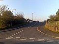
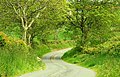
English: Waringsford , is a small village in County Down, Northern Ireland, 6km south east of Dromore. In the 2001 Census it had a population of 129 people. It lies within the Banbridge District Council area. The village, despite the lack of services, has seen substantial property development in the last five years, helped by its rural setting, relative tranquility and close proximity to the A1.
Media in category "Waringsford"
The following 26 files are in this category, out of 26 total.
-
 Aughnaskeagh Road, Waringford - geograph.org.uk - 1262733.jpg 640 × 480; 81 KB
-
 Ballela Chapel - geograph.org.uk - 1061357.jpg 640 × 480; 72 KB
-
 Church Road, Aughnaskeagh - geograph.org.uk - 1262762.jpg 640 × 480; 92 KB
-
 Crossroads, Aughnaskeagh - geograph.org.uk - 1263217.jpg 640 × 480; 63 KB
-
 Ednego Avenue near Dromore - geograph.org.uk - 579115.jpg 640 × 427; 124 KB
-
 Ednego Avenue, Banbridge - geograph.org.uk - 703364.jpg 640 × 480; 114 KB
-
 Eirford Park, Waringsford - geograph.org.uk - 1260844.jpg 640 × 480; 57 KB
-
 Enagh Road, Enagh - geograph.org.uk - 1260793.jpg 640 × 480; 53 KB
-
 Garvaghy Parish Church, Waringsford - geograph.org.uk - 1260566.jpg 640 × 480; 53 KB
-
 Garvaghy Road, Waringsford - geograph.org.uk - 1260525.jpg 640 × 480; 58 KB
-

-
 Lane near Waringsford - geograph.org.uk - 1283558.jpg 640 × 363; 116 KB
-
 Old mill at Ballooly near Katesbridge (1) - geograph.org.uk - 422732.jpg 640 × 426; 149 KB
-
 Old mill at Ballooly near Katesbridge (2) - geograph.org.uk - 422734.jpg 640 × 426; 206 KB
-
 Old mill at Ballooly near Katesbridge (3) - geograph.org.uk - 422736.jpg 640 × 426; 154 KB
-
 River near Waringsford - geograph.org.uk - 752751.jpg 640 × 429; 92 KB
-
 Shot Lane, Enagh - geograph.org.uk - 1260869.jpg 640 × 480; 60 KB
-
 The Banbridge Road near Waringsford - geograph.org.uk - 752700.jpg 640 × 400; 78 KB
-
 The Enagh Road near Waringsford - geograph.org.uk - 1283535.jpg 640 × 366; 95 KB
-
 The Enagh Road, Waringsford - geograph.org.uk - 1248041.jpg 610 × 372; 87 KB
-
 The Fedney Road near Waringsford - geograph.org.uk - 814443.jpg 640 × 410; 115 KB
-
 Thorn Hill Road, Garvaghy - geograph.org.uk - 1260470.jpg 640 × 480; 105 KB
-
 Tory Brae, Aughnaskeagh - geograph.org.uk - 1263227.jpg 640 × 480; 64 KB
-
 Tullinisky Road, Waringsford - geograph.org.uk - 1254652.jpg 640 × 480; 69 KB
-
 Waringsford Orange Hall.jpg 640 × 480; 53 KB
-
 Waringsford Village - geograph.org.uk - 1266023.jpg 640 × 480; 65 KB


_-_geograph.org.uk_-_422732.jpg)
_-_geograph.org.uk_-_422734.jpg)
_-_geograph.org.uk_-_422736.jpg)


