Category:Ward's Stone
Jump to navigation
Jump to search
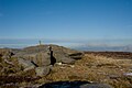
English: Ward's Stone is a hill in the civil parishes of Caton-with-Littledale and Over Wyresdale, in the Lancaster district, in the county of Lancashire, England.
mountain in the United Kingdom  | |||||
| Upload media | |||||
| Instance of | |||||
|---|---|---|---|---|---|
| Location |
| ||||
| Topographic prominence |
| ||||
| Elevation above sea level |
| ||||
| Parent peak | |||||
 | |||||
Media in category "Ward's Stone"
The following 32 files are in this category, out of 32 total.
-
 Carved Stone, Wards Stone - geograph.org.uk - 770772.jpg 640 × 480; 96 KB
-

-
 Eastern Trig Pillar - Ward's Stone Top - geograph.org.uk - 2223054.jpg 2,000 × 3,008; 2.8 MB
-
 Eastern Ward's Stone trig point - geograph.org.uk - 4090823.jpg 3,872 × 2,592; 2.18 MB
-
 Fence corner on Ward's Stone and Queen's Chair - geograph.org.uk - 4090852.jpg 3,872 × 2,592; 5.68 MB
-
 From Ward's Stone - geograph.org.uk - 770762.jpg 640 × 480; 30 KB
-
 Grey Mare and Foal - geograph.org.uk - 1091751.jpg 640 × 480; 44 KB
-
 Grey Mare and Foal - geograph.org.uk - 506578.jpg 640 × 426; 257 KB
-
 Grey Mare and Foal - Ward's Stone - Bowland - geograph.org.uk - 2857373.jpg 3,264 × 2,448; 1.72 MB
-

-

-
 Near the summit of Ward's Stone - geograph.org.uk - 970152.jpg 640 × 408; 71 KB
-
 On Ward's Stone - geograph.org.uk - 2191056.jpg 2,560 × 1,920; 1.71 MB
-
 Queen's Chair - geograph.org.uk - 506586.jpg 640 × 426; 416 KB
-
 Queen's Chair, Ward's Stone - geograph.org.uk - 4396355.jpg 480 × 640; 132 KB
-
 Raised peat on Ward's Stone - geograph.org.uk - 4090792.jpg 3,872 × 2,592; 5.54 MB
-
 Raised peat, Ward's Stone - geograph.org.uk - 3408612.jpg 640 × 425; 192 KB
-
 Rocks by Ward's Stone eastern Trig Pillar - geograph.org.uk - 506587.jpg 640 × 426; 339 KB
-
 Small cairn on the Grey Mare and Foal - geograph.org.uk - 970165.jpg 640 × 420; 68 KB
-

-
 Stile and fence Ward's Stone - geograph.org.uk - 970211.jpg 640 × 427; 105 KB
-
 Tarn on Ward's Stone Plateau - geograph.org.uk - 506589.jpg 640 × 426; 243 KB
-
 The Grey Mare and Foal - geograph.org.uk - 3259664.jpg 640 × 425; 250 KB
-
 The Grey Mare ^ Foal Rocks - geograph.org.uk - 2223048.jpg 3,008 × 2,000; 2.48 MB
-
 The Queen's Chair Rock Formation - geograph.org.uk - 2223041.jpg 3,008 × 2,000; 2.93 MB
-
 Trig Pillar Wards Stone - geograph.org.uk - 272782.jpg 640 × 480; 62 KB
-
 Trig Pillar, Ward's Stone - geograph.org.uk - 2191052.jpg 2,560 × 1,920; 1.01 MB
-
 Trig point, Mallowdale Fell - geograph.org.uk - 1819737.jpg 2,592 × 1,944; 1.2 MB
-
 Ward's Stone east top - geograph.org.uk - 49520.jpg 640 × 480; 74 KB
-
 Ward's Stone east trig point - geograph.org.uk - 1726887.jpg 2,272 × 1,712; 766 KB
-
 Ward's Stone Plateau - geograph.org.uk - 506572.jpg 640 × 426; 275 KB
-
 Who turned the lights out ^ - Ward's Stone - Bowland - geograph.org.uk - 2857349.jpg 3,264 × 2,448; 1.61 MB


