Category:Walton Park Cemetery
Jump to navigation
Jump to search
| Object location | | View all coordinates using: OpenStreetMap |
|---|
cemetery in Walton, Liverpool, England  | |||||
| Upload media | |||||
| Instance of | |||||
|---|---|---|---|---|---|
| Location | Walton, Liverpool, Merseyside, North West England, England | ||||
| Start time |
| ||||
| End time |
| ||||
 | |||||
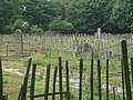
Opened 1856 as a parochial cemetery, and closed 1950s. Now the location of Rice Lane City Farm.
Subcategories
This category has the following 2 subcategories, out of 2 total.
W
- Walton Park Cemetery chapel (7 F)
Media in category "Walton Park Cemetery"
The following 10 files are in this category, out of 10 total.
-
 Entrance gates to Walton Cemetery.jpg 5,149 × 3,392; 22.89 MB
-
 North lodge of Walton Park Cemetery.jpg 4,474 × 3,170; 19.13 MB
-
 Plan of Walton Cemetery.jpg 3,193 × 4,208; 20.98 MB
-
 Rice Lane City Farm, July 18 2010 (2).jpg 3,072 × 2,304; 1.18 MB
-
 Rice Lane City Farm, July 18 2010 (3).jpg 3,072 × 2,304; 1.21 MB
-
 Rice Lane City Farm, July 18 2010 (5).jpg 3,072 × 2,304; 1.2 MB
-
 Rice Lane City Farm, July 18 2010 (6).jpg 3,072 × 2,304; 1.21 MB
-
 Rice Lane City Farm, July 18 2010.jpg 3,072 × 2,304; 1.2 MB
-
 Sign to Walton Park Cemetery.jpg 3,902 × 3,121; 14.02 MB
-
 South lodge of Walton Park Cemetery.jpg 4,780 × 3,235; 24.67 MB


.jpg)
.jpg)
.jpg)
.jpg)


