Category:Walton, Leeds
Jump to navigation
Jump to search
village and civil parish in Leeds, West Yorkshire, England, UK | |||||
| Upload media | |||||
| Instance of | |||||
|---|---|---|---|---|---|
| Location | Leeds, West Yorkshire, Yorkshire and the Humber, England | ||||
 | |||||
English: Walton is an affluent village and civil parish 2 miles (3 km) east of Wetherby, West Yorkshire, England. It is adjacent to Thorp Arch village and includes part of the Thorp Arch Trading Estate. The village is in the LS 23 Leeds postcode area, The nearest locally important town is Wetherby, with Tadcaster and the large village of Boston Spa nearby.
Nederlands: Walton is een dorp (village) en civil parish in het bestuurlijke gebied City of Leeds, in het Engelse graafschap West Yorkshire.
Subcategories
This category has the following 6 subcategories, out of 6 total.
B
H
S
T
W
Media in category "Walton, Leeds"
The following 137 files are in this category, out of 137 total.
-
 A quiet corner of Walton - geograph.org.uk - 4115976.jpg 1,600 × 1,200; 329 KB
-
 Along Hall Park Road - geograph.org.uk - 5375180.jpg 640 × 427; 254 KB
-
 Along Rudgate - geograph.org.uk - 5375639.jpg 640 × 427; 175 KB
-
 Along Springs Lane - geograph.org.uk - 5375171.jpg 640 × 427; 250 KB
-
 Approaching Rudgate - geograph.org.uk - 5375182.jpg 640 × 427; 207 KB
-
 Avenue C and Street 7 - geograph.org.uk - 5612373.jpg 640 × 427; 201 KB
-
 Avenue C E, Thorp Arch Trading Estate. - geograph.org.uk - 4130842.jpg 1,600 × 1,064; 439 KB
-
 Avenue E E, Thorp Arch retail estate - geograph.org.uk - 4130472.jpg 1,600 × 1,064; 421 KB
-
 Avenue E E, Thorp Arch retail estate - geograph.org.uk - 4130544.jpg 1,600 × 1,064; 481 KB
-
 Avenue F, Thorp Arch Trading Estate. - geograph.org.uk - 4130836.jpg 1,600 × 1,064; 628 KB
-

-
-
-
 Bridge 15 on the National Cycle Network 665 - geograph.org.uk - 4130302.jpg 1,600 × 1,064; 903 KB
-
 Building 515 on Avenue E E - geograph.org.uk - 4130548.jpg 1,600 × 1,064; 364 KB
-
 Building 519 on Avenue E E - geograph.org.uk - 4130812.jpg 1,600 × 1,064; 409 KB
-
-

-
 Bus stop on Avenue E - geograph.org.uk - 5612376.jpg 427 × 640; 181 KB
-
 Cornfield at Walton Gates - geograph.org.uk - 490100.jpg 640 × 478; 135 KB
-
 Cottage, Hall Park Road, Walton - geograph.org.uk - 3798815.jpg 640 × 480; 66 KB
-
 Cricket ground, Walton - geograph.org.uk - 3798797.jpg 640 × 480; 60 KB
-
 Cricket pavilion, Walton - geograph.org.uk - 3798794.jpg 640 × 480; 54 KB
-
 Crossing Wetherby Road on NCN 665 - geograph.org.uk - 4212567.jpg 1,024 × 768; 131 KB
-
 Descending Rudgate - geograph.org.uk - 5375656.jpg 640 × 427; 224 KB
-
 Double bend on Hall Park Road - geograph.org.uk - 5267890.jpg 1,024 × 768; 133 KB
-
 Eddie Brown Depot - geograph.org.uk - 4130827.jpg 1,600 × 1,064; 504 KB
-
 Electricity supply infrastructure, Hall Park - geograph.org.uk - 5267896.jpg 1,024 × 768; 190 KB
-
 Ellercarr Lane - geograph.org.uk - 5874487.jpg 5,184 × 3,456; 7.48 MB
-

-

-
 Entrance to Thorpe Arch Sorting Site - geograph.org.uk - 4130482.jpg 1,600 × 1,064; 593 KB
-
 Entrance to Walton Cricket Club - geograph.org.uk - 5375173.jpg 640 × 427; 213 KB
-
 Farm entrance off Springs Lane - geograph.org.uk - 3798560.jpg 640 × 480; 60 KB
-
 Farm track off Wighill Lane - geograph.org.uk - 4130936.jpg 1,600 × 1,064; 494 KB
-
 Farmland and hedgerow - geograph.org.uk - 3798789.jpg 640 × 480; 111 KB
-
 Farmland east of Sykes House Farm - geograph.org.uk - 5267390.jpg 1,024 × 768; 132 KB
-
 Farmland north of Walton Lodge Farm - geograph.org.uk - 5267918.jpg 1,024 × 768; 175 KB
-
 Farmland off Wighill Lane - geograph.org.uk - 2729467.jpg 640 × 480; 47 KB
-
 Farmland south-west of Walton Wood - geograph.org.uk - 5267921.jpg 1,024 × 768; 184 KB
-
 Farmland towards Walton Lodge - geograph.org.uk - 2729460.jpg 640 × 480; 45 KB
-
 Farmland west of Rudgate - geograph.org.uk - 5267905.jpg 1,024 × 768; 159 KB
-
 Field beside Springs Lane - geograph.org.uk - 5875953.jpg 5,184 × 3,456; 5.83 MB
-
 Field boundary on the west side of Rudgate - geograph.org.uk - 5267913.jpg 1,024 × 615; 125 KB
-
 Field off Springs Lane - geograph.org.uk - 5375172.jpg 640 × 427; 206 KB
-
 Field with a muddy entrance, off Springs Lane - geograph.org.uk - 5267355.jpg 1,024 × 768; 203 KB
-
 Former bunker at Thorp Arch Trading Estate - geograph.org.uk - 4115955.jpg 1,600 × 1,200; 334 KB
-
 Fox and Hounds, Walton - geograph.org.uk - 5875966.jpg 5,184 × 3,456; 7.05 MB
-
 Grange Avenue - Wighill Lane - geograph.org.uk - 5325446.jpg 640 × 480; 53 KB
-
 Hall Park Road - geograph.org.uk - 5375178.jpg 640 × 427; 216 KB
-
 Hall Park Road - geograph.org.uk - 5874489.jpg 5,184 × 3,456; 5.51 MB
-
-
 Hall Park Road entering Walton - geograph.org.uk - 5267414.jpg 1,024 × 768; 170 KB
-
 Hall Park Road, heading east - geograph.org.uk - 5267426.jpg 1,024 × 768; 121 KB
-
 Hall Parks Farm - geograph.org.uk - 295572.jpg 640 × 384; 62 KB
-
 Hall Parks Farm - geograph.org.uk - 5375181.jpg 640 × 427; 200 KB
-
 Heading North East out of Walton - geograph.org.uk - 5875847.jpg 5,184 × 3,456; 4.14 MB
-
 In Walton Wood (1) - geograph.org.uk - 5874235.jpg 5,184 × 3,456; 6.86 MB
-
 In Walton Wood (2) - geograph.org.uk - 5874238.jpg 5,184 × 3,456; 3.98 MB
-
 Large Field beside Rudgate - geograph.org.uk - 5874502.jpg 5,184 × 3,456; 7.66 MB
-
 Localised flooding at Hall Park - geograph.org.uk - 5267901.jpg 1,024 × 614; 134 KB
-
 Localised flooding off Hall Park Road - geograph.org.uk - 5267407.jpg 1,024 × 768; 131 KB
-
 Looking along Rudgate - geograph.org.uk - 5375655.jpg 640 × 427; 186 KB
-
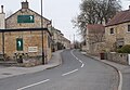
 Main Street and Smiddy Hill - geograph.org.uk - 5375179.jpg 640 × 427; 218 KB
-
 Main Street, Walton - geograph.org.uk - 5375175.jpg 640 × 427; 224 KB
-
 National Cycle Network 665 - geograph.org.uk - 4130294.jpg 1,600 × 1,064; 805 KB
-
 National Cycle Network 665 - geograph.org.uk - 4130298.jpg 1,600 × 1,064; 662 KB
-
 Old Post House - School Lane - geograph.org.uk - 5325543.jpg 640 × 480; 52 KB
-
 Pillbox at Thorp Arch Trading Estate - geograph.org.uk - 4130902.jpg 1,600 × 1,064; 862 KB
-
 Pond off Springs Lane, Walton - geograph.org.uk - 3798802.jpg 640 × 480; 89 KB
-
 Rape field beside Springs Lane - geograph.org.uk - 5375168.jpg 640 × 427; 252 KB
-
 Recently ploughed field, Hall Park - geograph.org.uk - 5267885.jpg 1,024 × 768; 167 KB
-
 Recently ploughed field, west of Rudgate - geograph.org.uk - 5267931.jpg 1,024 × 768; 196 KB
-
 Route 665 - Walton Gates - geograph.org.uk - 248221.jpg 479 × 640; 114 KB
-
 Rudgate (Roman Road) heading south - geograph.org.uk - 2728807.jpg 640 × 480; 50 KB
-
 Rudgate (Roman Road) heading south - geograph.org.uk - 2729463.jpg 640 × 480; 64 KB
-
 Rudgate looking north - geograph.org.uk - 3798222.jpg 1,024 × 768; 188 KB
-
 Rudgate looking north from the brow of a hill - geograph.org.uk - 3798229.jpg 1,024 × 768; 165 KB
-
 Scaffolding Yard - geograph.org.uk - 5375658.jpg 640 × 427; 201 KB
-
 School Lane - geograph.org.uk - 5375174.jpg 640 × 427; 190 KB
-

-
 School Lane - Wetherby Road - geograph.org.uk - 5325545.jpg 640 × 480; 53 KB
-
 School Lane junction with Spring Lane, Walton - geograph.org.uk - 5960384.jpg 1,024 × 683; 178 KB
-

-
 Smiddy Hill - Wighill Lane - geograph.org.uk - 5325447.jpg 640 × 480; 66 KB
-
-
 Springs Lane - geograph.org.uk - 3798786.jpg 640 × 480; 93 KB
-
 Springs Lane - geograph.org.uk - 3798801.jpg 640 × 480; 65 KB
-
 Springs Lane - geograph.org.uk - 5960388.jpg 1,024 × 683; 306 KB
-
 Springs Lane approaching York Road - geograph.org.uk - 5960392.jpg 1,024 × 683; 232 KB
-
 Springs Lane in winter, heading north - geograph.org.uk - 5267383.jpg 1,024 × 768; 154 KB
-
 Springs Lane in winter, heading south - geograph.org.uk - 5267339.jpg 1,024 × 768; 128 KB
-
 Springs Lane near Walton Park Cricket Club - geograph.org.uk - 5960385.jpg 1,024 × 683; 211 KB
-
 Springs Lane, looking towards Walton - geograph.org.uk - 4115978.jpg 1,024 × 768; 188 KB
-
 St Peter's Church Sundial, Walton - geograph.org.uk - 3014999.jpg 4,896 × 3,168; 4.65 MB
-
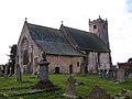 St Peter's Church, Walton - geograph.org.uk - 2249849.jpg 3,264 × 2,448; 1.43 MB
-
 St. Peter's Church, Walton - geograph.org.uk - 3798805.jpg 640 × 480; 103 KB
-
 St. Peter's Church, Walton - geograph.org.uk - 5875958.jpg 5,184 × 3,456; 6.79 MB
-
 Straw Bales in Field beside Springs Lane - geograph.org.uk - 5875946.jpg 5,184 × 3,456; 5.79 MB
-
 Street 7 - geograph.org.uk - 5612374.jpg 640 × 427; 198 KB
-
 Street 7, Thorp Arch Trading Estate. - geograph.org.uk - 4130823.jpg 1,600 × 1,064; 495 KB
-
 Street 8, Thorp Arch Trading Estate - geograph.org.uk - 5874508.jpg 5,184 × 3,456; 5.48 MB
-
 Sustrans route 66 cycle track - geograph.org.uk - 719315.jpg 600 × 424; 240 KB
-
 The Fox and Hounds, Walton - geograph.org.uk - 2249841.jpg 2,783 × 1,921; 952 KB
-
 The Fox ^ Hounds, Walton - geograph.org.uk - 3798817.jpg 640 × 480; 74 KB
-
 Thorp Arch Trading Estate - Avenue B - geograph.org.uk - 6185569.jpg 4,000 × 3,000; 3.06 MB
-
 Thorp Arch Trading Estate - Street 7 - geograph.org.uk - 6185562.jpg 4,000 × 3,000; 3.42 MB
-
 Towards Walton Lodge Farm - geograph.org.uk - 5375654.jpg 640 × 427; 176 KB
-
 Towards Walton Wood - geograph.org.uk - 5375640.jpg 640 × 427; 212 KB
-
 Track beside the Eastern Edge of Thorp Arch Trading Estate - geograph.org.uk - 5874515.jpg 5,184 × 3,456; 6.52 MB
-
 Track leading towards Walton Wood - geograph.org.uk - 5874498.jpg 5,184 × 3,456; 6.9 MB
-
 Track off Wighill Lane - geograph.org.uk - 2729468.jpg 640 × 480; 89 KB
-
 Track to Walton Lodge Farm - geograph.org.uk - 5375659.jpg 640 × 427; 205 KB
-
 Track to Walton Wood - geograph.org.uk - 2729462.jpg 640 × 480; 100 KB
-
 Track towards Walton Wood - geograph.org.uk - 5704957.jpg 1,600 × 1,200; 790 KB
-

-
 Trees on Mill Hill, near Walton - geograph.org.uk - 5267417.jpg 1,024 × 768; 238 KB
-
 Uncultivated field margin, Hall Park - geograph.org.uk - 5267907.jpg 1,024 × 768; 209 KB
-
 Uncultivated field margin, off Springs Lane - geograph.org.uk - 5267362.jpg 1,024 × 614; 235 KB
-
 View across fields towards Walton Wood - geograph.org.uk - 5874494.jpg 5,184 × 3,456; 7.7 MB
-
 View towards HM Prison Walton, Leeds - geograph.org.uk - 248219.jpg 640 × 479; 98 KB
-
 Village cricket ground, Walton - geograph.org.uk - 2249850.jpg 3,264 × 2,448; 1.56 MB
-
 Walton - Walton Gates.jpg 640 × 478; 179 KB
-
 Walton Main Street from School Lane - geograph.org.uk - 959232.jpg 640 × 446; 214 KB
-
 Walton Main Street from Smiddy Hill - geograph.org.uk - 959242.jpg 640 × 488; 201 KB
-
 Walton Old Hall - Smiddy Hill - geograph.org.uk - 5325453.jpg 640 × 480; 96 KB
-
 Walton Park Cricket Club - geograph.org.uk - 5875819.jpg 5,184 × 3,456; 5.64 MB
-
 Walton Village Hall - geograph.org.uk - 3015017.jpg 3,744 × 2,592; 2.49 MB
-
 Walton Village Hall - geograph.org.uk - 4115965.jpg 1,600 × 1,143; 421 KB
-
 Walton Village Hall - School Lane - geograph.org.uk - 959231.jpg 640 × 489; 236 KB
-

-

-
 Winter farmland, south-east of Sykes House Farm - geograph.org.uk - 5267396.jpg 1,024 × 768; 226 KB
-
 Winter tree at Hall Park - geograph.org.uk - 5267887.jpg 1,024 × 768; 129 KB
-
 Winter trees, Hall Park Road - geograph.org.uk - 5267403.jpg 768 × 1,024; 463 KB
-
 Farmhouse on Springs Lane, Walton - geograph.org.uk - 324896.jpg 640 × 480; 102 KB
-


.jpg)
.jpg)
.jpg)


_-_geograph.org.uk_-_5874235.jpg)
_-_geograph.org.uk_-_5874238.jpg)


_heading_south_-_geograph.org.uk_-_2728807.jpg)
_heading_south_-_geograph.org.uk_-_2729463.jpg)


