Category:Wall, Staffordshire
Jump to navigation
Jump to search
village and civil parish in Staffordshire, UK  | |||||
| Upload media | |||||
| Instance of | |||||
|---|---|---|---|---|---|
| Location | Lichfield, Staffordshire, West Midlands, England | ||||
 | |||||
Subcategories
This category has the following 5 subcategories, out of 5 total.
C
- Chesterfield, Staffordshire (8 F)
H
- Hilton, Lichfield (7 F)
L
- Letocetum (31 F)
P
- Pipehill (1 F)
S
- St John's Church, Wall (8 F)
Media in category "Wall, Staffordshire"
The following 126 files are in this category, out of 126 total.
-
 A461 bridge over M6 (T) - geograph.org.uk - 4566059.jpg 640 × 270; 40 KB
-
 A461 Bridge, M6 (Toll) - geograph.org.uk - 2661360.jpg 640 × 430; 42 KB
-
 A461 Heading to Muckley Corner. - geograph.org.uk - 2444420.jpg 640 × 428; 62 KB
-
 A461 overbridge over M6 (T) east - geograph.org.uk - 4564444.jpg 640 × 323; 40 KB
-
 A5 View - geograph.org.uk - 2273916.jpg 800 × 600; 84 KB
-
 A5190 heading west - geograph.org.uk - 3419748.jpg 640 × 480; 54 KB
-

-
 Approaching Wall crossroad - geograph.org.uk - 6092271.jpg 1,514 × 1,136; 692 KB
-
 Ashcroft Lane - geograph.org.uk - 3419590.jpg 640 × 480; 54 KB
-
 Barn Farm, Hilton - geograph.org.uk - 1141016.jpg 640 × 480; 66 KB
-
 Barn Farm, Hilton - geograph.org.uk - 2804119.jpg 640 × 428; 63 KB
-
 Boat Lane - geograph.org.uk - 3553649.jpg 640 × 480; 103 KB
-
 Bridge over M6 (Toll) - geograph.org.uk - 2661373.jpg 640 × 430; 40 KB
-

-
 Bulmoor Lane Junction - geograph.org.uk - 2277069.jpg 640 × 480; 59 KB
-

-
 Chesterfield Stream - geograph.org.uk - 2273911.jpg 800 × 600; 184 KB
-
 Church View - geograph.org.uk - 2273969.jpg 800 × 600; 137 KB
-
 Cranebrook Lane - geograph.org.uk - 3553630.jpg 640 × 480; 82 KB
-
 Cranebrook Lane - geograph.org.uk - 3553640.jpg 640 × 480; 65 KB
-
 Cranebrook Lane heading north - geograph.org.uk - 3553655.jpg 640 × 480; 91 KB
-
 Cranebrook Lane, Hilton - geograph.org.uk - 1141010.jpg 640 × 480; 71 KB
-
 Cranebrooke Lane Bridge, M6 Toll Road - geograph.org.uk - 3671613.jpg 640 × 427; 189 KB
-
 Crop field, Pipehill - geograph.org.uk - 3553686.jpg 640 × 480; 101 KB
-
 Cross-City Line crossing Watling Street - geograph.org.uk - 6092238.jpg 674 × 506; 216 KB
-
 Crossroads Near Wall, Staffordshire - geograph.org.uk - 2486856.jpg 640 × 428; 55 KB
-

-

-
 English Heritage site at Wall - geograph.org.uk - 2790941.jpg 3,648 × 2,736; 2.65 MB
-
 Farmland and woodland, Aldershawe - geograph.org.uk - 3419628.jpg 640 × 480; 71 KB
-
 Farmland near Wall - geograph.org.uk - 3419611.jpg 1,024 × 572; 97 KB
-
 Farmland off Wall Lane - geograph.org.uk - 3419626.jpg 640 × 480; 67 KB
-
 Farmland off Wall Lane - geograph.org.uk - 3419687.jpg 640 × 480; 61 KB
-
 Farmland, Muckley Corner - geograph.org.uk - 3553651.jpg 640 × 480; 75 KB
-
 Field entrance off Cranebrook Lane - geograph.org.uk - 3553634.jpg 640 × 480; 99 KB
-
 Field off Boat Lane - geograph.org.uk - 3553647.jpg 640 × 480; 80 KB
-
 Fields near Ryknild Street - geograph.org.uk - 6092187.jpg 2,272 × 1,704; 1.17 MB
-
 Footpath near Chesterfield Farm - geograph.org.uk - 3419600.jpg 640 × 480; 87 KB
-
 Forlorn light emitting diodes - geograph.org.uk - 1978542.jpg 1,024 × 683; 297 KB
-
 Gantry over the M6 Toll - geograph.org.uk - 3195440.jpg 4,382 × 1,978; 1.73 MB
-
 Gantry, M6 (Toll) - geograph.org.uk - 2661407.jpg 640 × 430; 42 KB
-
 Gantry, M6 (Toll) - geograph.org.uk - 2661420.jpg 640 × 430; 44 KB
-
 Grazing off Raikes Lane - geograph.org.uk - 3419592.jpg 640 × 480; 105 KB
-

-
 Houses In Wall - geograph.org.uk - 1496894.jpg 640 × 480; 87 KB
-

-

-

-

-

-
 Junction T5 junction ahead - geograph.org.uk - 4564455.jpg 640 × 398; 41 KB
-

-
 K6 Kiosk Wall, Staffordshire.jpg 3,648 × 5,472; 2.14 MB
-
 Letocetum heated rooms.jpg 789 × 592; 129 KB
-
 Letocetum Roman remains at Wall - geograph.org.uk - 5409875.jpg 800 × 600; 128 KB
-
 Letocetum Roman remains at Wall - geograph.org.uk - 5409879.jpg 800 × 600; 138 KB
-
 Letocetum Site of 3rd Civilian Development.jpg 840 × 630; 101 KB
-
 Lines family sketchbook - Disc1 015 - Hawthorne at Wall, Lichfield.jpg 2,157 × 2,760; 1.37 MB
-
 M6 Toll a mile from junction T5 - geograph.org.uk - 2825980.jpg 640 × 481; 39 KB
-

-
 M6 Toll east of Junction 6 - geograph.org.uk - 2326397.jpg 640 × 480; 70 KB
-
 M6 Toll near Little Oaks Farm - geograph.org.uk - 2825947.jpg 640 × 481; 30 KB
-
 M6 Toll Road - geograph.org.uk - 3553644.jpg 640 × 480; 54 KB
-
 M6 Toll Road - geograph.org.uk - 3671623.jpg 640 × 427; 208 KB
-
 M6 Toll Road Approaching Junction T5 - geograph.org.uk - 3669803.jpg 640 × 480; 247 KB
-
 M6 Toll road south of Wall Lane Farm - geograph.org.uk - 4566049.jpg 640 × 330; 44 KB
-
 M6 Toll Road Southbound - geograph.org.uk - 3669788.jpg 640 × 480; 234 KB
-
 M6 Toll Road, Cranebrooke Lane Bridge - geograph.org.uk - 3671606.jpg 640 × 480; 195 KB
-
 M6 Toll Road, Walsall Road Bridge - geograph.org.uk - 3669415.jpg 640 × 480; 265 KB
-
 M6 Toll south-west of Wall - geograph.org.uk - 3694516.jpg 640 × 481; 37 KB
-
 Manor Farm, Wall, Staffordshire - geograph.org.uk - 2486886.jpg 640 × 428; 55 KB
-
 Minor road heading west, Wall - geograph.org.uk - 3419621.jpg 640 × 480; 74 KB
-
 Modern roman milepost near Letocetum at Wall, Staffordshire.JPG 4,000 × 6,000; 7.42 MB
-

-
 Motorway bridge over Ashcroft Lane - geograph.org.uk - 3419605.jpg 640 × 480; 56 KB
-
 Muckley Corner Hotel - geograph.org.uk - 1861232.jpg 640 × 480; 205 KB
-
 Muckley Corner Roundabout. - geograph.org.uk - 2444448.jpg 640 × 428; 72 KB
-
 Muckley Corner View - geograph.org.uk - 3670444.jpg 800 × 538; 61 KB
-
 Not open for lunch - geograph.org.uk - 1978537.jpg 1,024 × 683; 145 KB
-
 Old Bridge - geograph.org.uk - 4852272.jpg 640 × 426; 128 KB
-
 Old Canal - geograph.org.uk - 4852279.jpg 640 × 426; 66 KB
-

-
 Overbridge near Hilton House - geograph.org.uk - 4564447.jpg 640 × 323; 39 KB
-
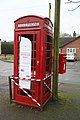
 Phone box library at Wall, Staffordshire.JPG 4,000 × 6,000; 7.57 MB
-
 Picturesque house - geograph.org.uk - 2790935.jpg 2,984 × 2,736; 1.95 MB
-
 Public footpath, Wall - geograph.org.uk - 2790962.jpg 1,600 × 1,200; 498 KB
-
 Raikes Lane - geograph.org.uk - 3419595.jpg 640 × 480; 92 KB
-
 Rail Bridge Over M6 Toll Road - geograph.org.uk - 3669767.jpg 640 × 480; 221 KB
-

-
 Railway bridge over the M6 (Toll) - geograph.org.uk - 2661425.jpg 640 × 430; 49 KB
-
 Railway bridge, Wall Lane - geograph.org.uk - 1231601.jpg 640 × 419; 66 KB
-
 Railway heading west - geograph.org.uk - 3419685.jpg 640 × 480; 117 KB
-
 Railway line, Wall Lane - geograph.org.uk - 1231595.jpg 480 × 640; 103 KB
-
 Road sign, M6 (Toll) - geograph.org.uk - 2661392.jpg 640 × 371; 40 KB
-
 Roman Town at Wall, Staffordshire.jpg 4,320 × 3,240; 5.47 MB
-
 Roman View - geograph.org.uk - 2273945.jpg 800 × 600; 122 KB
-
 Roman Walls View - geograph.org.uk - 2277078.jpg 640 × 480; 87 KB
-
 Ryknild Street About to Cross A5127 - geograph.org.uk - 3951899.jpg 640 × 480; 118 KB
-
 Sign Gantry Over M6 Toll Road - geograph.org.uk - 3669760.jpg 640 × 480; 233 KB
-

-
 The A461 crosses the M6 Toll - geograph.org.uk - 3195439.jpg 4,295 × 1,648; 1.54 MB
-
 The Muckley Corner Hotel - geograph.org.uk - 2617437.jpg 800 × 600; 252 KB
-
 The Trooper at Wall - geograph.org.uk - 2788885.jpg 3,648 × 2,736; 2.7 MB
-
 The Trooper pub, Wall - geograph.org.uk - 3419617.jpg 640 × 482; 57 KB
-
 The Trooper Public House, Wall - geograph.org.uk - 3527897.jpg 4,172 × 2,854; 2.44 MB
-
 The Trooper Restaurant at Wall - geograph.org.uk - 1231576.jpg 640 × 434; 74 KB
-
 The Trooper, Wall Heath - geograph.org.uk - 2486812.jpg 640 × 428; 82 KB
-
 Thornyhurst Lane, Hilton - geograph.org.uk - 3553638.jpg 640 × 480; 119 KB
-

-

-
 Trainline over the M6 Toll - geograph.org.uk - 3717849.jpg 4,318 × 2,174; 1.64 MB
-
 Tree and farmland near Wall - geograph.org.uk - 2984266.jpg 640 × 253; 28 KB
-
 Wall church and remains of Letocetum Roman town - geograph.org.uk - 6092258.jpg 2,272 × 1,704; 1,006 KB
-
 Wall church and the entrance to the Roman site - geograph.org.uk - 6092248.jpg 2,220 × 1,665; 1.17 MB
-
 Wall Hall, Wall.jpg 1,600 × 1,200; 410 KB
-
 Wall Lane - geograph.org.uk - 3419630.jpg 1,200 × 900; 286 KB
-
 Wall Lane heading north - geograph.org.uk - 3419694.jpg 640 × 480; 70 KB
-
 Wall Roman Site Museum - geograph.org.uk - 2790929.jpg 3,648 × 2,736; 2.84 MB
-
 Wall Roman Town - geograph.org.uk - 2790943.jpg 3,648 × 2,048; 2.15 MB
-
 Wall village - geograph.org.uk - 6092267.jpg 1,489 × 1,117; 451 KB
-
 Wall Village Hall - geograph.org.uk - 2790616.jpg 3,648 × 2,048; 1.71 MB
-
 Wall, Lichfield, Staffordshire - geograph.org.uk - 2486837.jpg 428 × 640; 76 KB
-
 Wall, Roman remains - geograph.org.uk - 2790567.jpg 3,417 × 2,042; 2.18 MB
-
 Watling St at Wall.jpg 3,250 × 2,229; 2.19 MB
-
 Watling Street, Wall - geograph.org.uk - 1496890.jpg 640 × 480; 71 KB
-
 Wall Crossroads - geograph.org.uk - 131672.jpg 640 × 427; 72 KB
_-_geograph.org.uk_-_4566059.jpg)
_-_geograph.org.uk_-_2661360.jpg)

_east_-_geograph.org.uk_-_4564444.jpg)


_-_geograph.org.uk_-_2661373.jpg)


_-_geograph.org.uk_-_2661407.jpg)
_-_geograph.org.uk_-_2661420.jpg)


_-_geograph.org.uk_-_2661425.jpg)


_-_geograph.org.uk_-_2661392.jpg)


_Watling_Street_-_geograph.org.uk_-_1231580.jpg)


