Category:Waiheke Island
Jump to navigation
Jump to search
island in the Hauraki Gulf of New Zealand  | |||||
| Upload media | |||||
| Instance of | |||||
|---|---|---|---|---|---|
| Part of | |||||
| Location | Auckland Region, New Zealand | ||||
| Located in or next to body of water | |||||
| Width |
| ||||
| Length |
| ||||
| Highest point |
| ||||
| Population |
| ||||
| Area |
| ||||
| Elevation above sea level |
| ||||
 | |||||
Subcategories
This category has the following 15 subcategories, out of 15 total.
D
- A Decade of Rain (2 F)
F
- Flotsam (sculpture) (2 F)
H
- Hakaimango Point (3 F)
M
- Matiatia (14 F)
- Mawhitipana Bay (4 F)
O
- Oneroa, New Zealand (8 F)
- Onetangi (3 F)
- Owhanake Bay (1 F)
P
R
- Rua Kuriwao (3 F)
S
- Stony Batter (15 F)
T
- Te Whetūmatarau Point (2 F)
W
- Whakanewha Regional Park (5 F)
Media in category "Waiheke Island"
The following 153 files are in this category, out of 153 total.
-
 2013-03-06 Daldinia dennisii Wollw., J.A. Simpson & M. Stadler (2004) 314334.jpg 3,888 × 2,592; 1.5 MB
-
 Admiralty Chart No 1896. Entrances to Auckland Harbour nautical chart 55767, Published 1857.jpg 16,329 × 11,791; 41.69 MB
-
 Alfred Sharpe - A golden eve, Waiheke Island - Google Art Project.jpg 5,305 × 3,293; 6.24 MB
-
 Anton Forde, Sculpture on the Gulf 2.jpg 4,032 × 3,024; 4.32 MB
-
 Anton Forde, Sculpture on the Gulf 3.jpg 4,032 × 3,024; 4.19 MB
-
 Anton Forde, Sculpture on the Gulf.jpg 3,024 × 4,032; 4.84 MB
-
 Auckland vineyards on Waiheke.jpg 3,264 × 2,448; 2.27 MB
-
 Bach 3928.jpg 3,888 × 1,599; 3.73 MB
-
 Beach on Waiheke Island NZ.jpg 719 × 479; 49 KB
-
 Blackpool, New Zealand.jpg 4,020 × 2,561; 4.26 MB
-
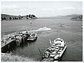
 Coast Guard Boat Waiheke Dock.jpg 1,280 × 960; 223 KB
-
 Cowes Bay, Waiheke Island (21312810510) - cropped.jpg 3,229 × 2,248; 2.15 MB
-
 Cowes Bay, Waiheke Island (21312810510).jpg 4,738 × 6,445; 3.69 MB
-
 Cowes Bay, Waiheke Island, looking north (21311675718).jpg 6,444 × 4,711; 3.14 MB
-
 Cowes Bay, Waiheke Island, taken from the wharf looking west (21652096742).jpg 6,472 × 4,676; 3.52 MB
-
 Cycle Lane On Waiheke Island Road.jpg 1,599 × 1,200; 1.17 MB
-
 Denis O'Connor 1.jpg 4,032 × 3,024; 6.22 MB
-
 Denis O'Connor SOTG 2024.jpg 4,032 × 3,024; 4.48 MB
-
 Denis O'Connor The Last Post Office 1.jpg 4,032 × 3,024; 3.27 MB
-
 Denis O'Connor The Last Post Office 2.jpg 4,032 × 3,024; 6.2 MB
-
 Denis O'Connor The Last Post Office 3.jpg 4,032 × 3,024; 3.51 MB
-
 Denis O'Connor The Last Post Office 4.jpg 4,032 × 3,024; 3.96 MB
-
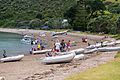
 Dinghy viewed from a cliff (Unsplash).jpg 5,184 × 3,456; 9.17 MB
-
 DSCN1438 Waiheke Island Ducks Sign.jpg 4,608 × 3,456; 6.85 MB
-
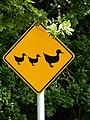 DSCN1439 Waiheke Island Ducks Sign.jpg 3,456 × 4,608; 6.45 MB
-
 Dscp0708 Waiheke Island Ducks Sign.jpg 4,608 × 3,456; 6.57 MB
-
 Eddie Clemens 2023 1.jpg 3,024 × 4,032; 1.73 MB
-
 Enclosure Bay.jpg 4,000 × 3,000; 3.87 MB
-
 Ferries at the wharf, Cowes Bay, Waiheke Island (21627607082).jpg 6,416 × 4,717; 3.44 MB
-
 Ferries at the wharf, Cowes Bay, Waiheke Island (21676786722).jpg 6,460 × 4,728; 3.37 MB
-
 Ferry Wharf Eastern End Of Waiheke Island.jpg 1,600 × 1,200; 304 KB
-
 Ferry. Matiatia, Waiheke Island.jpg 3,280 × 2,460; 3.05 MB
-
 Flight from Cook Islands to New Zealand. Auckland - panoramio.jpg 2,048 × 1,150; 447 KB
-
 Flight from Cook Islands to New Zealand. Over Auckland (482307) (Rotoroa Island).jpg 1,690 × 1,089; 298 KB
-
 Flight from Cook Islands to New Zealand. Over Auckland (482307).jpg 3,650 × 2,050; 1.22 MB
-
 General view of Awaawaroa Bay, Waiheke Island (20879418473).jpg 6,431 × 4,692; 3.86 MB
-
 General view of Cowes Bay, Waiheke Island (21420749140).jpg 6,478 × 4,706; 2.94 MB
-
 Glass Waiheke.jpg 768 × 928; 102 KB
-
 Goldwater vineyard.jpg 1,024 × 688; 208 KB
-
 Harbourside Serenity (212522793).jpeg 2,048 × 1,366; 657 KB
-
 Hooks Bay from Stony Batter 1.jpg 2,000 × 1,329; 2.3 MB
-
 Hooks Bay from Stony Batter 2.jpg 1,329 × 2,000; 2.49 MB
-
 Hotel and wharf, Cowes Bay, Waiheke Island (21043824373).jpg 6,437 × 4,685; 4.09 MB
-
-
 Jane Downe's Habitat 2022.jpg 3,024 × 4,032; 4.84 MB
-
 Jonas Raw Reflect 2022 1.jpg 3,024 × 4,032; 2.78 MB
-
 Jonas Raw Reflect 2022 2.jpg 3,024 × 4,032; 4 MB
-
 Jonas Raw Reflect 2022 3.jpg 3,024 × 4,032; 2.1 MB
-
 Jonas Raw Reflect 2022.jpg 3,024 × 4,032; 4.36 MB
-
 Jorge Wright Head Within 2022.jpg 4,032 × 3,024; 4.12 MB
-
 Lang Ea KA BOOM!.jpg 3,024 × 4,032; 6.75 MB
-
 Man o War Bay, Waiheke island.jpg 2,000 × 1,329; 2.91 MB
-
 Man o' War Vineyards and Hooks Bay.jpg 1,329 × 2,000; 2.63 MB
-
 Matiatia (Waiheke) banner View of bay with ferry terminal and anchorage.JPG 2,100 × 300; 827 KB
-
 Matiatia Headland 1.jpg 4,032 × 3,024; 2.91 MB
-
 Matiatia track 1.jpg 4,032 × 3,024; 4.98 MB
-
 Matiatia-closeup.jpg 2,272 × 1,704; 1.51 MB
-
 Men boarding a yacht, Cowes Bay, Waiheke Island (21449306779).jpg 6,479 × 4,717; 3.84 MB
-
 Merrick's Waiheke.jpg 512 × 325; 33 KB
-
 Motuhaka Island in Church Bay.jpg 4,000 × 3,000; 3.28 MB
-
 Motukaha Island.jpg 4,000 × 3,000; 3.05 MB
-
 Museum of Waiheke.jpg 4,032 × 3,024; 4.61 MB
-

-
 New Zealand 14 201.jpg 2,048 × 1,536; 759 KB
-
 New Zealand Dotterel Waiheke Island.jpg 1,708 × 1,280; 374 KB
-
 New Zealand Dotterel Waiheke Island2.jpg 2,050 × 1,534; 559 KB
-
 Noises Islands.JPG 1,646 × 1,924; 791 KB
-
 NZ-Waiheke I.png 405 × 590; 114 KB
-
 Oneroa Beach Panorama.jpg 1,920 × 534; 120 KB
-
 Oneroa Beach, Waiheke Island.jpg 4,000 × 1,064; 560 KB
-
 Onetangi Beach pōhutukawa.jpg 4,032 × 3,024; 5.04 MB
-
 Onetangi-reserve.jpg 4,608 × 2,592; 5.3 MB
-
 Ostend, New Zealand.jpg 4,032 × 3,024; 3.45 MB
-
 Palm Beach New Zealand.jpg 1,024 × 321; 291 KB
-
 Palmbeach1.jpg 5,152 × 3,432; 3.83 MB
-
 Papakohatu Island.jpg 4,000 × 3,000; 1.82 MB
-
 Putiki in the Island of Waiheke.jpg 800 × 454; 54 KB
-
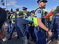
 Pūtiki Protest Waiheke Island 2.jpg 4,032 × 3,024; 3.47 MB
-
 Pūtiki Protest Waiheke Island 4.jpg 1,440 × 1,440; 425 KB
-
 Pūtiki Protest Waiheke Island 6.jpg 4,032 × 3,024; 2.32 MB
-
 Pūtiki Protest Waiheke Island 7.jpg 1,440 × 1,199; 394 KB
-
 Pūtiki Protest Waiheke Island 8.jpg 1,440 × 1,440; 365 KB
-
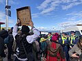 Pūtiki Protest Waiheke Island 9.jpg 4,032 × 3,024; 1.95 MB
-
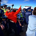
 Pūtiki Protest Waiheke Island.jpg 3,024 × 4,032; 2.79 MB
-
 Sandcastle on Waiheke Island New Zealand.jpg 3,472 × 2,604; 1.44 MB
-
 Scudding into Putiki, August 7, 1849.jpg 512 × 329; 41 KB
-
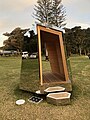
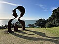
 Sculpture on the Gulf 2024 1.jpg 4,032 × 3,024; 4.74 MB
-
 Sculpture on the Gulf 2024 11.jpg 3,024 × 4,032; 4.53 MB
-
 Sculpture on the Gulf 2024 12.jpg 4,032 × 3,024; 5.4 MB
-
 Sculpture on the Gulf 2024 13.jpg 4,032 × 3,024; 7.92 MB
-
 Sculpture on the Gulf 2024 14.jpg 4,032 × 3,024; 3.5 MB
-
 Sculpture on the Gulf 2024 15.jpg 3,024 × 4,032; 4.98 MB
-
 Sculpture on the Gulf 2024 16.jpg 4,032 × 3,024; 1.4 MB
-
 Sculpture on the Gulf 2024 17.jpg 4,032 × 3,024; 1.13 MB
-
 Sculpture on the Gulf 2024 18.jpg 4,032 × 3,024; 3.5 MB
-
 Sculpture on the Gulf 2024 19.jpg 4,032 × 3,024; 2.02 MB
-
 Sculpture on the Gulf 2024 2.jpg 4,032 × 3,024; 3.43 MB
-
 Sculpture on the Gulf 2024 20.jpg 3,024 × 4,032; 1.51 MB
-
 Sculpture on the Gulf 2024 21.jpg 2,773 × 3,697; 2 MB
-
 Sculpture on the Gulf 2024 22.jpg 4,032 × 3,024; 1.02 MB
-
 Sculpture on the Gulf 2024 3.jpg 4,032 × 3,024; 4.29 MB
-
 Sculpture on the Gulf 2024 4.jpg 3,024 × 4,032; 3.7 MB
-
 Sculpture on the Gulf 2024 5.jpg 4,032 × 3,024; 4.46 MB
-
 Sculpture on the Gulf 2024 6.jpg 4,032 × 3,024; 4.4 MB
-
 Sculpture on the Gulf 2024 7.jpg 4,032 × 3,024; 2.8 MB
-
 Sculpture on the Gulf 2024 8.jpg 4,032 × 3,024; 5.1 MB
-
 Sculpture on the Gulf 2024 9.jpg 3,024 × 4,032; 2.9 MB
-
 Stony Batter boulders and young pohutukawa.jpg 2,000 × 1,329; 2.32 MB
-
 Stony Batter Waiheke Vineyards.jpg 1,600 × 1,200; 216 KB
-
 Surfdale from Kennedy Point.jpg 4,000 × 2,248; 4.05 MB
-
 Susi Newborn March 2021.jpg 3,024 × 4,032; 5.5 MB
-
 Susi Newborn Waiheke 2023.jpg 2,463 × 4,030; 3.94 MB
-
 Tree Waiheke Island NZ.jpg 3,472 × 2,604; 1.53 MB
-
 View of Pipitewai Bay in Awaawaroa Bay, Waiheke Island (21042275964).jpg 6,419 × 4,698; 4.09 MB
-
 View of Pipitewai Bay in Awaawaroa Bay, Waiheke Island (21399384248).jpg 6,444 × 4,629; 4.35 MB
-
 View of the headland and wharf, Awaawaroa Bay, Waiheke Island (21490231572).jpg 6,461 × 4,692; 3.75 MB
-
 Waiheke Island Aerodrome (aerial view).jpg 274 × 214; 49 KB
-
 Waiheke Island banner Aerial view from west.jpg 2,100 × 301; 468 KB
-
 Waiheke Island Ferry Terminal At Night.jpg 1,600 × 1,200; 1.09 MB
-
 Waiheke Island from Beachlands, Manukau 13 June 2005.jpg 2,448 × 1,855; 3.02 MB
-
 Waiheke Island landscape.jpg 4,000 × 3,000; 3.44 MB
-
 Waiheke Island Main Entry Has Cycle Path.jpg 1,600 × 1,200; 1.33 MB
-
 Waiheke Island Mar 2024 MRD 01.jpg 3,792 × 2,704; 2.36 MB
-
 Waiheke Island Mar 2024 MRD 02.jpg 3,971 × 2,978; 1.98 MB
-
 Waiheke Island Mar 2024 MRD 03.jpg 4,032 × 3,024; 3.07 MB
-
 Waiheke Island Mar 2024 MRD 04.jpg 3,899 × 2,702; 6.49 MB
-
 Waiheke Island Mar 2024 MRD 05.jpg 4,032 × 3,024; 4.09 MB
-
 Waiheke Island Mar 2024 MRD 09.jpg 4,032 × 3,024; 3.99 MB
-
 Waiheke Island Mar 2024 MRD 10.jpg 3,343 × 2,518; 2.43 MB
-
 Waiheke Island Mar 2024 MRD 11.jpg 3,024 × 4,032; 4.73 MB
-
 Waiheke Island Mar 2024 MRD 12.jpg 4,032 × 3,024; 3.74 MB
-
 Waiheke Island Mar 2024 MRD 13.jpg 4,032 × 3,024; 4.71 MB
-
 Waiheke Island Mar 2024 MRD 14.jpg 3,353 × 2,544; 1.72 MB
-
 Waiheke island new zealand - mudbrick.jpg 2,016 × 1,512; 1.08 MB
-
 Waiheke Island Oneroa Beach from Korora Road.jpg 4,608 × 3,456; 6.53 MB
-
 Waiheke Island Oneroa Beach.jpg 4,608 × 3,456; 6.24 MB
-
 Waiheke Island protest marina 2021 (2).jpg 4,032 × 3,024; 3.75 MB
-
 Waiheke Island protest.jpg 4,032 × 3,024; 3.56 MB
-
 Waiheke Island Seen From Above West.jpg 1,600 × 1,200; 1.36 MB
-
 Waiheke Island Vineyard.jpg 3,888 × 2,592; 5.91 MB
-
 Waiheke Island, North Island, New Zealand (7070617203).jpg 2,592 × 1,944; 1.12 MB
-
 Waiheke landsat 7 27 August 2002.JPG 736 × 462; 50 KB
-
 Waiheke Marina detail 1.jpg 4,032 × 3,024; 2.77 MB
-
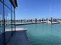 Waiheke Marina detail 2.jpg 4,032 × 3,024; 2.32 MB
-
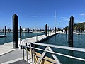 Waiheke Marina detail 3.jpg 4,032 × 3,024; 2.33 MB
-
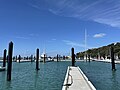 Waiheke Marina detail 4.jpg 4,032 × 3,024; 2.02 MB
-
 Waiheke Marina detail 5.jpg 4,032 × 3,024; 2.34 MB
-
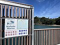 Waiheke Marina detail 6.jpg 4,032 × 3,024; 2.84 MB
-
 Waiheke, E side.jpg 512 × 337; 28 KB
-
 WaihekeIsland.png 1,152 × 784; 829 KB
-
 Walking on the beach, Awaawaroa Bay, Waiheke Island (21677434552).jpg 6,444 × 4,647; 4.01 MB
-
 Wharf and pavilion at Cowes Bay, Waiheke Island (20560702748).jpg 6,441 × 4,752; 4.48 MB
-
 Work and Income New Zealand.jpg 3,072 × 2,304; 2.32 MB
_314334.jpg)


_-_cropped.jpg)
.jpg)
.jpg)
.jpg)


.jpg)


.jpg)
.jpg)


_(Rotoroa_Island).jpg)
.jpg)
.jpg)
.jpg)


.jpeg)


.jpg)
.jpg)


.jpg)


.jpg)
.jpg)
.jpg)
.jpg)


.jpg)


.jpg)


.jpg)
.jpg)

_banner_View_of_bay_with_ferry_terminal_and_anchorage.JPG)