Category:Voorstad Sint Jacob 1 (Roermond)
Jump to navigation
Jump to search
| Object location | | View all coordinates using: OpenStreetMap |
|---|
building in Roermond, Netherlands  | |||||
| Upload media | |||||
| Instance of | |||||
|---|---|---|---|---|---|
| Part of | |||||
| Location | Roermond, Limburg, Netherlands | ||||
| Street address |
| ||||
| Located on street | |||||
| Heritage designation |
| ||||
 | |||||
|
This is a category about rijksmonument number 32669
|
| Address |
|
Media in category "Voorstad Sint Jacob 1 (Roermond)"
The following 10 files are in this category, out of 10 total.
-
 Aanzicht - Roermond - 20189927 - RCE.jpg 1,200 × 802; 178 KB
-
 Achtergevel - Roermond - 20189928 - RCE.jpg 1,200 × 959; 265 KB
-
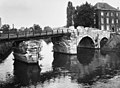
 Overzicht met Roer - Roermond - 20354465 - RCE.jpg 1,174 × 1,200; 328 KB
-
 Overzicht naar het zuid-westen - Roermond - 20189049 - RCE.jpg 1,200 × 877; 230 KB
-
 RM32669 Roermond.jpg 1,944 × 2,592; 1.22 MB
-
 Roermond, Voorstad Sint Jacob 1 (RM32669) + Maria Theresiabrug (RM32609)-2.jpg 4,977 × 3,180; 3.99 MB
-
 Roermond, Voorstad Sint Jacob 1 (RM32669) + Maria Theresiabrug (RM32609)-3.jpg 4,757 × 2,849; 3.16 MB
-
 Roermond, Voorstad Sint Jacob 1 (RM32669) + Maria Theresiabrug (RM32609).jpg 3,667 × 2,959; 2.87 MB
-
 Stenen brug over de Roer vanuit het noorden - Roermond - 20189046 - RCE.jpg 1,200 × 891; 139 KB
-
 Voorstad Sint Jacob - Roermond - 20189030 - RCE.jpg 1,195 × 1,200; 235 KB


_%2B_Maria_Theresiabrug_(RM32609)-2.jpg)
_%2B_Maria_Theresiabrug_(RM32609)-3.jpg)
_%2B_Maria_Theresiabrug_(RM32609).jpg)

