Category:Vismarktstraat 2, Breda
Jump to navigation
Jump to search
| Object location | | View all coordinates using: OpenStreetMap |
|---|
house in Breda, Netherlands  | |||||
| Upload media | |||||
| Instance of | |||||
|---|---|---|---|---|---|
| Location | Breda, North Brabant, Netherlands | ||||
| Street address |
| ||||
| Heritage designation |
| ||||
 | |||||
|
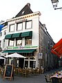
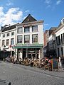
This is a category about rijksmonument number 10339
|
| Address |
|
Media in category "Vismarktstraat 2, Breda"
The following 10 files are in this category, out of 10 total.
-
 Breda Centrum DSCF2876.JPG 2,816 × 2,112; 2.51 MB
-
 Havermarkt breda DSCF2277.JPG 2,112 × 2,816; 2.55 MB
-
 Havermarkt Breda DSCF2279.JPG 2,816 × 2,112; 2.68 MB
-
 Havermarkt Breda DSCF8581.JPG 2,816 × 2,112; 2.52 MB
-
 Overzicht - Breda - 20041662 - RCE.jpg 1,200 × 824; 186 KB
-
 P1000950copyVismarktstraat.jpg 2,448 × 3,264; 5.17 MB
-
 RM10339 Breda - Vismarktstraat 2.jpg 1,944 × 2,592; 1.42 MB
-
 Vismarktstraat, Breda DSCF4315.jpg 2,048 × 1,536; 1.54 MB
-
 Voorgevels - Breda - 20041658 - RCE.jpg 829 × 1,200; 198 KB
-
 Voorgevels - Breda - 20041660 - RCE.jpg 1,200 × 813; 175 KB


