Category:Visakhapatnam Port
Jump to navigation
Jump to search
| Object location | | View all coordinates using: OpenStreetMap |
|---|
Port of India in the Bay of Bengal  | |||||
| Upload media | |||||
| Instance of | |||||
|---|---|---|---|---|---|
| Location |
| ||||
| Located in or next to body of water | |||||
| Street address |
| ||||
| Inception |
| ||||
| Date of official opening |
| ||||
| official website | |||||
 | |||||
Subcategories
This category has the following 2 subcategories, out of 2 total.
P
W
Media in category "Visakhapatnam Port"
The following 58 files are in this category, out of 58 total.
-
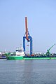
 A Ship enters into Inner Harbour at Vizag seaport 01.JPG 2,860 × 2,156; 4.47 MB
-
 A Ship enters into Inner Harbour at Vizag seaport 02.JPG 3,072 × 2,304; 4.43 MB
-
 A view of the Vizag Port Stadim during an Educational Fair.jpg 1,600 × 1,200; 247 KB
-
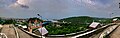
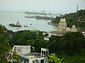
 A view of Visakhapatnam Port Trust from Rose Hill 1.jpg 4,032 × 3,024; 2.64 MB
-
 A view of Visakhapatnam Port Trust from Rose Hill 2.jpg 7,185 × 3,658; 6.64 MB
-
 A view of Vizag from Port Flyover.jpg 4,032 × 3,024; 1.77 MB
-
 A view Visakhapatnam Port Trust from Rose Hill 3.jpg 4,032 × 3,024; 3.16 MB
-
 A view Visakhapatnam Port Trust from Rose Hill 4.jpg 4,032 × 3,024; 2.2 MB
-
 Barriers at Vizag seaport.JPG 3,072 × 2,140; 3.43 MB
-
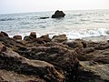
 Beautiful sea view.jpg 4,592 × 3,448; 7.54 MB
-
 Cargo Ship and breakwaters.jpg 4,948 × 1,303; 6.87 MB
-
 Clouds and Sunset near Vizag Port 1.jpg 4,032 × 3,024; 2.06 MB
-
 Coal and Ore Handling at Vizag Harbour 01.jpg 2,888 × 1,284; 2.05 MB
-
 Coal and Ore Handling at Vizag Harbour 02.jpg 1,904 × 1,124; 1.45 MB
-
 Coal Deposits near Rose Hill.jpg 4,032 × 3,024; 2.58 MB
-
 Containers entering Visakhapatnam port.jpg 3,664 × 2,744; 2.8 MB
-
 Dolphins Nose with a lenticular cloud.jpg 5,568 × 3,712; 2.24 MB
-
 Fishes In Visakhapatnam Port 23.jpg 2,920 × 376; 982 KB
-
 INS Jyoti (A58) departing from Visakhapatnam harbor.jpg 6,000 × 4,000; 23.41 MB
-
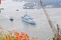
 INS Sutlej (J17) docked in Visakhapatnam port.jpg 6,000 × 4,001; 22.48 MB
-
 Inside View of Vizag Port Stadium During an Educational Fair.jpg 1,600 × 1,200; 171 KB
-
 Kailashgiri Viewpoint (2077770856).jpg 1,920 × 2,560; 2.54 MB
-
 Major Ports of India.png 855 × 741; 229 KB
-
 Naval dockyard Entrance.jpg 4,032 × 3,024; 2.37 MB
-
 Panorama covering both Visakhapatnam Port Trust and Slum.jpg 11,822 × 3,778; 11.26 MB
-
 Panorama of A view Visakhapatnam Port Trust from Rose Hill.jpg 10,202 × 3,628; 10.49 MB
-
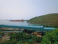
 Port Area - panoramio.jpg 1,800 × 1,350; 745 KB
-
 Ram Krishna beach, Vizag.jpg 2,272 × 1,704; 1.07 MB
-
 Reached the destination.jpg 6,000 × 4,000; 5.41 MB
-
 Ship at vizag port1.JPG 3,072 × 2,192; 4.02 MB
-
 Ship at vizag.JPG 1,942 × 1,944; 1.33 MB
-
 Slum in Visakhapatnam.jpg 4,032 × 3,024; 3.1 MB
-

-
-
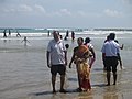 Tourists at Vizag (Visakhapatnam) sea beach.jpg 1,600 × 1,200; 450 KB
-
 Transport at Vizag 10.jpg 2,592 × 3,872; 3.29 MB
-
 View of Vizag Port 1.jpg 3,264 × 2,093; 3.69 MB
-
 Visakhapatnam Harbour.jpg 2,816 × 2,112; 3.17 MB
-
 Visakhapatnam Outer Harbour.jpg 2,816 × 2,112; 3.08 MB
-
 Visakhapatnam Port and Dolphin nose mountain from Kailasagiri (May 2019).jpg 6,000 × 4,000; 7.96 MB
-
 Visakhapatnam port from RK beach at night.jpg 6,000 × 4,000; 16.14 MB
-
 Visakhapatnam seaport from Fishing Harbour.jpg 3,824 × 2,866; 2.46 MB
-
 Visakhapatnam seaport from Fishing harbour.jpg 4,000 × 3,000; 2.06 MB
-
 Vizag harbour View 03.jpg 3,264 × 2,448; 2.33 MB
-
 Vizag harbour view1.JPG 3,072 × 1,036; 1.56 MB
-
 Vizag Inner Harbor (9564417538).jpg 3,070 × 3,283; 5.96 MB
-
 Vizag port 2019.jpg 4,224 × 3,168; 3.62 MB
-
 Vizag Port Aerial.jpg 4,592 × 2,582; 8.46 MB
-
 Vizag port inner harbour view 02.jpg 1,600 × 999; 978 KB
-
 Vizag Port View.jpg 3,024 × 4,032; 2.21 MB
-
 Vizag Port with Dolphin nose in background.jpg 2,480 × 3,465; 2.94 MB
-
 Vizag Port.jpg 4,000 × 3,000; 2.76 MB
-
 Vizag Sea beach 04.jpg 4,128 × 3,096; 3.16 MB
-
 Vizag Sea beach 05.jpg 4,128 × 3,096; 3.35 MB
-
 Vizag Seaport aerial view.jpg 700 × 525; 35 KB
-
 Vizag seaport.jpg 700 × 525; 85 KB
-
 VizagHarbourFIG3.jpg 750 × 821; 247 KB
-
 VizagPort.jpg 583 × 388; 33 KB


_departing_from_Visakhapatnam_harbor.jpg)
_docked_in_Visakhapatnam_port.jpg)

.jpg)


_sea_beach.jpg)


.jpg)


.jpg)


