Category:Visa maps of the United States
Jump to navigation
Jump to search
Countries of North America: Antigua and Barbuda · The Bahamas · Barbados · Belize · Canada · Costa Rica · Cuba · Dominican Republic · El Salvador · Grenada · Guatemala · Haiti · Honduras · Jamaica · Mexico · Nicaragua · Panama · Saint Kitts and Nevis · Saint Lucia · Saint Vincent and the Grenadines · Trinidad and Tobago‡ · United States of America‡
Other territories: Bermuda
‡: partly located in North America
Other territories: Bermuda
‡: partly located in North America
Countries of Oceania: Australia · Fiji · Kiribati · Marshall Islands · Nauru · New Zealand · Palau · Papua New Guinea · Samoa · Solomon Islands · Tonga · Tuvalu · Vanuatu
Partly: Indonesia
Partly: Indonesia
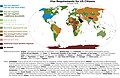
English: This category collects all kind of passport- and visa-related maps that concern the USA as a host country or issuer country.
Media in category "Visa maps of the United States"
The following 17 files are in this category, out of 17 total.
-

-
 US visa validity period.png 1,500 × 625; 42 KB
-
 US-Visa-policy.svg 1,725 × 760; 2.77 MB
-
 USVisaFree zh.png 1,425 × 625; 23 KB
-
 Visa free access for US passports.png 1,357 × 628; 49 KB
-
 Visa policy of the USA.png 1,425 × 625; 42 KB
-
 Visa policy of the USA.svg 2,754 × 1,398; 813 KB
-
 Visa Reqs US Citizens Oct 16.jpg 6,916 × 4,517; 3.51 MB
-
 Visa requirements for American citizens.PNG 1,425 × 625; 33 KB
-
 Visa requirements for United States citizens - Proposal.png 1,425 × 625; 40 KB
-
 Visa requirements for United States citizens.png 1,425 × 625; 45 KB
-
 Visa requirements for United States citizens.svg 941 × 479; 1.9 MB
-
 Visa requirements map for US citizens.png 1,347 × 624; 33 KB
-
 Visa Requirments for United States Citizens.png 2,754 × 1,398; 639 KB
-
 VisaWaiverProgram2.png 1,357 × 628; 20 KB
-
 VisaWaiverProgramMalt.png 1,480 × 625; 44 KB
-
 VisaWaiverProgramUlt.png 1,425 × 625; 31 KB
_Countries,_with_Ranges_of_VWP_Traveler_Admissions_to_the_United_States,_Fiscal_Year_2013_(27202459053).jpg)


