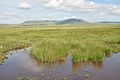
Category:Views of Pen-y-ghent
Jump to navigation
Jump to search
Wikimedia category | |||||
| Upload media | |||||
| Instance of | |||||
|---|---|---|---|---|---|
| Category combines topics | |||||
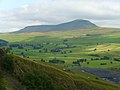
| Pen-y-ghent | |||||
mountain in the United Kingdom  | |||||
| Instance of | |||||
| Located in protected area | |||||
| Location |
| ||||
| Mountain range | |||||
| Topographic prominence |
| ||||
| Elevation above sea level |
| ||||
| Parent peak | |||||
 | |||||
Media in category "Views of Pen-y-ghent"
The following 54 files are in this category, out of 54 total.
-
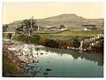 (Penyghent, from Horton, Yorkshire, England) (LOC) (16801681621).jpg 1,024 × 772; 209 KB
-
 2014 Pen-y-ghent from East.jpg 4,608 × 3,456; 6.4 MB
-
 2014 Pen-y-ghent from South.jpg 4,608 × 3,456; 8.56 MB
-
 2015 Ribblehead Viaduct 1.jpg 4,452 × 2,968; 7.35 MB
-

-
 A small limestone pavement - geograph.org.uk - 1204959.jpg 640 × 569; 94 KB
-
-

-

-
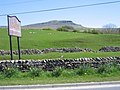
 Across Ribblesdale from Moughton Nab - geograph.org.uk - 1502626.jpg 640 × 480; 52 KB
-
 B007 Pen y Ghent climb.JPG 1,600 × 1,200; 202 KB
-

-

-

-

-
 Limestone Pavement and Pen-y-ghent - geograph.org.uk - 1620646.jpg 640 × 480; 105 KB
-

-

-
 Near Sulber pot view of Pen y ghent - geograph.org.uk - 1386291.jpg 640 × 480; 90 KB
-
 Path to Pen y Ghent.JPG 1,024 × 768; 139 KB
-
 Pen y ghent - geograph.org.uk - 712830.jpg 640 × 404; 243 KB
-

-
 Pen-y-Ghent (7573).jpg 4,288 × 2,848; 6.27 MB
-
 Pen-y-Ghent (7576).jpg 4,288 × 2,848; 5.99 MB
-
 Pen-y-Ghent (7579).jpg 4,288 × 2,848; 6.29 MB
-
 Pen-y-ghent (7583).jpg 4,288 × 2,848; 5.32 MB
-
 Pen-y-ghent (7584).jpg 4,288 × 2,848; 4.13 MB
-
 Pen-y-Ghent (7590).jpg 4,288 × 2,848; 6.79 MB
-
 Pen-y-ghent (7596).jpg 4,288 × 2,848; 5.47 MB
-
 Pen-y-ghent (7609).jpg 4,288 × 2,848; 6.03 MB
-
 Pen-y-ghent (7622).jpg 4,288 × 2,848; 6.18 MB
-
 Pen-y-ghent (7804).jpg 4,288 × 2,848; 5.98 MB
-
 Pen-y-Ghent (7807).jpg 4,288 × 2,848; 6.43 MB
-
 Pen-y-ghent (7809).jpg 4,288 × 2,848; 6.69 MB
-
 Pen-y-ghent (7810).jpg 4,288 × 2,848; 4.99 MB
-
 Pen-y-ghent (7817).jpg 4,288 × 2,848; 5.91 MB
-
 Pen-y-ghent - geograph.org.uk - 497841.jpg 640 × 480; 183 KB
-
 Pen-y-ghent from Swarth Moor - geograph.org.uk - 1755392.jpg 640 × 480; 102 KB
-
 Pen-y-ghent viewed from Park Fell trig - geograph.org.uk - 2797348.jpg 640 × 480; 204 KB
-
 Pen-y-ghent viewed from the Ribble Way - geograph.org.uk - 3575896.jpg 640 × 480; 140 KB
-
-
 Penyghent from Silverdale Road - geograph.org.uk - 4149244.jpg 4,000 × 3,000; 6.02 MB
-
 Penyghent, from Horton, Yorkshire, England-LCCN2002708313.jpg 3,686 × 2,780; 3.13 MB
-
 Penyghent, from Horton, Yorkshire, England-LCCN2002708313.tif 3,686 × 2,780; 29.32 MB
-
 Plover Hill and Pen y ghent - geograph.org.uk - 701417.jpg 640 × 427; 217 KB
-
 Pothole and Penyghent - geograph.org.uk - 413484.jpg 480 × 640; 116 KB
-

-
 Winshaw and the view to Pen y ghent - geograph.org.uk - 644257.jpg 640 × 480; 165 KB
-
 Pen y Ghent - geograph.org.uk - 8046.jpg 640 × 480; 74 KB
-
 Pen y Ghent from Crooks - geograph.org.uk - 195055.jpg 640 × 480; 113 KB
-
 Pen-y-ghent - geograph.org.uk - 283320.jpg 1,024 × 768; 285 KB
-
 Pen-y-ghent viewed from Horton Scar - geograph.org.uk - 709326.jpg 640 × 480; 185 KB
-
 The Pennine Way - geograph.org.uk - 706920.jpg 640 × 480; 224 KB
-
 The Pennine Way towards Pen-y-ghent - geograph.org.uk - 429076.jpg 640 × 480; 191 KB
_(LOC)_(16801681621).jpg)


_with_Pen_y_ghent_on_the_skyline._-_geograph.org.uk_-_679663.jpg)


.jpg)
.jpg)
.jpg)
.jpg)
.jpg)
.jpg)
.jpg)
.jpg)
.jpg)
.jpg)
.jpg)
.jpg)
.jpg)
.jpg)


