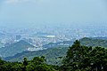
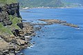
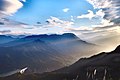
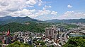
Category:Views from mountains in New Taipei
Jump to navigation
Jump to search
English: Views from mountains in New Taipei.
日本語: 新北市の山岳より見下ろす風景。
한국어: 신베이 시의 산에서 굽어본 풍경
中文(臺灣):新北市山區所見景色
Wikimedia category | |||||
| Upload media | |||||
| Instance of | |||||
|---|---|---|---|---|---|
| Category combines topics | |||||
| Category:Mountains of New Taipei | |||||
Wikimedia category | |||||
| Instance of | |||||
| |||||
Subcategories
This category has the following 8 subcategories, out of 8 total.
G
J
- Views from Mount Jiangziliao (10 F)
K
- Views from Mt. Keelung (8 F)
S
- Views from Mount Shizaitou (2 F)
Y
- Views from Yuanshan (Sanxia) (12 F)
Media in category "Views from mountains in New Taipei"
The following 200 files are in this category, out of 232 total.
(previous page) (next page)-
 1 yehliu 2015 panorama.jpg 11,811 × 4,944; 21.36 MB
-
 2008-03-08 coastal skyline from Jioufen.jpg 3,648 × 2,736; 1.85 MB
-
 2010-12-29 remote view in Wulai District.jpg 3,000 × 4,000; 4.97 MB
-
 2012新北市瑞芳區猴硐地區.jpg 1,224 × 1,632; 368 KB
-
 2018 Aerial View of Xindian District b.jpg 6,016 × 4,016; 2.9 MB
-
 2018 Aerial View of Xindian District.jpg 4,016 × 6,016; 1.63 MB
-
 2018 Bitou Cape B.jpg 6,016 × 4,016; 19.45 MB
-
 2018 TRA Houtong Station Area 新北市瑞芳區猴硐地區 b.jpg 6,400 × 2,160; 8.32 MB
-
 2018 TRA Houtong Station Area 新北市瑞芳區猴硐地區.jpg 4,016 × 6,016; 16.62 MB
-
 2018Feitsui Dam.jpg 4,896 × 3,264; 1.14 MB
-
 2018Feitsui réservoir(翠峰路眺望).jpg 6,400 × 2,160; 2.26 MB
-
 2018Feitsui réservoir.jpg 4,896 × 3,264; 2.63 MB
-
 2019 The Landscape at the 9th layer of Shueiduei Scenic Park b.jpg 6,000 × 4,000; 2.48 MB
-
 2019 The Landscape at the 9th layer of Shueiduei Scenic Park.jpg 4,000 × 6,000; 12.99 MB
-
 2019 The Landscape from WuGu ChaoZong Park.jpg 9,600 × 1,440; 1.68 MB
-
 2019 The Night Landscape at the 9th layer of Shueiduei Scenic Park.jpg 6,000 × 4,000; 2.28 MB
-
 2021 MaGang Inspection site x.jpg 6,000 × 4,000; 11.8 MB
-
 2022 Mao'ao, New Taipei.jpg 6,000 × 4,000; 11.87 MB
-
 20230714 Xindian, New Taipei Cityscape.jpg 5,504 × 3,096; 9.15 MB
-
 208, Taiwan, 新北市金山區磺港里 - panoramio (6).jpg 5,085 × 3,390; 9.48 MB
-
 208, Taiwan, 新北市金山區磺港里 - panoramio.jpg 1,200 × 800; 907 KB
-
 224, Taiwan, 新北市瑞芳區南雅里 - panoramio (1).jpg 1,200 × 800; 972 KB
-
 224, Taiwan, 新北市瑞芳區南雅里 - panoramio (2).jpg 1,200 × 800; 829 KB
-
 224, Taiwan, 新北市瑞芳區南雅里 - panoramio (7).jpg 1,200 × 800; 564 KB
-
 224, Taiwan, 新北市瑞芳區南雅里 - panoramio (8).jpg 1,200 × 800; 835 KB
-
 224, Taiwan, 新北市瑞芳區基山里 - panoramio.jpg 3,840 × 2,160; 2.54 MB
-
 224, Taiwan, 新北市瑞芳區崇文里 - panoramio (14).jpg 3,840 × 2,160; 2.63 MB
-
 224, Taiwan, 新北市瑞芳區崇文里 - panoramio (16).jpg 3,840 × 2,160; 2.37 MB
-
 224, Taiwan, 新北市瑞芳區崇文里 - panoramio (17).jpg 3,840 × 2,160; 2.25 MB
-
 224, Taiwan, 新北市瑞芳區崇文里 - panoramio (18).jpg 3,840 × 2,160; 2.13 MB
-
 224, Taiwan, 新北市瑞芳區崇文里 - panoramio (19).jpg 3,840 × 2,160; 1.83 MB
-
 224, Taiwan, 新北市瑞芳區崇文里 - panoramio (7).jpg 2,160 × 3,840; 2.59 MB
-
 224, Taiwan, 新北市瑞芳區石山里 - panoramio (16).jpg 4,608 × 3,456; 15.53 MB
-
 224, Taiwan, 新北市瑞芳區石山里 - panoramio (23).jpg 3,872 × 2,592; 4.29 MB
-
 224, Taiwan, 新北市瑞芳區石山里 - panoramio (35).jpg 3,872 × 2,592; 4.93 MB
-
 224, Taiwan, 新北市瑞芳區石山里 - panoramio (36).jpg 3,872 × 2,592; 4.94 MB
-
 224, Taiwan, 新北市瑞芳區石山里 - panoramio (37).jpg 3,872 × 2,592; 4.39 MB
-
 224, Taiwan, 新北市瑞芳區石山里 - panoramio.jpg 1,200 × 800; 429 KB
-
 226, Taiwan, 新北市平溪區菁桐里 - panoramio (16).jpg 4,256 × 2,832; 5.63 MB
-
 228, Taiwan, 新北市貢寮區和美里 - panoramio (1).jpg 1,200 × 800; 555 KB
-
 237, Taiwan, 新北市三峽區有木里 - panoramio (1).jpg 1,200 × 800; 895 KB
-
 243, Taiwan, 新北市泰山區義學里 - panoramio (2).jpg 4,096 × 2,304; 1.85 MB
-
 243, Taiwan, 新北市泰山區義學里 - panoramio (4).jpg 4,096 × 2,304; 2.82 MB
-
 243, Taiwan, 新北市泰山區義學里 - panoramio (5).jpg 4,096 × 2,304; 2.92 MB
-
 A view of Yehliu geopark, Taiwan 03.jpg 3,456 × 4,608; 3.28 MB
-
 Arou Keng 阿柔坑 - panoramio.jpg 3,648 × 2,736; 3.21 MB
-
 Baisha Bay 白沙灣 - panoramio (cropped).jpg 3,510 × 2,340; 2.24 MB
-
 Baisha Bay 白沙灣 - panoramio.jpg 3,510 × 2,632; 2.89 MB
-
 Bali DistrictDSC 4202.jpg 6,016 × 4,000; 3.51 MB
-
 Bali, New Taipei Cityscape 20230228.jpg 8,256 × 5,504; 17.5 MB
-
 Bear Mountain (熊空附近林場) - panoramio (1).jpg 1,200 × 800; 1.25 MB
-
 Bird`s Eye View from Nanshan Fude Temple 南山福德宮鳥瞰 - panoramio.jpg 3,562 × 2,670; 2.69 MB
-
 Bitan Xindian Taiwan.jpg 4,000 × 3,000; 3.09 MB
-
 Bitou Cape 鼻頭角 - panoramio.jpg 4,000 × 3,000; 3.81 MB
-
 Buddhist Temple at Sijhid (汐止拱北殿) - panoramio (4).jpg 1,200 × 800; 1.49 MB
-
 Caoling Historic Trail - panoramio (15).jpg 3,648 × 2,736; 3.2 MB
-
 Caoling Historic Trail - panoramio (2).jpg 2,736 × 3,648; 3.77 MB
-
 CHENGLIN bridge(New Taipei)2018.jpg 6,016 × 4,016; 12.94 MB
-
 City In The Mountains (107527227).jpeg 2,048 × 1,152; 439 KB
-
 Cityscape of Bali, New Taipei 20230228.jpg 8,256 × 5,504; 24.81 MB
-
 Coast of Yeliu promontory.jpg 2,304 × 3,072; 1.02 MB
-
 Crescent Bridge (New Taipei)2018.jpg 6,016 × 4,016; 2.12 MB
-
 Dharma Drum Mountain 09.jpg 4,032 × 3,024; 1.45 MB
-
 Dharma Drum Mountain 10.jpg 4,032 × 3,024; 2.14 MB
-
 Dharma Drum Mountain 11.jpg 4,032 × 3,024; 1.68 MB
-
 Dharma Drum Mountain 12.jpg 4,032 × 3,024; 2.11 MB
-
 Dharma Drum Mountain 18.jpg 4,032 × 3,024; 1.51 MB
-
 Dharma Drum Mountain Tian Na Monastery 三峽法鼓山天南寺展望2018.jpg 4,896 × 3,264; 6.58 MB
-
 Dharma Drum Mountain Tian Na Monastery 三峽法鼓山天南寺眺望三角湧大橋2018.jpg 6,016 × 4,016; 18.12 MB
-
 Distant View of Maoao Fishing Harbor 卯澳漁港遠眺 - panoramio.jpg 3,140 × 2,307; 1.86 MB
-
 DSC 8920水湳洞.jpg 6,016 × 4,000; 1.97 MB
-
 Emerald Reservoir 翡翠水庫 - panoramio.jpg 6,000 × 4,000; 9.56 MB
-
 Feicui Resevoir 翡翠水庫 - panoramio.jpg 6,000 × 4,000; 8.5 MB
-
 Fu Jen Catholic University 2018 (cropped).jpg 3,125 × 1,775; 3.9 MB
-
 Fu Jen Catholic University Hospital 2018 (cropped).jpg 2,865 × 1,807; 3.81 MB
-
 Fu Jen Catholic University Hospital 2018.jpg 6,016 × 4,016; 16.9 MB
-
 Fu Jen Catholic University Hospital and College of Medicine 2018 (cropped).jpg 3,370 × 1,630; 4.02 MB
-
 FUJI1767.jpg 4,896 × 3,264; 2.34 MB
-
 Fushan.jpg 2,592 × 1,936; 1.51 MB
-
 FUZHOU bridge(NewTaipei)2018.jpg 6,016 × 4,016; 15.03 MB
-
 Hongludi 洪爐地 - panoramio.jpg 2,973 × 2,229; 1.7 MB
-
 Huayuan Xincheng Community 花園新城 - panoramio.jpg 6,000 × 4,000; 8.19 MB
-
 Image-Chin-Pao Mountain Cemetery view.jpg 2,272 × 1,704; 775 KB
-
 Jiguanshi - panoramio (10).jpg 2,432 × 3,648; 3.25 MB
-
 Jiguanshi - panoramio (12).jpg 2,432 × 3,648; 3.27 MB
-
 Jiguanshi - panoramio (15).jpg 2,432 × 3,648; 4.22 MB
-
 Jiguanshi - panoramio (19).jpg 2,432 × 3,648; 3.48 MB
-
 Jiguanshi - panoramio (20).jpg 5,136 × 1,304; 4.22 MB
-
 Jiguanshi - panoramio (21).jpg 5,136 × 1,320; 4.37 MB
-
 Jiguanshi - panoramio (23).jpg 6,568 × 1,328; 6.12 MB
-
 Jiguanshi - panoramio (4).jpg 2,432 × 3,648; 4.45 MB
-
 Jiguanshi - panoramio (6).jpg 2,432 × 3,648; 3.74 MB
-
 Jiguanshi - panoramio (7).jpg 2,432 × 3,648; 3.34 MB
-
 Jiguanshi - panoramio (8).jpg 2,432 × 3,648; 3.88 MB
-
 Jiguanshi - panoramio.jpg 3,648 × 2,432; 3.65 MB
-
 Jinguashi 070909 8.jpg 653 × 490; 64 KB
-
 Jinguashi view from Jioufen 20100731.jpg 1,800 × 1,200; 844 KB
-
 Jinguashi wikivoyage pagebanner.jpeg 4,256 × 623; 1.36 MB
-
 Jiu Fen - panoramio.jpg 2,393 × 1,105; 387 KB
-
 Keelung Islet in beautiful blue sea on 6 July 2017.jpg 3,072 × 1,981; 950 KB
-
 Kuosheng Nuclear Power Plant-P1020606.JPG 3,648 × 2,736; 3.46 MB
-
 Leong IMG 0834 (7180998480).jpg 2,592 × 1,728; 1.49 MB
-
 Long Tong Coast (龍洞岬) - panoramio (2).jpg 1,200 × 800; 962 KB
-
 Long Tong Coast (龍洞岬) - panoramio (4).jpg 1,200 × 800; 762 KB
-
 Longdong Cape 龍洞岬 - panoramio (2).jpg 4,244 × 3,182; 2.5 MB
-
 Looking down at Shuinandong from Mount Keelung.jpg 3,264 × 2,448; 4.23 MB
-
 Mount Keelung seen from somewhere in Bitou Cape Park.jpg 3,072 × 1,977; 1.4 MB
-
 Mount Keelung under sunny clouds sky on 6 July 2017.jpg 3,072 × 1,981; 1.68 MB
-
 Mount Zhuzi 20060630.jpg 1,280 × 851; 492 KB
-
 New Taipei Skyline (52000051713).jpg 3,644 × 1,496; 1.06 MB
-
 Overcast weather at Yinyang Sea.jpg 800 × 600; 49 KB
-
 Pinglin 坪林 - panoramio.jpg 3,648 × 2,736; 2.53 MB
-
 Port of Taipei from above.jpg 1,280 × 960; 1.13 MB
-
 Port of TaipeiFUJI3534.jpg 4,896 × 3,264; 1 MB
-
 Qiandao Lake, Taiwan.jpg 4,032 × 3,024; 1.94 MB
-
 San-Ying Pipe Bridge 三鶯水管橋 - panoramio.jpg 2,851 × 2,137; 2.52 MB
-
 Sanxia Dapu 三峽大埔 - panoramio.jpg 3,648 × 2,736; 2.31 MB
-
 Sanxia District 三峽區 - panoramio.jpg 3,648 × 2,736; 3.01 MB
-
 Sanxia Township 三峽 - panoramio.jpg 5,831 × 3,891; 6.69 MB
-
 SC02909 Panoramic view from Yehliu Geopark in Taiwan.jpg 4,912 × 1,920; 2.42 MB
-
 Shihting District Banner.jpg 4,896 × 700; 553 KB
-
 Shulin Garbage Incinerator 樹林焚化爐 - panoramio.jpg 3,481 × 2,611; 1.97 MB
-
 Sunset over Tamsui, New Taipei 20170222.jpg 4,600 × 2,800; 7.7 MB
-
 Taipei basin - panoramio.jpg 3,648 × 2,736; 3.48 MB
-
 Taipei Port-2.jpg 3,264 × 2,448; 744 KB
-
 Taipei Skyline from Hongludi 20220807.jpg 4,691 × 3,127; 2.98 MB
-
 Taishan 泰山 - panoramio.jpg 5,936 × 3,956; 5.83 MB
-
 Taiwan 2009 JinGuaShi Historic Gold Mine Valley View Right Page FRD 8840.jpg 4,256 × 2,828; 4.77 MB
-
 Taiwan North Geopark Wikivoyage banner.JPG 2,100 × 300; 230 KB
-
 Taoyuan Valley Trail - panoramio (21).jpg 3,288 × 1,371; 2.53 MB
-
 Taoyuan Valley Trail - panoramio (22).jpg 3,970 × 1,497; 3.11 MB
-
 Taoyuan Valley Trail - panoramio (23).jpg 6,812 × 1,542; 5.65 MB
-
 Taoyuan Valley Trail - panoramio (4).jpg 2,736 × 3,648; 4.74 MB
-
 Teapot mountain pano.png 3,682 × 1,339; 6.79 MB
-
 Thousand Island Lake, Taiwan.jpg 4,179 × 2,776; 5.91 MB
-
 Twin Candlestick Islets2017.jpg 4,000 × 6,016; 13.61 MB
-
 Twkengo0001.jpg 1,224 × 816; 174 KB
-
 Vapor of geothermal at yangmingshan with a dust storm layer.jpg 6,016 × 4,016; 15.9 MB
-
 View from above to the Yinyang Sea.jpg 2,592 × 1,944; 1.02 MB
-
 View from Mount Nanzhilin looking down over the coast.jpg 2,448 × 3,264; 4.07 MB
-
 View from the top of Nanzilin Mountain.jpg 4,460 × 2,430; 2.6 MB
-
 View northwest looking towards the Luzhu coast from Linkou Plateau.jpg 3,200 × 2,132; 2.41 MB
-
 View of Thousand Island Lake which looks like crocodile.jpg 5,333 × 3,527; 18.35 MB
-
 Views from Yangmingshan National Park.jpg 3,072 × 1,728; 1.62 MB
-
 Xindian Skyline 20171007.jpg 3,648 × 2,736; 2.95 MB
-
 Xindian Skyline.jpg 1,024 × 768; 347 KB
-
 Xindian.jpg 1,024 × 768; 279 KB
-
 Xueshan Tunnel Pinglin End 雪山隧道坪林端 - panoramio.jpg 3,648 × 2,736; 2.52 MB
-
 Yehliu Taipei 1.jpg 4,160 × 3,120; 3.29 MB
-
 Yehliu Taipei, Pacific ocean.jpg 4,160 × 3,120; 3.5 MB
-
 Zhonghe banner.jpg 5,294 × 756; 2.02 MB
-
 Zhonghe District 中和區 - panoramio.jpg 5,294 × 3,528; 5.3 MB
-
 Zhonghe.jpg 1,023 × 413; 149 KB
-
 【新北景點】平溪。菁桐。十分一日遊 (32364403450).jpg 1,800 × 1,200; 1.05 MB
-
 三峽區 Sanxia District - panoramio.jpg 3,621 × 2,091; 2.22 MB
-
 九份看港口和東海/East China Sea and Ports from Chiufen - panoramio.jpg 4,320 × 3,240; 5.57 MB
-
 于右任墓 俯瞰三芝.JPG 4,288 × 3,216; 2.91 MB
-
 于右任墓 俯瞰左側山景.JPG 4,288 × 3,216; 2.96 MB
-
 于右任墓 墓前遠景.JPG 4,288 × 3,216; 2.85 MB
-
 于右任墓 墓前遠眺.JPG 4,288 × 3,216; 2.89 MB
-
 于右任墓 石獅.JPG 4,288 × 3,216; 3.03 MB
-
 于右任墓 遠眺三芝.JPG 4,288 × 3,216; 2.9 MB
-
 台65線2018.jpg 9,600 × 2,160; 10.19 MB
-
 台北市區 Downtown Taipei - panoramio.jpg 3,357 × 2,518; 2.68 MB
-
 台北港 Taipei Port - panoramio.jpg 3,648 × 2,432; 2.08 MB
-
 台灣, 台北九份 - panoramio (3).jpg 2,560 × 1,920; 2.33 MB
-
 台灣高鐵 Taiwan High Speed Rail - panoramio.jpg 2,292 × 3,210; 3.03 MB
-
 國道3號碧潭橋(斜柆式拱橋)DSC 0572.JPG 6,016 × 4,000; 13.27 MB
-
 在復興山頭環視海岸.jpg 9,552 × 2,912; 6.7 MB
-
 基隆山雲海IMG 7378.jpg 3,840 × 2,160; 779 KB
-
 山城的煙雨濛濛.jpg 1,861 × 879; 51 KB
-
 後村堰.JPG 2,816 × 2,112; 3.48 MB
-
 從天車間遠眺海岸.jpg 3,000 × 4,000; 1.53 MB
-
 從復興山遠眺基隆嶼.jpg 4,000 × 3,000; 1.75 MB
-
 新北-金瓜石神社 (31599147824).jpg 1,800 × 1,200; 437 KB
-
 新北-金瓜石神社 (31599148084).jpg 1,800 × 1,200; 396 KB
-
 新北-金瓜石神社 (32402397826).jpg 1,800 × 1,200; 880 KB
-
 新北-金瓜石神社 (32402406056).jpg 1,800 × 1,200; 551 KB
-
 新北-金瓜石神社 (32442383785).jpg 1,800 × 1,200; 537 KB
-
 新坡一街 Xinpo1stStreet Apartment Complex2017.jpg 6,400 × 2,160; 5.75 MB
-
 新店 Xindian - panoramio.jpg 4,402 × 3,302; 3.72 MB
-
 新店溪 Xindian River - panoramio (10).jpg 4,608 × 3,456; 6.1 MB
-
 柑腳溪.jpg 3,264 × 2,448; 3 MB
-
 樹林區 Shulin District - panoramio.jpg 5,325 × 3,550; 3.18 MB
-
 樹林大同山遠眺高鐵2017.jpg 4,016 × 6,016; 3.26 MB
-
 樹林焚化爐 Shulin Incinerator - panoramio.jpg 3,450 × 2,300; 2.24 MB
-
 水湳洞.jpg 1,424 × 1,068; 267 KB
-
 法鼓山鐘樓.jpg 1,000 × 563; 322 KB
-
 深坑 Shen Keng - panoramio.jpg 3,492 × 2,618; 2.68 MB
-
 渡南橋 Dunan Bridge - panoramio.jpg 6,000 × 4,000; 7.53 MB
-
 烘爐地夜景.jpg 3,072 × 2,048; 753 KB
-
 燭台雙嶼 - panoramio (1).jpg 3,264 × 1,840; 1.74 MB
-
 燭台雙嶼 - panoramio.jpg 3,264 × 1,840; 1.83 MB
-
 燭臺嶼 Candlestick Island - panoramio.jpg 2,341 × 1,545; 1.43 MB
-
 獅頭山公園 Shitoushan Park - panoramio.jpg 3,840 × 1,080; 1.52 MB
-
 瑞芳區新柑橋DSC 9730.jpg 6,016 × 4,000; 4.91 MB
-
 瑞芳區新柑橋FUJI9196.jpg 4,896 × 3,264; 3.13 MB
-
 瑞芳水湳洞FUJI1845.JPG 4,896 × 3,264; 2.73 MB
-
 瑞芳阿美家園9745.jpg 4,896 × 3,264; 1.69 MB
-
 瑞金公路 - panoramio.jpg 3,648 × 2,736; 1.86 MB


.jpg)

.jpg)
.jpg)
.jpg)
.jpg)

.jpg)
.jpg)
.jpg)
.jpg)
.jpg)
.jpg)
.jpg)
.jpg)
.jpg)
.jpg)
.jpg)

.jpg)
.jpg)
.jpg)
.jpg)
.jpg)
.jpg)


.jpg)


_-_panoramio_(1).jpg)


_-_panoramio_(4).jpg)
.jpg)
.jpg)
2018.jpg)
.jpeg)


2018.jpg)


.jpg)
.jpg)

.jpg)


2018.jpg)


.jpg)
.jpg)
.jpg)
.jpg)
.jpg)
.jpg)
.jpg)
.jpg)


.jpg)
_-_panoramio_(2).jpg)
_-_panoramio_(4).jpg)
.jpg)


.jpg)
.jpg)


.jpg)


.jpg)

DSC_0572.JPG)


.jpg)
.jpg)
.jpg)
.jpg)
.jpg)

.jpg)


.jpg)


.jpg)
.jpg)
.jpg)
.jpg)
.jpg)
.jpg)
.jpg)