Category:Views from automobiles in Daytona Beach, Florida
Jump to navigation
Jump to search
Wikimedia category | |||||
| Upload media | |||||
| Instance of | |||||
|---|---|---|---|---|---|
| Category combines topics | |||||
| Daytona Beach | |||||
city in Volusia County, Florida, United States     | |||||
| Instance of | |||||
| Location | Volusia County, Florida | ||||
| Head of government |
| ||||
| Inception |
| ||||
| Population |
| ||||
| Area |
| ||||
| Elevation above sea level |
| ||||
| official website | |||||
 | |||||
Media in category "Views from automobiles in Daytona Beach, Florida"
The following 43 files are in this category, out of 43 total.
-
 August Seven Inn Sign; SE Corner of FL 441 & Silver Beach Ave.jpg 3,648 × 2,736; 2.1 MB
-
 CR430eRoad-FL430-CR483-FL483signs (39474868475).jpg 2,400 × 1,600; 1.91 MB
-
 CR483sRoad-BigTreeRoad (26500528368).jpg 2,400 × 1,600; 2.25 MB
-
 Daytona International Speedway from US 92.jpg 3,648 × 2,736; 2.11 MB
-
 Daytona International Speedway Tunnel from US 92.jpg 3,648 × 2,736; 2.05 MB
-
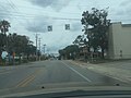
 Driving on Daytona Beach.jpg 3,264 × 2,448; 1.83 MB
-
 EB US 92 @ North Terminus FL 441.jpg 3,648 × 2,736; 2.05 MB
-
 EB US 92 Daytona Beach; Speedway, Airport, or Beaches.jpg 3,648 × 2,736; 2 MB
-
 EB US 92 Sign @ Broadway Bridge in Daytona Beach.jpg 3,648 × 2,736; 2.05 MB
-
 FL430eRoad-TwinSpansOverIntracoastal (26500545158).jpg 2,400 × 1,600; 1.78 MB
-
 FL430eRoadSign-EastOfUS1 (26500541198).jpg 2,400 × 1,600; 2.11 MB
-
 Florida I95nb Bellevue Ave Overpass.jpg 5,184 × 3,456; 5.19 MB
-
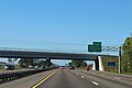
 Florida I95nb Exit 261.jpg 5,184 × 3,456; 5.2 MB
-
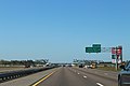
 Florida I95nb Exit 265 .5 mile.jpg 5,184 × 3,456; 5.42 MB
-
 Florida I95nb Exit 265 1 mile.jpg 5,184 × 3,456; 5.25 MB
-
 Florida I95nb Exit 265.jpg 5,184 × 3,456; 5.13 MB
-
 Florida I95nb LPGA Blvd.jpg 5,184 × 3,456; 5.28 MB
-
 Gateway Restaurant from North End of FL 441.jpg 3,648 × 2,736; 2.03 MB
-
 Int95nRoad-Exit261-US92-TwoThirdsMile (27973984339).jpg 2,400 × 1,600; 1.66 MB
-
 N End FL 441 @ US 92.jpg 3,648 × 2,736; 2.03 MB
-
 NB FL 441 @ Silver Beach Avenue.jpg 3,648 × 2,736; 2.01 MB
-
 NB FL 441; Bike Lane Ends; JCT US 92.jpg 3,648 × 2,736; 2.09 MB
-
 NB FL 441; Evacuation Route @ 90-point-7 FM-2.jpg 3,648 × 2,736; 2.04 MB
-
 NB FL 441; Evacuation Route @ Mobile Avenue.jpg 3,648 × 2,736; 2.02 MB
-
 NB FL 5A @ FL 430.jpg 3,648 × 2,736; 2.07 MB
-
 NB FL 5A @ US 92; Daytona SC or Bethune-Cookman U.jpg 3,648 × 2,736; 2.04 MB
-
 NB FL 5A @ US 92; Krispy Kreme.jpg 3,648 × 2,736; 2.04 MB
-
 NB FL 5A @ US 92; Signs.jpg 3,648 × 2,736; 2.04 MB
-
 NB FL 5A; Bike Lane Ends 300 Feet.jpg 3,648 × 2,736; 2.1 MB
-
 NB FL 5A; First shield north of US 92.jpg 3,648 × 2,736; 2.07 MB
-
 NB FL 5A; Jct US 92.jpg 3,648 × 2,736; 2.12 MB
-
 NB FL 5A; Photo Enforced Signals before FL 430.jpg 3,648 × 2,736; 2.06 MB
-
 SB Florida SR 441; Bike Lane Ends 500 Feet.jpg 3,648 × 2,736; 2.04 MB
-
 SB Florida SR 441; First Reassurance Shield.jpg 3,648 × 2,736; 2.02 MB
-
 South Beach Street (DB) Pedestrian Xing North of Orange Avenue.jpg 3,648 × 2,736; 2.05 MB
-
 US92eRoad-JctFL441sign (24883044477).jpg 2,400 × 1,600; 1.43 MB
-
 US92wRoadSign-IntracoastalBridge (27973985119).jpg 2,400 × 1,600; 1.74 MB
-
 WB Beginning; Daytona Beach Vets Memorial Bridge.jpg 3,648 × 2,736; 2.01 MB
-
 WB End; Daytona Beach Vets Memorial Bridge.jpg 3,648 × 2,736; 2 MB
-
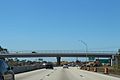
 WB US 92; Daytona Beach Pedestrian Bridge.jpg 3,648 × 2,736; 2.04 MB
-
 WB US 92; Overhead US 1 Sign.jpg 3,648 × 2,736; 2.11 MB
-
 WB US 92; Speedway Pedestrian Bridge.jpg 3,648 × 2,736; 1.99 MB
-
 Welcome to Daytona Beach - panoramio.jpg 3,328 × 2,159; 2.49 MB

.jpg)
.jpg)


.jpg)
.jpg)


.jpg)


_Pedestrian_Xing_North_of_Orange_Avenue.jpg)
.jpg)
.jpg)


