Category:Views from U.S. Route 17
Jump to navigation
Jump to search
Wikimedia category | |||||
| Upload media | |||||
| Instance of | |||||
|---|---|---|---|---|---|
| Category combines topics | |||||
| U.S. Route 17 | |||||
U.S. Numbered Highway in the United States   | |||||
| Instance of | |||||
| Location |
| ||||
| Transport network | |||||
| Inception |
| ||||
| Length |
| ||||
| Terminus | |||||
| |||||
Subcategories
This category has the following 2 subcategories, out of 2 total.
C
- Views from Cooper River Bridge (13 F)
U
- Views from U.S. Route 17/92 (26 F)
Media in category "Views from U.S. Route 17"
The following 48 files are in this category, out of 48 total.
-
 Amtrak Auto Train between Seville and Crescent City, Florida-01.jpg 3,648 × 2,736; 2.1 MB
-
 Amtrak Auto Train between Seville and Crescent City, Florida-02.jpg 3,648 × 2,736; 1.96 MB
-
 Amtrak Auto Train between Seville and Crescent City, Florida-03.jpg 3,648 × 2,736; 2.06 MB
-
 Amtrak Auto Train between Seville and Crescent City, Florida-04.jpg 3,648 × 2,736; 2.07 MB
-
 Angel's Dining Car; Palatka, Florida.jpg 3,648 × 2,736; 1.97 MB
-
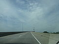 Driving along Sidney Lanier Bridge a.JPG 4,608 × 3,456; 3.54 MB
-
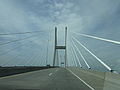
 Driving along Sidney Lanier Bridge b.JPG 4,608 × 3,456; 3.63 MB
-
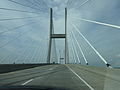
 Driving along Sidney Lanier Bridge c.JPG 4,608 × 3,456; 3.81 MB
-
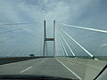
 Driving along Sidney Lanier Bridge d.JPG 4,608 × 3,456; 3.92 MB
-
 Driving along Sidney Lanier Bridge e.JPG 4,608 × 3,456; 4 MB
-
 Driving along Sidney Lanier Bridge f.JPG 4,608 × 3,456; 3.75 MB
-
 Forest Motel; Ridgeland, SC.jpg 5,152 × 3,864; 7.55 MB
-
 Frampton Plantation; Point South, SC-1.jpg 3,648 × 2,736; 2.02 MB
-
 Horne's in Port Royal, VA from US 17.jpg 3,648 × 2,736; 2.06 MB
-
 Liberty County, GA, USA - panoramio - Idawriter.jpg 2,686 × 2,030; 1.04 MB
-
 Moosehaven; Orange Park, FL-1.jpg 3,648 × 2,736; 2.01 MB
-
 Moosehaven; Orange Park, FL-2.jpg 3,648 × 2,736; 2.04 MB
-
 Moosehaven; Orange Park, FL-3.jpg 3,648 × 2,736; 2.06 MB
-
 N End US 17-278 Overlap; Ridgeland, SC.jpg 5,152 × 3,864; 7.63 MB
-
 NB Main Truss of the FL-GA St Marys River US 17 Bridge.jpg 3,648 × 2,736; 2.09 MB
-
 NB US 17 @ Trout River Bridge; Jacksonville, FL-3.jpg 3,648 × 2,736; 2 MB
-
 NB US 17 before Old US 17 and I-95, SC.jpg 5,152 × 3,864; 7.54 MB
-
 NB US 17 near FL 40.jpg 3,648 × 2,736; 2.09 MB
-
 NB US 17 Truck Xing Warning Sign in Gross, Florida.jpg 3,648 × 2,736; 2.12 MB
-
 NB US 17; Agricultural Inspection Station; Half Mile.jpg 3,648 × 2,736; 2.07 MB
-
 NB US 17; Saint Marys River Sign.jpg 3,648 × 2,736; 2.09 MB
-
 NB US 23 Begins in Jacksonville, FL.jpg 3,648 × 2,736; 2.05 MB
-
 NWB US 17-FL 100 Truck Weigh Station (Closed).jpg 3,648 × 2,736; 2.06 MB
-
 NWB US 17-FL 100 Truck Weigh Station Entrance.jpg 1,628 × 911; 171 KB
-
 NWB US 17-FL 100; Nat'l Guard Armory-Truck Route FL 20 Sign west of 19th Street.jpg 3,648 × 2,736; 2.03 MB
-
 Old US 17 Begins; Ridgeland, SC.jpg 5,152 × 3,864; 7.53 MB
-
 Old-Fashioned McDonald's Sign on US 17; Winter Haven, FL.jpg 3,648 × 2,736; 2.05 MB
-
 Palaktastationplaltform.jpg 800 × 600; 75 KB
-
 Pierson, FL Water Tower from NB US 17.jpg 3,648 × 2,736; 2.1 MB
-
 Putnam CR 309 RR Xing from US 17.jpg 3,648 × 2,736; 2.07 MB
-
 SEB US 17-FL 100 Enters San Mateo.jpg 3,648 × 2,736; 2.1 MB
-
 SEB US 17-FL 100 Truck Weigh Station Entrance.jpg 3,648 × 2,736; 2.1 MB
-
 SEB US 17-FL 100; NB FL 207-1.jpg 3,648 × 2,736; 1.96 MB
-
 South Carolina US17nb Beaufort County.jpg 5,184 × 3,456; 5.08 MB
-
 South Carolina US17nb The Ace Basin.jpg 5,184 × 3,456; 4.5 MB
-
 South Carolina US17nb US21 Beaufort exit.jpg 5,184 × 3,456; 4.32 MB
-
 Steffens Restaurant Sign; Kingsland, GA.jpg 3,648 × 2,736; 2.09 MB
-
 US17nUS21nsUS17altToUS15signs-BeaufortCountySC (30688395793).jpg 2,400 × 1,600; 1.95 MB
-
 US17sRoad-OldWhiteSC700sign (31381734951).jpg 2,400 × 1,600; 1.76 MB
-
 US17sRoad-TheAceBasin (31496932865).jpg 2,400 × 1,600; 2.06 MB
-
 US17sRoadGA-SavannahBridgeAhead (31381570321).jpg 2,400 × 1,600; 1.46 MB
-
 US17sRoadGA-TalmadgeMemorialBridge (31381577241).jpg 2,400 × 1,600; 1.58 MB
-
 US17sRoadGA404SpurWestRoadSigns (31350820722).jpg 2,400 × 1,600; 1.7 MB


.jpg)


.jpg)
.jpg)
.jpg)
.jpg)
.jpg)
.jpg)