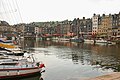
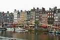
Category:Vieux Bassin d'Honfleur
Jump to navigation
Jump to search
| Object location | | View all coordinates using: OpenStreetMap |
|---|
wet dock dug during the reign of Louis XIV  | |||||
| Upload media | |||||
| Instance of | |||||
|---|---|---|---|---|---|
| Location | Honfleur, canton of Honfleur | ||||
 | |||||
Subcategories
This category has the following 4 subcategories, out of 4 total.
Media in category "Vieux Bassin d'Honfleur"
The following 200 files are in this category, out of 244 total.
(previous page) (next page)-
 1 of 10 - Honfleur, Calvados Normandy - FRANCE.jpg 2,896 × 1,944; 1.3 MB
-
 2 of 10 - Honfleur, Calvados Normandy - FRANCE.jpg 1,944 × 2,896; 1.2 MB
-
 20210825 Honfleur -25.jpg 8,256 × 4,985; 25.25 MB
-
 4 of 10 - Honfleur, Calvados Normandy - FRANCE.jpg 2,853 × 1,920; 1.15 MB
-
 5 of 10 - Honfleur, Calvados Normandy - FRANCE.jpg 2,896 × 1,944; 1.17 MB
-
 8 of 10 - Honfleur, Calvados Normandy - FRANCE.jpg 2,896 × 1,944; 1.32 MB
-
 Ardoises Honfleur maisons.jpg 4,288 × 2,848; 4.54 MB
-
 CHARMING HONFLEUR.jpg 3,998 × 2,104; 1.94 MB
-
 Clocher de l'église Sainte-Catherine et Maisons du vieux bassin d'Honfleur.jpg 2,192 × 3,902; 3.36 MB
-
 Honfleur, le vieux port (Camille Corot).jpg 1,600 × 1,200; 432 KB
-
 Eglise Saint-Etienne Honfleur2009.JPG 3,264 × 2,448; 1.77 MB
-
 Façades de maisons du vieux bassin d'Honfleur.jpg 2,042 × 3,636; 4.02 MB
-
 FR-honfl-alter-hafen.jpg 4,928 × 3,264; 3.71 MB
-
 FR-Honfleur-vieux-bassin-1.jpg 4,928 × 3,264; 3.37 MB
-
 FR-Honfleur-vieux-bassin-2.jpg 4,928 × 3,264; 2.87 MB
-
 France Calvados Honfleur port.jpg 2,048 × 1,536; 1.36 MB
-
 France Calvados Honfleur port2.jpg 2,048 × 1,536; 1.32 MB
-
 France Normandie 14 Honfleur 02.jpg 3,008 × 2,000; 3 MB
-
 France Normandie 14 Honfleur 03.jpg 3,008 × 2,000; 2.67 MB
-
 France-000558 - Marina (14750465220).jpg 6,000 × 4,000; 22.48 MB
-
 France-000560 - Marina (14936773942).jpg 6,000 × 4,000; 16.52 MB
-
 France-000603 - Tour Boat (14750830977).jpg 6,000 × 4,000; 17.89 MB
-
 France-000611 - Marina (14934343311).jpg 6,069 × 4,105; 18.76 MB
-
 François-Monique01.JPG 2,736 × 3,648; 1.89 MB
-
 François-Monique02.JPG 2,736 × 3,648; 1.93 MB
-
 François-Monique03.JPG 2,379 × 3,352; 1.23 MB
-
 Harbour-Honfleur-Normandy-france-Rene-Cortin.jpg 5,568 × 3,712; 8.23 MB
-
 HavenHonfleur-GNUFDL.jpg 2,048 × 1,536; 1.2 MB
-
 Honfleur (289663262).jpg 2,667 × 2,005; 909 KB
-
 Honfleur - 1986.jpg 5,306 × 3,095; 1.87 MB
-
 Honfleur - 2007-07-15 - IMG 6454.jpg 2,048 × 1,360; 2.31 MB
-
 Honfleur - 2007-07-15 - IMG 6461.jpg 2,048 × 1,360; 2.9 MB
-
 Honfleur - 2007-07-15 - IMG 6491.jpg 2,048 × 1,360; 2.23 MB
-
 Honfleur - 2007-07-15 - IMG 6499.jpg 2,048 × 1,360; 2.37 MB
-
 Honfleur - 2007-07-15 - IMG 6518.jpg 2,048 × 1,360; 2.25 MB
-
 Honfleur - 2007-07-15 - IMG 6536.jpg 1,921 × 1,276; 2.63 MB
-
 Honfleur - 2007-07-15 - IMG 6542.jpg 2,048 × 1,360; 2.16 MB
-
 Honfleur - 2007-07-15 - IMG 6550.jpg 757 × 1,140; 789 KB
-
 Honfleur - 2007-07-15 - IMG 6562.jpg 2,018 × 1,340; 2.09 MB
-
 Honfleur - 2007-07-15 - IMG 6571.jpg 1,596 × 1,060; 1.48 MB
-
 Honfleur - 2007-07-15 - IMG 6581.jpg 2,048 × 1,360; 2.72 MB
-
 Honfleur - Le peintre du vieux port.jpg 1,344 × 1,000; 899 KB
-
 Honfleur - Le vieux port 1.jpg 1,567 × 1,000; 542 KB
-
 Honfleur - panoramio (1).jpg 3,846 × 2,805; 2.15 MB
-
 HONFLEUR - panoramio (1).jpg 2,816 × 1,872; 2.49 MB
-
 Honfleur - panoramio (10).jpg 3,648 × 2,736; 4.07 MB
-
 Honfleur - panoramio (2).jpg 4,000 × 2,888; 3.21 MB
-
 HONFLEUR - panoramio (4).jpg 2,816 × 1,872; 2.01 MB
-
 Honfleur - panoramio (7).jpg 3,648 × 2,736; 3.62 MB
-
 Honfleur - Quai de la Quarantaine - View SSW on le Vieux Bassin.jpg 3,024 × 2,016; 2.65 MB
-
 Honfleur - Quai Sainte-Catherine 46.JPG 2,736 × 3,648; 2.74 MB
-
 Honfleur 03.jpg 3,456 × 2,304; 3.83 MB
-
 Honfleur 04.jpg 3,456 × 2,304; 3.6 MB
-
 Honfleur 05.jpg 3,456 × 2,304; 3.6 MB
-
 Honfleur 0633.jpg 1,240 × 1,000; 1.35 MB
-
 Honfleur 0638.jpg 1,238 × 1,000; 1.3 MB
-
 Honfleur 07.jpg 3,456 × 2,304; 4.06 MB
-
 Honfleur 10.jpg 3,456 × 1,961; 1.71 MB
-
 Honfleur 101.jpg 5,472 × 3,648; 16.74 MB
-
 Honfleur 102.jpg 5,472 × 3,648; 16.17 MB
-
 Honfleur 103.jpg 5,472 × 3,648; 17.53 MB
-
 Honfleur 104.jpg 3,648 × 5,472; 16.15 MB
-
 Honfleur 105.jpg 5,472 × 3,648; 17.96 MB
-
 Honfleur 107.jpg 3,648 × 5,472; 16.56 MB
-
 Honfleur 108.jpg 3,648 × 5,472; 20.44 MB
-
 Honfleur 12-29 (15817772354).jpg 3,840 × 5,760; 4.41 MB
-
 Honfleur 12-29 (15820203643).jpg 5,472 × 3,648; 4.27 MB
-
 Honfleur 12-29 (16252614338).jpg 5,760 × 3,840; 5.78 MB
-
 Honfleur 12.jpg 3,456 × 2,304; 4.44 MB
-
 Honfleur 17.jpg 2,304 × 3,456; 3.54 MB
-
 Honfleur 18.jpg 3,456 × 2,304; 4.2 MB
-
 Honfleur 2008 PD 84.JPG 2,272 × 1,704; 844 KB
-
 Honfleur 2008 PD 85.JPG 2,272 × 1,704; 854 KB
-
 Honfleur 2008 PD 86.JPG 2,272 × 1,704; 850 KB
-
 Honfleur 2008 PD 87.JPG 1,704 × 2,272; 626 KB
-
 Honfleur 2008 PD 89.JPG 2,272 × 1,704; 845 KB
-
 Honfleur 2008 PD 90.JPG 1,704 × 2,272; 789 KB
-
 Honfleur 2008 PD 91.JPG 1,704 × 2,272; 736 KB
-
 Honfleur 2008 PD 92.JPG 2,272 × 1,704; 843 KB
-
 Honfleur 2008 PD 93.JPG 2,272 × 1,704; 837 KB
-
 Honfleur 2008 PD 94.JPG 2,272 × 1,704; 845 KB
-
 Honfleur 69.jpg 3,456 × 2,304; 3.39 MB
-
 Honfleur 88.jpg 3,456 × 2,304; 3.36 MB
-
 Honfleur 9299.JPG 2,848 × 4,288; 6.58 MB
-
 Honfleur 9302.jpg 2,848 × 4,288; 7.28 MB
-
 Honfleur alter Hafen.jpg 2,592 × 1,558; 2.91 MB
-
 Honfleur by night.jpg 2,000 × 1,500; 1.13 MB
-
 Honfleur France pier.JPG 2,708 × 2,632; 5.24 MB
-
 Honfleur france.jpeg 1,600 × 1,067; 860 KB
-
 Honfleur la Lieutenance (1).jpg 2,592 × 1,944; 1.73 MB
-
 Honfleur la Lieutenance (2).jpg 2,592 × 1,944; 1.63 MB
-
 Honfleur le port.jpg 2,619 × 1,759; 1.62 MB
-
 Honfleur le vieux bassin.JPG 1,536 × 2,048; 1.31 MB
-
 Honfleur old wharfs, France (1).jpg 2,592 × 1,944; 1.48 MB
-
 Honfleur old wharfs, France (2).jpg 2,592 × 1,944; 1.9 MB
-
 Honfleur old wharfs, France (3).jpg 2,592 × 1,944; 1.88 MB
-
 Honfleur old wharfs, France (4).jpg 2,592 × 1,944; 1.57 MB
-
 Honfleur old wharfs, France (5).jpg 2,592 × 1,944; 3.86 MB
-
 Honfleur Port 10.jpg 6,000 × 4,000; 9.95 MB
-
 Honfleur Port 11.jpg 6,000 × 4,000; 8.71 MB
-
 Honfleur Port 12.jpg 6,000 × 4,000; 7.02 MB
-
 Honfleur Port 13.jpg 6,000 × 4,000; 8.16 MB
-
 Honfleur Port 14.jpg 6,000 × 4,000; 9.55 MB
-
 Honfleur Port 15.jpg 6,000 × 4,000; 10.28 MB
-
 Honfleur Port.jpg 4,839 × 3,161; 7.29 MB
-
 Honfleur port.JPG 4,896 × 3,672; 7.04 MB
-
 Honfleur reflections (16645696874).jpg 1,520 × 2,120; 906 KB
-
 Honfleur reflections (17266357402).jpg 2,116 × 1,508; 882 KB
-
 Honfleur Vieux Bassin 1.jpg 4,584 × 2,210; 3.82 MB
-
 Honfleur Vieux Bassin 2.jpg 4,588 × 3,442; 5.37 MB
-
 Honfleur Vieux Bassin 3.jpg 4,542 × 2,917; 4.96 MB
-
 Honfleur Vieux Bassin 4.jpg 4,536 × 2,995; 4.72 MB
-
 Honfleur Vieux Bassin 5.jpg 4,592 × 2,991; 5.76 MB
-
 Honfleur Vieux Bassin 6.jpg 4,592 × 3,448; 6.48 MB
-
 Honfleur Vieux Bassin 7.jpg 4,574 × 2,891; 5.04 MB
-
 Honfleur Vieux Bassin 8.jpg 4,586 × 3,050; 5.25 MB
-
 Honfleur Vieux Bassin Quai Saint-Étienne 01.jpg 4,583 × 2,308; 3.74 MB
-
 Honfleur Vieux Bassin Quai Saint-Étienne 02.jpg 4,584 × 3,023; 5.15 MB
-
 Honfleur Vieux Bassin Quai Saint-Étienne 03.jpg 4,546 × 3,097; 5.37 MB
-
 Honfleur Vieux Bassin Quai Saint-Étienne 04.jpg 4,542 × 3,317; 5.29 MB
-
 Honfleur Vieux Bassin Quai Saint-Étienne 06.jpg 4,563 × 3,220; 5.22 MB
-
 Honfleur Vieux Bassin Quai Saint-Étienne 07.jpg 4,559 × 3,228; 6.21 MB
-
 Honfleur Vieux Bassin Quai Saint-Étienne 08.jpg 4,564 × 3,042; 5.96 MB
-
 Honfleur Vieux Bassin Quai Saint-Étienne 09.jpg 4,560 × 3,406; 5.16 MB
-
 Honfleur Vieux Bassin Quai Saint-Étienne 10.jpg 4,583 × 3,083; 5.24 MB
-
 Honfleur Vieux Bassin Quai Saint-Étienne 11.jpg 4,559 × 2,904; 4.83 MB
-
 Honfleur Vieux Bassin Quai Saint-Étienne 12.jpg 4,583 × 3,032; 5.27 MB
-
 Honfleur Vieux Bassin Quai Saint-Étienne 13.jpg 4,564 × 3,166; 5.35 MB
-
 Honfleur Vieux Bassin Quai Saint-Étienne 14.jpg 4,572 × 2,904; 5.05 MB
-
 Honfleur Vieux Bassin Quai Saint-Étienne 15.jpg 4,560 × 2,955; 5.08 MB
-
 Honfleur Vieux Bassin Quai Saint-Étienne 16.jpg 4,497 × 3,229; 4.99 MB
-
 Honfleur Vieux Bassin Quai Saint-Étienne 17.jpg 4,560 × 3,406; 5.35 MB
-
 Honfleur Vieux Bassin Quai Saint-Étienne 18.jpg 4,564 × 3,135; 5.3 MB
-
 Honfleur Vieux Bassin Quai Saint-Étienne 19.jpg 4,573 × 3,265; 5.31 MB
-
 Honfleur Vieux Bassin Quai Sainte-Catherine 30.jpg 4,484 × 3,298; 5.41 MB
-
 Honfleur vieux bassin.jpg 800 × 600; 211 KB
-
 Honfleur waterfront.jpg 5,184 × 3,456; 2.89 MB
-
 Honfleur, Hafen 01.jpg 4,000 × 3,000; 2.93 MB
-
 Honfleur, Hafen 02.jpg 4,000 × 3,000; 2.98 MB
-
 Honfleur, Hafen 03.jpg 3,000 × 4,000; 2.85 MB
-
 Honfleur, Hafen 04.jpg 3,000 × 4,000; 2.26 MB
-
 Honfleur, Hafen01.jpg 2,816 × 2,112; 2.34 MB
-
 Honfleur, Hafen02.jpg 1,608 × 2,109; 1.84 MB
-
 Honfleur, Hafen03.jpg 2,816 × 2,112; 970 KB
-
 Honfleur, Harbour.jpg 3,558 × 1,918; 1,010 KB
-
 Honfleur, le vieux port.jpg 1,600 × 1,071; 369 KB
-
 Honfleur, Normandy 1987.jpg 1,756 × 1,116; 2.75 MB
-
 Honfleur, vieux bassin, quai Saint-Étienne, de nuit, août 2015.jpg 5,312 × 2,988; 5.62 MB
-
 Honfleur, vieux bassin, quai Sainte-Catherine août 2015.jpg 5,312 × 2,988; 6.25 MB
-
 Honfleur-L'écluse du vieux bassin-20120914.jpg 4,272 × 2,848; 2.33 MB
-
 Honfleur-La Lieutenance VBVP-20120914.jpg 4,272 × 2,848; 1.94 MB
-
 Honfleur-port.jpg 3,243 × 2,162; 1,007 KB
-
 Honfleur-Quai sainte Catherine-20120914.jpg 4,272 × 2,848; 2.85 MB
-
 Honfleur-Quai Ste Catherine VPHV-20120914.jpg 6,750 × 2,750; 2.56 MB
-
 Honfleur-Quai Ste Catherine-20120916.jpg 4,272 × 2,848; 5.4 MB
-
 Honfleur-Écluse du vieux port-20120914.jpg 4,272 × 2,848; 1.98 MB
-
 Honfleur-Église St Étienne-20120914.jpg 4,272 × 2,848; 1.8 MB
-
 HONFLEUR.jpg 1,160 × 711; 1.44 MB
-
 Honfleur1.jpg 2,504 × 1,676; 2.55 MB
-
 Honfleur2019 (16).jpg 5,184 × 3,456; 7.54 MB
-
 Honfleur2019 (17).jpg 5,184 × 3,456; 7.42 MB
-
 Honfleur2019 (18).jpg 5,184 × 3,456; 6.86 MB
-
 Honfleur2019 (19).jpg 5,184 × 3,456; 7.27 MB
-
 Honfleur2019 (23).jpg 5,184 × 3,456; 13.66 MB
-
 Honfleur2019 (24).jpg 5,184 × 3,456; 12.64 MB
-
 Honfleur2019 (33).jpg 3,456 × 5,184; 12.11 MB
-
 Honfleur2019 (34).jpg 3,456 × 5,184; 13.45 MB
-
 Honfleur4.jpg 1,508 × 1,997; 1.8 MB
-
 Honfleur5.jpg 1,815 × 2,057; 2.34 MB
-
 HonfleurHarbour.png 320 × 240; 135 KB
-
 HonfleurNormandië.jpg 1,174 × 793; 632 KB
-
 Honfleurpano1.JPG 5,336 × 713; 932 KB
-
 Immeuble Honfleur.jpg 3,264 × 2,448; 1.29 MB
-
 L180 - Port d'Honfleur.JPG 4,000 × 3,000; 3.88 MB
-
 Le port de honfleur - panoramio - jean-michel gobet.jpg 1,920 × 2,560; 1.12 MB
-
 Le port de Honfleur - panoramio - jean-michel gobet.jpg 2,560 × 1,920; 1.2 MB
-
 Le port de honfleur - panoramio.jpg 2,560 × 1,920; 1.09 MB
-
 Le port de Honfleur - panoramio.jpg 2,560 × 1,920; 1.21 MB
-
 Le quai d'Honfleur (14).JPG 4,000 × 3,000; 5.58 MB
-
 Maisons du vieux bassin d'Honfleur et clocher de l'église Sainte Catherine.jpg 2,968 × 3,958; 6.32 MB
-
 Mobeye-ÉtéDesVilles-Honfleur-132.jpg 3,200 × 2,400; 591 KB
-
 Mobeye-ÉtéDesVilles-Honfleur-133.jpg 3,200 × 2,400; 589 KB
-
 Mobeye-ÉtéDesVilles-Honfleur-134.jpg 3,200 × 2,400; 844 KB
-
 Normandie 01 (RaBoe).jpg 800 × 640; 464 KB
-
 Normandie 02 (RaBoe).jpg 800 × 640; 460 KB
-
 Old port in Honfleur. France.jpg 4,203 × 2,673; 9.07 MB
-
 Panoramique du vieux bassin d'Honfleur.jpg 6,176 × 1,920; 7.44 MB
-
 Peintre du Vieux Bassin d'Honfleur (own film Scanné).jpg 1,445 × 923; 359 KB
-
 PM 007645 F Honfleur.jpg 600 × 400; 175 KB
-
 PM 007646 F Honfleur.jpg 600 × 400; 194 KB
-
 PM 030495 F Honfleur.jpg 600 × 155; 128 KB
-
 PM 030500 F Honfleur.jpg 600 × 249; 177 KB
-
 PORT D'HONFLEUR - panoramio.jpg 3,648 × 2,736; 4.69 MB
-
 Port d'Honfleur 2.JPG 1,280 × 960; 443 KB
-
 Port d'Honfleur.JPG 1,280 × 960; 439 KB
-
 Port de Honfleur (Calvados, NORMANDIE).jpg 3,700 × 2,788; 2.35 MB
-
 Port de Honfleur - panoramio.jpg 3,840 × 2,160; 2.67 MB
-
 Port de Honfleur - Vieux Port.jpg 600 × 480; 72 KB
-
 Port de Honfleur.jpg 4,032 × 3,024; 3.6 MB
-
 Port vieux de honfleur.JPG 4,608 × 3,456; 3.36 MB


.jpg)


.jpg)
.jpg)
.jpg)
.jpg)


.jpg)


.jpg)
.jpg)
.jpg)
.jpg)
.jpg)
.jpg)


.jpg)
.jpg)
.jpg)


.jpg)
.jpg)


.jpg)
.jpg)
.jpg)
.jpg)
.jpg)


.jpg)
.jpg)


.jpg)
.jpg)
.jpg)
.jpg)
.jpg)
.jpg)
.jpg)
.jpg)


.JPG)


.jpg)
.jpg)

.jpg)


.jpg)


