Category:Vasatz-Siedlung
Jump to navigation
Jump to search
| Object location | | View all coordinates using: OpenStreetMap |
|---|

| Upload media | |||||
| Instance of | |||||
|---|---|---|---|---|---|
| Location | Dresden, Saxony, Germany | ||||
 | |||||
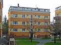
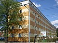
Deutsch: Vasatz-Siedlung in Dresden-Strehlen mit den Wohnhäusern und Häuserzeilen Dohnaer Straße 28; 28b; 28c; 28d; 30; 30b; 30c; 30d; 32; 32b; 32c; 32d; 32e; 34 sowie Hugo-Bürkner-Straße 2; 2b und Rayskistraße 32-44 und 33-37.
Media in category "Vasatz-Siedlung"
The following 11 files are in this category, out of 11 total.
-
 DD-DohnaerStr-30d.jpg 2,275 × 1,708; 1.42 MB
-
 Dohnaer Straße 30b-c Strehlen.JPG 4,320 × 2,432; 4.55 MB
-
 Dohnaer Straße 32 Strehlen.JPG 4,320 × 2,432; 4.45 MB
-
 DohnaerStr28-DD.jpg 1,915 × 1,155; 423 KB
-
 DohnaerStr28bd-DD.jpg 1,918 × 1,254; 386 KB
-
 DohnaerStr32de-DD.jpg 2,048 × 1,360; 603 KB
-
 DohnaerStr34-DD.jpg 2,048 × 1,360; 630 KB
-
 DohnaerStr61-DD.jpg 1,545 × 1,159; 413 KB
-
 Hugo-Bürkner-Str2-DD.jpg 1,883 × 1,302; 492 KB
-
 Rayskistr32-44-DD.jpg 1,804 × 1,353; 509 KB
-
 Rayskistr33-DD.jpg 1,798 × 1,199; 496 KB


