Category:Valleys of Oregon
Jump to navigation
Jump to search
States of the United States: Alabama · Alaska · Arizona · Arkansas · California · Colorado · Connecticut · Delaware · Georgia · Hawaii · Idaho · Illinois · Indiana · Iowa · Kansas · Kentucky · Maine · Maryland · Massachusetts · Mississippi · Missouri · Montana · Nebraska · Nevada · New Hampshire · New Jersey · New Mexico · New York · North Carolina · North Dakota · Oklahoma · Oregon · Pennsylvania · Rhode Island · South Carolina · South Dakota · Tennessee · Texas · Utah · Vermont · Virginia · Washington · West Virginia · Wyoming
Wikimedia category | |||||
| Upload media | |||||
| Instance of | |||||
|---|---|---|---|---|---|
| Category combines topics | |||||
| Oregon | |||||
state of the United States of America     | |||||
| Pronunciation audio | |||||
| Instance of | |||||
| Part of | |||||
| Named after |
| ||||
| Location |
| ||||
| Located in or next to body of water | |||||
| Capital | |||||
| Legislative body | |||||
| Executive body | |||||
| Highest judicial authority | |||||
| Anthem | |||||
| Head of government |
| ||||
| Inception |
| ||||
| Highest point | |||||
| Population |
| ||||
| Area |
| ||||
| Elevation above sea level |
| ||||
| Different from | |||||
| Maximum temperature record |
| ||||
| Minimum temperature record |
| ||||
| official website | |||||
 | |||||
Subcategories
This category has the following 9 subcategories, out of 9 total.
C
G
P
R
T
W
Media in category "Valleys of Oregon"
The following 35 files are in this category, out of 35 total.
-
 Alluvial Formations near Succor Creek - panoramio.jpg 3,888 × 2,592; 4.51 MB
-
 Applegate.jpg 800 × 600; 174 KB
-
 Canal-Treasure-Valley.jpg 1,920 × 1,080; 455 KB
-
 Glacial Valley MtHoodWilderness.jpg 1,382 × 1,509; 393 KB
-
 GopherValleyOregon.JPG 2,816 × 1,503; 965 KB
-
 Grande Ronde River and Grande Ronde Basalt IMG 4536.jpg 3,888 × 2,592; 4.05 MB
-
 Grande ronde valley near elgin.jpg 4,288 × 2,848; 8.02 MB
-
 Imnaha Valley at Sunset (543564859).jpg 1,280 × 800; 176 KB
-
-
 Mill Creek Valley from Evans Ranch, Ochoco Forest, 1916 - NARA - 299166.jpg 3,000 × 1,710; 1.27 MB
-
 Mount Hood from Bald Mountain flickr Thomas Shahan.jpg 1,842 × 1,044; 953 KB
-

-
 Oregon jefferson park.jpeg 2,816 × 2,112; 1.54 MB
-
 Owyhee River (9683657152).jpg 5,757 × 3,835; 19.36 MB
-
 Patton Valley - Washington County, Oregon.JPG 3,872 × 2,592; 3.82 MB
-
-
 Pleasant Valley near Mitchell, Oregon (3424976302).jpg 4,469 × 3,575; 1.28 MB
-
 Riddle Ranch, Little Blitzen Valley, Oregon, BLM.jpg 760 × 506; 79 KB
-
 Sandy River Headwaters.jpg 1,569 × 2,092; 567 KB
-
 Spencerbutte view.jpg 1,600 × 1,200; 640 KB
-
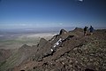
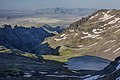
 Steens Mountain in eastern Oregon (9680476233).jpg 5,758 × 3,836; 22.89 MB
-
 Steens Mountain in eastern Oregon (9680511439).jpg 5,616 × 3,744; 16.62 MB
-
 Steens Mountain in eastern Oregon (9680512343).jpg 5,398 × 3,599; 16.37 MB
-
 Steens Mountain in eastern Oregon (9680513441).jpg 5,616 × 3,744; 18.01 MB
-
 Steens Mountain in eastern Oregon (9680520613).jpg 5,438 × 3,626; 23 MB
-
 Steens Mountain in eastern Oregon (9683715608).jpg 5,758 × 3,837; 22.67 MB
-
 Steens Mountain in eastern Oregon (9683717576).jpg 5,758 × 3,838; 27.23 MB
-
 Steens Mountain in eastern Oregon (9683735042).jpg 5,755 × 3,836; 20.13 MB
-
 Steens Mountain in eastern Oregon (9683737744).jpg 5,616 × 3,744; 23.58 MB
-
 Valley in the Chehalem Mountains of Oregon.JPG 3,872 × 2,592; 3.85 MB
-
 Valley-of-North-Fork-WallaWalla.JPG 1,984 × 1,488; 701 KB
-
 View of Alpha Farm Co-op facing west from the eastern slope of Alpha..jpg 4,080 × 3,072; 5.27 MB
-
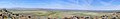 Warner Valley pano.jpg 12,140 × 1,872; 3.43 MB
-
 Warner Valley, Oregon.PNG 428 × 317; 11 KB
-
 Wild Horses on Steens Mountain (6983016963).jpg 1,690 × 1,127; 1.79 MB


.jpg)
.jpg)


_05-1973_(4271683099).jpg)

.jpg)


.jpg)


.jpg)
.jpg)
.jpg)
.jpg)
.jpg)
.jpg)
.jpg)
.jpg)
.jpg)


.jpg)