Category:Vännäs läger
Jump to navigation
Jump to search
| Object location | | View all coordinates using: OpenStreetMap |
|---|
 | |||||
| Upload media | |||||
| Instance of | |||||
|---|---|---|---|---|---|
| Location | Vännäs, Vännäs Municipality, Västerbotten County, Sweden | ||||
| Heritage designation |
| ||||
| Inception |
| ||||
 | |||||
Subcategories
This category has the following 2 subcategories, out of 2 total.
F
V
- Vännäs Motormuseum (7 F)
Media in category "Vännäs läger"
The following 7 files are in this category, out of 7 total.
-
 Vännäs läger lägerhyddan 2011-09-11.jpg 1,953 × 1,301; 2.97 MB
-
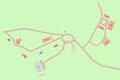 Vännäs läger map.jpg 826 × 548; 29 KB
-
 Vännäs läger marketenteriet 2011-09-10.jpg 3,906 × 2,602; 9.22 MB
-
 Vännäs läger officersbostadshus 2011-09-10.jpg 3,906 × 2,602; 9.29 MB
-
 Vännäs läger ufb 2011-09-10.jpg 3,868 × 2,546; 10.28 MB
-
 Vännäs läger uo-mässen 2011-09-10.jpg 3,906 × 2,602; 5.45 MB
-
 Vännäs läger-Underoffm-St salen-2012-08-09.jpg 3,906 × 2,602; 1.93 MB


