Category:Utah State Route 281 (1969-1991)
Jump to navigation
Jump to search
former state highway in St. George, Utah, United States  | |||||
| Upload media | |||||
| Instance of | |||||
|---|---|---|---|---|---|
| Location | St. George, Washington County, Utah | ||||
| Transport network | |||||
| Owned by |
| ||||
| Maintained by |
| ||||
| Inception |
| ||||
| Dissolved, abolished or demolished date |
| ||||
| Length |
| ||||
| Terminus | |||||
| Replaces | |||||
 | |||||
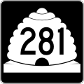
English: Media related to Utah State Route 281 (1969-1991) (SR-281), a former 2.1-mile (3.4 km) state highway in St. George, Utah, United States, that included the streets near and surrounding Dixie College (now Utah Tech University).
Specifically, SR-281 included the following streets:
- 700 East (University Avenue), from Utah State Route 34 (St. George Boulevard / East 100 North) to East 600 South
- East 600 South, from South 700 East to South 900 East
- South 900 East, from East 600 South to East 400 South
- East 400 South, from South 900 East to South 1000 East
- South 1000 East, from East 400 South to East 100 South
- East 100 South, from South 1000 East to South 700 East (South University Avenue)
Subcategories
This category has the following 2 subcategories, out of 2 total.
S
Media in category "Utah State Route 281 (1969-1991)"
The following 2 files are in this category, out of 2 total.
-
 Utah 281.svg 750 × 600; 73 KB
-
 Utah SR 281.svg 385 × 385; 10 KB
