Category:Utah State Route 148 (1945-1969)
Jump to navigation
Jump to search
former state highway in Juab County, Utah, United States  | |||||
| Upload media | |||||
| Instance of | |||||
|---|---|---|---|---|---|
| Location | Juab County, Utah | ||||
| Transport network | |||||
| Owned by |
| ||||
| Maintained by |
| ||||
| Inception |
| ||||
| Dissolved, abolished or demolished date |
| ||||
| Length |
| ||||
| Terminus | |||||
 | |||||
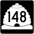
English: Media related to Utah State Route 148 (1945-1969) (SR-148), a former 9.3-mile (15.0 km) state highway in Juab County, Utah, United States, that connected U.S. Route 6 / Utah State Route 27 (US 6 / SR-27) and Weiss Highway at Jericho Junction {south of Jericho) with Utah State Route 132 (about 14.6 miles [23.5 km] northeast of Leamington). The road is now known as Juab County Road 1812. From 1933 to 1945, this section of highway designated as the western end of Utah State Route 132 and the section of highway from this highway's eastern terminus west to US 6 in Lynndal was designated as SR-148. In 1945, the two sections switched designations.
Subcategories
This category has the following 2 subcategories, out of 2 total.
Media in category "Utah State Route 148 (1945-1969)"
The following 2 files are in this category, out of 2 total.
-
 Utah 148.svg 750 × 600; 73 KB
-
 Utah SR 148.svg 385 × 385; 8 KB
