Category:Utah State Route 105 (1916-1964)
Jump to navigation
Jump to search
former state highway in Spanish Fork, Utah, United States  | |||||
| Upload media | |||||
| Instance of | |||||
|---|---|---|---|---|---|
| Location | Utah County, Utah | ||||
| Transport network | |||||
| Owned by |
| ||||
| Maintained by |
| ||||
| Inception |
| ||||
| Dissolved, abolished or demolished date |
| ||||
| Length |
| ||||
| Terminus | |||||
| Partially coincident with | |||||
 | |||||
English: Media related to Utah State Route 105 (1916-1964), SR-105, the former 3.8162-mile (6.1416 km) state highway designation (legislative overlay) for a small section of U.S. Route 6 / U.S. Route 50 in what is now entirely within Spanish Fork, Utah, United States, that connected Route 1 (U.S. Route 91 / South Main Street) with U.S. Route 50 / U.S. Route 89 at Moark Junction. In 1964, SR-105 was redesignated as part of Utah State Route 26, but then became Utah State Route 27 in 1969 and is now part of Utah State Rout 198.
Subcategories
This category has only the following subcategory.
Media in category "Utah State Route 105 (1916-1964)"
The following 5 files are in this category, out of 5 total.
-
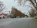 North toward SR-156 & SR-198 junction, Apr 16.jpg 2,592 × 1,944; 2.31 MB
-
 South toward SR-156 & SR-198 junction, Apr 16.jpg 2,592 × 1,944; 2.4 MB
-
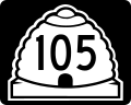 Utah 105.svg 750 × 600; 73 KB
-
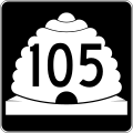 Utah SR 105.svg 385 × 385; 9 KB
-
 West toward SR-156 & SR-198 junction, Apr 16.jpg 2,592 × 1,944; 2.44 MB


Categories:
- Former state highways in Utah
- Former state highways in Utah County, Utah
- State highways in the Utah Valley
- Spanish Fork, Utah
- U.S. Route 6 in Utah
- U.S. Route 50 in Utah (1953-1976)
- Utah State Route 26 (1910-1969)
- Roads numbered 105
- Utah state highways established in 1916
- Utah state highways decommissioned in 1964