Category:Utah Division (D&RGW)
Jump to navigation
Jump to search
rail line in Utah and Colorado in the United States  | |||||
| Upload media | |||||
| Instance of | |||||
|---|---|---|---|---|---|
| Location |
| ||||
| Replaced by | |||||
| |||||
English: Media related to the Utah Division (D&RGW), a rail line of the former Denver and Rio Grande Western Railroad that connects Grand Junction, Colorado and Salt Lake City, Utah in the Western United States.
Subcategories
This category has the following 8 subcategories, out of 8 total.
G
- Green River station (Utah) (12 F)
H
- Helper station (13 F)
P
- Provo Union Depot (2 F)
S
T
- Thompson station (6 F)
U
Media in category "Utah Division (D&RGW)"
The following 88 files are in this category, out of 88 total.
-
 410 MSS P 24 B3 F7.jpg 2,601 × 1,661; 747 KB
-
 Break in tracks at southern end of Blue Line, Apr 15.jpg 2,816 × 2,112; 2.53 MB
-
 California Zephyr Green River.jpg 3,840 × 2,160; 874 KB
-
 California Zephyr north of Green River.jpg 1,882 × 1,080; 383 KB
-
 California Zephyr passing Provo FrontRunner Station.jpg 3,296 × 2,472; 1.28 MB
-
 Castle Gate, Utah - From The California Zephyr - panoramio (4).jpg 2,585 × 1,780; 572 KB
-
 Castle Gate.png 686 × 631; 651 KB
-
 Crescent Junction (Utah, USA).jpg 3,072 × 2,048; 1.01 MB
-
 D&RGW 5771 EB Castle Gate June 1975x4 (12225401393).jpg 4,096 × 2,731; 7.22 MB
-
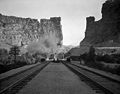 D&RGW Castle Gate steam train approaching.jpg 640 × 501; 30 KB
-
 D&RGW Castle Gate.jpg 640 × 502; 40 KB
-
 Dinosaur Diamond Prehistoric Highway - Train near Castle Gate Mine - NARA - 7718037.jpg 2,256 × 1,496; 921 KB
-

-
 East at Price River and tracks in Kyune, Utah, May 17.jpg 2,592 × 1,944; 2.3 MB
-
 East at SR-139 & SR-157 junction, May 17.jpg 2,592 × 1,944; 2.42 MB
-
 East at train end in Kyune, Utah, May 17.jpg 2,592 × 1,944; 2.33 MB
-
 East at train in Kyune, Utah, May 17.jpg 2,592 × 1,944; 2.38 MB
-
 East at Utah Division bridge over Williow Creek, May 17.jpg 2,592 × 1,944; 2.05 MB
-
 East in east end of The Red Narrows at most narrow part, Dec 16.jpg 2,592 × 1,944; 2.44 MB
-
 East in east end of The Red Narrows, Dec 16.jpg 2,592 × 1,944; 2.42 MB
-
 East in Provo Yard toward FrontRunner end of line, Mar 15.jpg 2,816 × 2,112; 2.73 MB
-
 East in west end of The Red Narrows, Dec 16.jpg 2,592 × 1,944; 2.43 MB
-
 FrontRunner at future Vineyard station, Feb 16.jpg 2,816 × 2,112; 2.35 MB
-
 FrontRunner at level crossing for W 400 S Orem, Utah, Mar 16.jpg 2,592 × 1,944; 2.21 MB
-
 FrontRunner leaving Provo Station.JPG 3,296 × 2,472; 1.18 MB
-
 Green River Amtrak.jpg 3,008 × 2,000; 2.41 MB
-
 Greenriver old 1982 jul 18.jpg 500 × 330; 40 KB
-
 Greenriver1.jpg 300 × 200; 14 KB
-
 Level crossing for W 400 S Orem, Utah, Mar 16.jpg 2,592 × 1,944; 2.22 MB
-
 Looking north from American Fork Station.JPG 2,816 × 2,112; 2.55 MB
-
 Looking south from Vineyard station, bird's eye view.JPG 2,816 × 2,112; 2.62 MB
-
 North along UP tracks at Slant Road, Mapleton, Utah, Feb 17.jpg 2,592 × 1,944; 2.3 MB
-
 North at Price River from US 191, May 17.jpg 2,592 × 1,944; 2.19 MB
-
 North at SR-139 & SR-157 junction, May 17.jpg 2,592 × 1,944; 2.44 MB
-
 North in Provo Yard toward FrontRunner end of line, Mar 15.jpg 2,816 × 2,112; 2.55 MB
-
 Northeast at Price River & Utah Division from US-6 in Utah County, Utah, Dec 16.jpg 2,592 × 1,944; 2.36 MB
-
 Northeast at US-6 & SR-96 junction, Dec 16.jpg 2,592 × 1,944; 2.35 MB
-
 Northeast on track from S 1300 E, Draper, Utah, Apr 15.jpg 2,816 × 2,112; 2.79 MB
-
 Northwest along tracks, E 12715 South, Draper, Utah, Apr 15.jpg 2,816 × 2,112; 2.66 MB
-
 Northwest at train end in Colton, Utah, May 17.jpg 2,592 × 1,944; 2.41 MB
-
 Northwest at train in Colton, Utah, May 17.jpg 2,592 × 1,944; 2.37 MB
-
 Northwest at US-6 Price River bridge in Utah County, Utah, Dec 16.jpg 2,592 × 1,944; 2.27 MB
-
 Provo Amtrak station from FrontRunner, Provo, Utah, Jul 16.jpg 2,592 × 1,944; 2.33 MB
-
 Red Narrows, Spanish Fork Canon Utah D.& R.G.Ry. C.R. Savage, Photo..jpg 2,466 × 1,897; 990 KB
-
 South along UP tracks at Slant Road, Mapleton, Utah, Feb 17.jpg 2,592 × 1,944; 2.36 MB
-
 South at Price River from US 191, May 17.jpg 2,592 × 1,944; 2.14 MB
-
 South at SR-139 & SR-157 junction, May 17.jpg 2,592 × 1,944; 2.43 MB
-
 South at tracks Price River in Kyune, Utah, May 17.jpg 2,592 × 1,944; 2.26 MB
-
 South at train end in Kyune, Utah, May 17.jpg 2,592 × 1,944; 2.15 MB
-
 South at US 6 & US 191 junction in Castle Gate, Utah, May 17.jpg 2,592 × 1,944; 2.26 MB
-
 Southeast along tracks, E 12715 South, Draper, Utah, Apr 15.jpg 2,816 × 2,112; 2.69 MB
-
 Southeast at Castle Gate, Utah, May 17.jpg 2,592 × 1,944; 2.25 MB
-
 Southeast at US-6 Price River bridge in Utah County, Utah, Dec 16.jpg 2,592 × 1,944; 2.28 MB
-
 Southeast on track from S 1300 E, Draper, Utah, Apr 15.jpg 2,816 × 2,112; 2.61 MB
-
 Southeast on US 6 in Mill Fork, Utah, May 17.jpg 2,592 × 1,944; 2.39 MB
-
 Southwest at Price River & Utah Division from US-6 in Utah County, Utah, Dec 16.jpg 2,592 × 1,944; 2.4 MB
-
 Southwest at US-6 & SR-96 junction, Dec 16.jpg 2,592 × 1,944; 2.34 MB
-

-
 The Eastbound California Zephyr near Tucker Utah - panoramio.jpg 2,698 × 1,864; 699 KB
-
 Thompson Springs, UT 8-26-12 (8003659315).jpg 1,550 × 1,205; 601 KB
-
 Thompson Springs.jpg 2,048 × 1,536; 855 KB
-
 Two Union Pacific engines in Provo, Utah.JPG 2,816 × 2,112; 2.28 MB
-
 Union Pacific Locomotive at Helper Utah - panoramio.jpg 2,533 × 1,659; 1.2 MB
-
 US Highway 6 - Utah - 7688477066.jpg 3,072 × 2,304; 461 KB
-
 US Highway 6 - Utah - 7688477824.jpg 3,072 × 2,304; 468 KB
-
 US Highway 6 - Utah - 7688478536.jpg 3,072 × 2,304; 469 KB
-
 US Highway 6 - Utah - 7688478992.jpg 3,072 × 2,304; 479 KB
-
 US Highway 6 - Utah - 7688481200.jpg 3,072 × 2,304; 467 KB
-
 US Highway 6 - Utah - 7688492176.jpg 3,072 × 2,304; 489 KB
-
 US Highway 6 - Utah - 7688492864.jpg 3,072 × 2,304; 397 KB
-
 US Highway 6 - Utah - 7688515062.jpg 3,072 × 2,304; 434 KB
-
 UTAH MK50-3 at Thistle, Utah.jpg 4,000 × 2,469; 3.28 MB
-
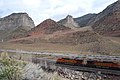
 UTAH MK50-3 Price Canyon 1.jpg 4,349 × 2,685; 3.66 MB
-
 UTAH MK50-3 Price Canyon 3.jpg 4,395 × 2,713; 5.05 MB
-
 UTAH MK50-3 Price Canyon 4.jpg 4,698 × 2,899; 4.75 MB
-
 UTAH MK50-3 Soldier Summit 2.jpg 4,292 × 2,649; 5.05 MB
-
 UTAH MK50-3 Soldier Summit 5.jpg 3,497 × 2,159; 1.8 MB
-
 UTAH MK50-3 Soldier Summit 6.jpg 2,267 × 3,400; 1.25 MB
-
 UTAH MK50-3 Soldier Summit 7.jpg 4,752 × 2,933; 3.11 MB
-
 UTAH MK50-3 Soldier Summit 8.jpg 4,662 × 2,878; 4.17 MB
-
 UTAH MK50-3 Soldier Summit 9.jpg 4,752 × 2,933; 5.24 MB
-
 UTAH MK50-3 Thistle, Utah 11.jpg 4,000 × 2,469; 4.14 MB
-
 UTAH MK50-3 Thistle, Utah 12.jpg 4,700 × 2,901; 4.41 MB
-
 Vineyard station site, bird's eye view.JPG 2,816 × 2,112; 2.49 MB
-
 West at SR-139 & SR-157 junction, May 17.jpg 2,592 × 1,944; 2.38 MB
-
 West at train in Colton, Utah, May 17.jpg 2,592 × 1,944; 2.35 MB
-
 West in east end of The Red Narrows, Dec 16.jpg 2,592 × 1,944; 2.35 MB
-
 West of Grand Junction CA (12136986296).jpg 2,272 × 1,704; 3.64 MB


.jpg)

.jpg)
.jpg)


.jpg)


.jpg)
Categories:
- Railway lines in Utah
- Railway lines in Colorado
- Transport in Salt Lake County, Utah
- Transport in Utah County, Utah
- Transport in Wasatch County, Utah
- Transport in Carbon County, Utah
- Transport in Emery County, Utah
- Transport in Grand County, Utah
- Transport in Mesa County, Colorado
- Transport in the Utah Valley
- Denver and Rio Grande Western Railroad
- Locations along Interstate 70 in Emery County, Utah
- Locations along Interstate 70 in Grand County, Utah
- Locations along U.S. Route 6 in Carbon County, Utah
- Locations along U.S. Route 6 in Emery County, Utah
- Locations along U.S. Route 6 in Grand County, Utah
- Locations along U.S. Route 6 in Utah County, Utah
- Locations along U.S. Route 6 in Wasatch County, Utah
- Locations along U.S. Route 50 in Emery County, Utah
- Locations along U.S. Route 50 in Grand County, Utah
- Locations along U.S. Route 50 in Utah (1953-1976) in Carbon County, Utah
- Locations along U.S. Route 50 in Utah (1953-1976) in Emery County, Utah
- Locations along U.S. Route 50 in Utah (1953-1976) in Grand County, Utah
- Locations along U.S. Route 50 in Utah (1953-1976) in Utah County, Utah
- Locations along U.S. Route 50 in Utah (1953-1976) in Wasatch County, Utah
- Locations along U.S. Route 50 in Utah (1926-1953) in Carbon County, Utah
- Locations along U.S. Route 50 in Utah (1926-1953) in Emery County, Utah
- Locations along U.S. Route 50 in Utah (1926-1953) in Grand County, Utah
- Locations along U.S. Route 50 in Utah (1926-1953) in Utah County, Utah
- Locations along U.S. Route 50 Alternate in Utah County, Utah
- Locations along U.S. Route 89 in Utah County, Utah
- Locations along U.S. Route 191 in Carbon County, Utah
- Locations along U.S. Route 191 in Emery County, Utah
- Locations along U.S. Route 191 in Grand County, Utah
- Locations along Utah State Route 4 (1962-1977) in Emery County, Utah
- Locations along Utah State Route 4 (1962-1977) in Grand County, Utah
- Locations along Utah State Route 10 in Carbon County, Utah
- Locations along Utah State Route 19 in Emery County, Utah
- Locations along Utah State Route 27 (1927-1977) in Carbon County, Utah
- Locations along Utah State Route 27 (1927-1977) in Emery County, Utah
- Locations along Utah State Route 27 (1927-1977) in Utah County, Utah
- Locations along Utah State Route 27 (1927-1977) in Wasatch County, Utah
- Locations along Utah State Route 94
- Locations along Utah State Route 96 in Utah County, Utah