Category:Upper Rissington
Jump to navigation
Jump to search
village in the United Kingdom  | |||||
| Upload media | |||||
| Instance of | |||||
|---|---|---|---|---|---|
| Location | Cotswold, Gloucestershire, South West England, England | ||||
 | |||||
English: Upper Rissington is a village and civil parish in the Cotswold district of Gloucestershire, England, located about two-and-a-half miles east of Bourton-on-the-Water. According to the Gloucestershire Mid-2004 Ward and Parish Population Estimates it had a population of 994.
Media in category "Upper Rissington"
The following 45 files are in this category, out of 45 total.
-
 "Shoppers" at Cotswold Reclamation - geograph.org.uk - 1436877.jpg 640 × 480; 286 KB
-

-

-
 A424 near the Rissingtons - geograph.org.uk - 2651846.jpg 640 × 480; 70 KB
-
 Airfield business park - geograph.org.uk - 2789070.jpg 4,320 × 3,240; 4.4 MB
-
 Airfield view - geograph.org.uk - 2789353.jpg 4,320 × 3,240; 4.3 MB
-
 Bridleway past Wyck Beacon - geograph.org.uk - 3197598.jpg 640 × 427; 252 KB
-
 Bus stop at Upper Rissington - geograph.org.uk - 1555717.jpg 427 × 640; 49 KB
-
 Down the hill - geograph.org.uk - 2789095.jpg 4,320 × 3,240; 4.4 MB
-
 End of lane - geograph.org.uk - 2731590.jpg 4,320 × 3,240; 5.1 MB
-
 If the phone doesn't ring, it's me - geograph.org.uk - 1440488.jpg 469 × 640; 157 KB
-
 Junction at Upper Rissington - geograph.org.uk - 1226472.jpg 640 × 427; 57 KB
-
 Little Rissington Airfield (1) - geograph.org.uk - 2732351.jpg 4,320 × 3,240; 4.79 MB
-
 Little Rissington Airfield (3) - geograph.org.uk - 2732381.jpg 4,320 × 3,240; 4.77 MB
-
 No way in now - geograph.org.uk - 2731584.jpg 4,320 × 3,240; 5.36 MB
-
 Once the Royal Air Force - geograph.org.uk - 2731613.jpg 4,320 × 3,240; 4.73 MB
-
 Oxfordshire Way - geograph.org.uk - 4787398.jpg 640 × 360; 61 KB
-
 Phipp Feeds, Wyck Beacon - geograph.org.uk - 5146000.jpg 4,000 × 3,000; 2.81 MB
-
 Reclamation yard - geograph.org.uk - 2731596.jpg 4,320 × 3,240; 4.92 MB
-
 Salvage at the reclamation yard 1 - geograph.org.uk - 1436913.jpg 640 × 481; 252 KB
-
 Salvage at the reclamation yard 10 - geograph.org.uk - 1436970.jpg 640 × 480; 304 KB
-
 Salvage at the reclamation yard 2 - geograph.org.uk - 1436916.jpg 640 × 482; 283 KB
-
 Salvage at the reclamation yard 3 - geograph.org.uk - 1436923.jpg 640 × 480; 266 KB
-
 Salvage at the reclamation yard 4 - geograph.org.uk - 1436928.jpg 640 × 480; 238 KB
-
 Salvage at the reclamation yard 5 - geograph.org.uk - 1436934.jpg 480 × 640; 250 KB
-
 Salvage at the reclamation yard 6 - geograph.org.uk - 1436942.jpg 640 × 480; 257 KB
-
 Salvage at the reclamation yard 7 - geograph.org.uk - 1436946.jpg 640 × 480; 272 KB
-
 Salvage at the reclamation yard 8 - geograph.org.uk - 1436953.jpg 480 × 640; 265 KB
-
 Salvage at the reclamation yard 9 - geograph.org.uk - 1436960.jpg 640 × 481; 282 KB
-
 Sheep on Wyck Beacon - geograph.org.uk - 5592695.jpg 6,000 × 4,000; 4.47 MB
-
 The top of Wyck Beacon - geograph.org.uk - 5592699.jpg 6,000 × 4,000; 4.16 MB
-
 Tree roots - geograph.org.uk - 3197592.jpg 640 × 427; 215 KB
-
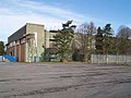
 Upper Rissington Business Park (1) - geograph.org.uk - 2732332.jpg 4,320 × 3,240; 5.03 MB
-
 Upper Rissington Business Park (2) - geograph.org.uk - 2732340.jpg 4,320 × 3,240; 4.92 MB
-
 Upper Rissington Business Park (3) - geograph.org.uk - 2732348.jpg 4,320 × 3,240; 5.15 MB
-
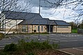 Upper Rissington Village Hall.jpg 4,128 × 2,752; 2.75 MB
-
 Wyck Beacon - geograph.org.uk - 3197607.jpg 640 × 427; 198 KB
-
 Cotswold Reclamation yard - geograph.org.uk - 1436848.jpg 640 × 481; 238 KB
-
 Industrial Estate - geograph.org.uk - 678156.jpg 640 × 480; 58 KB
-
 Lancaster Drive - geograph.org.uk - 308977.jpg 640 × 480; 68 KB
-
 Little Rissington Airfield - geograph.org.uk - 232747.jpg 640 × 480; 43 KB
-
 Older housing at Upper Rissington - geograph.org.uk - 308981.jpg 640 × 480; 96 KB
-
 Upper Rissington Business Park - geograph.org.uk - 232745.jpg 640 × 480; 81 KB
-
 Wyck Beacon - geograph.org.uk - 234374.jpg 480 × 640; 130 KB
-
 Wyck Beacon - geograph.org.uk - 77121.jpg 640 × 427; 103 KB


_-_geograph.org.uk_-_2732351.jpg)
_-_geograph.org.uk_-_2732381.jpg)


_-_geograph.org.uk_-_2732332.jpg)
_-_geograph.org.uk_-_2732340.jpg)
_-_geograph.org.uk_-_2732348.jpg)


