Category:Uplistsikhe
Jump to navigation
Jump to search
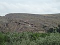
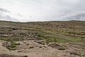
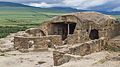
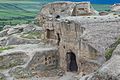
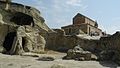
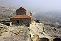
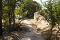
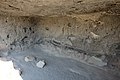
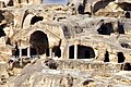
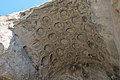
Uplistsikhe is a ruined rock-hewn city of ancient Georgia
| Object location | | View all coordinates using: OpenStreetMap |
|---|
|
This is a category about a monument in Georgia identified by the ID 1953
|
|
English: Uplistsikhe
ქართული: უფლისციხე
|
Deutsch: Uplistsiche
Polski: Upliscyche
|
Русский: Уплисцихе
Українська: Уплісцихе
|
Српски / srpski: Уплисцихе
Suomi: Uplistsikhe
|
ancient city in Georgia  Footpath at the south-west gate of Uplistsikhe | |||||
| Upload media | |||||
| Instance of |
| ||||
|---|---|---|---|---|---|
| Location | Shida Kartli, Georgia | ||||
| Heritage designation |
| ||||
| Inception |
| ||||
 | |||||
Subcategories
This category has the following 6 subcategories, out of 6 total.
K
- Kura, Uplistsikhe (53 F)
U
- Uplistsikhe Cave City (51 F)
- Uplistsikhe in art (11 F)
- Uplistsikhe maps (5 F)
- Uplistsikhe secret tunnel (8 F)
Media in category "Uplistsikhe"
The following 200 files are in this category, out of 624 total.
(previous page) (next page)-

-

-
 191 Uplistikhe Georgia (1541497658).jpg 1,600 × 1,200; 318 KB
-
 2016 Uplisciche, Rezerwat historyczno-architektoniczny (001).jpg 5,472 × 3,648; 13.14 MB
-
 2016 Uplisciche, Rezerwat historyczno-architektoniczny (002).jpg 4,936 × 3,291; 10.9 MB
-
 2016 Uplisciche, Rezerwat historyczno-architektoniczny (007).jpg 5,472 × 3,648; 13.09 MB
-
 2016 Uplisciche, Rezerwat historyczno-architektoniczny (008).jpg 5,471 × 3,647; 13.06 MB
-
 2016 Uplisciche, Rezerwat historyczno-architektoniczny (009).jpg 5,214 × 3,476; 12.24 MB
-
 2016 Uplisciche, Rezerwat historyczno-architektoniczny (012).jpg 5,464 × 3,643; 14.54 MB
-
 2016 Uplisciche, Rezerwat historyczno-architektoniczny (013).jpg 3,076 × 4,614; 9.46 MB
-
 2016 Uplisciche, Rezerwat historyczno-architektoniczny (014).jpg 5,472 × 3,648; 14.27 MB
-
 2016 Uplisciche, Rezerwat historyczno-architektoniczny (015).jpg 5,153 × 3,435; 12.87 MB
-
 2016 Uplisciche, Rezerwat historyczno-architektoniczny (016).jpg 4,668 × 3,116; 9.4 MB
-
 2016 Uplisciche, Rezerwat historyczno-architektoniczny (018).jpg 5,328 × 3,552; 13.28 MB
-
 2016 Uplisciche, Rezerwat historyczno-architektoniczny (019).jpg 5,094 × 3,396; 13.98 MB
-
 2016 Uplisciche, Rezerwat historyczno-architektoniczny (020).jpg 5,376 × 3,584; 15.59 MB
-
 2016 Uplisciche, Rezerwat historyczno-architektoniczny (023).jpg 5,215 × 3,477; 13.12 MB
-
 2016 Uplisciche, Rezerwat historyczno-architektoniczny (024).jpg 5,250 × 3,500; 13.6 MB
-
 2016 Uplisciche, Rezerwat historyczno-architektoniczny (025).jpg 5,341 × 3,604; 12.86 MB
-
 2016 Uplisciche, Rezerwat historyczno-architektoniczny (026).jpg 5,449 × 3,633; 15.98 MB
-
 2016 Uplisciche, Rezerwat historyczno-architektoniczny (027).jpg 5,388 × 3,592; 15.11 MB
-
 2016 Uplisciche, Rezerwat historyczno-architektoniczny (028).jpg 5,135 × 3,423; 12.14 MB
-
 2016 Uplisciche, Rezerwat historyczno-architektoniczny (030).jpg 4,843 × 3,229; 9.62 MB
-
 2016 Uplisciche, Rezerwat historyczno-architektoniczny (031).jpg 5,472 × 3,648; 15.23 MB
-
 2016 Uplisciche, Rezerwat historyczno-architektoniczny (032).jpg 5,417 × 3,611; 17.05 MB
-
 2016 Uplisciche, Rezerwat historyczno-architektoniczny (034).jpg 5,190 × 3,460; 13.51 MB
-
 2016 Uplisciche, Rezerwat historyczno-architektoniczny (035).jpg 4,887 × 3,258; 10.6 MB
-
 2016 Uplisciche, Rezerwat historyczno-architektoniczny (036).jpg 5,148 × 3,432; 12.55 MB
-
 2016 Uplisciche, Rezerwat historyczno-architektoniczny (037).jpg 4,629 × 2,604; 8.48 MB
-
 2016 Uplisciche, Rezerwat historyczno-architektoniczny (038).jpg 4,482 × 2,988; 10.43 MB
-
 2016 Uplisciche, Rezerwat historyczno-architektoniczny (039).jpg 5,282 × 3,579; 14.37 MB
-
 2016 Uplisciche, Rezerwat historyczno-architektoniczny (040).jpg 5,056 × 3,371; 11.09 MB
-
 2016 Uplisciche, Rezerwat historyczno-architektoniczny (041).jpg 5,376 × 3,584; 13.16 MB
-
 2016 Uplisciche, Rezerwat historyczno-architektoniczny (042).jpg 5,471 × 3,647; 15.27 MB
-
 2016 Uplisciche, Rezerwat historyczno-architektoniczny (043).jpg 4,773 × 3,182; 11.74 MB
-
 2016 Uplisciche, Rezerwat historyczno-architektoniczny (044).jpg 5,472 × 3,648; 15.31 MB
-
 2016 Uplisciche, Rezerwat historyczno-architektoniczny (045).jpg 5,365 × 3,577; 14.46 MB
-
 2016 Uplisciche, Rezerwat historyczno-architektoniczny (046).jpg 4,965 × 3,310; 11.74 MB
-
 2016 Uplisciche, Rezerwat historyczno-architektoniczny (049).jpg 5,472 × 3,648; 12.43 MB
-
 2016 Uplisciche, Rezerwat historyczno-architektoniczny (050).jpg 5,472 × 3,648; 13.69 MB
-
 2016 Uplisciche, Rezerwat historyczno-architektoniczny (051).jpg 5,472 × 3,648; 13.4 MB
-
 2016 Uplisciche, Rezerwat historyczno-architektoniczny (052).jpg 4,952 × 3,301; 12.39 MB
-
 2016 Uplisciche, Rezerwat historyczno-architektoniczny (053).jpg 5,462 × 3,641; 13.89 MB
-
 2016 Uplisciche, Rezerwat historyczno-architektoniczny (054).jpg 4,704 × 3,136; 10.16 MB
-
 2016 Uplisciche, Rezerwat historyczno-architektoniczny (055).jpg 4,839 × 3,226; 10.82 MB
-
 2016 Uplisciche, Rezerwat historyczno-architektoniczny (056).jpg 5,148 × 3,432; 12.26 MB
-
 2016 Uplisciche, Rezerwat historyczno-architektoniczny (057).jpg 5,320 × 3,547; 15.54 MB
-
 2016 Uplisciche, Rezerwat historyczno-architektoniczny (058).jpg 5,350 × 3,567; 12.24 MB
-
 2016 Uplisciche, Rezerwat historyczno-architektoniczny (059).jpg 5,248 × 3,499; 11.48 MB
-
 2016 Uplisciche, Rezerwat historyczno-architektoniczny (060).jpg 5,281 × 2,947; 11.43 MB
-
 2016 Uplisciche, Rezerwat historyczno-architektoniczny (061).jpg 5,424 × 3,616; 12.25 MB
-
 2016 Uplisciche, Rezerwat historyczno-architektoniczny (062).jpg 5,214 × 3,476; 13.61 MB
-
 2016 Uplisciche, Rezerwat historyczno-architektoniczny (064).jpg 4,810 × 3,207; 11.56 MB
-
 2016 Uplisciche, Rezerwat historyczno-architektoniczny (065).jpg 4,636 × 3,091; 11.26 MB
-
 2016 Uplisciche, Rezerwat historyczno-architektoniczny (066).jpg 5,302 × 3,535; 15.61 MB
-
 2016 Uplisciche, Rezerwat historyczno-architektoniczny (068).jpg 4,510 × 3,007; 10.65 MB
-
 2016 Uplisciche, Rezerwat historyczno-architektoniczny (069).jpg 4,872 × 3,248; 12.38 MB
-
 2016 Uplisciche, Rezerwat historyczno-architektoniczny (070).jpg 5,311 × 3,541; 12.16 MB
-
 2016 Uplisciche, Rezerwat historyczno-architektoniczny (071).jpg 5,137 × 3,425; 11.59 MB
-
 2016 Uplisciche, Rezerwat historyczno-architektoniczny (075).jpg 5,113 × 3,409; 13.32 MB
-
 2016 Uplisciche, Rezerwat historyczno-architektoniczny (076).jpg 4,989 × 3,326; 12.58 MB
-
 2016 Uplisciche, Rezerwat historyczno-architektoniczny (077).jpg 5,451 × 3,634; 13.77 MB
-
 2016 Uplisciche, Rezerwat historyczno-architektoniczny (078).jpg 5,294 × 3,529; 13.58 MB
-
 2016 Uplisciche, Rezerwat historyczno-architektoniczny (079).jpg 5,369 × 3,613; 13.9 MB
-
 2016 Uplisciche, Rezerwat historyczno-architektoniczny (080).jpg 5,472 × 3,648; 14.58 MB
-
 2016 Uplisciche, Rezerwat historyczno-architektoniczny (081).jpg 4,908 × 3,272; 10.96 MB
-
 2016 Uplisciche, Rezerwat historyczno-architektoniczny (082).jpg 5,214 × 3,539; 12.82 MB
-
 2017 - Uplistsikhe.jpg 2,527 × 1,685; 2.35 MB
-
 2019 07 - Georgien 0234.jpg 7,360 × 4,912; 26.17 MB
-
 A final look at the Uplistsikhe cave town before we descend (30194043266).jpg 4,896 × 3,264; 5.72 MB
-
 A hole on the roof to let out the smoke (30143380301).jpg 4,896 × 3,264; 4.5 MB
-
 A true dungeon, the type you read about in novels (30143378331).jpg 4,896 × 3,264; 6.65 MB
-
 A water- grain storage tank in one of the cave houses (29599520703).jpg 4,896 × 3,264; 4.9 MB
-
 An incomplete carved house (30228818485).jpg 4,896 × 3,264; 5.82 MB
-
 August 2013 at Uplistsikhe 01.jpg 3,840 × 2,160; 4.04 MB
-
 August 2013 at Uplistsikhe 02.jpg 3,840 × 2,160; 4.02 MB
-
 August 2013 at Uplistsikhe 03.jpg 3,840 × 2,160; 4.06 MB
-
 August 2013 at Uplistsikhe 04.jpg 3,840 × 2,160; 4.1 MB
-
 August 2013 at Uplistsikhe 05.jpg 3,840 × 2,160; 4.3 MB
-
 August 2013 at Uplistsikhe 06.jpg 3,840 × 2,160; 3.98 MB
-
 August 2013 at Uplistsikhe 08.jpg 2,160 × 3,840; 4.83 MB
-
 August 2013 at Uplistsikhe 09.jpg 2,160 × 3,840; 4.29 MB
-
 August 2013 at Uplistsikhe 10.jpg 3,840 × 2,160; 4.8 MB
-
 August 2013 at Uplistsikhe 11.jpg 2,160 × 3,840; 4 MB
-
 August 2013 at Uplistsikhe 12.jpg 3,840 × 2,160; 5.22 MB
-
 August 2013 at Uplistsikhe 13.jpg 3,840 × 2,160; 5.26 MB
-
 August 2013 at Uplistsikhe 14.jpg 3,840 × 2,160; 5.45 MB
-
 August 2013 at Uplistsikhe 15.jpg 3,840 × 2,160; 5.38 MB
-
 August 2013 at Uplistsikhe 16.jpg 3,840 × 2,160; 4.93 MB
-
 August 2013 at Uplistsikhe 17.jpg 3,840 × 2,160; 3.8 MB
-
 August 2013 at Uplistsikhe 18.jpg 3,840 × 2,160; 4.24 MB
-
 August 2013 at Uplistsikhe 19.jpg 3,840 × 2,160; 4.64 MB
-
 August 2013 at Uplistsikhe 20.jpg 3,840 × 2,160; 4.26 MB
-
 August 2013 at Uplistsikhe 21.jpg 3,840 × 2,160; 3.36 MB
-
 August 2013 at Uplistsikhe 22.jpg 3,840 × 2,160; 4.32 MB
-
 August 2013 at Uplistsikhe 23.jpg 3,840 × 2,160; 3.94 MB
-
 August 2013 at Uplistsikhe 24.jpg 2,160 × 3,840; 3.02 MB
-
 August 2013 at Uplistsikhe 25.jpg 3,840 × 2,160; 3.3 MB
-
 August 2013 at Uplistsikhe 26.jpg 3,840 × 2,160; 3.18 MB
-
 August 2013 at Uplistsikhe 27.jpg 2,160 × 3,840; 3.42 MB
-
 August 2013 at Uplistsikhe 28.jpg 2,160 × 3,840; 1.45 MB
-
 August 2013 at Uplistsikhe 29.jpg 3,840 × 2,160; 4.14 MB
-
 August 2013 at Uplistsikhe 30.jpg 3,840 × 2,160; 4.56 MB
-
 August 2013 at Uplistsikhe 31.jpg 2,160 × 3,840; 3.45 MB
-
 August 2013 at Uplistsikhe 32.jpg 3,840 × 2,160; 4.36 MB
-
 August 2013 at Uplistsikhe 33.jpg 3,840 × 2,160; 4.55 MB
-
 August 2013 at Uplistsikhe 34.jpg 3,840 × 2,160; 4.37 MB
-
 August 2013 at Uplistsikhe 35.jpg 3,840 × 2,160; 4.37 MB
-
 August 2013 at Uplistsikhe 36.jpg 2,160 × 3,840; 3.27 MB
-
 August 2013 at Uplistsikhe 37.jpg 3,840 × 2,160; 3.58 MB
-
 August 2013 at Uplistsikhe 38.jpg 3,840 × 2,160; 4.04 MB
-
 August 2013 at Uplistsikhe 39.jpg 3,840 × 2,160; 3.75 MB
-
 August 2013 at Uplistsikhe 40.jpg 3,840 × 2,160; 3.75 MB
-
 August 2013 at Uplistsikhe 41.jpg 3,840 × 2,160; 3.81 MB
-
 August 2013 at Uplistsikhe 42.jpg 2,160 × 3,840; 4.25 MB
-
 August 2013 at Uplistsikhe 43.jpg 2,160 × 3,840; 4.24 MB
-
 August 2013 at Uplistsikhe 44.jpg 3,840 × 2,160; 3.86 MB
-
 August 2013 at Uplistsikhe 45.jpg 3,840 × 2,160; 3.79 MB
-
 August 2013 at Uplistsikhe 46.jpg 3,840 × 2,160; 3.6 MB
-
 August 2013 Uplistsikhe 01.jpg 3,840 × 2,160; 3.97 MB
-
 August 2013 Uplistsikhe 02.jpg 3,840 × 2,160; 3.28 MB
-
 August 2013 Uplistsikhe 03.jpg 3,840 × 2,160; 3.73 MB
-
 August 2013 Uplistsikhe 04.jpg 3,840 × 2,160; 3.67 MB
-
 August 2013 Uplistsikhe 05.jpg 3,840 × 2,160; 3.76 MB
-
 August 2013 Uplistsikhe 06.jpg 3,840 × 2,160; 4.76 MB
-
 August 2013 Uplistsikhe 07.jpg 2,160 × 3,840; 4.85 MB
-
 August 2013 Uplistsikhe 08.jpg 3,840 × 2,160; 3.71 MB
-
 August 2013 Uplistsikhe 09.jpg 3,840 × 2,160; 3.82 MB
-
 August 2013 Uplistsikhe 10.jpg 2,160 × 3,840; 2.8 MB
-
 August 2013 Uplistsikhe 11.jpg 2,160 × 3,840; 2.56 MB
-
 August 2013 Uplistsikhe 12.jpg 3,840 × 2,160; 4.28 MB
-
 August 2013 Uplistsikhe 14.jpg 2,160 × 3,840; 2.86 MB
-
 August 2013 Uplistsikhe 15.jpg 2,160 × 3,840; 2.96 MB
-
 August 2013 Uplistsikhe 17.jpg 3,840 × 2,160; 4.72 MB
-
 August 2013 Uplistsikhe 18.jpg 2,160 × 3,840; 4.58 MB
-
 August 2013 Uplistsikhe 19.jpg 3,840 × 2,160; 5.08 MB
-
 August 2013 Uplistsikhe 20.jpg 3,840 × 2,160; 4.15 MB
-
 August 2013 Uplistsikhe 21.jpg 3,840 × 2,160; 2.97 MB
-
 August 2013 Uplistsikhe 22.jpg 3,840 × 2,160; 4.1 MB
-
 August 2013 Uplistsikhe 23.jpg 3,840 × 2,160; 3.41 MB
-
 August 2013 Uplistsikhe 24.jpg 3,840 × 2,160; 4.76 MB
-
 August 2013 Uplistsikhe 27.jpg 3,840 × 2,160; 3.98 MB
-
 August 2013 Uplistsikhe 29.jpg 3,840 × 2,160; 5.4 MB
-
 August 2013 Uplistsikhe 31.jpg 3,840 × 2,160; 3.65 MB
-
 August 2013 Uplistsikhe 37.jpg 3,840 × 2,160; 3.92 MB
-
 August 2013 Uplistsikhe 39.jpg 3,840 × 2,160; 3.53 MB
-
 August 2013 Uplistsikhe 40.jpg 3,840 × 2,160; 3.83 MB
-
 August 2013 Uplistsikhe 41.jpg 3,840 × 2,160; 3.79 MB
-
 August 2013 Uplistsikhe 43.jpg 3,840 × 2,160; 4.65 MB
-
 August 2013 Uplistsikhe 44.jpg 2,160 × 3,840; 4.92 MB
-
 August 2013 Uplistsikhe 45.jpg 3,840 × 2,160; 3.92 MB
-
 August 2013 Uplistsikhe 46.jpg 3,840 × 2,160; 3.98 MB
-
 August 2013 Uplistsikhe 47.jpg 3,840 × 2,160; 3.93 MB
-
 August 2013 Uplistsikhe 48.jpg 3,840 × 2,160; 4.42 MB
-
 Beautiful interior of Queen Tamar's Hall (30194065496).jpg 4,896 × 3,264; 5.24 MB
-
 Ekls.jpg 2,560 × 1,920; 1.61 MB
-
 Entering the 'Red Halls' in the Uplistsikhe hilltop cave town (30194053776).jpg 4,896 × 3,264; 6.39 MB
-
 Environs of Uplistsikhe, a medieval rock-hewn town in Georgia.jpg 5,184 × 3,888; 15.94 MB
-
 Esempio di casa.jpg 1,024 × 768; 319 KB
-
 Far view of one of the large cave houses (30228811245).jpg 4,896 × 3,264; 5.73 MB
-
 Far view of the Temple of Makvliani (29932497330).jpg 4,896 × 3,264; 6.67 MB
-
 Georgia (6).jpg 2,304 × 3,456; 2.96 MB
-
 Gori - Uplisziche Höhlendorf 02.JPG 2,736 × 3,648; 2.48 MB
-
 Gori - Uplisziche Höhlendorf, Decke eines Hauses.JPG 3,648 × 2,736; 3.1 MB
-
 Gori - Uplisziche Höhlendorf, Kirche und Wohnungen.JPG 3,584 × 2,016; 1.58 MB
-
 Gori - Uplisziche Höhlendorf, Kirche.JPG 3,584 × 2,016; 1.11 MB
-
 Gori - Uplisziche Höhlendorf, Treppe zur Kirche.JPG 2,736 × 3,275; 2.03 MB
-
 Gori - Uplisziche Höhlendorf, Wohnungen.JPG 3,584 × 2,016; 1.29 MB
-
 Gori - Uplisziche Höhlendorf.JPG 3,584 × 2,016; 1.42 MB
-
 Gori reis 08 (12).jpg 768 × 1,024; 114 KB
-
 Gori reis 08 (16).jpg 1,024 × 768; 116 KB
-
 Gori reis 08 (18).jpg 768 × 1,024; 93 KB
-
 Guleuri (1).jpg 2,256 × 1,504; 2.24 MB
-
 Guleuri (15).jpg 2,048 × 1,536; 737 KB
-
 Guleuri (17).jpg 2,023 × 1,443; 639 KB
-
 Guleuri (19).jpg 2,048 × 1,536; 545 KB
-
 Guleuri (2).jpg 2,256 × 1,504; 2.72 MB
-
 Guleuri (24).jpg 2,048 × 1,536; 1.12 MB
-
 Holy way, Uplistsikhe (1).jpg 4,368 × 2,912; 9.66 MB
-
 Holy way, Uplistsikhe (2).jpg 2,912 × 4,368; 10.93 MB
-
 Holy way, Uplistsikhe.jpg 4,368 × 2,912; 11.92 MB
-
 I was surprised at the stone masonry in the Uplistsikhe cave town (30228821785).jpg 4,896 × 3,264; 6.77 MB
-
 Inside an erstwhile bakery (29932566710).jpg 4,896 × 3,264; 5.95 MB
-
 Landscape near Gori.jpg 6,662 × 2,457; 3.42 MB
-
 Long Temple, Uplistsikhe.jpg 908 × 605; 598 KB
-
 Luxurious dome- skylight in Queen Tamar's Hall (29599512323).jpg 4,896 × 3,264; 6.58 MB
-
 More remnants of 'red' in the Red Halls (29599507433).jpg 4,896 × 3,264; 6.64 MB
-
 Natural still life (48358789116).jpg 5,148 × 3,592; 5.08 MB
-
 One of the large residences in the cave town atop the hill (30228815685).jpg 4,896 × 3,264; 6.15 MB
-
 Overview of the surrounding rocky countryside (30194051286).jpg 4,896 × 3,264; 6.43 MB
-
 Profilo, Uplistsikhe.jpg 1,024 × 768; 363 KB
-
 Skalní a jeskynní město Uplistsikhe.JPG 2,816 × 1,880; 2.18 MB
-
 Sleeping hard class in one of the cave houses (30143383711).jpg 4,896 × 3,264; 6.01 MB
-
 Temple of Mavkliani, Uplistsikhe.jpg 716 × 477; 420 KB
-
 Temple with caissons, Uplistsikhe.jpg 863 × 575; 604 KB
-
 The cave town of Uplistsikhe is located just outside Gori (30143389521).jpg 4,896 × 3,264; 6.78 MB
-
 The ceiling detail in Queen Tamar's Hall was amazing (30228813795).jpg 4,896 × 3,264; 6.51 MB
-

-
 The former Uplistsikhe high street (29598673624).jpg 4,896 × 3,264; 5.89 MB
-
 The rock at Uplistsikhe that resembles a human (30113942432).jpg 4,896 × 3,264; 6.61 MB


.jpg)
.jpg)
.jpg)
.jpg)
.jpg)
.jpg)
.jpg)
.jpg)
.jpg)
.jpg)
.jpg)
.jpg)
.jpg)
.jpg)
.jpg)
.jpg)
.jpg)
.jpg)
.jpg)
.jpg)
.jpg)
.jpg)
.jpg)
.jpg)
.jpg)
.jpg)
.jpg)
.jpg)
.jpg)
.jpg)
.jpg)
.jpg)
.jpg)
.jpg)
.jpg)
.jpg)
.jpg)
.jpg)
.jpg)
.jpg)
.jpg)
.jpg)
.jpg)
.jpg)
.jpg)
.jpg)
.jpg)
.jpg)
.jpg)
.jpg)
.jpg)
.jpg)
.jpg)
.jpg)
.jpg)
.jpg)
.jpg)
.jpg)
.jpg)
.jpg)
.jpg)
.jpg)
.jpg)
.jpg)
.jpg)


.jpg)
.jpg)
.jpg)
.jpg)
.jpg)


.jpg)

.jpg)


.jpg)
.jpg)
.jpg)


.jpg)
.jpg)
.jpg)
.jpg)
.jpg)
.jpg)
.jpg)
.jpg)
.jpg)
.jpg)
.jpg)

.jpg)
.jpg)

.jpg)
.jpg)
.jpg)
.jpg)
.jpg)


.jpg)


.jpg)
.jpg)
.jpg)
.jpg)
.jpg)