Category:United Kingdom photographs taken on 2010-05-02
Jump to navigation
Jump to search
Countries of Europe: Austria · Azerbaijan‡ · Belgium · Bosnia and Herzegovina · Bulgaria · Croatia · Cyprus‡ · Czech Republic · Denmark · Estonia · Finland · France‡ · Germany · Greece · Hungary · Italy · Kazakhstan‡ · Latvia · Lithuania · Malta · Netherlands‡ · Norway · Poland · Portugal‡ · Romania · Russia‡ · Serbia · Slovakia · Spain‡ · Sweden · Switzerland · Turkey‡ · Ukraine · United Kingdom
‡: partly located in Europe
‡: partly located in Europe
| ← | 2 May 2010 | → | ||
| ← | May 2010 | → | ||

United Kingdom photographs taken on 2 May 2010.
Image files should be categorized here automatically using {{taken on}} template. Direct categorisation is also possible, if automatic is impossible.
Subcategories
This category has only the following subcategory.
Media in category "United Kingdom photographs taken on 2010-05-02"
The following 154 files are in this category, out of 154 total.
-
 A line of trees south of Mannings Heath (geograph 1864033).jpg 640 × 430; 134 KB
-
 Alma Inn, Cottonstones (4572163130).jpg 1,778 × 1,729; 2.62 MB
-
 American Great Horned Owl (4587388434).jpg 2,574 × 2,808; 4.09 MB
-
 Architectural Plants, Nuthurst (geograph 1862239).jpg 640 × 430; 137 KB
-
 ASK 21 at Milfield 2nd May 2010 092.jpg 3,888 × 2,592; 2.12 MB
-
 Barn Owl (4575701579).jpg 1,404 × 1,866; 1.53 MB
-
 Barn, Nuthurst Farm (geograph 1862159).jpg 640 × 430; 130 KB
-
 Baynards Station (closed)-geograph-1875884.jpg 640 × 430; 156 KB
-
 Bengal Eagle Owl (4570462553).jpg 2,756 × 3,428; 5.47 MB
-
 Bengal Eagle Owl 2 (4571105196).jpg 2,748 × 2,820; 4.4 MB
-
 Bishops Lydeard - King Alfred WCG104.JPG 1,024 × 768; 258 KB
-
 Bishops Lydeard - PMT SL805 (805EVT).jpg 1,366 × 910; 272 KB
-
 Bishops Lydeard ACH441.jpg 1,024 × 768; 259 KB
-
 Bishops Lydeard Depot - North Western 206 (CDB206).jpg 1,024 × 768; 243 KB
-
 Bishops Lydeard Grey Cars AFJ740T.jpg 1,024 × 768; 301 KB
-
 Bishops Lydeard HJA965E.jpg 1,024 × 768; 245 KB
-
 Bishops Lydeard LJH665.jpg 1,024 × 768; 281 KB
-
 Bishops Lydeard Rossendale 45.jpg 1,024 × 768; 219 KB
-
 Bishops Lydeard Royal Blue 1228 and 2200.jpg 1,024 × 768; 325 KB
-
 Bishops Lydeard Stockport 295 EDB549.jpg 1,024 × 768; 369 KB
-
 Bluebell Walk along River Nene - panoramio.jpg 2,048 × 1,536; 1.88 MB
-
 Bluebells - panoramio (1).jpg 2,048 × 1,536; 1.92 MB
-
 Brockholes Nature Reserve (geograph 2088041).jpg 1,200 × 813; 258 KB
-
 Bus stand - geograph.org.uk - 1837062.jpg 640 × 480; 81 KB
-

-
 Car park, Black Horse, Nuthurst (geograph 1862220).jpg 640 × 430; 158 KB
-
 CastleHoward MAY2010.JPG 3,888 × 2,592; 1.8 MB
-
 Centrair SNC-34 at Milfield 2nd May 2010.jpg 2,816 × 1,880; 1.65 MB
-
 East platform, Baynards Station (closed)-geograph-1875891.jpg 640 × 430; 152 KB
-
 Entrance to Home Farm, Sedgwick Lane (geograph 1861441).jpg 640 × 430; 146 KB
-
 Evening in Regent's Park - panoramio.jpg 1,024 × 768; 484 KB
-
 Farm machinery by a tree, Nuthurst Farm (geograph 1862181).jpg 640 × 430; 143 KB
-
 Farmhouse, Cooks Farm (geograph 1862307).jpg 640 × 430; 121 KB
-
 Field by the path south by Sedgwick Park (geograph 1861620).jpg 640 × 430; 123 KB
-
 Field by the path south by Sedgwick Park (geograph 1861641).jpg 640 × 430; 126 KB
-
 Footpath entering Lower Copse (geograph 1861513).jpg 640 × 430; 194 KB
-
 Footpath junction, Spring Wood (geograph 1862686).jpg 640 × 430; 182 KB
-
 Footpath, Sedgwick Park (geograph 1861498).jpg 640 × 430; 142 KB
-
 Glasshouse, Architectural Plants, Nuthurst (geograph 1862247).jpg 640 × 430; 129 KB
-
 Glider at Milfield. - panoramio.jpg 2,816 × 1,880; 1.68 MB
-
 Gliders at Milfield gliding club - panoramio.jpg 2,816 × 1,880; 1.82 MB
-
 Goggleby Stone - geograph.org.uk - 1889779.jpg 640 × 427; 80 KB
-
 Golding Lane, Mannings Heath (geograph 1864568).jpg 640 × 430; 142 KB
-
 Grave of Rev. Thomas Hog, Kiltearn (geograph 1863723).jpg 427 × 640; 69 KB
-
 Great Grey Owl 1 (4571095634).jpg 2,768 × 4,512; 7.48 MB
-
 Great Grey Owl 2 (4570453977).jpg 3,168 × 4,224; 7.87 MB
-
 Gunton Hall Main Entrance - geograph.org.uk - 1836754.jpg 640 × 480; 155 KB
-
 Henge - panoramio (1).jpg 3,888 × 2,592; 4.89 MB
-
 Henge - panoramio.jpg 3,888 × 2,592; 4.58 MB
-
 Henge house - panoramio.jpg 3,888 × 2,592; 4.97 MB
-
 Henge pole - panoramio.jpg 2,592 × 3,888; 4.42 MB
-
 Home Wood (geograph 1861624).jpg 640 × 430; 108 KB
-
 Horses, Sedgwick park (geograph 1861505).jpg 640 × 430; 149 KB
-
 Horsham Bus Station - geograph.org.uk - 1880306.jpg 640 × 430; 49 KB
-
 Horsham Heritage Sign, Sedgwick Park (geograph 1861483).jpg 640 × 430; 156 KB
-

-
 Hyde Park. The Tree - panoramio.jpg 1,024 × 768; 307 KB
-
 Inside Northampton 258 (GNH258F) upper saloon.jpg 1,024 × 768; 264 KB
-
 Iron Railway Bridge over River North Esk, Auchendinny.jpg 1,600 × 1,200; 795 KB
-
 Journey to majestic Wales 100502-F-WU507-709.jpg 2,700 × 1,793; 4.04 MB
-

-
 Kilroot bus, Belfast - geograph.org.uk - 1837040.jpg 798 × 457; 115 KB
-
 Langford Mead - Quantock UFX856S and 157TYB.jpg 1,366 × 820; 246 KB
-
 Langford Mead - Southern Vectis 501.jpg 1,024 × 768; 118 KB
-
 Langford Mead - Western National 1935 and Southern Vectis 501.jpg 1,024 × 768; 220 KB
-
 Langley Marsh - East Kent JG9938.jpg 1,024 × 768; 290 KB
-
 Langley Marsh - North Western 372 (AJA132).jpg 1,024 × 768; 302 KB
-
 Langley Marsh Grey Cars 890.jpg 1,024 × 768; 259 KB
-
 Langley Marsh workshop Barton 467.jpg 1,024 × 768; 235 KB
-
 Lanner Falcon (4570443485).jpg 1,816 × 1,784; 1.83 MB
-
 Locomotives at Porthmadog Harbour Station, Gwynedd - geograph.org.uk - 1844310.jpg 3,872 × 2,592; 3.41 MB
-
 Looking over a camp site in Aberaeron - panoramio.jpg 4,000 × 2,248; 3.2 MB
-
 Lych Gate, St Andrews Church, Nuthurst (geograph 1862233).jpg 640 × 430; 166 KB
-
 Maelmim entrance stone - panoramio.jpg 3,888 × 2,592; 5.91 MB
-

-
 Mannings Heath Village Hall, Golding Lane (geograph 1864617).jpg 640 × 430; 121 KB
-
 Manor House ceiling 1 (4570396615).jpg 3,168 × 4,752; 4.63 MB
-
 Manor House ceiling 2 (4570393935).jpg 4,752 × 3,168; 4.41 MB
-
 Manor House Rear 1 (4571040086).jpg 5,686 × 3,225; 9.98 MB
-
 Manor House Rear 2 (4571050118).jpg 4,752 × 3,168; 8.51 MB
-
 Manor House Windows (4571044624).jpg 4,752 × 2,946; 7.05 MB
-
 Marylebone, London, UK - panoramio (2).jpg 1,024 × 768; 404 KB
-
 Milfield Glider club hanger - panoramio.jpg 2,816 × 1,880; 1.51 MB
-
 Norton Fitzwarren - Northampton 258 (GNH258F).jpg 1,024 × 768; 262 KB
-
 Nuthurst Village Sign (geograph 1862236).jpg 640 × 430; 178 KB
-
 Oak tree by Sedgwick Lane (geograph 1861413).jpg 640 × 430; 122 KB
-

-
 Overton-on-Dee - Owrtyn - geograph.org.uk - 1843843.jpg 800 × 534; 186 KB
-
 Owl Eyes (4572888238).jpg 1,133 × 714; 644 KB
-
 Owl Eyes 2 (4572252391).jpg 1,574 × 942; 1.01 MB
-
 Oxus (4571953602).jpg 3,648 × 2,736; 1.79 MB
-
 Piper PA-25 Pawnee G-ATFR - panoramio.jpg 3,888 × 2,592; 3.31 MB
-
 Piper PA-25 Pawnee G-CTUG glider Tug - panoramio.jpg 2,816 × 1,880; 1.59 MB
-
 Piper PA-25 Pawnee towing a Schleicher ASW20L at Milfield - panoramio.jpg 2,816 × 1,880; 1.45 MB
-
 Piper PA-25 Pawnee towing Glider into the air. - panoramio.jpg 2,816 × 1,880; 1.29 MB
-
 Piper Super Cub G-BJCI - panoramio.jpg 3,888 × 2,592; 3.5 MB
-
 Piper Super Cub PA-18-150 G-BJCI - panoramio.jpg 3,888 × 2,592; 3.48 MB
-

-
 Postbox and telephone box, Nuthurst (geograph 1862214).jpg 640 × 430; 168 KB
-
 Promenade Gardens, Lytham St Annes-geograph-1853956.jpg 640 × 480; 122 KB
-
 Pulse bus in Western Road - geograph.org.uk - 1838911.jpg 640 × 480; 55 KB
-
 RAF Memorial at Filfield. - panoramio.jpg 2,816 × 1,880; 2.18 MB
-
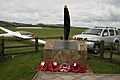
 RAF Milfield memorial - panoramio.jpg 3,888 × 2,592; 3.94 MB
-
 Reconstructed Henge - panoramio.jpg 3,888 × 2,592; 4.54 MB
-
 Reconstructed henge house - panoramio.jpg 3,888 × 2,592; 4.72 MB
-
 Reconstructed Henge. - panoramio.jpg 3,888 × 2,592; 4.89 MB
-
 Regent's Park - panoramio.jpg 1,024 × 768; 429 KB
-
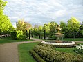
 Regent's Park in May - panoramio.jpg 1,024 × 768; 337 KB
-
 Replica Henge House. - panoramio.jpg 3,888 × 2,592; 5.16 MB
-
 Rising Sun, Tarporley.jpg 640 × 426; 80 KB
-
 Royal Blue coach 1228 (HOD 30), 2 May 2010.jpg 550 × 680; 276 KB
-
 Royal Blue coach 2200 (OTT 43), 2 May 2010.jpg 520 × 430; 206 KB
-
 Rural view near Mannings Heath (geograph 1864038).jpg 640 × 430; 119 KB
-
 Scheibe SF-25c Falke at milfield 2nd May 2010. - panoramio.jpg 2,816 × 1,880; 1.56 MB
-
 Scheibe SF-25s Falke G-MILD - panoramio.jpg 2,816 × 1,880; 1.75 MB
-
 Sedgwick Lane- south (geograph 1861437).jpg 640 × 430; 137 KB
-
 Sedgwick Park (geograph 1861493).jpg 640 × 430; 110 KB
-
 Sedgwick Park gate entrance (geograph 1861471).jpg 640 × 430; 155 KB
-
 Sedgwick sign, Sedgwick Lane (Geograph 1861446 by Nigel Chadwick).jpg 640 × 430; 112 KB
-
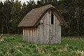
 Shed, The Recreation Ground, Mannings Heath (geograph 1864604).jpg 640 × 365; 89 KB
-
 Slingsby Vega at Milfield 2nd May 2010 - 91.jpg 3,888 × 2,592; 2.68 MB
-
 Slingsby Vega at Milfield borders gliding club 093.jpg 2,816 × 1,880; 1.37 MB
-
 Spring Wood (geograph 1862698).jpg 640 × 430; 198 KB
-
 St Andrews Church, Nuthurst (geograph 1862231).jpg 640 × 430; 169 KB
-
 St Anne's Library - geograph.org.uk - 1838071.jpg 640 × 480; 166 KB
-
 St Martin's Church In Cwmyoy.jpg 3,458 × 1,729; 1.66 MB
-
-
 Stile at a footpath junction, Mannings Heath (geograph 1864068).jpg 640 × 430; 183 KB
-
 Taunton station - J Wood 20 (EVD406).jpg 1,024 × 768; 245 KB
-
 Tawny Owl (4570449055).jpg 2,608 × 2,800; 4.26 MB
-
 The end of Nuthurst Rd, Monks Gate (geograph 1863968).jpg 640 × 430; 148 KB
-
-
 The Old Technical College - geograph.org.uk - 1846483.jpg 640 × 506; 123 KB
-
 The Recreation Ground, Mannings Heath (geograph 1864611).jpg 640 × 430; 128 KB
-

-

-
-

-

-
-

-

-

-

-

-

-

-

-
-

-
 Village sign and Water trough, Mannings Heath (geograph 1864184).jpg 640 × 430; 173 KB
-
 White Faced Scops owl (4571082914).jpg 2,184 × 2,968; 3.86 MB
-
 WHR & FR May 2010 465.JPG 2,642 × 3,674; 1.33 MB
-
 WHR & FR May 2010 483.JPG 4,000 × 3,000; 3 MB
.jpg)
.jpg)
.jpg)
.jpg)

.jpg)
.jpg)
-geograph-1875884.jpg)
.jpg)
.jpg)

.jpg)

.jpg)


.jpg)
.jpg)


.jpg)


-geograph-1875891.jpg)
.jpg)

.jpg)
.jpg)
.jpg)
.jpg)
.jpg)
.jpg)
.jpg)
.jpg)


.jpg)
.jpg)
.jpg)
.jpg)

.jpg)


.jpg)
.jpg)

.jpg)
.jpg)

_upper_saloon.jpg)


.jpg)


.jpg)


.jpg)


.jpg)


.jpg)
.jpg)
.jpg)
.jpg)
.jpg)
.jpg)
.jpg)

.jpg)
.jpg)
.jpg)
.jpg)

.jpg)
.jpg)
.jpg)


.jpg)
.jpg)


,_2_May_2010.jpg)
,_2_May_2010.jpg)
.jpg)


.jpg)
.jpg)
.jpg)
.jpg)
.jpg)


.jpg)
.jpg)


.jpg)
.jpg)
.jpg)
.jpg)
_(4577453018).jpg)

.jpg)

_(4582151499).jpg)
_(4582151999).jpg)
_(4582152403).jpg)
_(4582152801).jpg)
_(4582154271).jpg)
_(4582154757).jpg)
_(4582155681).jpg)
_(4582779964)_(2).jpg)
_(4582780396)_(2).jpg)
_(4582782770).jpg)
_(4582783210).jpg)
_(4582784572).jpg)
_(4582796840).jpg)
_(4582797468).jpg)
_(4582798762).jpg)
.jpg)
.jpg)

