Category:United Kingdom photographs taken on 2010-04-16
Jump to navigation
Jump to search
Countries of Europe: Austria · Belarus · Belgium · Croatia · Czech Republic · Denmark · Finland · France‡ · Georgia‡ · Germany · Greece · Hungary · Italy · Latvia · Liechtenstein · Lithuania · Luxembourg · Netherlands‡ · Norway · Poland · Russia‡ · Serbia · Slovakia · Spain‡ · Sweden · Switzerland · Turkey‡ · Ukraine · United Kingdom
‡: partly located in Europe
‡: partly located in Europe
| ← | 16 April 2010 | → | ||
| ← | April 2010 | → | ||

United Kingdom photographs taken on 16 April 2010.
Image files should be categorized here automatically using {{taken on}} template. Direct categorisation is also possible, if automatic is impossible.
Subcategories
This category has only the following subcategory.
Media in category "United Kingdom photographs taken on 2010-04-16"
The following 168 files are in this category, out of 168 total.
-
 1229190-Portchester Castle (2).JPG 4,027 × 2,661; 7.63 MB
-
 1229190-Portchester Castle (3).JPG 4,064 × 2,720; 7.32 MB
-
 1229190-Portchester Castle (7).JPG 4,058 × 2,805; 7.67 MB
-
 1229190-Portchester Castle.JPG 4,272 × 2,848; 7.9 MB
-
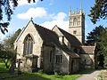
 1339235-Church of St Mary (2).JPG 4,272 × 2,848; 8.59 MB
-
 1339235-Church of St Mary (3).jpg 4,151 × 3,577; 6.24 MB
-
 1339235-Church of St Mary.JPG 3,986 × 2,827; 6.7 MB
-
 144013 at Heysham Port (1).jpg 1,944 × 1,296; 993 KB
-
 144013 at Heysham Port.jpg 1,944 × 1,296; 1,002 KB
-
 144013 at Lancaster.jpg 1,944 × 1,296; 934 KB
-
 168-003 Chiltern hatton Bank (26347887828).jpg 3,504 × 2,336; 2.15 MB
-
 5043 Hatton Bank (7) (39322536315).jpg 3,504 × 2,336; 2.13 MB
-
 66142 , Oakerthorpe (4525932633).jpg 5,169 × 2,546; 2.74 MB
-
 66729 , Tupton (4526201081).jpg 2,500 × 1,274; 974 KB
-
 Andrena (Euandrena) bicolor - Gwynne's mining bee - Flickr - S. Rae.jpg 1,674 × 1,377; 1.14 MB
-
 Antari (4535357092).jpg 4,182 × 2,376; 4.34 MB
-
 Armaments display at RAF Tain.jpg 640 × 480; 154 KB
-
 Arrivals board, Heathrow T5, April 16 2010, crop.JPG 1,584 × 2,023; 809 KB
-
 Ashfield Railway Station - geograph.org.uk - 1810056.jpg 2,272 × 1,704; 847 KB
-
 Audley End - panoramio (1).jpg 3,072 × 2,304; 1.45 MB
-
 Audley End - panoramio.jpg 3,072 × 2,304; 1.53 MB
-
 Audley End over River Cam - panoramio.jpg 3,072 × 2,304; 1.46 MB
-
 Audley End West Front - panoramio.jpg 3,072 × 2,304; 1.04 MB
-
 BA planes at Heathrow.JPG 5,024 × 1,200; 1.46 MB
-
 Balancing act - geograph.org.uk - 1811812.jpg 640 × 480; 146 KB
-
 Billy no mates.jpg 446 × 480; 32 KB
-
 Black Knight Rocket (4538394732).jpg 1,629 × 4,297; 3.45 MB
-
 Boulton and Watt Steam Engine 1786 (4537762717).jpg 2,784 × 4,356; 5.68 MB
-
 Bradford Industrial Museum entrance-1000.jpg 1,000 × 656; 186 KB
-
 Bridge at Audley End - panoramio.jpg 3,072 × 2,304; 2.27 MB
-
 Broadmead Brook at Nettleton Bottom. - panoramio.jpg 2,816 × 2,112; 3.47 MB
-
 BW Hugin (4534729177).jpg 4,155 × 2,455; 3.64 MB
-
 Camera obscura Edinburgh 2 (4550205909).jpg 3,193 × 4,680; 7.43 MB
-
 Church Hill, Grange over Sands - geograph.org.uk - 1835284.jpg 1,000 × 734; 293 KB
-
 Clay serpent (4538385230).jpg 3,996 × 3,156; 7.19 MB
-
 CobblestonsInLondon.jpg 1,536 × 2,048; 1,009 KB
-
 Colourful recycling point - geograph.org.uk - 1808075.jpg 800 × 600; 212 KB
-
 Colourful tank target at RAF Tain.jpg 640 × 480; 109 KB
-
 Control tower at RAF Tain bombing range.jpg 640 × 480; 115 KB
-
 Corpse Entrance. - geograph.org.uk - 1822587.jpg 2,882 × 2,606; 3.14 MB
-
 Courtyard Royal Mile Edinburgh (4537851291).jpg 3,191 × 4,254; 7.7 MB
-
 Cross Country Voyager Hatton Bank (2) (40783440401).jpg 3,504 × 2,336; 1.89 MB
-
 Dalby Forest - panoramio (1).jpg 666 × 1,000; 794 KB
-
 Dalby Forest - panoramio.jpg 666 × 1,000; 229 KB
-
 Dane End Farm (4530512725).jpg 2,272 × 1,704; 828 KB
-
 Dell Spring (4531131094).jpg 2,640 × 1,980; 1.62 MB
-
 Demolition Art Edinburgh (4537842163).jpg 4,032 × 1,770; 4.8 MB
-
 Double Meridian , Oakerthorpe (4532009737).jpg 2,800 × 1,867; 953 KB
-
 Earby Post Office - geograph.org.uk - 1808414.jpg 2,470 × 1,853; 646 KB
-
 Edinburgh (4550202001).jpg 3,144 × 4,528; 6.91 MB
-
 Edinburgh Castle Night (4536005722).jpg 4,602 × 2,536; 3.52 MB
-
 Eglwys Cynhaearn, Ynyscynhaearn - geograph.org.uk - 1818524.jpg 892 × 1,024; 233 KB
-
 Eider Ducks (4535666092).jpg 720 × 966; 617 KB
-
 Ellesmere locomotive of 1861 (1).jpg 4,068 × 2,988; 7.55 MB
-
 Ellesmere locomotive of 1861 (2).jpg 2,628 × 2,562; 3.73 MB
-
 Ellesmere locomotive of 1861.jpg 3,648 × 3,078; 7.41 MB
-
 Engine in motion 1786 (4538388002).jpg 3,000 × 2,364; 3.62 MB
-
 Englefield House - geograph.org.uk - 1824880.jpg 640 × 426; 114 KB
-
 Eudasyphora - Flickr - S. Rae (3).jpg 1,497 × 1,191; 1.07 MB
-
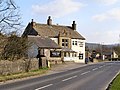
 Fleece Inn, Skipton.jpg 2,213 × 1,660; 464 KB
-
 Flight Formation (4529513164).jpg 2,953 × 1,965; 420 KB
-
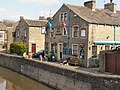
 Former canal wharf, Calne - geograph.org.uk - 1856628.jpg 800 × 602; 154 KB
-
 Forth Belle (4535254234).jpg 4,068 × 2,928; 6.06 MB
-
 Forth Rail Bridge 1 (4535846738).jpg 15,780 × 2,222; 19.78 MB
-
 Forth Rail Bridge 2 (4535811172).jpg 4,752 × 3,168; 5.88 MB
-
 Forth Rail Bridge 3 (4535199055).jpg 4,695 × 2,851; 7.09 MB
-
 Forth Rail Bridge 4 (4535184557).jpg 4,752 × 3,168; 6.96 MB
-
 Forth Rail Bridge 5 (4535213331).jpg 4,440 × 2,970; 7.42 MB
-
 Forth Rail Bridge 6 (4535839634).jpg 2,839 × 4,496; 7.36 MB
-
 Forth Rail Bridge 7 (4555994254).jpg 4,596 × 2,767; 8.27 MB
-
 Forth Rail Bridge 8 (4555347481).jpg 4,614 × 2,977; 7.95 MB
-
 Forth Rail Bridge 9 (4555987032).jpg 3,168 × 4,752; 10.38 MB
-
 Forth Road Bridge 1 (4535710336).jpg 3,168 × 4,752; 7.24 MB
-
 Forth Road Bridge 2 (4535081899).jpg 2,956 × 4,539; 5.77 MB
-
 Forth Road Bridge 3 (4535720282).jpg 4,236 × 3,168; 5.98 MB
-
 Forth Road Bridge 4.jpg 2,208 × 3,448; 5.5 MB
-
 Forth Road Bridge 5 (4535100283).jpg 3,046 × 4,264; 7.49 MB
-
 Forth Road Bridge 6 (4550211943).jpg 7,157 × 2,403; 10.22 MB
-
 Gladstones Land Golden Hawk 1 (4530215559).jpg 2,778 × 2,664; 4.61 MB
-
 Green Tower, Red Bus - geograph.org.uk - 2059521.jpg 1,892 × 1,446; 503 KB
-
 High fencing - Thorford Park - geograph.org.uk - 1818673.jpg 640 × 480; 105 KB
-
 Highland Pioneer.jpg 1,944 × 1,296; 1.05 MB
-
 Hopetoun Tug (4535298626).jpg 3,987 × 2,665; 6.22 MB
-
 House Hans Adolf Krebs.jpg 2,109 × 1,840; 1 MB
-
 Inchcolm Abbey Firth of Forth 1 (4534896123).jpg 4,323 × 2,587; 6.01 MB
-
 Inchcolm Abbey Firth of Forth 2 (4535572494).jpg 4,752 × 3,168; 8.28 MB
-
 Inchmickery (4535494704).jpg 3,681 × 2,293; 4.1 MB
-
 James Street, Nuncargate - geograph.org.uk - 1829581.jpg 640 × 479; 63 KB
-
 Lego Forth Rail Bridge (4535825492).jpg 4,752 × 3,168; 8.05 MB
-
 Ford and Footbridge at Little Bytham (geograph 1827185).jpg 3,872 × 2,592; 2.37 MB
-
 Loch nan Tunnag.jpg 640 × 480; 107 KB
-
 Metal figure National Museum (4538380016).jpg 4,332 × 3,084; 8.02 MB
-
 Mill Roundabout - Geograph-1807828-by-M-J-Richardson.jpg 1,024 × 768; 108 KB
-
 MindTheGap.jpg 2,048 × 1,536; 878 KB
-
 Moritz Schulte (4535333018).jpg 3,342 × 2,070; 2.97 MB
-
 Moritz Schulte 2 (4534678395).jpg 4,437 × 2,429; 4.63 MB
-
 Netherend Stores - geograph.org.uk - 1809721.jpg 640 × 480; 218 KB
-
 Observation tower in RAF Tain bombing range (geograph 1814686).jpg 640 × 481; 149 KB
-
 Oystercatchers and Eider Ducks (4535032571).jpg 2,768 × 1,636; 2.36 MB
-
 Pamber Priory Church - geograph.org.uk - 1822677.jpg 426 × 640; 112 KB
-
 Parish Church of Saint Paul, Grange over Sands.jpg 1,000 × 660; 266 KB
-
 Pentrefelin, Gwynedd 1822837.jpg 1,024 × 612; 201 KB
-
 RAF Tain bombing range (geograph 1811861).jpg 640 × 480; 146 KB
-
 RAF Tain bombing range (geograph 1811873).jpg 640 × 480; 105 KB
-
 RAF Tain bombing range (geograph 1814655).jpg 640 × 480; 152 KB
-
 RAF Tain bombing range (geograph 1814659).jpg 640 × 480; 122 KB
-
 RAF Tain bombing range.jpg 640 × 481; 131 KB
-
 Rectory, Simonburn - geograph.org.uk - 1822605.jpg 3,648 × 2,736; 5.62 MB
-
 Rock formation at millstone edge derbyshire - panoramio.jpg 3,888 × 2,592; 2.66 MB
-
 Rose and Crown, Skipton.jpg 2,326 × 1,745; 785 KB
-

-
 Sailing Boat (4535484994).jpg 3,364 × 2,396; 4.45 MB
-
 Scott Memorial at night (4536014302).jpg 2,265 × 2,913; 1.66 MB
-
 Scott Monument night 2 (4526888588).jpg 3,192 × 3,000; 3.61 MB
-
 Scottish National Museum 1 (4537773123).jpg 4,110 × 3,118; 5.28 MB
-
 Scottish National Museum 2 (4538408132).jpg 3,168 × 4,752; 6.95 MB
-
 Scottish National Museum 3 (4537783295).jpg 2,901 × 4,505; 6.06 MB
-
 Scottish National Museum 4 (4538419258).jpg 4,752 × 3,156; 8.39 MB
-
 Scottish National Museum 5 (4537799895).jpg 4,752 × 3,168; 6.78 MB
-
 Scottish National Museum 6 (4537795123).jpg 3,168 × 4,752; 7.49 MB
-
 Scottish National Museum 7 (4537803797).jpg 3,804 × 3,138; 5.51 MB
-
 Scottish National Museum 8 (4538438484).jpg 3,168 × 4,752; 7.47 MB
-
 Scottish National Museum 9 (4538443246).jpg 3,168 × 4,752; 7.24 MB
-
 Scottish National Museum Roof old building (4537820507).jpg 3,168 × 4,752; 10.29 MB
-
 Scottish National Museum Roof old building 2 (4538458194).jpg 4,266 × 3,168; 10.51 MB
-
 Seagull 1 (4535030447).jpg 2,292 × 1,680; 1.24 MB
-
 Seagull 2 (4535035071).jpg 2,820 × 1,986; 1.98 MB
-
 Shadwell station East London Line north entrance pre-open April2010.jpg 2,592 × 1,944; 1.19 MB
-
 Skipton Bus Station - geograph.org.uk - 1808831.jpg 2,551 × 1,914; 691 KB
-
 Skipton War Memorial.jpg 2,400 × 1,800; 979 KB
-
 SKS Tugela (4535374074).jpg 3,876 × 2,064; 3.25 MB
-
 Sky Sports TV in Brentford - panoramio.jpg 3,648 × 2,736; 3.49 MB
-
 Sky TV Offices at Brentford - panoramio.jpg 3,648 × 2,736; 3.56 MB
-
 St Cuthbert's Parish Church, Elsdon - geograph.org.uk - 1809663.jpg 1,024 × 768; 276 KB
-
 St Cuthbert's Parish Church, Elsdon - geograph.org.uk - 1820406.jpg 1,024 × 768; 253 KB
-
 St. Margaret's. Yatton Keynell. - panoramio.jpg 2,816 × 2,112; 3.19 MB
-
 St. Mungo's Church, Simonburn - geograph.org.uk - 1820025.jpg 3,501 × 2,618; 2.99 MB
-
 St. Mungo's Church, Simonburn - geograph.org.uk - 1822550.jpg 2,213 × 1,667; 1.46 MB
-
 St. Mungo's Church, Simonburn - geograph.org.uk - 1822570.jpg 2,366 × 3,507; 2.8 MB
-
 Stables at Audley End - panoramio.jpg 3,072 × 2,304; 1.7 MB
-
 Target vehicles at RAF Tain bombing range.jpg 640 × 481; 154 KB
-
 Targets at RAF Tain bombing range.jpg 640 × 480; 129 KB
-
 Thatcham Nature Discovery Centre - geograph.org.uk - 1808052.jpg 800 × 600; 93 KB
-
 The Craven, Skipton.jpg 2,652 × 1,989; 741 KB
-
 The Forest tram stop (geograph 1811197).jpg 800 × 600; 131 KB
-

-

-

-
 The Punch Bowl - geograph.org.uk - 1808481.jpg 2,349 × 1,762; 712 KB
-
 The Royal Shepherd, Skipton.jpg 2,816 × 2,112; 1.11 MB
-
 The Wheatsheaf, Oxford Road, Calne - geograph.org.uk - 1856534.jpg 800 × 530; 95 KB
-
 Train Redland 2010 - Flickr - Greater Bristol Metro Rail.jpg 1,654 × 1,045; 1.72 MB
-
 Tugs (4535280128).jpg 4,521 × 2,893; 6.74 MB
-
 Tugs 2 (4534655057).jpg 3,732 × 2,736; 4.3 MB
-
 Tyrrell Ford Engine (4538349280).jpg 2,896 × 3,760; 5.15 MB
-
 Underground eruption notice.JPG 1,532 × 2,156; 1.51 MB
-
 Wardrops Court Dragons (4538476638).jpg 4,341 × 2,733; 6.02 MB
-
 Warning notice at RAF Tain bombing range.jpg 640 × 480; 146 KB
-
 Warren's Green (4530511299).jpg 2,317 × 1,736; 730 KB
-
 Warrens Green Farm (4530499563).jpg 2,309 × 1,737; 706 KB
-
 Warrens Green Farm (4530510545).jpg 2,221 × 1,664; 931 KB
-
 Waverley Station Roof Night (4536012240).jpg 4,752 × 3,030; 6.81 MB
-
 Weather vane by Harringworth Lodge (geograph 1834788).jpg 2,736 × 3,648; 2.14 MB
-
 What is this? (It's coal fungus!) (4534550852).jpg 1,980 × 2,640; 1.05 MB
-
 Whimsical targets at RAF Tain.jpg 640 × 480; 148 KB
-
 Wierd sunset produced by the iceland ash cloud in april 2010 - panoramio.jpg 3,888 × 2,592; 1.95 MB
-
 Wylam Dilly Locomotive circa 1815 (1).jpg 3,040 × 4,544; 7.04 MB
-
 Wylam Dilly Locomotive circa 1815.jpg 4,261 × 3,917; 7.57 MB
.JPG)
.JPG)
.JPG)

.JPG)
.jpg)

.jpg)


.jpg)
_(39322536315).jpg)
.jpg)
.jpg)
_bicolor_-_Gwynne%27s_mining_bee_-_Flickr_-_S._Rae.jpg)
.jpg)


.jpg)


.jpg)


.jpg)
.jpg)

.jpg)


.jpg)
_(40783440401).jpg)
.jpg)

.jpg)
.jpg)
.jpg)
.jpg)

.jpg)
.jpg)

.jpg)
.jpg)
.jpg)

.jpg)

.jpg)

.jpg)

.jpg)
.jpg)
.jpg)
.jpg)
.jpg)
.jpg)
.jpg)
.jpg)
.jpg)
.jpg)
.jpg)
.jpg)

.jpg)
.jpg)


.jpg)

.jpg)
.jpg)
.jpg)

.jpg)
.jpg)

.jpg)


.jpg)
.jpg)

.jpg)
.jpg)


.jpg)
.jpg)
.jpg)
.jpg)


.jpg)
.jpg)
.jpg)
.jpg)
.jpg)
.jpg)
.jpg)
.jpg)
.jpg)
.jpg)
.jpg)
.jpg)
.jpg)
.jpg)
.jpg)
.jpg)


.jpg)


.jpg)


.jpg)
.jpg)
.jpg)

.jpg)

.jpg)
.jpg)
.jpg)
.jpg)
.jpg)
_(4534550852).jpg)


.jpg)

.jpg)
.jpg)
.jpg)