Category:United Kingdom photographs taken on 2010-03-14
Jump to navigation
Jump to search
Countries of Europe: Austria · Belgium · Croatia · Czech Republic · Estonia · Finland · France‡ · Germany · Greece · Hungary · Republic of Ireland · Italy · Latvia · Lithuania · Luxembourg · Netherlands‡ · Norway · Poland · Portugal‡ · Romania · Russia‡ · Spain‡ · Sweden · Turkey‡ · Ukraine · United Kingdom
‡: partly located in Europe
‡: partly located in Europe
| ← | 14 March 2010 | → | ||
| ← | March 2010 | → | ||

United Kingdom photographs taken on 14 March 2010.
Image files should be categorized here automatically using {{taken on}} template. Direct categorisation is also possible, if automatic is impossible.
Subcategories
This category has the following 2 subcategories, out of 2 total.
Media in category "United Kingdom photographs taken on 2010-03-14"
The following 200 files are in this category, out of 1,333 total.
(previous page) (next page)-
 'The Dolphin' - Old Plymouth Breweries livery - geograph.org.uk - 1755538.jpg 1,200 × 1,600; 424 KB
-

-
 A cycle route at Tweedside - geograph.org.uk - 1756638.jpg 640 × 427; 154 KB
-
 A ford on Ryknield Street - geograph.org.uk - 1755114.jpg 640 × 480; 81 KB
-
 A Milestone - geograph.org.uk - 1753518.jpg 667 × 1,000; 130 KB
-
 A new house on Musgrave Road - panoramio.jpg 3,072 × 2,304; 1.84 MB
-
 A new track through Reedham station - geograph.org.uk - 1754214.jpg 640 × 480; 136 KB
-
 A path across the heath in Sutton Park - geograph.org.uk - 1755126.jpg 640 × 480; 140 KB
-
 A view of North Cave Wetlands - geograph.org.uk - 1754255.jpg 640 × 480; 315 KB
-
 A1 at Barton - geograph.org.uk - 1752635.jpg 3,264 × 2,448; 1.62 MB
-
 A40 heading towards Abergavenny - geograph.org.uk - 1753979.jpg 640 × 447; 101 KB
-
 A6097 to Doncaster - geograph.org.uk - 1758866.jpg 640 × 480; 73 KB
-
 A614 approaching Red Hill Roundabout - geograph.org.uk - 1760116.jpg 640 × 480; 65 KB
-
 A614 towards Nottingham - geograph.org.uk - 1760112.jpg 640 × 480; 62 KB
-
 A65, Long Preston - geograph.org.uk - 1753731.jpg 640 × 480; 111 KB
-
 Admiral Nelson - Manchester Road - geograph.org.uk - 1753907.jpg 640 × 480; 66 KB
-
 Afon Eiddew - geograph.org.uk - 1754480.jpg 3,648 × 2,736; 5.1 MB
-
 Aisgill Viaduct - geograph.org.uk - 1754593.jpg 3,648 × 2,736; 1.79 MB
-
 All Saints' church spire - geograph.org.uk - 1755095.jpg 640 × 426; 95 KB
-
 All's quiet in Upper Nut Hurst - geograph.org.uk - 1755297.jpg 640 × 480; 135 KB
-
 Alureds Barn - geograph.org.uk - 1752159.jpg 1,600 × 1,061; 382 KB
-
 An old road at Selkirk - geograph.org.uk - 1756849.jpg 640 × 427; 147 KB
-
 And Another Wade Bridge - geograph.org.uk - 1753509.jpg 1,000 × 667; 137 KB
-
 Angel telecom - Rooley Avenue - geograph.org.uk - 1752713.jpg 640 × 480; 67 KB
-
 Angerton Hall - geograph.org.uk - 1752893.jpg 1,024 × 784; 291 KB
-
 Another Milestone - geograph.org.uk - 1754658.jpg 1,000 × 667; 192 KB
-
 Another view of Blackroot Pool - geograph.org.uk - 1755305.jpg 619 × 453; 104 KB
-
 Another Wade Bridge - geograph.org.uk - 1753504.jpg 640 × 427; 83 KB
-
 Ant hills on Brockeridge Common - geograph.org.uk - 1757230.jpg 4,191 × 2,719; 7.66 MB
-
 Anti Tank Pimples, Coast Road - geograph.org.uk - 1757907.jpg 768 × 1,024; 208 KB
-
-
 Approaching Giant's Seat - geograph.org.uk - 1753566.jpg 2,816 × 2,112; 1.6 MB
-
 Approaching level crossing no 38 - geograph.org.uk - 1754184.jpg 640 × 480; 127 KB
-
 Aqua Restaurant, St George Wharf, Vauxhall - geograph.org.uk - 1752532.jpg 3,264 × 2,448; 2.63 MB
-
 Aqueduct from the A9 - geograph.org.uk - 1753453.jpg 1,000 × 667; 109 KB
-

-
 Arrow slit window - geograph.org.uk - 1759459.jpg 427 × 640; 43 KB
-
 Holy Trinity Church, Arrow - geograph.org.uk - 1752938.jpg 6,048 × 4,032; 1.69 MB
-
 Attractive setting - geograph.org.uk - 1752923.jpg 6,048 × 4,032; 1.69 MB
-
 B 5 Hair Salon - Manchester Road - geograph.org.uk - 1752940.jpg 457 × 640; 80 KB
-
 B and U Takeaway - Manchester Road - geograph.org.uk - 1753918.jpg 444 × 640; 70 KB
-
 B T Doors - Manchester Road - geograph.org.uk - 1752726.jpg 640 × 490; 91 KB
-
 B4329 south of Bwlch-gwynt - geograph.org.uk - 1753634.jpg 2,400 × 1,577; 834 KB
-
 B4329 south of Bwlch-gwynt - geograph.org.uk - 1753639.jpg 2,400 × 1,600; 1.01 MB
-
 B6276 ,Going over Deadman Gill Bridge - geograph.org.uk - 1754646.jpg 3,648 × 2,736; 1.74 MB
-
 B6386 - geograph.org.uk - 1759538.jpg 640 × 480; 81 KB
-
 B6386 Nottingham Road - geograph.org.uk - 1759511.jpg 640 × 480; 114 KB
-
 B6386 Oxton Road - geograph.org.uk - 1759453.jpg 640 × 480; 110 KB
-
 B6386 Oxton Road - geograph.org.uk - 1759466.jpg 640 × 480; 63 KB
-
 B6386 Oxton Road - geograph.org.uk - 1759492.jpg 640 × 480; 71 KB
-
 B6386 Southwell Road - geograph.org.uk - 1759571.jpg 640 × 480; 106 KB
-
 B6386 Southwell Road - geograph.org.uk - 1759579.jpg 640 × 480; 92 KB
-
 B6386 towards Southwell - geograph.org.uk - 1759547.jpg 640 × 480; 99 KB
-
 B6386 towards Southwell - geograph.org.uk - 1759557.jpg 640 × 480; 92 KB
-
 B684 towards Arnold - geograph.org.uk - 1758659.jpg 640 × 480; 49 KB
-
 Baad Park - geograph.org.uk - 1763090.jpg 640 × 359; 92 KB
-
 Baad Park - geograph.org.uk - 1763097.jpg 640 × 359; 86 KB
-
 Babylon Pizza - Manchester Road - geograph.org.uk - 1754527.jpg 640 × 502; 87 KB
-
 Back Lane - geograph.org.uk - 1760925.jpg 640 × 480; 94 KB
-
 The Old Chapel, Low Hill, Hawksworth Road - geograph.org.uk - 1773552.jpg 3,072 × 2,304; 2.38 MB
-
 The Potted Meat Stick, Baildon - geograph.org.uk - 1772437.jpg 640 × 480; 54 KB
-
 Baildon Moor - geograph.org.uk - 1773747.jpg 3,072 × 2,304; 2.43 MB
-
 Baildon Moor - geograph.org.uk - 1773757.jpg 640 × 480; 55 KB
-
 Baildon Moor Garage - geograph.org.uk - 1772315.jpg 640 × 480; 47 KB
-
 Baildon Moravian Church - geograph.org.uk - 1772380.jpg 640 × 480; 79 KB
-
-

-

-
 Banham Lock Smith Head Office, Pascal Street, London - geograph.org.uk - 1752559.jpg 3,264 × 2,448; 2.62 MB
-
 Bank Erosion, Riffa Beck - geograph.org.uk - 1756287.jpg 683 × 1,024; 229 KB
-
 Bank Farm cottages from the east - geograph.org.uk - 1757458.jpg 840 × 630; 180 KB
-
 Bank of the River Ouse, Stretham - geograph.org.uk - 1755020.jpg 800 × 600; 141 KB
-
-

-
 Bankwood Farm - geograph.org.uk - 1759608.jpg 640 × 480; 73 KB
-
 Baptist Chapel, Stretham - geograph.org.uk - 1763098.jpg 800 × 600; 157 KB
-
 Baptist Church, Stourbridge - geograph.org.uk - 1773188.jpg 3,072 × 2,304; 2.37 MB
-
 Barn owl in flight - geograph.org.uk - 1752886.jpg 1,622 × 1,217; 824 KB
-
 Barnes Hall Farm - geograph.org.uk - 1757431.jpg 2,560 × 1,920; 1.49 MB
-
 Barton Bridge crosses Barton Brook - geograph.org.uk - 1760801.jpg 640 × 427; 150 KB
-
 Barton Brook - geograph.org.uk - 1759889.jpg 640 × 427; 115 KB
-
 Barton Brook from Barton Bridge, Raglan - geograph.org.uk - 1754394.jpg 427 × 640; 263 KB
-
 Barton on Sea, coast path closed - geograph.org.uk - 1760081.jpg 640 × 480; 73 KB
-

-
 Barton on Sea, newsagent and café - geograph.org.uk - 1760069.jpg 480 × 640; 53 KB
-
 Barton on Sea, postbox № BH25 70 - geograph.org.uk - 1760077.jpg 480 × 640; 63 KB
-
 Beach @ Butlins - geograph.org.uk - 1761990.jpg 4,000 × 3,000; 2.41 MB
-
 Beach huts, Broadsands Beach, near Churston - geograph.org.uk - 1753135.jpg 1,600 × 1,200; 308 KB
-
 Beachlands Way - geograph.org.uk - 1757953.jpg 1,024 × 768; 183 KB
-
 Beanford Lane - geograph.org.uk - 1759524.jpg 640 × 480; 100 KB
-
 Beddington, Aldwick Road - geograph.org.uk - 1754010.jpg 3,456 × 2,304; 5.77 MB
-
 Beddington, Lavington Road - geograph.org.uk - 1754479.jpg 3,456 × 2,304; 5.93 MB
-
 Beddington, Richmond Green - geograph.org.uk - 1754048.jpg 3,456 × 2,304; 7.62 MB
-
 Beddington, Richmond Green - geograph.org.uk - 1754055.jpg 3,456 × 2,304; 7.13 MB
-
 Beddington, River Wandle, looking downstream - geograph.org.uk - 1754033.jpg 3,456 × 2,304; 7.52 MB
-
 Beddington, River Wandle, looking upstream - geograph.org.uk - 1754028.jpg 2,400 × 1,600; 4.8 MB
-
 Beddington, River Wandle, looking west - geograph.org.uk - 1753994.jpg 3,456 × 2,304; 7.75 MB
-
 Beddington, Salcott Road - geograph.org.uk - 1754485.jpg 3,456 × 2,304; 6.58 MB
-
 Beddington, The Wandle Trail - geograph.org.uk - 1753982.jpg 3,456 × 2,304; 7.71 MB
-
 Beddington, The Wandle Trail - geograph.org.uk - 1754015.jpg 3,456 × 2,304; 7.61 MB
-
 Beddington, The Wandle Trail - geograph.org.uk - 1754493.jpg 3,456 × 2,304; 6.92 MB
-
 Bekesbourne village hall on Station Road - geograph.org.uk - 1765130.jpg 640 × 480; 109 KB
-
 Bell Brook Farm - geograph.org.uk - 1753649.jpg 2,048 × 1,536; 1.72 MB
-

-
 Bench Mark, Field Bavant - geograph.org.uk - 1753336.jpg 480 × 640; 214 KB
-
 Bench with a view - geograph.org.uk - 1755239.jpg 1,500 × 967; 191 KB
-
 Bend in the track - geograph.org.uk - 1752644.jpg 640 × 480; 96 KB
-

-
 Bentham from Barrow Wake - geograph.org.uk - 1755258.jpg 1,500 × 1,000; 160 KB
-
 Beside Westwood Coppice - geograph.org.uk - 1755096.jpg 640 × 480; 159 KB
-
 BetFred - Manchester Road - geograph.org.uk - 1752765.jpg 640 × 606; 91 KB
-
 Biggin Lane junction, Biggin - geograph.org.uk - 1759860.jpg 1,024 × 683; 158 KB
-
 Bingley Road, Baildon Moor - geograph.org.uk - 1773728.jpg 3,072 × 2,304; 2.61 MB
-
 Bingley Road, Baildon Moor - geograph.org.uk - 1773736.jpg 640 × 480; 44 KB
-
 Black shale^ exposure near Ashurst Beacon - geograph.org.uk - 1752694.jpg 1,000 × 750; 1.14 MB
-
 Blocked track - geograph.org.uk - 1752660.jpg 640 × 480; 97 KB
-
 Blooms Garden Centre near Prestbury Park - geograph.org.uk - 1753026.jpg 1,600 × 1,200; 239 KB
-
 Boats on the Slipway - geograph.org.uk - 1761230.jpg 1,024 × 682; 209 KB
-
 Bolton Road Bridge - geograph.org.uk - 1753760.jpg 2,816 × 2,112; 1.95 MB
-
 Bonner Hill, Calverton - geograph.org.uk - 1758895.jpg 640 × 480; 56 KB
-
 Bread Street and the Cathedral of All Saints - geograph.org.uk - 1753373.jpg 1,920 × 2,560; 897 KB
-
 Bridge 1236 at Reedham station - geograph.org.uk - 1754207.jpg 480 × 640; 139 KB
-
 Bridge at Kearsley Station - geograph.org.uk - 1753750.jpg 2,374 × 1,781; 959 KB
-
 Bridge at Londonderry Wharf, Keynsham - geograph.org.uk - 1754022.jpg 1,024 × 766; 456 KB
-
 Bridge on Ellenwhorne Lane - geograph.org.uk - 1752113.jpg 1,024 × 679; 332 KB
-
 Bridge over River Garry - geograph.org.uk - 1753475.jpg 1,000 × 667; 122 KB
-
 Bridge over the railway - geograph.org.uk - 1753479.jpg 1,000 × 667; 132 KB
-
 Bridleway alongside West Moor Wood - geograph.org.uk - 1753374.jpg 1,024 × 768; 250 KB
-
 Bridleway Gate - geograph.org.uk - 1756253.jpg 1,024 × 683; 196 KB
-
 Bridleway junction, Lustleigh Cleave - geograph.org.uk - 1762332.jpg 640 × 480; 165 KB
-
 Bridleway near Eastwood Farm - geograph.org.uk - 1758711.jpg 640 × 480; 87 KB
-
 Bridleway near Hagg Cottage - geograph.org.uk - 1758821.jpg 640 × 480; 102 KB
-
 Bridleway near Lambley House - geograph.org.uk - 1758663.jpg 640 × 480; 127 KB
-
 Bridleway near Stainburn - geograph.org.uk - 1756245.jpg 1,024 × 683; 234 KB
-
 Bridleway on line of Devil's Causeway - geograph.org.uk - 1753303.jpg 1,024 × 768; 229 KB
-

-
 Bridleway on Lustleigh Cleave - geograph.org.uk - 1762243.jpg 480 × 640; 148 KB
-
 Bridleway on Lustleigh Cleave - geograph.org.uk - 1762292.jpg 640 × 480; 131 KB
-
 Bridleway on Lustleigh Cleave - geograph.org.uk - 1762506.jpg 480 × 640; 159 KB
-
 Bridleway to Hagg Farm - geograph.org.uk - 1758832.jpg 640 × 480; 130 KB
-
 Bridleway to Lowdham - geograph.org.uk - 1758671.jpg 640 × 480; 81 KB
-
 Bridleway to Lowdham - geograph.org.uk - 1758674.jpg 640 × 480; 73 KB
-
 Bridleway to Manor Farm - geograph.org.uk - 1758668.jpg 640 × 480; 86 KB
-
 Bridleway to Thurgarton - geograph.org.uk - 1759593.jpg 640 × 480; 94 KB
-
 Bridleway to Thurgarton - geograph.org.uk - 1759596.jpg 640 × 480; 75 KB
-
 Bridleway to Thurgarton - geograph.org.uk - 1759611.jpg 640 × 480; 69 KB
-
 Bridleway to Thurgarton - geograph.org.uk - 1759619.jpg 640 × 480; 81 KB
-
 Bridleway to Thurgarton - geograph.org.uk - 1759625.jpg 640 × 480; 81 KB
-
 Brixham Rugby Club - geograph.org.uk - 1754074.jpg 1,600 × 1,207; 396 KB
-
 Broadwalk, Caerleon - geograph.org.uk - 1754087.jpg 640 × 498; 67 KB
-
 Bronze statue "Field Gunner" - geograph.org.uk - 1753069.jpg 900 × 585; 230 KB
-
 Brough Castle - geograph.org.uk - 1754599.jpg 3,648 × 2,736; 1.67 MB
-
 Brough Castle - geograph.org.uk - 1754602.jpg 3,648 × 2,736; 1.84 MB
-
 Brough Castle, Clifford's Tower - geograph.org.uk - 1754613.jpg 3,648 × 2,736; 1.89 MB
-
 Brough Castle, the keep - geograph.org.uk - 1754620.jpg 3,648 × 2,736; 1.36 MB
-
 Brown Edge Quarries footpath - geograph.org.uk - 1753557.jpg 640 × 480; 149 KB
-
 Bubbles Car Wash - Manchester Road - geograph.org.uk - 1753904.jpg 640 × 412; 47 KB
-
 Direction signs on Bucklebury Common - geograph.org.uk - 1760986.jpg 640 × 480; 132 KB
-
 Bucklebury Common - geograph.org.uk - 1760971.jpg 640 × 461; 95 KB
-
 Buildings at Londonderry Wharf near Keynsham - geograph.org.uk - 1754029.jpg 1,600 × 991; 557 KB
-
 Bullington - Bullington Cross Inn - geograph.org.uk - 1770641.jpg 640 × 480; 67 KB
-
 Bullington - Bullington Cross Inn - geograph.org.uk - 1770652.jpg 640 × 480; 87 KB
-
 Bullington - Bullington Cross Inn - geograph.org.uk - 1770665.jpg 640 × 480; 72 KB
-
 Bullington - Bullington Cross Inn - geograph.org.uk - 1770674.jpg 640 × 480; 91 KB
-
 Bullington - Bullington Cross Inn - geograph.org.uk - 1770685.jpg 640 × 480; 62 KB
-
 Bullington - Bullington Cross Inn - geograph.org.uk - 1770692.jpg 640 × 480; 65 KB
-
 Bullington - Bullington Cross Inn - geograph.org.uk - 1770699.jpg 640 × 480; 106 KB
-
 Burbage Moor - geograph.org.uk - 1753553.jpg 640 × 480; 151 KB
-
 Bus depot - geograph.org.uk - 1798761.jpg 800 × 600; 143 KB
-
 Bust, Madresfield Court - geograph.org.uk - 1765218.jpg 426 × 640; 99 KB
-
 By the Bovey - geograph.org.uk - 1761735.jpg 640 × 480; 131 KB
-
 Byway of the B6386 - geograph.org.uk - 1759460.jpg 640 × 480; 153 KB
-
 Cairns Castle - geograph.org.uk - 1763111.jpg 640 × 359; 77 KB
-
 Calverton Road - geograph.org.uk - 1758654.jpg 640 × 480; 88 KB
-
 Calverton Road, Arnold - geograph.org.uk - 1758652.jpg 640 × 480; 74 KB
-
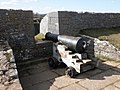 Cannon, on the ramparts, at Berry Head - geograph.org.uk - 1752899.jpg 1,600 × 1,200; 504 KB
-
 Car dealership, Raglan - geograph.org.uk - 1760834.jpg 640 × 460; 98 KB
-
 Car park and approach to Raglan Castle - geograph.org.uk - 1759407.jpg 640 × 427; 110 KB
-
 Car park in Northernhay - geograph.org.uk - 1755462.jpg 640 × 480; 241 KB
-
 Caravans in the forest - geograph.org.uk - 1752599.jpg 640 × 480; 96 KB
-
 Carbinswood Lane - geograph.org.uk - 1760918.jpg 640 × 480; 96 KB
-
 Carved Stone in Riffa Wood - geograph.org.uk - 1756275.jpg 1,024 × 683; 198 KB
-
 Castle Farm, Raglan - geograph.org.uk - 1754477.jpg 640 × 427; 133 KB
-
 Castle Hill, Settle - geograph.org.uk - 1755360.jpg 480 × 640; 73 KB
-
 Castleberg Sports, Cheapside, Settle - geograph.org.uk - 1755354.jpg 480 × 640; 69 KB
-

-
 Cauldstane Slap from Baad Park - geograph.org.uk - 1763092.jpg 640 × 359; 83 KB
-
 Celler Hill - geograph.org.uk - 1756258.jpg 1,024 × 683; 148 KB
-
 Cemetery, Lustleigh - geograph.org.uk - 1763890.jpg 640 × 480; 100 KB
-

-
 Centuries of wear - geograph.org.uk - 1752874.jpg 2,448 × 3,264; 3.01 MB
-

-
 Challeycroft, Milton Street, Higher Brixham - geograph.org.uk - 1754102.jpg 1,600 × 1,311; 300 KB
-
 Chapel Square, Settle - geograph.org.uk - 1755371.jpg 640 × 480; 136 KB
-
 Chapel Street and the Fishermans Memorial - geograph.org.uk - 1768873.jpg 3,010 × 1,693; 2.16 MB
-
 Chapel Street, Stretham - geograph.org.uk - 1763080.jpg 800 × 600; 126 KB
-
 Chapel Street, Stretham - geograph.org.uk - 1763081.jpg 800 × 600; 145 KB
-
 Chaseley Hotel, Queen Street - geograph.org.uk - 1753367.jpg 1,920 × 2,560; 1.25 MB
-
 Cheltenham Racecourse - geograph.org.uk - 1753466.jpg 1,500 × 1,000; 157 KB
-
 Chepstow Road, Raglan - geograph.org.uk - 1754153.jpg 640 × 404; 139 KB


_(1)_-_geograph.org.uk_-_1752787.jpg)
_(2)_-_geograph.org.uk_-_1752818.jpg)


