Category:United Kingdom photographs taken on 2010-02-26
Jump to navigation
Jump to search
Countries of Europe: Austria · Belgium · Czech Republic · Finland · France‡ · Georgia‡ · Germany · Hungary · Republic of Ireland · Italy · Kazakhstan‡ · Malta · Netherlands‡ · Poland · Portugal‡ · Romania · Russia‡ · Serbia · Spain‡ · Sweden · Switzerland · Turkey‡ · Ukraine · United Kingdom
‡: partly located in Europe
‡: partly located in Europe
| ← | 26 February 2010 | → | ||
| ← | February 2010 | → | ||

United Kingdom photographs taken on 26 February 2010.
Image files should be categorized here automatically using {{taken on}} template. Direct categorisation is also possible, if automatic is impossible.
Subcategories
This category has only the following subcategory.
L
Media in category "United Kingdom photographs taken on 2010-02-26"
The following 200 files are in this category, out of 542 total.
(previous page) (next page)-
 100 years of worship - geograph.org.uk - 1728904.jpg 640 × 447; 240 KB
-
 165117 at Royal Oak.jpg 3,648 × 2,736; 3.92 MB
-
 2010 at Dawlish station - inside the waiting room.jpg 1,024 × 768; 136 KB
-
 2010 at Dawlish station - signal box protection.jpg 1,024 × 768; 239 KB
-
 2010 at Templecombe station - footbridge.jpg 1,024 × 768; 266 KB
-
 2010 at Templecombe station - goods shed.jpg 1,024 × 768; 190 KB
-
 2010 at Templecombe station - sun dial half past three.jpg 1,024 × 768; 385 KB
-
 2010 at Templecombe station - waiting room and signal box.jpg 1,024 × 768; 373 KB
-
 2010 at Templecombe station - waiting room interior.jpg 1,024 × 768; 189 KB
-
 6 Park Road - geograph.org.uk - 1726089.jpg 640 × 480; 61 KB
-
 A corner of Findon cemetery - geograph.org.uk - 1726562.jpg 640 × 428; 138 KB
-
 A crow on the beach - geograph.org.uk - 1727197.jpg 640 × 428; 97 KB
-

-
 A Rather Sodden Market Muir, Forfar - geograph.org.uk - 1728133.jpg 640 × 426; 52 KB
-
 A walk on the beach - geograph.org.uk - 1727208.jpg 640 × 428; 107 KB
-
 A wet field above Gappah - geograph.org.uk - 1753916.jpg 640 × 480; 414 KB
-
 A1120 at Sibton - geograph.org.uk - 1726347.jpg 3,072 × 2,304; 1.11 MB
-
 A3072 towards Copplestone - geograph.org.uk - 1727061.jpg 640 × 480; 107 KB
-
 A3400 bridge over River Stour - geograph.org.uk - 1726857.jpg 2,000 × 1,436; 223 KB
-
 A454 Hilton - geograph.org.uk - 1733367.jpg 800 × 600; 116 KB
-
 A48 sweeps out of Newnham - geograph.org.uk - 1729199.jpg 640 × 427; 162 KB
-
 Acer Way, Rogerstone - geograph.org.uk - 1727571.jpg 640 × 424; 59 KB
-
 Agricultural machinery dealer's yard - geograph.org.uk - 1742396.jpg 640 × 480; 373 KB
-
-
 An entrance to Church House Grounds - geograph.org.uk - 1726647.jpg 640 × 428; 154 KB
-
 An island in the Stour - geograph.org.uk - 1727201.jpg 2,000 × 1,355; 256 KB
-
 Angier's Almshouses - geograph.org.uk - 1730810.jpg 1,024 × 768; 161 KB
-
 Anglesey Coast Path - geograph.org.uk - 1742093.jpg 480 × 640; 147 KB
-
 Anglesey Coastal Path - geograph.org.uk - 1742082.jpg 640 × 480; 55 KB
-
 Anglesey Council Offices - geograph.org.uk - 1735063.jpg 640 × 485; 53 KB
-
 Animal feeders, Brockle - geograph.org.uk - 1732829.jpg 640 × 480; 100 KB
-
 Another Ethel Austin bites the dust - geograph.org.uk - 1735093.jpg 640 × 480; 89 KB
-
-
 Approach to Bradney - geograph.org.uk - 1733321.jpg 600 × 800; 133 KB
-

-
 Approach to Spreyton - geograph.org.uk - 1727287.jpg 640 × 480; 96 KB
-
-
 Approaching Trewarlett Cottage - geograph.org.uk - 1732363.jpg 640 × 480; 144 KB
-
-
 Awkward stile, Trewarlett - geograph.org.uk - 1732140.jpg 640 × 480; 149 KB
-
 Babcombe Copse - geograph.org.uk - 1751845.jpg 640 × 480; 422 KB
-
 Back to Mongewell - geograph.org.uk - 1728705.jpg 600 × 800; 173 KB
-
 Backs of new houses in Woodlands - geograph.org.uk - 1750653.jpg 640 × 480; 367 KB
-
 Barn and tree near Landlake Wood - geograph.org.uk - 1732025.jpg 640 × 462; 80 KB
-
 Barn at Larrick - geograph.org.uk - 1731306.jpg 640 × 428; 70 KB
-
 Barton Farm - geograph.org.uk - 1726876.jpg 2,000 × 1,502; 221 KB
-
 Basketball court, West Tarring - geograph.org.uk - 1726664.jpg 640 × 428; 128 KB
-
 Beechwood House, Newport - geograph.org.uk - 1726685.jpg 640 × 480; 131 KB
-
-
 Bench Mark at the almshouses - geograph.org.uk - 1730794.jpg 600 × 800; 148 KB
-
 Bench mark by the gate - geograph.org.uk - 1729721.jpg 1,024 × 768; 318 KB
-
 Bench mark on culvert wall near Aston Tirrold - geograph.org.uk - 1736533.jpg 1,600 × 1,071; 578 KB
-
 Bench Mark on the Milestone - geograph.org.uk - 1730798.jpg 600 × 800; 138 KB
-
 Bench mark under the paint - geograph.org.uk - 1729943.jpg 1,024 × 768; 202 KB
-
 Bench mark, Llanallgo - geograph.org.uk - 1738772.jpg 480 × 640; 89 KB
-
 Benllech sands - geograph.org.uk - 1742102.jpg 640 × 480; 61 KB
-

-

-
 Bittesby-Dismantled Railway - geograph.org.uk - 1726635.jpg 640 × 480; 106 KB
-
 Bittesby-Mere Road - geograph.org.uk - 1726705.jpg 640 × 480; 86 KB
-
 Blue machine on landfill, Sands Copse - geograph.org.uk - 1751874.jpg 640 × 427; 403 KB
-
 Boundary of Heathfield landfill site - geograph.org.uk - 1753936.jpg 640 × 480; 665 KB
-
-
 Bournemouth, Meyrick Park car park - geograph.org.uk - 1728903.jpg 640 × 480; 91 KB
-
 Bowpound Cross - geograph.org.uk - 1727137.jpg 640 × 480; 74 KB
-
 Bradney Hedge Cutting - geograph.org.uk - 1733332.jpg 600 × 800; 172 KB
-
 Bradney Riding Area - geograph.org.uk - 1733342.jpg 800 × 600; 171 KB
-
 Brereton Heath lake - geograph.org.uk - 1726472.jpg 2,048 × 1,536; 761 KB
-
 Bridge across A30, Launceston - geograph.org.uk - 1729515.jpg 640 × 480; 124 KB
-
 Bridge near Linnick Farm - geograph.org.uk - 1731987.jpg 640 × 480; 133 KB
-
 Bridge over Lowley Brook - geograph.org.uk - 1730117.jpg 640 × 480; 117 KB
-
 Bridge over the River Taw at East Rowden - geograph.org.uk - 1726846.jpg 640 × 480; 128 KB
-
 Bridge over the Stour at Wimpstone - geograph.org.uk - 1727415.jpg 2,000 × 1,501; 237 KB
-
 Bridleway to Ettington Park - geograph.org.uk - 1726777.jpg 2,000 × 1,502; 258 KB
-
 Bridleway to Goldicote Cutting - geograph.org.uk - 1726793.jpg 2,000 × 1,504; 256 KB
-
 Bridleway to Newnham Murren - geograph.org.uk - 1729830.jpg 1,024 × 768; 278 KB
-
 Broken window - geograph.org.uk - 1727494.jpg 427 × 640; 238 KB
-
 Broom Close, Rogerstone - geograph.org.uk - 1727558.jpg 640 × 549; 83 KB
-
 BT telephone exchange, Malpas, Newport - geograph.org.uk - 1727004.jpg 640 × 500; 104 KB
-
 Bungalows on Risca Road, Rogerstone - geograph.org.uk - 1727275.jpg 640 × 480; 67 KB
-
 Bus route 1 at the bus stop - geograph.org.uk - 1726573.jpg 640 × 428; 112 KB
-
 Bus stop by the A48 - geograph.org.uk - 1727238.jpg 640 × 427; 97 KB
-
 Camellia Avenue, Rogerstone - geograph.org.uk - 1727599.jpg 640 × 445; 56 KB
-
 Capitol House (4390755366).jpg 3,168 × 4,752; 6.3 MB
-

-
 Catkins and trolleys - geograph.org.uk - 1726515.jpg 2,048 × 1,536; 738 KB
-
-
 Children's Corner, Durrington cemetery - geograph.org.uk - 1726606.jpg 640 × 428; 136 KB
-
 Chimes, Pimlico, SW1 (4588775952).jpg 2,039 × 3,058; 2.38 MB
-
 Christchurch cemetery, near Newport - geograph.org.uk - 1726665.jpg 640 × 480; 140 KB
-
 Chudleigh Road B3193 near Rixey Park - geograph.org.uk - 1742399.jpg 640 × 480; 483 KB
-
 Church Cottage, Tarring - geograph.org.uk - 1726701.jpg 640 × 428; 100 KB
-
 Church Hill Road - geograph.org.uk - 1728832.jpg 1,600 × 1,067; 500 KB
-
-

-
 Churn Estate - geograph.org.uk - 1734335.jpg 1,600 × 1,194; 613 KB
-
 Claverley Approach - geograph.org.uk - 1733121.jpg 800 × 600; 114 KB
-
 Claverley Post Office - geograph.org.uk - 1733151.jpg 600 × 800; 94 KB
-
 Claverley War Memorial - geograph.org.uk - 1767805.jpg 480 × 640; 130 KB
-

-
 Clay waste haul road off John Acres Lane - geograph.org.uk - 1750622.jpg 640 × 480; 412 KB
-
 Clifford Drive emerges from woodland - geograph.org.uk - 1751832.jpg 640 × 480; 610 KB
-
 Clock tower, Newnham-on-Severn - geograph.org.uk - 1727837.jpg 431 × 640; 113 KB
-

-
 Composting plant, Heathfield Farm - geograph.org.uk - 1742361.jpg 640 × 480; 416 KB
-
-
 Converted farm buildings, Fosterville - geograph.org.uk - 1751886.jpg 640 × 480; 357 KB
-
 Coombe Rise, Findon Valley - geograph.org.uk - 1726590.jpg 640 × 428; 76 KB
-
 Corner of Lower Wharf - geograph.org.uk - 1729948.jpg 600 × 800; 86 KB
-

-
 Cornflower Close, Rogerstone - geograph.org.uk - 1727548.jpg 640 × 480; 55 KB
-
 Cottage on Hurdon Road (2) - geograph.org.uk - 1730054.jpg 640 × 481; 102 KB
-
 Cottage on Hurdon Road - geograph.org.uk - 1729950.jpg 640 × 465; 104 KB
-

-
 Cox's Lane - geograph.org.uk - 1729918.jpg 1,024 × 768; 192 KB
-
 Cox's Lane towards Crowmarsh - geograph.org.uk - 1729808.jpg 1,024 × 768; 228 KB
-
 Cricklepit Bridge at Exeter - geograph.org.uk - 1727334.jpg 640 × 428; 66 KB
-
 Crimscote village - geograph.org.uk - 1727207.jpg 2,000 × 1,429; 209 KB
-
 Crocus Close, Rogerstone - geograph.org.uk - 1727568.jpg 640 × 433; 64 KB
-
 Crop line, Huntley - geograph.org.uk - 1730464.jpg 640 × 427; 119 KB
-
 Cross at Hillerton Cross - geograph.org.uk - 1727174.jpg 640 × 480; 119 KB
-
 Cross Street - geograph.org.uk - 1726891.jpg 1,024 × 683; 270 KB
-
 Crossroads, Findon Valley - geograph.org.uk - 1726584.jpg 640 × 428; 89 KB
-
 Fly tipping by the gate - geograph.org.uk - 1729709.jpg 1,024 × 768; 317 KB
-
 Fundamental Bench Mark - geograph.org.uk - 1729727.jpg 1,024 × 768; 278 KB
-
 Fundamental Bench Mark 2 - geograph.org.uk - 1729737.jpg 1,024 × 708; 297 KB
-
 Fundamental Bench Mark 3 - geograph.org.uk - 1729747.jpg 1,024 × 768; 310 KB
-
 Fundamental Bench Mark 4 - geograph.org.uk - 1729759.jpg 1,024 × 768; 270 KB
-
 The Ridgeway - geograph.org.uk - 1728693.jpg 1,024 × 768; 220 KB
-
 Danger keep off - geograph.org.uk - 1727309.jpg 640 × 428; 80 KB
-
 Dawlish Coastgaurd Cottage and Boathouse.jpg 1,024 × 768; 318 KB
-
 Dawlish Water and Lawn in winter - geograph.org.uk - 1740198.jpg 640 × 480; 120 KB
-
 Derelict pig farm near Fosterville - geograph.org.uk - 1751871.jpg 640 × 427; 447 KB
-
 Deserted beach at Aberdaron - panoramio.jpg 3,648 × 2,736; 2.39 MB
-
 Deserted beach at Porth Oer - 'Whistling Sands' - panoramio.jpg 3,648 × 2,736; 2.41 MB
-

-
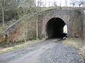
 Disused railway bridge in The Dingle - geograph.org.uk - 1738433.jpg 640 × 480; 135 KB
-
 Disused railway bridge in The Dingle - geograph.org.uk - 1738462.jpg 640 × 480; 125 KB
-
 Don't feed the birds^ - geograph.org.uk - 1742104.jpg 497 × 640; 59 KB
-
 Downwind from landfill - geograph.org.uk - 1751843.jpg 640 × 480; 650 KB
-
 Draining into the Severn - geograph.org.uk - 1727601.jpg 470 × 640; 106 KB
-
 Drove Road, a cleared site and a fire station, Swindon - geograph.org.uk - 1726420.jpg 1,600 × 1,200; 502 KB
-
 Dry stone wall on Smardale Fell - geograph.org.uk - 1730034.jpg 1,024 × 768; 201 KB
-
 Durrington cemetery - geograph.org.uk - 1726615.jpg 640 × 428; 193 KB
-
 Durrington cemetery, northern edge - geograph.org.uk - 1726631.jpg 640 × 428; 173 KB
-
 Early spring colours, Heathfield Farm - geograph.org.uk - 1742377.jpg 640 × 480; 603 KB
-
 East High Street, Forfar - geograph.org.uk - 1728108.jpg 640 × 426; 60 KB
-
 East Worthing, falling tide - geograph.org.uk - 1727299.jpg 640 × 428; 136 KB
-

-
 Eglwys Cyngar Sant, Llangefni - geograph.org.uk - 1738490.jpg 640 × 480; 114 KB
-
 Eglwys Cyngar Sant, Llangefni - geograph.org.uk - 1738516.jpg 640 × 480; 93 KB
-
 Electricity Sub Station, Sibton - geograph.org.uk - 1726343.jpg 2,304 × 3,072; 1.53 MB
-
 Empty beach at Aberdaron - panoramio.jpg 3,648 × 2,736; 2.4 MB
-
 Entering Claverley - geograph.org.uk - 1733169.jpg 600 × 800; 165 KB
-
 Entrance drive to Ettington Park Hotel - geograph.org.uk - 1726812.jpg 2,000 × 1,510; 278 KB
-
 Entrance drive to Ettington Park Hotel - geograph.org.uk - 1726828.jpg 1,500 × 2,144; 240 KB
-
 Entrance to Ettington Park Hotel - geograph.org.uk - 1726819.jpg 2,000 × 1,511; 238 KB
-

-

-

-
 Exeter city's west gate. - geograph.org.uk - 1727321.jpg 640 × 546; 144 KB
-
 Exeter's medieval bridge - geograph.org.uk - 1727323.jpg 640 × 428; 90 KB
-
 Exeter's medieval city - geograph.org.uk - 1727330.jpg 428 × 640; 114 KB
-
 F-GKES Gulfstream 1 Air Provence CVT 17-11-90 (33185803700).jpg 2,186 × 1,418; 581 KB
-
 Farmland near Larrick - geograph.org.uk - 1732640.jpg 640 × 366; 53 KB
-

-

-

-
 Field at Trewarlett - geograph.org.uk - 1732200.jpg 640 × 480; 109 KB
-
 Field by John Acres Lane - geograph.org.uk - 1742410.jpg 640 × 480; 413 KB
-

-
 Field south of Trewarlett - geograph.org.uk - 1732517.jpg 640 × 480; 91 KB
-
 Field, trees and clouds, Hurdon - geograph.org.uk - 1729903.jpg 640 × 451; 71 KB
-
 Findon Village Hall - geograph.org.uk - 1726541.jpg 640 × 428; 108 KB
-
 Focus DIY and gardening, Rogerstone - geograph.org.uk - 1727052.jpg 640 × 373; 56 KB
-
 Footbridge and weir by Talton Mill - geograph.org.uk - 1726904.jpg 1,500 × 2,004; 226 KB
-
 Footpath off Mill Street,Middleton - geograph.org.uk - 1726369.jpg 2,304 × 3,072; 1.43 MB
-
 Footpath off Rendham Road - geograph.org.uk - 1726327.jpg 2,304 × 3,072; 1.5 MB
-
 Footpath off the A1120 at Sibton - geograph.org.uk - 1726338.jpg 2,304 × 3,072; 1.16 MB
-
 Footpath to Alderminster from Wimpstone - geograph.org.uk - 1727403.jpg 2,000 × 1,494; 218 KB
-
 Footpath to Alscot Park - geograph.org.uk - 1727442.jpg 1,500 × 2,001; 217 KB
-
 Footpath to Ettington from Sotshole Coppice - geograph.org.uk - 1726660.jpg 2,000 × 1,502; 224 KB
-
 Footpath to the Ridgeway - geograph.org.uk - 1729818.jpg 1,024 × 768; 176 KB
-
 Fosterville - geograph.org.uk - 1750439.jpg 640 × 426; 389 KB
-
 Fosterville Lodge - geograph.org.uk - 1751830.jpg 640 × 480; 556 KB
-
 Fosterville, the house - geograph.org.uk - 1751882.jpg 640 × 480; 411 KB
-
 Four oaks above Babcombe - geograph.org.uk - 1753891.jpg 640 × 480; 628 KB
-
 Four trees in a field - geograph.org.uk - 1726671.jpg 2,000 × 1,503; 207 KB
-
 Gappah Farm - geograph.org.uk - 1753909.jpg 640 × 480; 443 KB
-
 Gappah from north of Babcombe - geograph.org.uk - 1753893.jpg 640 × 480; 464 KB
-
 Gappah Lane - geograph.org.uk - 1753895.jpg 640 × 480; 527 KB
-
 Gappah Lane above Gappah - geograph.org.uk - 1753905.jpg 640 × 480; 484 KB
-
 Gappah Lane east of Ugbrooke Stream - geograph.org.uk - 1753899.jpg 640 × 480; 554 KB
-
 Gate onto farmland near Trundlebeer - geograph.org.uk - 1726800.jpg 640 × 480; 92 KB
-
 Gateway to North Wyke Research Station - geograph.org.uk - 1726831.jpg 640 × 480; 123 KB
-
 Gateway to Treedown Farm - geograph.org.uk - 1727166.jpg 640 × 480; 87 KB
-

-
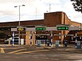
 Goring Business Park - geograph.org.uk - 1726709.jpg 640 × 428; 97 KB
-
 Goring Conservative Club - geograph.org.uk - 1726720.jpg 640 × 428; 103 KB
-
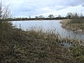
 Grange Farm Pools - geograph.org.uk - 1733407.jpg 800 × 600; 155 KB


.jpg)


.jpg)


_-_geograph.org.uk_-_1730054.jpg)


.jpg)


