Category:United Kingdom photographs taken on 2010-01-30
Jump to navigation
Jump to search
Countries of Europe: Austria · Belgium · Czech Republic · Denmark · Finland · France‡ · Germany · Greece · Hungary · Italy · Kazakhstan‡ · Netherlands‡ · Norway · Poland · Portugal‡ · Romania · Russia‡ · Serbia · Spain‡ · Sweden · Switzerland · Turkey‡ · Ukraine · United Kingdom
‡: partly located in Europe
‡: partly located in Europe
| ← | 30 January 2010 | → | ||
| ← | January 2010 | → | ||

United Kingdom photographs taken on 30 January 2010.
Image files should be categorized here automatically using {{taken on}} template. Direct categorisation is also possible, if automatic is impossible.
Subcategories
This category has the following 3 subcategories, out of 3 total.
Media in category "United Kingdom photographs taken on 2010-01-30"
The following 200 files are in this category, out of 260 total.
(previous page) (next page)-
-
 -2010-01-30 Hopper Head, 2 Church cottage, West Runton.JPG 605 × 865; 128 KB
-
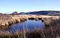
 158812, Avenue Wetlands Nature Reserve (4315619021).jpg 2,575 × 1,500; 3.03 MB
-
 2 Church Cottage West Runton 30 01 2010 (1).JPG 4,000 × 3,000; 2.59 MB
-
 2 Church Cottage West Runton 30 01 2010 (10).JPG 3,000 × 4,000; 2.15 MB
-
 2 Church Cottage West Runton 30 01 2010 (11).JPG 4,000 × 3,000; 2.46 MB
-
 2 Church Cottage West Runton 30 01 2010 (13).JPG 4,000 × 3,000; 2.38 MB
-
 2 Church Cottage West Runton 30 01 2010 (14).JPG 4,000 × 3,000; 2.35 MB
-
 2 Church Cottage West Runton 30 01 2010 (2).JPG 3,000 × 4,000; 2.13 MB
-
 2 Church Cottage West Runton 30 01 2010 (22).JPG 4,000 × 3,000; 2.33 MB
-
 2 Church Cottage West Runton 30 01 2010 (23).JPG 4,000 × 3,000; 2.32 MB
-
 2 Church Cottage West Runton 30 01 2010 (27).JPG 3,000 × 4,000; 2.15 MB
-
 2 Church Cottage West Runton 30 01 2010 (28).JPG 4,000 × 3,000; 2.56 MB
-
 2 Church Cottage West Runton 30 01 2010 (3).JPG 3,000 × 4,000; 2.17 MB
-
 2 Church Cottage West Runton 30 01 2010 (4).JPG 3,000 × 4,000; 2.17 MB
-
 2 Church Cottage West Runton 30 01 2010 (5).JPG 4,000 × 3,000; 2.38 MB
-
 2 Church Cottage West Runton 30 01 2010 (6).JPG 4,000 × 3,000; 2.3 MB
-
 2 Church Cottage West Runton 30 01 2010 (7).JPG 4,000 × 3,000; 2.28 MB
-
 2 Church Cottage West Runton 30 01 2010 (8).JPG 4,000 × 3,000; 2.3 MB
-
 2 Church Cottage West Runton 30 01 2010 (9).JPG 3,000 × 4,000; 2.18 MB
-
 2 Church Cottage West Runton 30 01 2010.JPG 4,000 × 3,000; 2.34 MB
-
 222002 , Grassmoor (4316316109).jpg 2,250 × 1,500; 3.15 MB
-
 222002 , Grassmoor (4316504764).jpg 2,250 × 1,500; 2.73 MB
-
 222011, Avenue Wetlands Nature Reserve (4316305272).jpg 5,184 × 3,456; 844 KB
-
 A col on the Cwm Ffynnon ridge - geograph.org.uk - 1768338.jpg 1,024 × 637; 228 KB
-
 A glacial erratic viewed against Glyder Fawr - geograph.org.uk - 1768330.jpg 1,024 × 743; 226 KB
-
 A perched block above Pen-y-pass - geograph.org.uk - 1768249.jpg 905 × 1,024; 280 KB
-
 A sheepfold at Burgh Hill - geograph.org.uk - 1691988.jpg 427 × 640; 153 KB
-
 A sign at Alemoor Reservoir - geograph.org.uk - 1692013.jpg 640 × 427; 167 KB
-
 A Snowplough prepares the Coire na Ciste Car Park - geograph.org.uk - 1690072.jpg 3,000 × 4,000; 3.15 MB
-
 Abutment of dismantled railway bridge - geograph.org.uk - 1700043.jpg 640 × 480; 135 KB
-
 Aldi, Central Park - geograph.org.uk - 1691578.jpg 1,280 × 856; 160 KB
-
 Alemoor Reservoir in late January - geograph.org.uk - 1692020.jpg 640 × 345; 154 KB
-
 Alexandra House, Moss Side - panoramio.jpg 3,072 × 2,304; 1.84 MB
-
 Allt na Ciste - geograph.org.uk - 1690213.jpg 3,000 × 4,000; 2.77 MB
-
 An empty bus park at Pen-y-pass - geograph.org.uk - 1768133.jpg 1,024 × 768; 233 KB
-
 An ex-school, Ernesettle - Plymouth - geograph.org.uk - 1700008.jpg 1,200 × 797; 664 KB
-
 An old skool direction sign in St Georges - Saturday 30th January 2010 - panoramio.jpg 3,072 × 2,304; 1.82 MB
-
 Approaching Casthorpe Hills (geograph 1685811).jpg 640 × 427; 92 KB
-

-
 Ascending the Glyder Path above Gorphwysfa - geograph.org.uk - 1768179.jpg 1,024 × 768; 242 KB
-
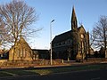
 Christ Church, Ashton under Lyne.jpg 1,024 × 768; 399 KB
-
 Ballymacormack Playing Fields.jpg 800 × 483; 336 KB
-
 Banc Blaenegnant - geograph.org.uk - 1706417.jpg 1,024 × 768; 294 KB
-
 Waters Edge country park from the Humber Bridge - geograph.org.uk - 1714674.jpg 1,600 × 1,200; 333 KB
-
 Beeching Way - geograph.org.uk - 1690553.jpg 1,024 × 734; 197 KB
-
 Bingo Hall - geograph.org.uk - 1690074.jpg 2,592 × 1,944; 2.19 MB
-
 Birkland Barrow - geograph.org.uk - 1772709.jpg 640 × 480; 190 KB
-
 Bog at the head of the Nant Hafod-frith - geograph.org.uk - 1704212.jpg 1,024 × 768; 354 KB
-
 Bog at the head of the Nant Hafod-frith - geograph.org.uk - 1706329.jpg 1,024 × 768; 385 KB
-
 Bog stream on Disgwilfa - geograph.org.uk - 1704199.jpg 1,024 × 768; 319 KB
-
 Boggy depression east of Disgwilfa - geograph.org.uk - 1706370.jpg 640 × 480; 142 KB
-

-
 Bridleway near Ashbury - geograph.org.uk - 1690151.jpg 480 × 640; 225 KB
-
 Broadway, New Moston - panoramio.jpg 3,072 × 2,304; 1.81 MB
-
 Bryn Eithinog and Lan Fawr - geograph.org.uk - 1706349.jpg 1,024 × 768; 343 KB
-
 Bryn Llyn Teifi - geograph.org.uk - 1706446.jpg 1,024 × 768; 217 KB
-
 Buckland Beacon commandments.jpg 4,288 × 2,848; 5.98 MB
-
 Bus in Stevensons Square, Manchester.jpg 2,048 × 1,536; 1.02 MB
-
 Bus route 19, Russell Drive, Malpas - geograph.org.uk - 1685945.jpg 640 × 473; 78 KB
-
 Bus, Banbridge (2) - geograph.org.uk - 1685397.jpg 640 × 386; 98 KB
-
 Cairn at the head of Cwm Egnant - geograph.org.uk - 1706421.jpg 1,024 × 768; 188 KB
-
 Carmyle Railway Station - geograph.org.uk - 1685166.jpg 640 × 480; 115 KB
-
 Casthorpe (geograph 1685810).jpg 640 × 427; 82 KB
-
 Casthorpe Road (geograph 1685786).jpg 640 × 427; 86 KB
-
 Central Park shops - geograph.org.uk - 1691584.jpg 1,280 × 856; 223 KB
-
 Chains, Torpoint Ferry - geograph.org.uk - 1701010.jpg 490 × 640; 85 KB
-
 Chairlifts march up the Stron an Aonaich - geograph.org.uk - 1690124.jpg 3,000 × 4,000; 3.1 MB
-
 Chapel Road, Grantown on Spey - geograph.org.uk - 1690003.jpg 3,000 × 4,000; 2.79 MB
-
 Chapel Terrace - geograph.org.uk - 1690067.jpg 640 × 480; 101 KB
-
 Aumbry - geograph.org.uk - 1701921.jpg 426 × 640; 77 KB
-
 St.Peter's tower and spire - geograph.org.uk - 1702345.jpg 426 × 640; 78 KB
-
 Clearburn Loch - geograph.org.uk - 1692036.jpg 640 × 421; 130 KB
-
 Coach stop in Lion Lane - geograph.org.uk - 1691686.jpg 640 × 480; 80 KB
-
 Colourful houses, Aberystwyth. - geograph.org.uk - 1727588.jpg 3,648 × 2,736; 2.53 MB
-
 Corfe Crescent, Hele - geograph.org.uk - 1692461.jpg 640 × 480; 76 KB
-
 Corfe Crescent, Hele - geograph.org.uk - 1692472.jpg 640 × 381; 50 KB
-
 Corfe Crescent, Hele - geograph.org.uk - 1692480.jpg 640 × 456; 53 KB
-
 Cornwall Beach - geograph.org.uk - 1700958.jpg 640 × 472; 80 KB
-
 Cornwall Beach - geograph.org.uk - 1700975.jpg 640 × 480; 78 KB
-
 Creagan Dubh Crags - geograph.org.uk - 1690110.jpg 4,000 × 3,000; 3 MB
-
 Creigiau Coed across Llyn Egnant - geograph.org.uk - 1706441.jpg 1,024 × 768; 225 KB
-

-
 Cwm Egnant - geograph.org.uk - 1706422.jpg 1,024 × 768; 342 KB
-
 Cwm Egnant from Bryn Eithinog - geograph.org.uk - 1706411.jpg 1,024 × 768; 359 KB
-
 Cwm Trawsnant from Pen-y-pass - geograph.org.uk - 1768279.jpg 1,024 × 768; 213 KB
-
 Dam of Llyn Pond Gwaith - geograph.org.uk - 1703899.jpg 1,024 × 768; 405 KB
-
 Dam, Llyn Pond Gwaith - geograph.org.uk - 1700934.jpg 480 × 640; 121 KB
-
 Definitely not the sunny side of the valley - geograph.org.uk - 1768142.jpg 1,024 × 768; 164 KB
-
 Derelict barn, Ruffinswick Farm - geograph.org.uk - 1690264.jpg 640 × 480; 190 KB
-
 St Michael's Church, Devonport - geograph.org.uk - 1701018.jpg 507 × 640; 57 KB
-
 Digging out Snow Holes - geograph.org.uk - 1690251.jpg 4,000 × 3,000; 2.75 MB
-
 Dormitory block at Pen-y-pass YH - geograph.org.uk - 1768273.jpg 1,024 × 624; 231 KB
-
 Drive to Odstone Farm - geograph.org.uk - 1690081.jpg 640 × 480; 144 KB
-
 Eilean Donan in snow.jpeg 3,072 × 2,304; 1.55 MB
-
 Eilean Donan winter panorama.jpeg 6,100 × 1,550; 2.08 MB
-
 Emmanuel Centre, Baker Street, Enfield - geograph.org.uk - 1691284.jpg 1,024 × 768; 277 KB
-

-
 Erratics above Llyn Cwmffynnon - geograph.org.uk - 1767908.jpg 1,024 × 957; 334 KB
-
 Erratics on the Cwm Ffynnon ridge - geograph.org.uk - 1768334.jpg 1,024 × 531; 214 KB
-
 Etherow Country Park - geograph.org.uk - 1690108.jpg 768 × 1,024; 473 KB
-
 Etherow Country Park - geograph.org.uk - 1690116.jpg 1,024 × 768; 513 KB
-
 Etherow Country Park - geograph.org.uk - 1690121.jpg 1,024 × 768; 348 KB
-
 Evening light, Compton Beauchamp - geograph.org.uk - 1690191.jpg 640 × 480; 113 KB
-
 Evening light, Compton Beauchamp - geograph.org.uk - 1690208.jpg 640 × 480; 138 KB
-
 Every Picture Tells a Story - geograph.org.uk - 1705009.jpg 640 × 467; 222 KB
-
 Expanded lochan on N Rannoch Moor - geograph.org.uk - 1773202.jpg 1,024 × 729; 171 KB
-
 Farmland by Old Beck (geograph 1685795).jpg 640 × 427; 99 KB
-
 Footpath, Kingstone Winslow - geograph.org.uk - 1690032.jpg 640 × 480; 204 KB
-
 Fox foraging along Allt Dubh-mor - geograph.org.uk - 1773235.jpg 1,024 × 720; 197 KB
-
 Fox trail on the moor - geograph.org.uk - 1773152.jpg 768 × 1,024; 600 KB
-

-
 Frosty morning, Pant-y-dwn - geograph.org.uk - 1692318.jpg 3,504 × 2,336; 1.76 MB
-
 Frozen bog stream, Pen y Bryn - geograph.org.uk - 1700861.jpg 768 × 1,024; 318 KB
-
 Frozen Farmhouse. - geograph.org.uk - 1692335.jpg 3,504 × 2,336; 5.09 MB
-
 Frozen pool, Cors Fochno (2) - geograph.org.uk - 1692331.jpg 3,504 × 2,336; 1.45 MB
-
 Frozen pool, Cors Fochno. - geograph.org.uk - 1692329.jpg 3,415 × 2,199; 1.8 MB
-
 Gateway to the Clore Learning Centre - geograph.org.uk - 1690131.jpg 2,592 × 3,872; 4.07 MB
-
 Glaslyn - geograph.org.uk - 1692371.jpg 1,024 × 756; 168 KB
-
 Glaslyn - geograph.org.uk - 1692406.jpg 1,024 × 768; 198 KB
-
 Glaslyn and Llyn Llydaw - geograph.org.uk - 1692388.jpg 1,024 × 768; 195 KB
-
 Glossop Road - geograph.org.uk - 1690132.jpg 1,024 × 768; 287 KB
-
 Glossop Road - geograph.org.uk - 1690141.jpg 1,024 × 768; 281 KB
-
 Going up Casthorpe Hills. (geograph 1685813).jpg 640 × 427; 136 KB
-
 Grant Road, Grantown-on-Spey - geograph.org.uk - 1690011.jpg 3,000 × 4,000; 2.81 MB
-
 Grant Road, Grantown-on-Spey - geograph.org.uk - 1690018.jpg 3,000 × 4,000; 2.81 MB
-
 Grazing land near Compton Beauchamp - geograph.org.uk - 1690253.jpg 640 × 480; 177 KB
-
 Grib Goch from Snowdon Great Gully - geograph.org.uk - 1692416.jpg 768 × 1,024; 190 KB
-
 Harbour Beacon - geograph.org.uk - 1757757.jpg 480 × 640; 97 KB
-
 Heading out of Coire na Ciste - geograph.org.uk - 1690193.jpg 3,000 × 4,000; 2.78 MB
-
 Memento mori - geograph.org.uk - 1735025.jpg 640 × 426; 66 KB
-
 Hornchurch Lane, Ernesettle - Plymouth - geograph.org.uk - 1700000.jpg 1,200 × 797; 665 KB
-
 Hotel garden, Wilton - geograph.org.uk - 1691169.jpg 640 × 480; 118 KB
-
 Houses by Shottermill Junior School - geograph.org.uk - 1691681.jpg 640 × 480; 113 KB
-
 Houses on Pendennis Road, Hele - geograph.org.uk - 1692450.jpg 640 × 416; 54 KB
-

-
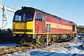 Hugh llewelyn 60 009 (5564430198).jpg 3,872 × 2,592; 1.8 MB
-
 Hugh llewelyn 66 068 (5564432072).jpg 3,872 × 2,592; 1.48 MB
-
 Ice sheet on Llyn Pond Gwaith - geograph.org.uk - 1703890.jpg 768 × 1,024; 339 KB
-
 Ice smoothed rocks alongside the Glyder Path - geograph.org.uk - 1768186.jpg 1,024 × 725; 214 KB
-
 Iceaxe Braking in Coire na Ciste - geograph.org.uk - 1690146.jpg 4,000 × 3,000; 2.92 MB
-
 Iced-up grasses by the Wilson Burn - geograph.org.uk - 1692027.jpg 640 × 427; 132 KB
-
 Junction Inn, Royton - panoramio.jpg 3,072 × 2,304; 1.7 MB
-
 Kelvinhead - geograph.org.uk - 1687044.jpg 1,024 × 768; 615 KB
-
 Kenmuir Mount Vernon Church (geograph 1685082).jpg 1,024 × 768; 247 KB
-
 Lamp IMG 9266.JPG 2,736 × 3,648; 3.32 MB
-
 Llyn Cwmffynnon and Glyder Fach - geograph.org.uk - 1767901.jpg 1,024 × 768; 230 KB
-
 Llyn Egnant - geograph.org.uk - 1706426.jpg 1,024 × 768; 306 KB
-
 Llyn Egnant dam - geograph.org.uk - 1706424.jpg 1,024 × 768; 211 KB
-
 Llyn Pond Gwaith and Graig Fawr - geograph.org.uk - 1700948.jpg 1,024 × 768; 275 KB
-
 Llyn Pond Gwaith from Pen y Bryn - geograph.org.uk - 1700850.jpg 1,024 × 768; 358 KB
-
 Llyn Teifi - geograph.org.uk - 1703988.jpg 1,024 × 768; 392 KB
-
 Llyn Teifi and Graig Felen - geograph.org.uk - 1704157.jpg 1,024 × 768; 330 KB
-
 Llyn Teifi dam - geograph.org.uk - 1704109.jpg 1,024 × 768; 365 KB
-
 Llyn Teifi overflow - geograph.org.uk - 1703942.jpg 1,024 × 768; 388 KB
-
 Llyn Teifi overflow - geograph.org.uk - 1704020.jpg 768 × 1,024; 419 KB
-
 Lochan Meall Phuill - geograph.org.uk - 1773248.jpg 1,024 × 768; 449 KB
-
 Lodge, Devonport Park - geograph.org.uk - 1701023.jpg 480 × 640; 87 KB
-

-
 Looking northwards up Vicarage Lane - geograph.org.uk - 1690069.jpg 480 × 640; 80 KB
-
 Looking towards the dam of Llyn Egnant - geograph.org.uk - 1706444.jpg 1,024 × 768; 291 KB
-
 Low tide on the River Clyde at Langbank, Renfrewshire. - panoramio.jpg 4,000 × 3,000; 5.52 MB
-
 Malpas Road bus route 18 - geograph.org.uk - 1686057.jpg 640 × 480; 76 KB
-
 Martley Church - geograph.org.uk - 1690260.jpg 640 × 480; 115 KB
-
 Mendick Hill - geograph.org.uk - 1744036.jpg 480 × 640; 130 KB
-
 Mid section of Priors Wood - geograph.org.uk - 1690064.jpg 480 × 640; 102 KB
-
 Mitchell Court, Central Park - geograph.org.uk - 1690719.jpg 1,280 × 856; 243 KB
-

-
 Moorland south of Llyn Teifi - geograph.org.uk - 1705633.jpg 1,024 × 768; 445 KB
-
 Moorland south of the Teifi pools - geograph.org.uk - 1706396.jpg 1,024 × 768; 404 KB
-
 Moston Brook, Failsworth - panoramio.jpg 3,072 × 2,304; 1.84 MB
-
 Mount Vernon Railway Station - geograph.org.uk - 1684906.jpg 640 × 480; 97 KB
-
 Nant Hafod-frith - geograph.org.uk - 1706402.jpg 1,024 × 768; 361 KB
-
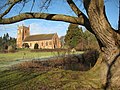
 Newtown Church Wem Rural.jpg 2,592 × 3,872; 6.84 MB
-
 No traffic to Easter Arboll^ - geograph.org.uk - 1703702.jpg 640 × 480; 140 KB
-
 Non-existent woods, Cors Fochno. - geograph.org.uk - 1692326.jpg 3,504 × 2,336; 4.8 MB
-
 Norwood Park (5) - geograph.org.uk - 1719206.jpg 640 × 480; 379 KB
-
 Old Beck (geograph 1685792).jpg 443 × 640; 127 KB
-

-
 Olympic A320 (4316182928).jpg 3,112 × 2,332; 2.8 MB
-
 On Cors Fochno. - geograph.org.uk - 1692324.jpg 3,504 × 2,336; 3.13 MB
-
 On Cors Fochno. - geograph.org.uk - 1692332.jpg 3,504 × 2,336; 2.35 MB
-
 Pant-y-dwn - geograph.org.uk - 1692319.jpg 3,440 × 2,238; 1.77 MB
-
 Pedestrian entrance, City College - geograph.org.uk - 1701026.jpg 640 × 480; 121 KB
-
 Pendennis Road, Hele - geograph.org.uk - 1692445.jpg 640 × 480; 61 KB
-
 Perched blocks above Gorphwysfa - geograph.org.uk - 1768202.jpg 1,024 × 733; 222 KB
-
 Pier Master's House, Cornwall Beach - geograph.org.uk - 1700984.jpg 480 × 640; 94 KB
-
 Porch graffiti - geograph.org.uk - 1704055.jpg 426 × 640; 157 KB
-
 Postbox in Old Mill Place - geograph.org.uk - 1690056.jpg 480 × 640; 120 KB
-
 Postbox, Southrop - geograph.org.uk - 1687454.jpg 480 × 640; 123 KB
-
 Power lines at gate to Glebe Farm - geograph.org.uk - 1711377.jpg 605 × 454; 62 KB
-
 Red Sandstone in Anstruther - geograph.org.uk - 1757753.jpg 480 × 640; 97 KB
-
 Ridgetop and Llyn Teifi - geograph.org.uk - 1706358.jpg 1,024 × 768; 338 KB
-
 River Etherow - geograph.org.uk - 1690009.jpg 1,024 × 768; 325 KB
-
 River Etherow - geograph.org.uk - 1690013.jpg 1,024 × 768; 297 KB
-
 River Etherow, bridge and weir - geograph.org.uk - 1690063.jpg 1,024 × 768; 366 KB
-
 River Etherow, the weir - geograph.org.uk - 1690088.jpg 1,024 × 768; 299 KB
-
 River Etherow, weir and bridge - geograph.org.uk - 1690076.jpg 1,024 × 768; 329 KB
-
 Roman Road - geograph.org.uk - 1744038.jpg 640 × 480; 145 KB
-
 Ropework, Coire na Ciste - geograph.org.uk - 1690226.jpg 3,000 × 4,000; 2.79 MB


.jpg)
.JPG)
.JPG)
.JPG)
.JPG)
.JPG)
.JPG)
.JPG)
.JPG)
.JPG)
.JPG)
.JPG)
.JPG)
.JPG)
.JPG)
.JPG)
.JPG)
.JPG)

.jpg)
.jpg)
.jpg)


.jpg)


_-_geograph.org.uk_-_1685397.jpg)


.jpg)
.jpg)


.jpg)


_-_geograph.org.uk_-_1692331.jpg)


.jpg)


.jpg)
.jpg)


.jpg)


_-_geograph.org.uk_-_1719206.jpg)
.jpg)

.jpg)


