Category:United Kingdom photographs taken on 2009-06-30
Jump to navigation
Jump to search
Countries of Europe: Austria · Belarus · Belgium · Croatia · Denmark · Estonia · Finland · France‡ · Germany · Greece · Hungary · Iceland · Republic of Ireland · Italy · Kazakhstan‡ · Malta · Netherlands‡ · Poland · Portugal‡ · Russia‡ · Spain‡ · Sweden · Switzerland · Turkey‡ · Ukraine · United Kingdom
‡: partly located in Europe
‡: partly located in Europe
| ← | 30 June 2009 | → | ||
| ← | June 2009 | → | ||

United Kingdom photographs taken on 30 June 2009.
Image files should be categorized here automatically using {{taken on}} template. Direct categorisation is also possible, if automatic is impossible.
Subcategories
This category has the following 2 subcategories, out of 2 total.
Media in category "United Kingdom photographs taken on 2009-06-30"
The following 200 files are in this category, out of 986 total.
(previous page) (next page)-
 (1702) Small Fan-footed Wave (Idaea biselata) (3686024520).jpg 1,500 × 1,004; 1.57 MB
-
 (1910) Lilac Beauty (Apeira syringaria) (3686019980).jpg 1,500 × 1,004; 1.26 MB
-
 (1947) The Engrailed (Ectropis bistortata) (3686017862).jpg 1,500 × 1,004; 1.47 MB
-
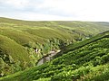
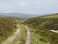
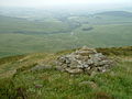
 791m top above Cam a' Choire Mòr - geograph.org.uk - 1596350.jpg 640 × 480; 105 KB
-

-

-
 A house in Bath Street, Stonehaven - geograph.org.uk - 1378035.jpg 640 × 453; 97 KB
-
 A lazy summers day in Finsbury Park - geograph.org.uk - 1470073.jpg 640 × 480; 117 KB
-
 A long way from Blackpool - geograph.org.uk - 1378512.jpg 640 × 480; 58 KB
-
 A private bridleway - geograph.org.uk - 1378640.jpg 640 × 480; 102 KB
-
 A private bridleway - geograph.org.uk - 1378678.jpg 640 × 480; 115 KB
-
 A seagull at Ilfracombe - geograph.org.uk - 1492740.jpg 640 × 456; 53 KB
-
 A seat by the path - geograph.org.uk - 1378650.jpg 640 × 480; 98 KB
-
 A438 At The Wootton Lane Junction - geograph.org.uk - 1378287.jpg 640 × 480; 147 KB
-
 A438, Looking West - geograph.org.uk - 1378294.jpg 640 × 480; 162 KB
-
 A55-A5122 junction - geograph.org.uk - 1397966.jpg 640 × 480; 212 KB
-
 A64 through Sherburn - geograph.org.uk - 1378966.jpg 640 × 480; 78 KB
-
 A650 junction Westgate Hill Street - geograph.org.uk - 1378479.jpg 640 × 480; 89 KB
-
 Abandoned Railway Track - geograph.org.uk - 1379912.jpg 640 × 509; 133 KB
-
 Access to Banchory Lodge Hotel - geograph.org.uk - 1380041.jpg 640 × 425; 71 KB
-
 Access To Claston Farm - geograph.org.uk - 1378478.jpg 480 × 640; 225 KB
-
 Achanalt Railway Station - geograph.org.uk - 1380867.jpg 640 × 480; 83 KB
-
 Achnasheen Primary School - geograph.org.uk - 1380946.jpg 640 × 480; 60 KB
-
 Action at the Helipad - geograph.org.uk - 1380128.jpg 640 × 480; 121 KB
-
 Air Museum - geograph.org.uk - 1436401.jpg 640 × 457; 254 KB
-
 All Saints Church, Wykeham - geograph.org.uk - 1379272.jpg 640 × 480; 100 KB
-

-
 Allt a' Chire Mhòir - geograph.org.uk - 1382095.jpg 640 × 360; 69 KB
-
 Allt a' Chireachain - geograph.org.uk - 1383744.jpg 640 × 360; 78 KB
-
 Allt a' Chireachain - geograph.org.uk - 1383759.jpg 640 × 480; 112 KB
-
 Allt a' Chireachain - geograph.org.uk - 1596376.jpg 640 × 480; 112 KB
-
 Allt a' Chireachain - geograph.org.uk - 1596378.jpg 640 × 480; 105 KB
-
 Allt a' Chireachain - geograph.org.uk - 1596382.jpg 640 × 480; 131 KB
-
 Allt a' Chireachain - geograph.org.uk - 1596392.jpg 640 × 480; 122 KB
-
 Allt a' Chireachain - geograph.org.uk - 1596398.jpg 640 × 480; 113 KB
-
 Allt a' Choire Bhig - geograph.org.uk - 1382755.jpg 640 × 360; 64 KB
-
 Allt a' Choire Bhig - geograph.org.uk - 1382765.jpg 640 × 480; 104 KB
-
 Allt a' Choire Bhig - geograph.org.uk - 1383684.jpg 640 × 480; 98 KB
-
 Allt a' Mhuillin - geograph.org.uk - 1381101.jpg 640 × 480; 113 KB
-
 Allt a' Mhuillin - geograph.org.uk - 1384562.jpg 640 × 480; 103 KB
-
 Allt a' Mhuillin - geograph.org.uk - 1593368.jpg 640 × 480; 91 KB
-
 Allt Uisgean - geograph.org.uk - 1381120.jpg 640 × 480; 110 KB
-
 Allt Uisgean - geograph.org.uk - 1381126.jpg 640 × 480; 82 KB
-
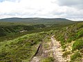
 Along the old Road from Scarffbanks - geograph.org.uk - 1382634.jpg 640 × 480; 70 KB
-
 Alternative take off site - geograph.org.uk - 1436420.jpg 640 × 457; 339 KB
-
 Alternative take off site - geograph.org.uk - 1436423.jpg 640 × 457; 347 KB
-
 Alternative take off site - geograph.org.uk - 1436425.jpg 640 × 457; 337 KB
-
 Alternative take off site - geograph.org.uk - 1436429.jpg 640 × 457; 428 KB
-
 Alternative take off site - geograph.org.uk - 1436433.jpg 640 × 457; 323 KB
-
 Alternative take off site - geograph.org.uk - 1436436.jpg 640 × 457; 284 KB
-
 Alternative take off site - geograph.org.uk - 1436443.jpg 640 × 457; 277 KB
-
 Alternative take off site - geograph.org.uk - 1436452.jpg 640 × 457; 391 KB
-
 Alwyne, Canonbury, London (3694850159).jpg 2,965 × 2,224; 2.61 MB
-
 Ambulance station, Raigmore - geograph.org.uk - 1380169.jpg 640 × 480; 82 KB
-
 American Airlines Boeing 767-300ER Lofting-1.jpg 1,280 × 849; 628 KB
-
 An Audenshaw Footpath - geograph.org.uk - 1379915.jpg 640 × 476; 123 KB
-
 An Deargant - geograph.org.uk - 1382011.jpg 640 × 480; 109 KB
-
 Another View of Beacon Windmill - geograph.org.uk - 1390225.jpg 640 × 426; 92 KB
-
 Apollo Bingo - geograph.org.uk - 1385223.jpg 640 × 480; 130 KB
-
 Approach to Wood Field Plantation - geograph.org.uk - 1378712.jpg 640 × 480; 136 KB
-
 Approaching Prior's Court - geograph.org.uk - 1378298.jpg 480 × 640; 246 KB
-
 Ardnamurchan Point.jpg 2,272 × 1,704; 1.42 MB
-
 Ashton Canal - geograph.org.uk - 1379917.jpg 640 × 480; 132 KB
-
 Ashton Fire Station - geograph.org.uk - 1379910.jpg 640 × 428; 108 KB
-
 Ashton Road, Inverness - geograph.org.uk - 1380137.jpg 640 × 433; 92 KB
-
 Ashton under Lyne Community Fire Station - geograph.org.uk - 1379925.jpg 640 × 488; 116 KB
-
 Ashton Canal - geograph.org.uk - 1379920.jpg 640 × 472; 118 KB
-
 Ayre of Belmont - geograph.org.uk - 1379000.jpg 640 × 426; 70 KB
-
 B4224 Leaves Hereford - geograph.org.uk - 1378506.jpg 640 × 480; 171 KB
-
 B8079, Blair Atholl - geograph.org.uk - 1593357.jpg 640 × 480; 104 KB
-
 St. Felix's Church in ivy - geograph.org.uk - 1380992.jpg 640 × 480; 78 KB
-
 Back Gate To The Quarry - geograph.org.uk - 1378283.jpg 640 × 480; 186 KB
-
 Back of the church - geograph.org.uk - 1383775.jpg 640 × 480; 92 KB
-
 Back of the cut - geograph.org.uk - 1397497.jpg 640 × 480; 104 KB
-
 Banchory Lodge Hotel sign - geograph.org.uk - 1380063.jpg 640 × 480; 106 KB
-
 Banchory Scout Hall - geograph.org.uk - 1380037.jpg 640 × 480; 102 KB
-

-
 Barricane Beach near Woolacombe - geograph.org.uk - 1495688.jpg 640 × 415; 41 KB
-
 Barton Road in Woolacombe - geograph.org.uk - 1495672.jpg 640 × 409; 69 KB
-
 Barton Road in Woolacombe - geograph.org.uk - 1495676.jpg 640 × 406; 66 KB
-
 Bassett - Greenhouse Lane - geograph.org.uk - 1379482.jpg 640 × 480; 80 KB
-
 Bath Hard Lane, Rochester - geograph.org.uk - 1381240.jpg 640 × 480; 130 KB
-

-
 Beacon Point and Hillsborough - geograph.org.uk - 1494243.jpg 640 × 413; 63 KB
-
 Becket Street from the bridge - geograph.org.uk - 1382501.jpg 450 × 600; 56 KB
-
 Beresford Road, Kits Coty - geograph.org.uk - 1381313.jpg 640 × 480; 86 KB
-
 Birnies Lane, Tomintoul - geograph.org.uk - 1385813.jpg 640 × 479; 108 KB
-
 Birnock Water from Greygill Head - geograph.org.uk - 1379205.jpg 640 × 480; 74 KB
-
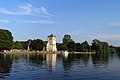 The River Thames and the church, Bisham - geograph.org.uk - 1556159.jpg 640 × 428; 162 KB
-
 Blackpool from South Pier - geograph.org.uk - 1385404.jpg 640 × 480; 123 KB
-
 Bloomfield Road from Central Drive - geograph.org.uk - 1384925.jpg 640 × 480; 113 KB
-
 Blue Boar Lane, Rochester - geograph.org.uk - 1381247.jpg 640 × 480; 88 KB
-
 Blue Plaque - geograph.org.uk - 1388677.jpg 640 × 480; 118 KB
-
 Blue plaque on the wall - geograph.org.uk - 1388654.jpg 640 × 480; 92 KB
-
 Boating and Beach Area, Center Parcs - geograph.org.uk - 1385959.jpg 640 × 480; 91 KB
-
 Boats at the pier - geograph.org.uk - 1381703.jpg 640 × 480; 78 KB
-
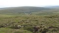
 Bog, Meall na Maoile - geograph.org.uk - 1595346.jpg 640 × 480; 151 KB
-
 Bog, Meall Odhar a' Chire - geograph.org.uk - 1382110.jpg 640 × 360; 86 KB
-
 Boudica's Way - a shady path - geograph.org.uk - 1378761.jpg 529 × 640; 186 KB
-
 Boudica's Way - a view - geograph.org.uk - 1378671.jpg 640 × 480; 111 KB
-
 Boudica's Way - approaching Caistor Lane - geograph.org.uk - 1378675.jpg 640 × 541; 130 KB
-
 Boudica's Way - footpath markers - geograph.org.uk - 1378686.jpg 480 × 640; 139 KB
-
 Boudica's Way - geograph.org.uk - 1378624.jpg 640 × 480; 108 KB
-
 Boudica's Way - information board - geograph.org.uk - 1378627.jpg 483 × 640; 97 KB
-

-
 Boudica's Way - plaque - geograph.org.uk - 1378633.jpg 600 × 521; 121 KB
-
 Boudica's Way - skirting Arminghall Wood - geograph.org.uk - 1378752.jpg 640 × 480; 130 KB
-
 Boudica's Way - to Arminghall Lane - geograph.org.uk - 1378743.jpg 480 × 640; 143 KB
-
 Boudica's Way - to Stoke Road - geograph.org.uk - 1378740.jpg 480 × 640; 131 KB
-

-

-
 Bracken on the hillside - geograph.org.uk - 1379116.jpg 640 × 480; 109 KB
-
 Bridge near Loch Doon - geograph.org.uk - 1493034.jpg 640 × 480; 79 KB
-
 Bridge on the River Bran - geograph.org.uk - 1381667.jpg 640 × 480; 128 KB
-
 Bridge over the Burn - geograph.org.uk - 1381754.jpg 640 × 480; 152 KB
-
 Bridge over the mill stream - geograph.org.uk - 1397447.jpg 640 × 480; 109 KB
-
 Bridge over the railway - geograph.org.uk - 1380920.jpg 450 × 600; 73 KB
-
 Bridge over the River Shiel - geograph.org.uk - 1395332.jpg 640 × 427; 111 KB
-
 Bridleway junction on Mickleden Edge - geograph.org.uk - 1379345.jpg 640 × 430; 59 KB
-
 Bridleway near Sherburn - geograph.org.uk - 1378974.jpg 640 × 480; 98 KB
-
 Bridleway near Sherburn - geograph.org.uk - 1379058.jpg 640 × 480; 87 KB
-
-
 Bridleway to the moor - geograph.org.uk - 1378637.jpg 640 × 427; 79 KB
-
 Bridleway, Sherburn Brow - geograph.org.uk - 1378934.jpg 640 × 480; 101 KB
-
 Brindles Close, Hutton - geograph.org.uk - 1396638.jpg 3,072 × 2,304; 1.51 MB
-
 Broadstrand Beach at Ilfracombe - geograph.org.uk - 1494235.jpg 640 × 434; 93 KB
-
 Broadstreet Common, Wentlooge Level - geograph.org.uk - 1401781.jpg 640 × 480; 76 KB
-
 Broken Back Plantation - geograph.org.uk - 1378706.jpg 640 × 480; 89 KB
-
 Brompton Cemetery - geograph.org.uk - 1379809.jpg 640 × 480; 105 KB
-
 Bryn-eithin - geograph.org.uk - 1393579.jpg 640 × 480; 247 KB
-
 Bull Lane, Rochester - geograph.org.uk - 1381279.jpg 640 × 480; 83 KB
-
 Cairn about 450m, Greygill Head - geograph.org.uk - 1379182.jpg 640 × 480; 64 KB
-
 Cairn approx. 350m, Greygill Head - geograph.org.uk - 1379133.jpg 640 × 480; 80 KB
-
 Cairn near 400m, Greygill Head - geograph.org.uk - 1379158.jpg 640 × 480; 82 KB
-
 Cam a' Choire Mòr - geograph.org.uk - 1382592.jpg 640 × 480; 109 KB
-
 Cam a' Choire Mòr - geograph.org.uk - 1596342.jpg 640 × 360; 60 KB
-
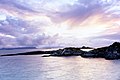 Camusdarach - geograph.org.uk - 1598880.jpg 640 × 425; 49 KB
-
 Car park across the road - geograph.org.uk - 1389998.jpg 640 × 480; 71 KB
-
 Car park off Norfolk Street - geograph.org.uk - 1388773.jpg 640 × 480; 97 KB
-
 Carn an Fhiadhain - geograph.org.uk - 1382066.jpg 640 × 360; 83 KB
-
 Carr Allt a'Chaise - geograph.org.uk - 1382771.jpg 640 × 480; 98 KB
-
 Carr Farm - geograph.org.uk - 1379808.jpg 640 × 480; 77 KB
-
 Carr Meall na Maoile - geograph.org.uk - 1381149.jpg 640 × 480; 93 KB
-
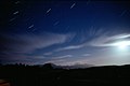 Carradale nightsky - geograph.org.uk - 1598877.jpg 640 × 429; 30 KB
-
 Cattle at Dykeside - geograph.org.uk - 1394049.jpg 640 × 427; 49 KB
-
 Cattle on Iffley Meadows - geograph.org.uk - 1381258.jpg 640 × 480; 81 KB
-
 Causeway across the Cheviot plateau - geograph.org.uk - 1421280.jpg 640 × 480; 62 KB
-
 Celtic cross Canna Geograph-1761616-by-Becky-Williamson.jpg 454 × 640; 102 KB
-
 Chapel Haddlesey Church - geograph.org.uk - 1378582.jpg 640 × 480; 56 KB
-
 Cheviot summit with prayer flags - geograph.org.uk - 1421276.jpg 640 × 480; 107 KB
-
 Choir stalls at St Mary's, Portsea - geograph.org.uk - 1378982.jpg 640 × 480; 74 KB
-

-
-
 Christchurch, the Salisbury Arms - geograph.org.uk - 1379614.jpg 640 × 480; 52 KB
-
 Church Clock Tower, Wykeham - geograph.org.uk - 1379280.jpg 480 × 640; 71 KB
-
 Church Road roundabout - geograph.org.uk - 1381645.jpg 640 × 480; 68 KB
-
 Cidaria fulvata & Laspeyria flexula (3685203315).jpg 1,500 × 1,004; 1.55 MB
-
 Cladding the remains - geograph.org.uk - 1378986.jpg 640 × 480; 92 KB
-
 Clatteringshaws Loch - geograph.org.uk - 1494699.jpg 640 × 480; 60 KB
-
 Clock on the side - geograph.org.uk - 1383837.jpg 450 × 600; 100 KB
-
 Clough Hollow - geograph.org.uk - 1379475.jpg 640 × 480; 113 KB
-
-
 Cockpen and Carrington Parish Church - geograph.org.uk - 1379987.jpg 640 × 480; 73 KB
-
 Col at the head of Cam a' Choire Mòr - geograph.org.uk - 1382596.jpg 640 × 480; 124 KB
-
 Collingwood Road, Kits Coty - geograph.org.uk - 1381290.jpg 640 × 480; 90 KB
-
 Collingwood Road, Kits Coty - geograph.org.uk - 1381300.jpg 640 × 480; 115 KB
-
 Commercial Premises on Abbey Street - geograph.org.uk - 1385626.jpg 640 × 480; 106 KB
-

-
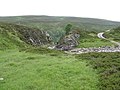
 Construction works, Allt a' Mhuillin - geograph.org.uk - 1593364.jpg 640 × 480; 93 KB
-
 Continuation ridge of Sròn na Faiceachan - geograph.org.uk - 1382600.jpg 640 × 480; 102 KB
-
 Copper Beech - geograph.org.uk - 1378509.jpg 640 × 480; 105 KB
-
 Core Farm - geograph.org.uk - 1378595.jpg 640 × 427; 226 KB
-
 Corner of Exchange Road and Clumber Road - geograph.org.uk - 1391400.jpg 640 × 480; 118 KB
-
 Cottages outside Elmsett - geograph.org.uk - 1378958.jpg 640 × 480; 130 KB
-
 Cottages, Ruston - geograph.org.uk - 1379253.jpg 640 × 480; 81 KB
-
 Crop Field North of Sherburn Cut - geograph.org.uk - 1379110.jpg 640 × 480; 79 KB
-
 Crop Field, Allison Wold Farm - geograph.org.uk - 1378921.jpg 640 × 480; 105 KB
-
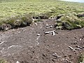
 Cross drain erosion - geograph.org.uk - 1382027.jpg 640 × 480; 120 KB
-
 Cross Wynd - geograph.org.uk - 1380383.jpg 480 × 640; 105 KB
-
 Crymlyn 1 - geograph.org.uk - 1379875.jpg 640 × 480; 236 KB
-
 Crymlyn 2 - geograph.org.uk - 1379879.jpg 640 × 480; 243 KB
-
 Culvert on forest track - geograph.org.uk - 1379239.jpg 640 × 480; 131 KB
-
 Cutler Heights Lane - geograph.org.uk - 1378379.jpg 640 × 480; 67 KB
-
 Cutler Heights Lane industrial units - geograph.org.uk - 1378372.jpg 640 × 480; 72 KB
-
 Cutter's Lane, Belfast - geograph.org.uk - 1379665.jpg 640 × 413; 83 KB
-
 Dalhousie Castle - geograph.org.uk - 1380003.jpg 640 × 480; 54 KB
-
 Dalhousie Industrial Estate - geograph.org.uk - 1379990.jpg 640 × 480; 63 KB
-

-
 Dam, Allt a' Mhuillin - geograph.org.uk - 1381095.jpg 640 × 480; 142 KB
-
 Damp road at Clough Hollow - geograph.org.uk - 1379492.jpg 640 × 480; 83 KB
-
 Denbrook Avenue - geograph.org.uk - 1378471.jpg 640 × 480; 41 KB
-
 Display within St Mary's, Portsea - geograph.org.uk - 1378855.jpg 640 × 480; 82 KB
-

-

-
 Dochgarroch Lock - kingsley - 30-JUN-09.JPG 2,560 × 1,920; 1.03 MB
-

-
 Driffield Telephone Exchange - geograph.org.uk - 1419628.jpg 640 × 480; 78 KB
-
 Driveway from Banchory Lodge Hotel - geograph.org.uk - 1380046.jpg 640 × 455; 99 KB
-
 Driveway from Banchory Lodge Hotel - geograph.org.uk - 1380056.jpg 640 × 474; 112 KB
-
 Drying bogs - geograph.org.uk - 1382730.jpg 640 × 480; 104 KB
_Small_Fan-footed_Wave_(Idaea_biselata)_(3686024520).jpg)
_Lilac_Beauty_(Apeira_syringaria)_(3686019980).jpg)
_The_Engrailed_(Ectropis_bistortata)_(3686017862).jpg)


.jpg)


.jpg)


