Category:United Kingdom photographs taken on 2009-02-05
Jump to navigation
Jump to search
Countries of Europe: Austria · Belarus · Belgium · Bulgaria · Estonia · France‡ · Germany · Greece · Republic of Ireland · Italy · Netherlands‡ · Norway · Romania · Russia‡ · Serbia · Spain‡ · Sweden · Switzerland · Turkey‡ · United Kingdom
‡: partly located in Europe
‡: partly located in Europe
| ← | 5 February 2009 | → | ||
| ← | February 2009 | → | ||

United Kingdom photographs taken on 5 February 2009.
Image files should be categorized here automatically using {{taken on}} template. Direct categorisation is also possible, if automatic is impossible.
Subcategories
This category has the following 3 subcategories, out of 3 total.
Media in category "United Kingdom photographs taken on 2009-02-05"
The following 200 files are in this category, out of 640 total.
(previous page) (next page)-
 "Loving Care" sculpture - geograph.org.uk - 1149748.jpg 570 × 427; 225 KB
-
 "Newstead", Matford Avenue, Exeter - geograph.org.uk - 1149400.jpg 570 × 427; 232 KB
-
 "Toby", Lover's Retreat - geograph.org.uk - 1148679.jpg 640 × 479; 80 KB
-
 34 Bus stop, Broad Lane - geograph.org.uk - 1148757.jpg 640 × 480; 99 KB
-
 A 'Pullman' train at Blea Moor - geograph.org.uk - 1152809.jpg 640 × 480; 192 KB
-
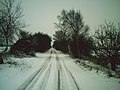
 A clearing in the forest - geograph.org.uk - 1149453.jpg 640 × 427; 88 KB
-
 A gap in the hedge, Llanmaes - geograph.org.uk - 1149135.jpg 640 × 480; 80 KB
-
 A Garland of Snow (3256658294).jpg 2,112 × 2,816; 2.36 MB
-
 A Land Rover heads for Gunnerfleet Farm - geograph.org.uk - 1151384.jpg 640 × 480; 239 KB
-

-

-

-
 A Mushy Mess - geograph.org.uk - 1148635.jpg 640 × 480; 98 KB
-
 A Northern Rail train at Ribblehead - geograph.org.uk - 1151063.jpg 640 × 480; 151 KB
-
 A patch of open ground - geograph.org.uk - 1152790.jpg 640 × 466; 64 KB
-
 A snowy Glen Uig - geograph.org.uk - 1148736.jpg 640 × 480; 67 KB
-
-

-

-
 A61 Derby Road - Traffic Jam - geograph.org.uk - 1148779.jpg 640 × 480; 48 KB
-
 AirSpace Hangar at IWM Duxford - geograph.org.uk - 1702623.jpg 640 × 427; 121 KB
-
 Alencon Way and some snow - geograph.org.uk - 1151039.jpg 640 × 475; 75 KB
-
 AMEC sign under blizzard (3256649936).jpg 2,816 × 2,112; 2.67 MB
-

-

-
 An empty Festival Place - geograph.org.uk - 1180524.jpg 640 × 467; 68 KB
-
 Angel in the snow - geograph.org.uk - 1152460.jpg 640 × 426; 79 KB
-
 Another job for security - geograph.org.uk - 1151041.jpg 640 × 469; 68 KB
-

-
 Archway to almshouses, Newtown, Exeter - geograph.org.uk - 1149427.jpg 570 × 427; 165 KB
-

-
 B4224 in a snowy Bromsash 1 - geograph.org.uk - 1149189.jpg 640 × 480; 190 KB
-
 B4224 in a snowy Bromsash 2 - geograph.org.uk - 1149198.jpg 640 × 480; 189 KB
-
 B9015 Mosstodloch to Rothes Road - geograph.org.uk - 1256718.jpg 640 × 426; 67 KB
-
 Badocks Wood in the snow - geograph.org.uk - 1148523.jpg 480 × 640; 133 KB
-
 Butter Cross, Bainton - geograph.org.uk - 1473299.jpg 640 × 480; 114 KB
-
 Bat boxes - geograph.org.uk - 1149465.jpg 640 × 427; 96 KB
-
 Batty Moss - geograph.org.uk - 1151907.jpg 640 × 480; 211 KB
-

-
 Beach side car park and picnic area - geograph.org.uk - 1159339.jpg 640 × 480; 57 KB
-
 Belties in the snow, Bishopstone - geograph.org.uk - 1149116.jpg 640 × 481; 203 KB
-
 Ben Tianavaig from Portree - geograph.org.uk - 1149120.jpg 640 × 167; 125 KB
-
 Bend in a country road near Llanmaes - geograph.org.uk - 1149212.jpg 640 × 480; 83 KB
-
 Bennet Close - residents parking - geograph.org.uk - 1152776.jpg 640 × 473; 70 KB
-

-
 Bethel, Rhiwbina, Cardiff - geograph.org.uk - 1148977.jpg 640 × 480; 60 KB
-
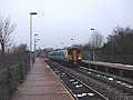
 Bicester North Station (Upline East) - geograph.org.uk - 1415495.jpg 640 × 480; 52 KB
-
 Bingham Linear Walk in Snow - geograph.org.uk - 1277692.jpg 640 × 426; 102 KB
-
 Black snow - geograph.org.uk - 1148912.jpg 640 × 470; 108 KB
-
 Blackpark Cottage near Inverdruie - geograph.org.uk - 1159065.jpg 640 × 427; 64 KB
-

-
 Blea Moor signalbox at dusk - geograph.org.uk - 1152852.jpg 640 × 480; 181 KB
-
 Blea Moor signalbox at dusk - geograph.org.uk - 1152853.jpg 640 × 480; 182 KB
-
 Blea Moor Tunnel - Southern Portal - geograph.org.uk - 1152942.jpg 640 × 480; 274 KB
-
 Blea Moor Tunnel - Southern Portal - geograph.org.uk - 1152943.jpg 640 × 480; 253 KB
-
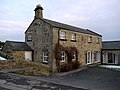
 Bliss Charity School - geograph.org.uk - 1212510.jpg 640 × 427; 68 KB
-

-
 Boundary Fence - geograph.org.uk - 1149351.jpg 640 × 427; 241 KB
-
 Boundary Signs, Bury Road - geograph.org.uk - 1149572.jpg 640 × 480; 56 KB
-
 Bramford Road - geograph.org.uk - 1154385.jpg 640 × 480; 83 KB
-
 Bream Cenotaph and beyond in winter - geograph.org.uk - 1284745.jpg 640 × 480; 72 KB
-
 Bream in winter - geograph.org.uk - 1284786.jpg 640 × 480; 92 KB
-
 Bream Primary in winter - geograph.org.uk - 1284791.jpg 640 × 480; 84 KB
-

-
 Bridge over Burn near Loch an Eilein - geograph.org.uk - 1159111.jpg 640 × 427; 86 KB
-
 Bridge west of Close House - geograph.org.uk - 1149176.jpg 640 × 480; 161 KB
-
 Bridgeofdoon.jpg 640 × 480; 120 KB
-
 Bridleway to Earl's Croome - geograph.org.uk - 1148877.jpg 640 × 426; 82 KB
-
 Broad Lane in snow - geograph.org.uk - 1148751.jpg 640 × 480; 96 KB
-
 Pillars in the snow - geograph.org.uk - 1149320.jpg 640 × 480; 65 KB
-
 St. Peter and St. Paul's in the snow.jpg 640 × 480; 74 KB
-
 Broadwell House - geograph.org.uk - 1149252.jpg 640 × 480; 67 KB
-
 Broken by the line - geograph.org.uk - 1152358.jpg 640 × 426; 82 KB
-
 Bromley Tesco View - geograph.org.uk - 1358406.jpg 640 × 480; 87 KB
-
 Burn by the Sheader road - geograph.org.uk - 1148720.jpg 640 × 480; 173 KB
-
 Burn, Lover's Retreat - geograph.org.uk - 1148673.jpg 640 × 479; 91 KB
-
 Burning Tree - geograph.org.uk - 1195892.jpg 640 × 480; 116 KB
-
 Burning Tree - geograph.org.uk - 1195900.jpg 640 × 480; 116 KB
-
 Bury Road - geograph.org.uk - 1149575.jpg 640 × 480; 67 KB
-
 Bus Route - geograph.org.uk - 1154332.jpg 480 × 640; 74 KB
-
 Bus Route - geograph.org.uk - 1154351.jpg 640 × 480; 86 KB
-
 Bypass Safety Fencing - geograph.org.uk - 1149592.jpg 640 × 473; 68 KB
-
 Cam Loch - geograph.org.uk - 1150093.jpg 640 × 480; 137 KB
-
 Captain Fraser's Folly. - geograph.org.uk - 1148747.jpg 640 × 480; 31 KB
-
 Car park, Coed-y-Wenallt, Cardiff - geograph.org.uk - 1149428.jpg 640 × 480; 60 KB
-
 Carrbridge Golf Course - geograph.org.uk - 1149334.jpg 427 × 640; 194 KB
-
 Carrfield Avenue Toton - geograph.org.uk - 1155468.jpg 640 × 480; 168 KB
-
 Carrfield Avenue Toton - geograph.org.uk - 1155470.jpg 640 × 480; 217 KB
-
 Carrfield Avenue Toton - geograph.org.uk - 1155483.jpg 640 × 480; 189 KB
-
 Cascade Pool Sandwell Valley (3255869752).jpg 4,752 × 2,688; 6.35 MB
-
 Caspian Point Building and approach road to Butetown Tunnel - geograph.org.uk - 1709437.jpg 4,416 × 3,312; 1.56 MB
-
 Castle Square - geograph.org.uk - 1151044.jpg 640 × 480; 88 KB
-
 Catkins and snow, Rhiwbina, Cardiff - geograph.org.uk - 1149000.jpg 640 × 480; 96 KB
-
 Cattle grid at Ribblehead - geograph.org.uk - 1151317.jpg 640 × 480; 203 KB
-
 Cedar in Church Meadow - geograph.org.uk - 1151158.jpg 435 × 640; 75 KB
-
 Cemetery wall, Elphin - geograph.org.uk - 1150085.jpg 640 × 480; 159 KB
-
 Chestnut Avenue in the snow - geograph.org.uk - 1148595.jpg 517 × 640; 98 KB
-
 Chilwell Memorial Park - geograph.org.uk - 1158636.jpg 640 × 480; 93 KB
-
 Across the fields - geograph.org.uk - 1150769.jpg 640 × 426; 41 KB
-
 Church across the field - geograph.org.uk - 1152362.jpg 640 × 426; 47 KB
-
 Ciao Baby - geograph.org.uk - 1151049.jpg 640 × 471; 76 KB
-

-
 Clapperbrook Lane, Alphington - geograph.org.uk - 1149452.jpg 570 × 427; 228 KB
-
 Clay Cross High Street (A61) - geograph.org.uk - 1148787.jpg 640 × 480; 70 KB
-
 Church of St.George the Martyr - geograph.org.uk - 1152338.jpg 640 × 426; 51 KB
-
 Church of St.George the Martyr - geograph.org.uk - 1152342.jpg 640 × 426; 62 KB
-
 Grave of Rev.Harries - geograph.org.uk - 1152451.jpg 640 × 426; 63 KB
-
 Coed-y-Wenallt, Cardiff - geograph.org.uk - 1149407.jpg 640 × 480; 145 KB
-
 Coed-y-Wenallt, Rhiwbina, Cardiff - geograph.org.uk - 1149376.jpg 640 × 480; 124 KB
-
 Coffin trolley, Ide church - geograph.org.uk - 1149510.jpg 570 × 427; 194 KB
-
 Coille Chiuthais in snow - geograph.org.uk - 1159388.jpg 640 × 412; 93 KB
-

-
 Communications tower, Wenallt, Cardiff - geograph.org.uk - 1149416.jpg 480 × 640; 105 KB
-

-
 Cottages at North Mains - geograph.org.uk - 1149520.jpg 640 × 427; 59 KB
-
 Court Road Bakery - geograph.org.uk - 1149871.jpg 640 × 427; 215 KB
-
 Court Road, Malvern - geograph.org.uk - 1149842.jpg 640 × 427; 238 KB
-
 Croftgowan in snow - geograph.org.uk - 1159394.jpg 640 × 480; 56 KB
-
 Croome River in winter - geograph.org.uk - 1153663.jpg 640 × 426; 35 KB
-

-

-
 Crossing Ribblehead Viaduct - geograph.org.uk - 1151938.jpg 640 × 480; 145 KB
-

-
 Crossroads northeast of Llanmaes - geograph.org.uk - 1149180.jpg 640 × 480; 76 KB
-
 Cuckoo Lane looking towards Hay Lane - geograph.org.uk - 1150973.jpg 480 × 640; 95 KB
-
 Culvert under the railway - geograph.org.uk - 1150757.jpg 640 × 426; 55 KB
-
 Danesmoor - Infants School - geograph.org.uk - 1149669.jpg 640 × 480; 61 KB
-

-
 Darton to Barnsley Railway - geograph.org.uk - 1148868.jpg 640 × 480; 82 KB
-
 Dearden Clough - geograph.org.uk - 1149570.jpg 640 × 480; 133 KB
-
 Dearden Clough off Bury Road - geograph.org.uk - 1149577.jpg 640 × 480; 123 KB
-
 Ditch across the field - geograph.org.uk - 1150762.jpg 400 × 600; 44 KB
-
 Door, Ivy House - geograph.org.uk - 1149295.jpg 479 × 640; 122 KB
-
 Drumrunie - abandoned house - geograph.org.uk - 1150105.jpg 640 × 480; 119 KB
-
 E Fullbrook - geograph.org.uk - 1152982.jpg 480 × 640; 53 KB
-

-
 Early morning snowfall - geograph.org.uk - 1193582.jpg 640 × 471; 89 KB
-
 Early start, Mercia Way, Warwick - geograph.org.uk - 1198076.jpg 640 × 480; 48 KB
-
 Echt Church - geograph.org.uk - 1153829.jpg 640 × 427; 71 KB
-
 Echt Hall - geograph.org.uk - 1153838.jpg 640 × 427; 49 KB
-
 Edenfield Bypass A56 - geograph.org.uk - 1149586.jpg 640 × 316; 40 KB
-
 Edenfield Bypass A56 looking North - geograph.org.uk - 1149588.jpg 640 × 480; 50 KB
-
 Edenwood Mill and Dearden Brook - geograph.org.uk - 1149555.jpg 640 × 480; 91 KB
-
 EIIR Postbox at Ribblehead - geograph.org.uk - 1151328.jpg 480 × 640; 240 KB
-
 Entrance to Beecraigs Country park - geograph.org.uk - 1149435.jpg 640 × 427; 88 KB
-
 Entrance to Leith Hall - geograph.org.uk - 1151868.jpg 640 × 480; 86 KB
-
 Estate Shops - geograph.org.uk - 1148978.jpg 640 × 480; 90 KB
-
 Everything for a village, Damerham - geograph.org.uk - 1149129.jpg 640 × 480; 177 KB
-
 Evidence of gritters - geograph.org.uk - 1285095.jpg 640 × 475; 88 KB
-
 St Matthew's Church, Exeter - geograph.org.uk - 1149420.jpg 570 × 427; 179 KB
-
 First light, Mercia Way, Warwick - geograph.org.uk - 1198088.jpg 640 × 480; 84 KB
-
 Follow my Leader (3255940036).jpg 4,752 × 3,168; 10.86 MB
-
 Footbridge across a drainage ditch - geograph.org.uk - 1149481.jpg 640 × 427; 107 KB
-

-
 Footbridge over Little Dale Beck - geograph.org.uk - 1152890.jpg 640 × 480; 205 KB
-
 Footpath alongside the Vyne School - geograph.org.uk - 1193596.jpg 640 × 475; 96 KB
-

-

-
 Footpath near Damerham - geograph.org.uk - 1149162.jpg 640 × 480; 216 KB
-
 Footpath near Stapleton Farm - geograph.org.uk - 1149210.jpg 640 × 480; 192 KB
-
 Forest Cottage - geograph.org.uk - 1159103.jpg 640 × 427; 97 KB
-

-
 From the bridge at Croughton - geograph.org.uk - 1580904.jpg 640 × 428; 89 KB
-
 Frosty fence - geograph.org.uk - 1193529.jpg 640 × 468; 97 KB
-
 Frozen water trough - geograph.org.uk - 1151051.jpg 480 × 640; 62 KB
-
 Frozen Waterwheel - geograph.org.uk - 1150916.jpg 640 × 426; 103 KB
-
 Fun in the snow - geograph.org.uk - 1150705.jpg 640 × 426; 52 KB
-
 Further up the track - geograph.org.uk - 1151038.jpg 640 × 480; 84 KB
-

-
 Gate on the track at Winterscales - geograph.org.uk - 1152747.jpg 640 × 480; 160 KB
-
 Gate, Tidy Brown Hill - geograph.org.uk - 1150394.jpg 640 × 427; 38 KB
-
 Gates into Malvern College Grounds - geograph.org.uk - 1149257.jpg 640 × 450; 320 KB
-
 Gauber Limekiln Pasture - geograph.org.uk - 1151281.jpg 640 × 480; 169 KB
-
 Gauchhill Plantation - geograph.org.uk - 1153858.jpg 640 × 427; 100 KB
-
 Geilsland School from Spier's.JPG 2,288 × 1,712; 1.23 MB
-
 George Stephenson's cottage, Wylam - geograph.org.uk - 1559957.jpg 408 × 446; 73 KB
-
 Girvan's main street - geograph.org.uk - 1159314.jpg 640 × 545; 87 KB
-
 Gravestone outside Ide church - geograph.org.uk - 1149516.jpg 416 × 570; 217 KB
-
 Great Frampton - geograph.org.uk - 1149240.jpg 640 × 480; 163 KB
-
 Corner Cottage Great Gidding - geograph.org.uk - 1148839.jpg 640 × 480; 53 KB
-
 Crown Cottage, Great Gidding - geograph.org.uk - 1149140.jpg 640 × 480; 64 KB
-

-
 St Michael's Bell Tower - geograph.org.uk - 1148937.jpg 480 × 640; 46 KB
-
 St Michael's Great Gidding - geograph.org.uk - 1148930.jpg 640 × 480; 86 KB
-
 Windmill Tower Great Gidding - geograph.org.uk - 1148858.jpg 640 × 480; 45 KB
-
 Gregory Close - a winter scene - geograph.org.uk - 1152801.jpg 640 × 473; 57 KB
-
 Gregory Close - geograph.org.uk - 1152800.jpg 640 × 468; 57 KB
-
 Gregory Close - Vivian Road - geograph.org.uk - 1152803.jpg 640 × 475; 72 KB
-
 Guphill Avenue in snow - geograph.org.uk - 1148765.jpg 480 × 640; 97 KB
-
 Hallforest Castle - geograph.org.uk - 1153848.jpg 640 × 427; 30 KB
-
 Hallforest through trees - geograph.org.uk - 1153867.jpg 640 × 427; 116 KB
-
 Hay rack on Cub's Moor - geograph.org.uk - 1148861.jpg 640 × 426; 77 KB
-
 Heading to Didcot - geograph.org.uk - 1152375.jpg 640 × 426; 49 KB
-
 Heading towards Kencot - geograph.org.uk - 1149398.jpg 640 × 480; 72 KB
-
 Heading up Vyne Road - geograph.org.uk - 1151035.jpg 640 × 477; 107 KB
-
 Heath High Level railway station in 2009.jpg 1,606 × 1,205; 622 KB
-
 Heath High Level Station, Cardiff - geograph.org.uk - 1148827.jpg 640 × 480; 62 KB
-

-
 Heavy with Snow - geograph.org.uk - 1153772.jpg 427 × 640; 89 KB
-
 Heddon Banks Farm Cottage - geograph.org.uk - 1558709.jpg 640 × 480; 86 KB


.jpg)


.jpg)


.jpg)


_-_geograph.org.uk_-_1415495.jpg)


.jpg)


_-_geograph.org.uk_-_1148787.jpg)


.jpg)


